Can someone explain how 'cc at tilt 1 vs tilt 4 can show debris?

Joined
Feb 8, 2005
Messages
789
Location
Metropolis, Illinois
Hello

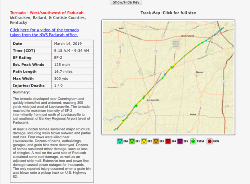
I am evaluating the March 14th KPAH tornado. The tornado missed the office by a few miles.

The tornado tracked across portions of Carlisle, Ballard, and McCracken Counties in western Kentucky.

Here is the LSR/summary
Summary of the March 14 supercells, flooding, and strong winds

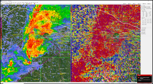
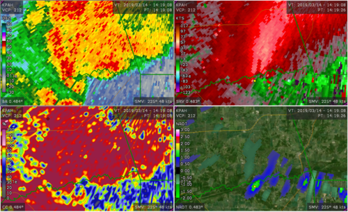
The first radar screenshot if tilt 1 (about 340' aloft). It is showing no debris on CC.

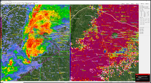
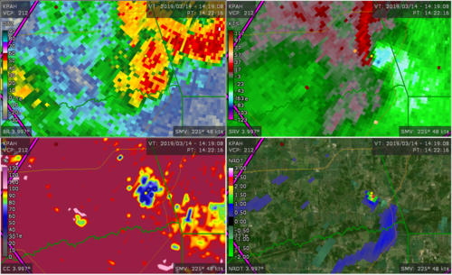
The second radar is tilt 4.0 (approx 2700' aloft) and is showing a strong CC tornado signature. There is a 30 second difference between tilt 1 and 4.

Keep in mind the tornado had already been causing damage for a period of time.

Why is the lower tilt not showing a strong 'cc signature?
2019-05-04_21-08-07.png
tornadoalready2.png
tornadoalready1.png

Thank you for your time

Beau
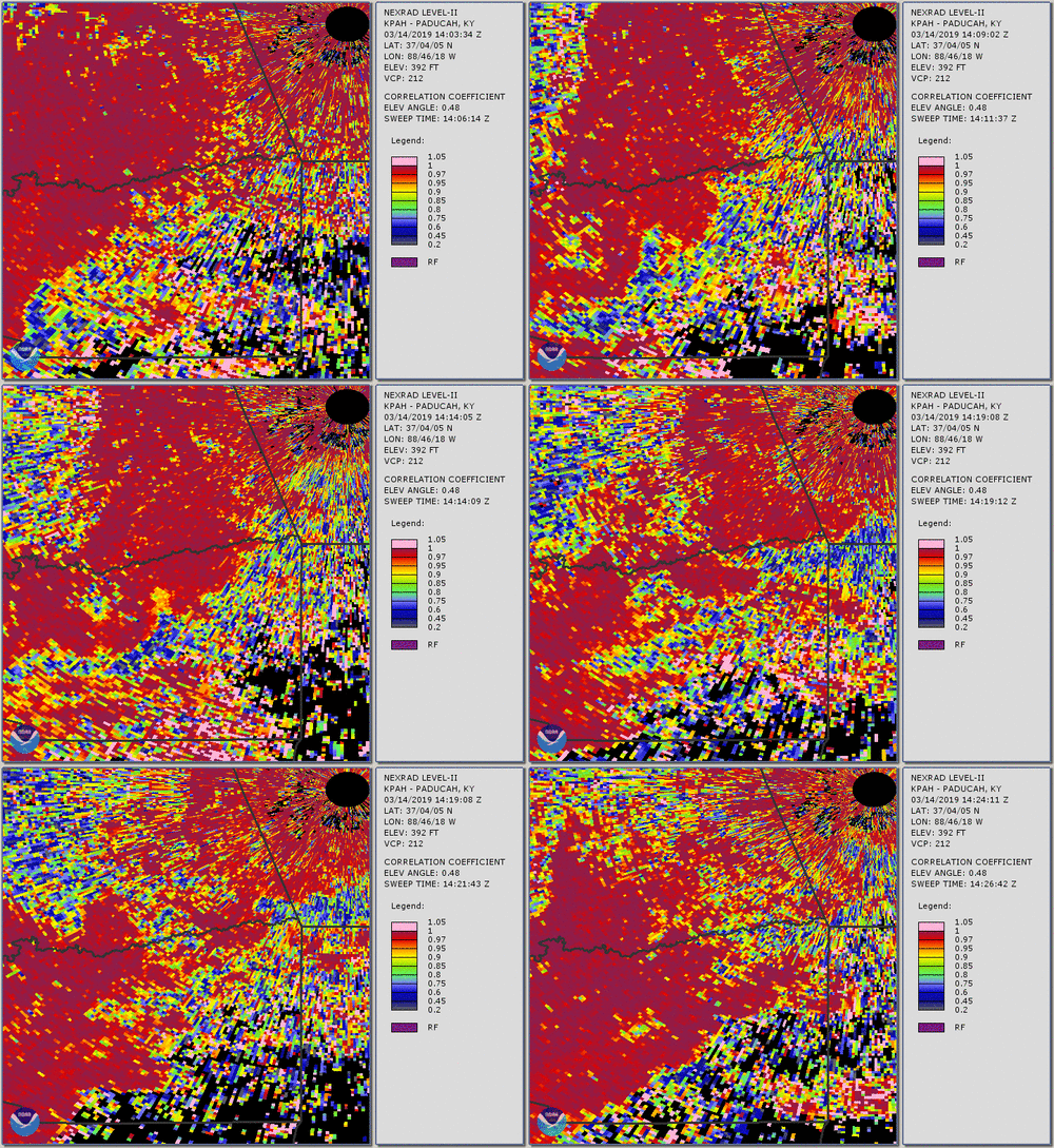
 
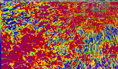
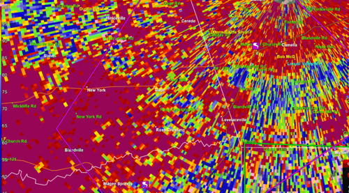
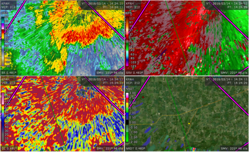
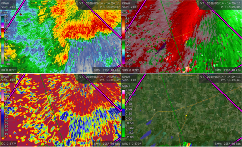
There's debris on the 1st tilt too in both cases, it's just not as obvious, especially in the later scan. I believe it's just that the 0.5 slice is so close to the ground near the radar site (< 500 ft ARL) that the data is extremely noisy. Clutter/clutter suppression, possible partial beam blockage and who knows what else may be affecting the signal return at 0.5 degrees. Below are the same times and slices but with additional data to help place the circulation relative to the CC minima. One can see the low CC values in the rotational area near the tip of the hook, it's just not very obvious relative to higher up. That said, the higher slice in the later scan is only at 0.9 degrees and also below 500 ft ARL so why there is so much less noise there isn't clear.

Radar to the NNE

17923
17924


17925
17926
 
EDIT: I agree with @GPhillips regarding noise/contamination close to the ground.It does help to see the time-series because you can see where the tornado is/would be esp. with the help that the RFD and Inflow notch/hook show up well in several frames. But I doubt a forecaster would say for sure that it is a TDS solely on Tilt 1, thus the need for viewing the vertical slices.

20190314_KPAH_TDS.gif

At at a higher tilt, the mesocyclone I guess would show high CC due to condensation throughout, with the TDS (low CC) sticking-out like a sore-thumb.

the higher slice in the later scan is only at 0.9 degrees and also below 500 ft ARL so why there is so much less noise there isn't clear.

The NWS assessment posted in the orig post did indicate some EF2 damage at approximately that time, so perhaps a stronger rotation or wider funnel were present (just a guess).

EDIT: I realized we made the same points, I just wasn't quick in formulating my answer lol.
 
Last edited:
This is the first case I have come across something like this. Very useful. I was reviewing the event and noticed that the CC was much much more evident on the upper scans. Definitely, something to keep in mind.

This is one reason I personally find it useful to go back and review events.

I learned something of value from these scans.

NROT did well on this tornado, as well.

Thanks for the input, thus far. I welcome more! :)
 
I should note that I have not looked at this event in any more detail that that involved with looking at some of the images presented in this thread. However, as GPhillips notes, there does appear to be a debris signature present, but the abundant ground clutter really complicates the analysis; ground clutter can cause a mess in the rhohv/CC field and severely limit its useful at times. Some radar sites are worse than others, as you'd expect. Fortunately, ground clutter *tends* to be most significant near the radar (say within 10-20 miles), which means that looking at a slightly higher tilt / elevation angle can let you see above the clutter but still relatively low in the troposphere. Some (much?) of the clutter impacts on the polarimetric variables should be removed when CLEAN-AP is implemented in the WSR-88D network, though I don't know the timeline for that. For those interested, more information on CLEAN-AP can be found in Torres and Warde (2014) -- see figs 9 and 10:

Torres, S.M. and D.A. Warde, 2014: Ground clutter mitigation for weather radars using the autocorrelation spectral density. J. Atmos. Oceanic Technol., 31, 2049–2066,https://doi.org/10.1175/JTECH-D-13-00117.1
 
Last edited:
Back
Top