Mike Smith
EF5
SPC has a pretty good outlook for the Upper Midwest Monday. I would not be surprised if they upgrade it to moderate due to wind or, possibly, tornado risk.
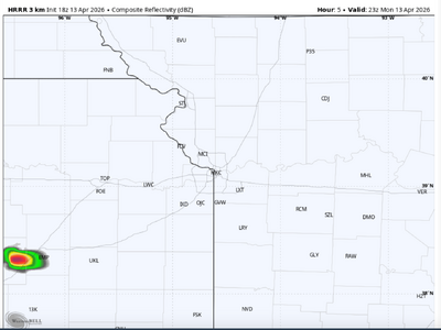
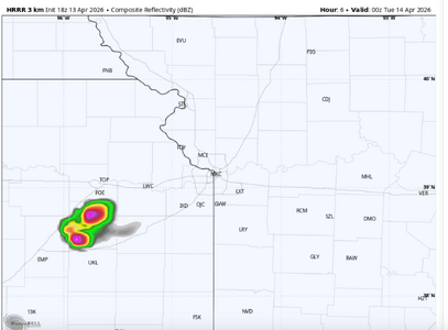
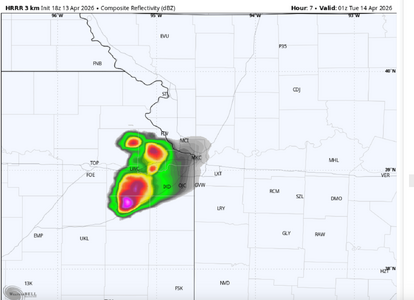
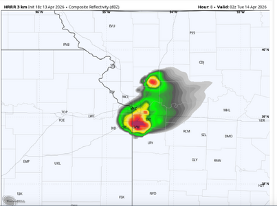
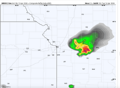
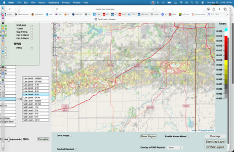
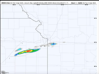
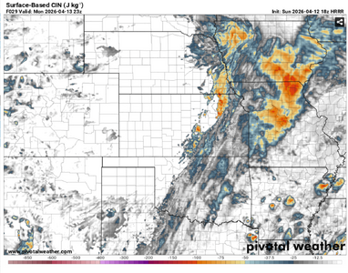
Of more curiosity to me is the potential for "day before the day" supercells with a tornado risk from central OK to NW MO. The HRRR ((18Z) shows the dry line gets to just east of the Flint Hills and then retreats after 23Z. Significantly, there is no diurnal pressure rise over the area and the SIGTOR is 3 to 3.3 with backing winds (~30°) east of the dry line. At 02Z (Tuesday in UTC) the 18Z HRRR shows an impulse from MHK to FSI moving over the threat area. I have attached the 23Z surface inhibition.
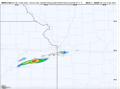
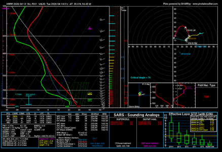
The 18Z HRRR does not convect anywhere from the central Plains to Upper Midwest (including SPC's "enhanced" area). Nor do any of the 12Z CAM's and I may be way off base. But with 3000+j of CAPE, no significant inhibition, and a source of lift, I think Central and NE Oklahoma, the eastern third of Kansas and west central and NW Missouri are worth keeping an eye on. The 01Z (8p Monday) sounding for MKC is pretty impressive if that impulse can create enough lift.
One thought about Tuesday: Some well known chasers have forecast a "tornado emergency" and another is forecasting a "historic outbreak" based on what they are posting on Twitter/X. While I certainly believe tornadoes are possible, I'm just not seeing a super big day.
I certainly invite others to post their thoughts. I may be way off-base.
Of more curiosity to me is the potential for "day before the day" supercells with a tornado risk from central OK to NW MO. The HRRR ((18Z) shows the dry line gets to just east of the Flint Hills and then retreats after 23Z. Significantly, there is no diurnal pressure rise over the area and the SIGTOR is 3 to 3.3 with backing winds (~30°) east of the dry line. At 02Z (Tuesday in UTC) the 18Z HRRR shows an impulse from MHK to FSI moving over the threat area. I have attached the 23Z surface inhibition.
The 18Z HRRR does not convect anywhere from the central Plains to Upper Midwest (including SPC's "enhanced" area). Nor do any of the 12Z CAM's and I may be way off base. But with 3000+j of CAPE, no significant inhibition, and a source of lift, I think Central and NE Oklahoma, the eastern third of Kansas and west central and NW Missouri are worth keeping an eye on. The 01Z (8p Monday) sounding for MKC is pretty impressive if that impulse can create enough lift.
One thought about Tuesday: Some well known chasers have forecast a "tornado emergency" and another is forecasting a "historic outbreak" based on what they are posting on Twitter/X. While I certainly believe tornadoes are possible, I'm just not seeing a super big day.
I certainly invite others to post their thoughts. I may be way off-base.
Attachments
Last edited: