2024 Tropical Season Discussion

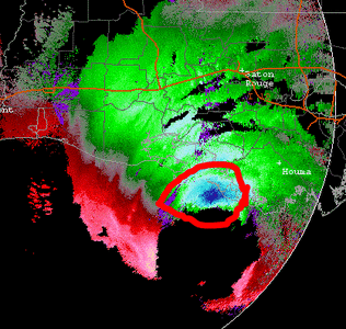
We finally have something to watch. Front in the Gulf provides some convergence. Tucked into the western GOM about as "good" as can be expected this year now. Next week, who knows? Medium chances of development, though.
Will potential "Francine" have enough time over water? Note the cloud band from area of concern arcing northeast toward coast near Louisiana.
Image.jpeg
 
Wow, can a potential pathway toward Louisiana look anymore oblique as future TS Francine looks to skirt the long TX coastline this week?
If I still lived in NOLA, I would venture outside. But, if a number of you dedicated hurricane-chasers feel non-plussed, I certainly get that!
 
Last edited:
Gordon has weakened to a tropical depression and is expected to turn NNE and either become a remnant low or restrengthen into a tropical storm later this week based on current NHC discussion. Meanwhile, Potential Tropical Cyclone Eight, while reportedly moving erratically, is in an area of relatively low shear and has the potential to intensify and become a tropical storm (Helene) within the next 12 hours.
View attachment 26276
Gordon absolutely epitomizes the atmospheric state of the tropical Atlantic MDR -- *not* good, to say the least!

In an average season this time of year (peak of Cabo Verde TC), this would be pitiful, but given the hyperactive forecasts? It's about as opposite as you will ever see.
 
Pre- and Post-Hunga-Tonga Eruption - global 300 mb temp anomalies (two images attached).

Non-trivial difference, esp. in the tropics! This means more convective stability overall. And that much colder in Antarctica? So it isn't just across-the-board warming globally. And polar regions are supposed to warm the most. That's happen in the Arctic, but not in Antarctica, and some cooling was going on before the volcanic eruption. Why don't we hear more about that? /s

I am not sure this eruption effect is getting as much attention in the scientific community as it should. What is going on globally is extraordinary IMHO.

It has been suggested that we have had ~10 years of linear gradual CO2 warming globally in just 2 years b/c of the temp spike since 2023.

With this in mind, with the warming observed at the surface and aloft,
this could be what would be expected in 2033-34 when CO2 gradual
linear warming gets to the level we see now. Of course, much study
and research is needed, but the sensible weather now as to the
suppressed Atlantic TCs is something we can't ignore.

Some questions:

1) Will CO2 warming down the road lead what we are seeing now?
Despite record warm Atlantic SSTs, more warming in the atmosphere
has apparently offset this, resulting in a more stable environment in
the tropics. The atmosphere does not react the same way to warmer
temps as the ocean, so this is a serious question with a possible
feedback present unaccounted for previously, and thus has big
implications for future TC activity.

2) As warming continues, how does the WV concentration in the
stratosphere change? Has this been studied at all?

3) The shift in the African monsoon trough, is this a result of the warming,
possibly from slight alteration of the Hadley Cell circulation? How is the
Walker Circulation being impacted, if at all? If disturbances off Africa have a
mean shift N, this not only has significant implications to Atlantic TC activity,
but also eastern Pacific activity, as a number of TCs in the eastern Pacific each
season on average are spawned by Atlantic tropical waves that cross Central
America.

Lots to consider here, and for the science itself, the anomalies seen in the
Atlantic this TC season have forced us to re-examine much, and ask many
questions, which in turn drives the science forward. This is a good thing
net-net.
 

Attachments

  • T300mb2015-2021.jpg
    T300mb2015-2021.jpg
    137.6 KB · Views: 2
  • T300mb2023_2024.jpg
    T300mb2023_2024.jpg
    154.1 KB · Views: 1
I was looking at the NHC site this morning. There are two areas currently highlighted. As I was looking at the probabilities of formation for each, I got to wondering: How much of the “missed” factors this season are also influencing the NHC forecasts? In other words, we now know that the seasonal prediction significantly overestimated the level of activity. @Boris Konon hypothesizes that water vapor from the volcanic eruption is a prime culprit (keep me honest here Boris). So if there was a “failure” to take that suppressive variable into account in the seasonal forecast, are the shorter-term forecasts for development also failing to recognize this or other suppressive factors? I know we are looking at very different timescales in these forecasts, but I assume there is also climatology factoring into the short term forecasts, so in that respect I was wondering if the probabilities for development might be overstated by failing to consider this year’s anomalous suppression of tropical systems. It’s kind of like with severe weather, where some seasons there seems to be a recurring failure mode that isn’t necessarily reflected in operational forecasts…
 
Heading to Orlando / Tampa tomorrow for recon on *likely" Hurricane Helene. I don't remember another PTC (Potential Tropical Cyclone) ever getting this must attention in history. Some areas in Florida are already planning on mandatory evacuations tomorrow. I can only surmise it's the extreme modeling that is causing concern for something that is not even a TC yet.

I'm guessing the models will eventually turn more to the right, given the upper air patterns. (Not a forecast). Regardless, the Tampa / northward areas will likely get some serious surge with some models showing 10+ feet even if the storm stays off shore. I'm not buying the intensity forecast quite yet, but better to be there than crying at home.
 
The resolution of today's global models is just not fine enough to handle storms of this nature as well saw with Acapulco last year.
 
Back
Top