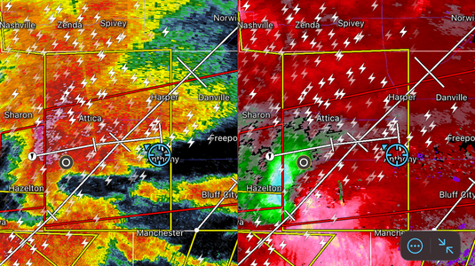
May 25, 2024 was the day after my very last of 11th grade, so it came as a great way to start off the summer. Models had hinted at just a stupidly favorable environment for days, but their were obvious caveats regarding moisture. By the 1730 day 2 outlook, most caveats had been sorted out, but the moderate upgrade and wording still genuinely put my entire chin on the floor with an resounding scream. With this excitement also came a sick feeling of fear, for this was my first 15% chase day and could possibly go high, and I knew if there was I day I was going to see a city get obliterated any time soon, it would be this day. So after packing cameras, equipment, and gloves for the chase the next day, I take a dusk walk to clear my head.
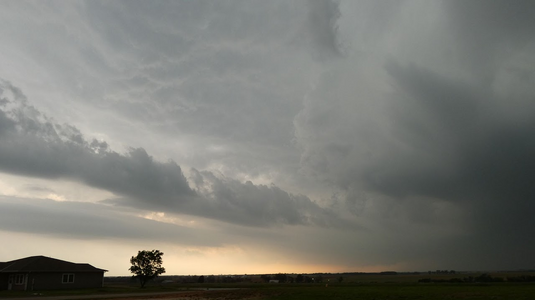
The next day after morning analysis, my Dad and I leave KC in the late morning and stage out of Wichita, where we met up with chase friends to do some plane spotting at the military base to pass time. We were hoping that the late moisture return would not delay the tornadoes to after dark. After 5:30 ish. Dad and I leave Wichita headed southwest towards Harper on highway 42. Anvil overspread was already visible leaving the metro, and increased with mammatus as we progressed southwest. I also noticed a tiny left split coming up from a separate cell in NW OK and got nervous that it would take out our storm, but it was way too small to do so and helped it if anything. Later on tho, I saw on radar the NW OK supercell going insane, and a new and MUCH larger left split (which was actually new clusters popping up on the north-propagating boundary from the Texas splits), was racing towards our storm. I then thought, "well great, there goes half the evening", but I still knew we had a good window given the rate at which the storm was strengthening. Pulling into the town of Anthony, KS at 6:40 pm, we set up 25-30 miles ahead of the cell and wait for it to hit better moisture and shear. It was becoming obvious the storm was going to turn tornadic any minute. A large mid-level inflow band had formed out of nowhere, consistent positive lightning activity was going nuts, and scud were organizing under the highly-visible base.
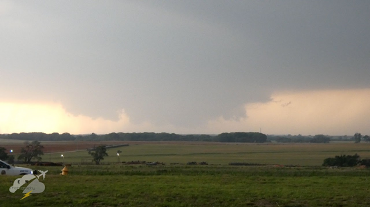
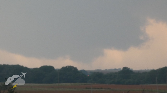
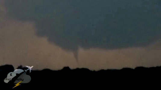
Shortly thereafter, an absolute unit of a wall cloud just appeared and the storm began to get that classic "boomerang" shape with a huge inflow notch and large RFD. It became obvious we were not far away from a violent wedge tornado. But that dam left-split was still coming in hot. Locals began getting antsy and law enforcement pulled up to watch the storm. A tor warning was issued and sirens went nuts. From that point onward, the wall cloud put down at least two small circulations that I could tell, with an EF0 confirmed in Hazelton. Dust was also being visibly lofted well south of the wall cloud.
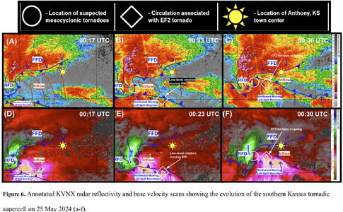
As the left split hit the storm, the base went completely obscured and the FFD was also starting to hit us, so we reposition. It turns out that unbeknownst to all of us on this storm at the time, a very unique and dangerous storm evolution was underway with the merging cells and their interaction with backed winds and convergence, as a rain-wrapped, strong EF2 tornado from a circulation along the left-split's outflow was sitting down miles away from the main meso and was charging northWEST through the supercell's notch at 60 mph. How no chasers were taken out by that is an absolute miracle.
My Dad and I head east on route 2/44 for a couple miles out of town and stop to wait and see if the supercell will survive the merger, and every other chaser and their dog starts passing us fleeing east. Not knowing what they are fleeing from due to a loss of cell coverage for multiple minutes, Dad and I keep moving. It became obvious that the cell did not survive the merger, so we start heading home. Learned later in Wichita about the farmstead that was destroyed on highway 2. Strong to severe storms were ongoing through most of southern and central KS through the evening, with insane gradient winds for some reason.
I have actually done a case study on this storm in the time since (
Anthony Rough Draft 10 18 25.pdf) to hopefully prevent chaser tragedies from weird evolutions like this. Despite the significant and dramatic event, the day did not not live up to the expectations of most, and that nosey left split tamed what would wave likely been a cyclic monster along the OK/KS border with easy EF3+ tors given the meso strength, parameter space, and examples of other storms during the outbreak. But that destructive merger no doubt saved lives, maybe my Dad and I's, who knows.
