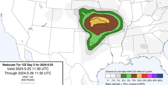
Whoa...quite the rejection of hopes by the 00Z CAMs that go out 60 hours...


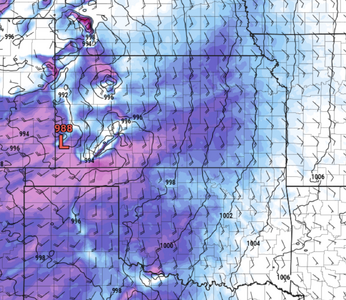
3 km NAM shows a pretty decent capping inversion at 00Z in SW OK, so that's probably the cause. The HREF-FV3 member also has that.
3 km NAM shows a pretty decent capping inversion at 00Z in SW OK, so that's probably the cause. The HREF-FV3 member also has that.