• A friendly and periodic reminder of the rules we use for fostering high SNR and quality conversation and interaction at Stormtrack: Forum rules

    P.S. - Nothing specific happened to prompt this message! No one is in trouble, there are no flame wars in effect, nor any inappropriate conversation ongoing. This is being posted sitewide as a casual refresher.

2023-03-31 REPORTS AR/IA/IL/IN/MO/MS/TN

Pravin Gupta

Enthusiast
Joined
Mar 28, 2015
Messages
7
Location
Iowa City Iowa
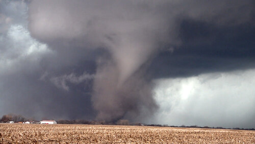
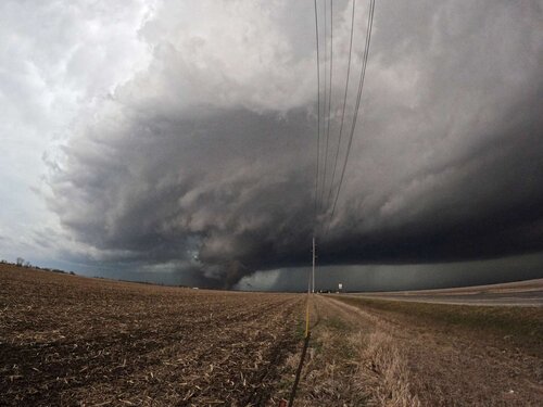
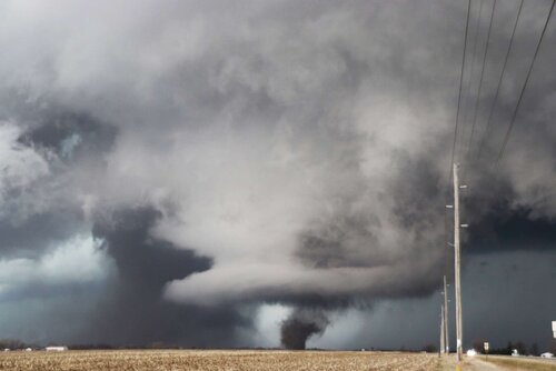
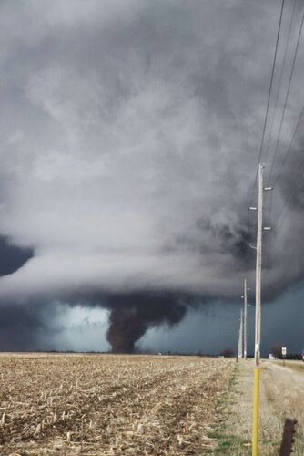
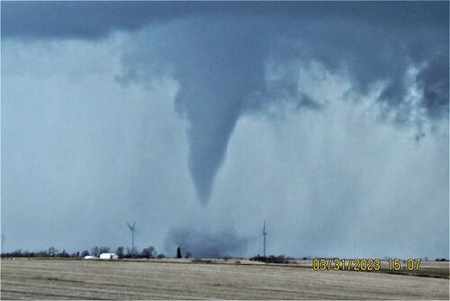
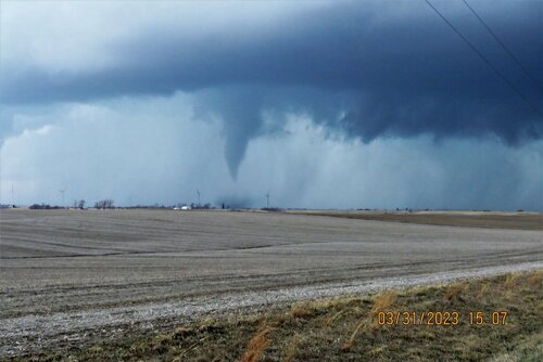
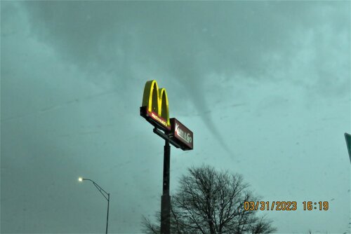
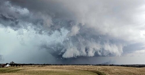
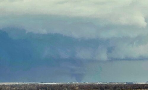
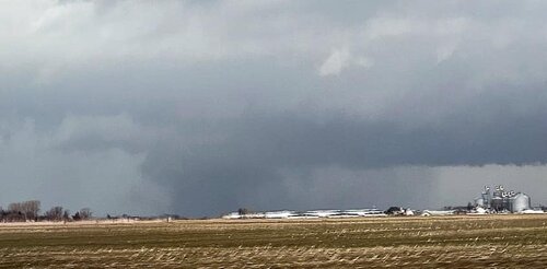
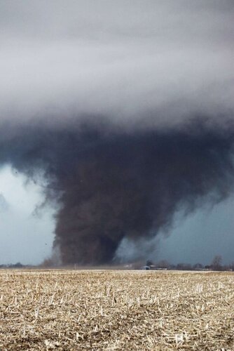
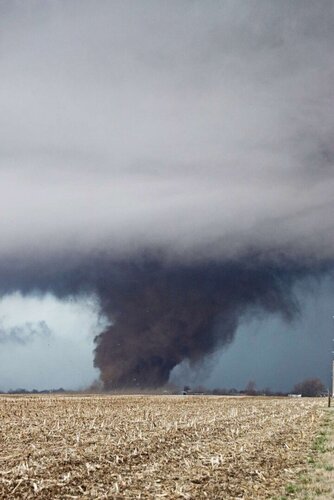
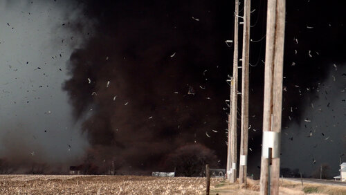
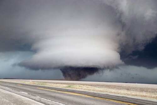
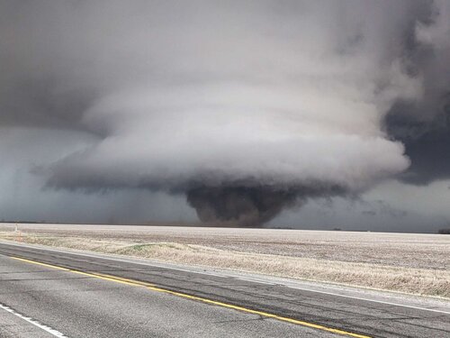
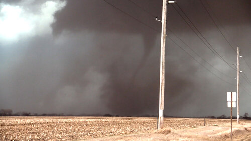
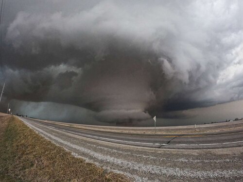
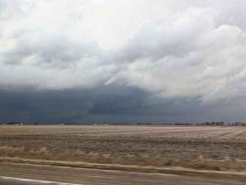
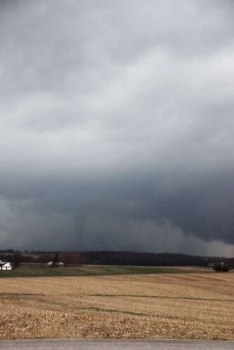
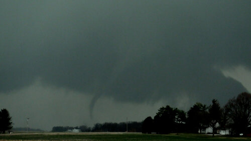
We left Iowa City area around 1 PM west on I-80 and targeted Brooklyn, Iowa. Conditions were insane for tornadic storms. Initially several cells broke out west of us. The cell coming at us from SW had a strong couplet and put down tornado in open field near Malcom. Stayed on the ground for good 5-6 minutes, before lifting. While racing east on I-80 trying to beat another tornado coming from south saw a lot of flying debris and eventually caught up with another rope tornado at West Branch.

Quite an exhilarating first chase of the season in our backyard, and home back for dinner.Malcom Iowa Tornado.jpgTornado Malcom Iowa 3-31-23.jpgRope Tornado West Branch Iowa 3-31-23.jpg
 
Last edited:
Admin please change the title to 2023-03-31 REPORTS: IA/AR/IL ...note more states may be needed.

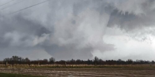
I could not leave KC until after 10am so I hauled up I-35 to get northeast then I planned to go east a bit. I ran into a cell that had caught my eye NW of Bethany MO and I watched it until it went TW. It tried for a while and had a few very weak attempts but nothing dropped. I stayed with it until I noticed the more out in front clear air cell to my SE. I arrives at that cell around Ash Grove Iowa and watched it also try. It really ramped up as it approached Ottumwa and dropped a wedge just to the NE of town. I spent the next couple hours chasing after the cell and it's many drops. I had to chase alone today without GPS and with storm speeds it was hard to keep up. I really needed a navigator today but I did manage to see the wedge and tornadoes all the way up and to include SW of Iowa City. At this time I decided to call the chase as it was a full blown line now and I was tired or fighting the speeds. I headed back to KC arriving at 10pm exactly 12 hours after I left. Below are a few of my photos taken from my cell phone ... I have yet to review dash cam but not expecting much there ... so ready for a classic KS chase!

1.jpg2.jpg3.jpg4.jpg
 
After botching several golden opportunities to see a spectacular, significant tornado going back to at least 2014 (or 2005 if you count the Stoughton F3 which nearly hit my house), finally got that monkey off my back yesterday in a big way!

Overnight/early morning developments had me considering switching my target to somewhere in Illinois rather than Iowa (possible later initiation and longer window for a discrete mode); but after another quick check of data before leaving work, mainly just consisting of the latest HRRR (soundings and synoptic maps, not just sim ref/UH!) and visible satellite I decided to stick with Iowa. Somewhere along/south of I-80 but it was really going to depend on how things developed on radar, since they were going to be moving at 60+ MPH toward me at the same time I was racing toward them.

I was initially tempted to go after a lead cell that showed a promising hook as it crossed I-80 east of Des Moines. It appeared to be on course to pass near Belle Plaine so instead of taking 151 all the way down to US-30 and I-380 as intended, I headed west on 30 from Cedar Rapids. However, now my target storm appeared to be struggling to take off on radar, even losing its severe thunderstorm warning for a while. Meanwhile, a storm to the south near the IA/MO border was looking better and better. I plugged Sigourney into my GPS and was off, on a route that took me through Blairstown, Margeno and North English. The railroad crossing gates were down on the Union Pacific main line in Blairstown. One of my other hobbies is railfanning, but this was NOT the time I wanted to see a train. The train crept up to the west of the crossing and stopped, and after about 30 seconds the gates went up. Phew!

The storm picked up a tornado warning, but fortunately for me didn't produce right away. It now looked like Sigourney would be too close for comfort to the forward flank of the fast-moving supercell, and I did NOT want to core-punch through blinding rain/possibly hail. I now plugged a little town called Keota into my GPS.

As I got nearer I began to pick up a little bit of rain from the forward-flank anvil of the rapidly approaching supercell, but nothing too heavy. Now the tornado warning contained the wording of a confirmed "large and extremely dangerous" tornado, and radar showed a very intense couplet and a clear tornado debris signature. It was now just about 4 PM. My heart began to beat faster as I turned west on IA-92 from IA-77 just south of Keota, turned my car around to face east in case a quick escape from the path was needed, then looked to my southwest...
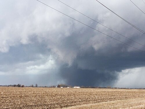
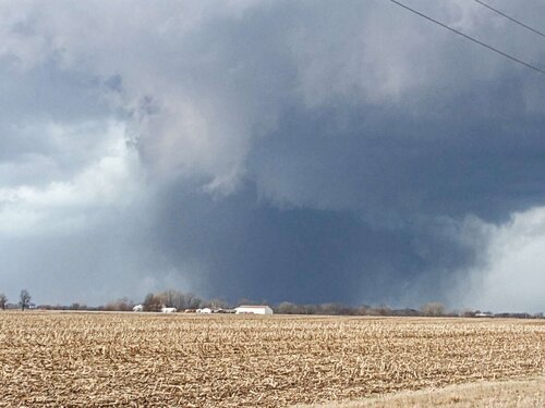
PXL_20230331_210850210-2048.jpgPXL_20230331_210854337-2048.jpg

A wedge tornado was already ongoing, but with distance and (lack of) contrast I couldn't really see the motion with it. After watching it approach for a few minutes, the storm cycled right in front of me. A small but intense area of rotation formed out in front of the first tornado (white cloud tendrils toward the upper left in the photos above), tightening into a truncated cone with a dusty debris cloud whirling below. It quickly became fully condensed, albeit shrouded in dust. Here it almost looked like a clone of Gilmore City, IA from last April, which I missed despite being within easy striking distance of the storm when it first went severe-warned.
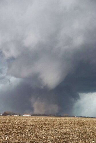
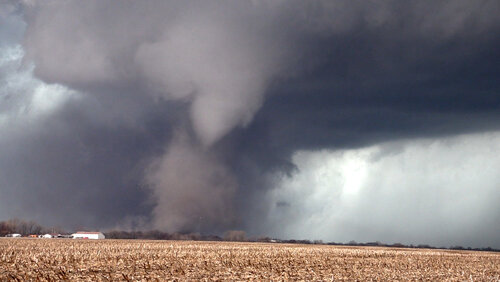
IMG_4039-2048.jpg033123KeotaIATornado.00_03_17_21.Still016.jpg033123KeotaIATornado.00_03_28_10.Still018.jpg

It then went through a rapid intensification and several changes in appearance, becoming a narrow Henryville-esque drillbit which expanded into a dusty stovepipe. Will continue in the next post due to attachment limits.
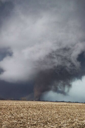
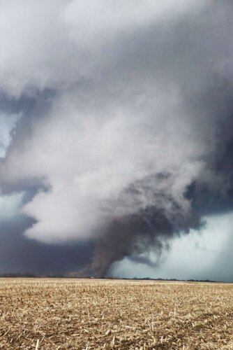
IMG_4041-2048.jpg
IMG_4042-2048.jpg
GOPR0226-2048.jpg
IMG_4044-2048.jpg
IMG_4047-2048.jpg
 
Last edited:
An explosion of debris ensued as the whirling, dusty stovepipe impacted some structures as it crossed 92 just to my west. In the video screen grab, I think that large chunk just to the left of the power poles is the better part of the roof of a house.

IMG_4049-2048.jpgIMG_4050-2048.jpg033123KeotaIATornado.00_05_01_13.Still015.jpg

As it passed into an open field just to my northwest, the tornado was now a stubby, dusty wedge beneath a ridiculously low-LCL, sculpted tornado cyclone/collar cloud (not unlike some of the 4/27/11 tornadoes, except not concealed within Dixie hills and trees!). The rope out of the first wedge was actually still on-going at this time, I didn't even notice it in real time but captured it by happy accident as the strong inflow wind (to my at-the-time annoyance) panned my camcorder off the new wedge. Also captured it on the far left of the ultrawide GoPro shot. At this point I realized I'd better move if I wanted any hope of staying with the fast-moving storm.

IMG_4054-2048.jpgPXL_20230331_211319336-2048.jpg
033123KeotaIATornado.00_05_32_00.Still019.jpg
GOPR0227-2048.jpg

I blasted east on 92 all the way to IA-1, where I turned north. I pulled over to set up again just after getting through Kalona, but just as I did so the cell began to be affected by surrounding upscale growth. I was able to catch a distant view of the fast-moving rope out from this location.

PXL_20230331_212013363-2048.jpg
IMG_4058-2048.jpg
033123KeotaIATornado.00_06_38_08.Still017.jpg

The storm still showed strong rotation and a possible debris signature as it approached and entered Iowa City, however it was merging into the QLCS and the rear flank became totally rain-wrapped. After navigating around some tree limbs blown onto US-218, I called the chase and let the storms race away into IL/WI. However the excitement wasn't over yet. My phone's battery was now critically low, genius me having left my charge cord at home and needing to rely on it for GPS and radar data all day. I decided to go to the Wal-Mart in Cedar Rapids and get a new USB charge cable for it just for the car. I was next in line at the checkout when the power went out! Another band of storms had formed behind the initial supercells, warned for severe winds. Everyone was herded to the back of the store. It took some time, but not too long before the power came back on and the self-checkouts brought back up so people could make their purchases and leave.

There was some debris in the streets in Cedar Rapids as I grabbed dinner at the Culver's before heading for home.

Quick cut of video highlights is up on my YouTube channel.

 
While I got called into work and was unable to chase, I ended up on my way back into Fort Wayne with the return load just as storms rolled in. Found myself in between to tornado warned areas of concern, saw some lowerings, but was unable to confirm any ground contact at the time. I did, however, come across two flipped over semis on I-469 that shut down the highway for the better part of an hour till they could clear a path for us to go down the exit ramp. Given the mangled signs, and the semis having turned perpendicular to the highway (I've been driving semis long enough to know how it looks when one is just turned over vs picked up), I suspect that the lowering I saw to my north did in fact touch down. Just waiting on confirmation from the IWX office who is doing surveys today and probably tomorrow.

If that did turn out to be a tornado, that would be the second time in 18 months that I've seen one from a semi, but last night's experience was certainly one of the more stressful ones that I've had behind the wheel of a semi, particularly since the straight line winds alone were enough to roll one.
 
Short summary: Two simultaneous tornadoes (A wedge-to-wedge hand-off) and my Iowa tornado jinx busted!


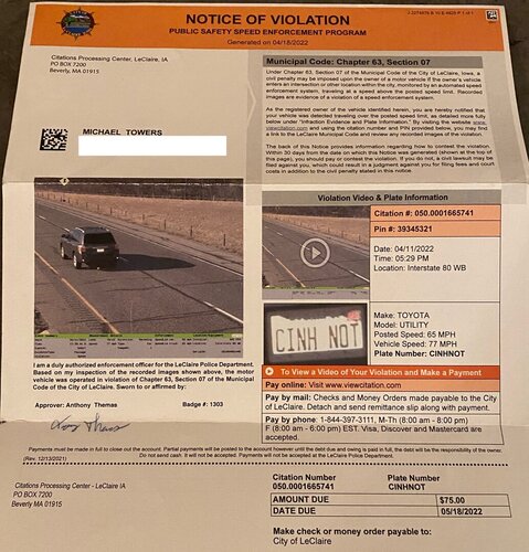
My chase nearly mirrored that of @Andy Wehrle but his video blows mine away! (My chase also mirrored yours on 2022-04-12…too fast…just let it go…bust!). With well over 20 chases in Iowa and not a single tornado to show for it I got off of I-88 to check data before heading into Bustola-Land. Observations confirmed Iowa was my best bet so once more I crossed the bridge into Iowa on I-80 but this time very cognizant of my speed as I-80 traverses through a small slice of the little border town of Le Claire and they’ve made that little slice a veritable gold mine. Just across the bridge where the speed limit goes from 70 to 65 (I know, not an excuse) you enter Le Claire which has installed speed cameras and if you’re more than 5 miles above the speed limit you’ll get a notice in the mail with a fine:

Fines 01.jpg

image0.jpeg

They got me doing 12 over last year and issued me a $75 fine. The good news is it’s a civil fine, not a moving violation. The bad news is not only the fine but if you throw their mail away thinking it’s junk (I almost did) and/or if you miss paying the fine by the deadline you get a civil judgment against you, your credit will likely take a huge hit and the fine likely increased along with court costs. So beware travelers both westbound and eastbound on I-80 within the first ½ mile into Iowa.

I noticed cells already firing west of Muscatine (area of at least two busts) heading toward me but I wanted to get into an environment more conducive for strong tornadoes and well west of the river. Like Andy, I noted two cells of interest as I headed west passing the exit for Moscow where I busted in 2009 and also 2020 ("Pandemic Hysteria 2020 Chase 1: Keep Your Distance Freddy Farmer!”). The cell east of Des Moines had been severe warned for at least 30 minutes but didn’t impress and was flanked by multiple cells which threatened a quick QLCS when the occluding front came through. The cell to the SW on the border of Missouri was also flanked but was further away from the impending front so it would likely remain isolated for a longer time span. It would also be progressing into an even more optimal tornadic environment so without much internal debate I picked it as my target. I planned on taking the exit for North English (where I busted in 2021) but didn’t want to overshoot my approach so I got off at the Wasserbahn Hotel exit, filled up the tank and initially headed south toward the target area where I’d previously busted in both 2011 & 2017 (making at least 6 previous busts in just this small slice of Iowa paradise!)

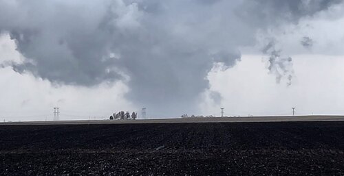
Taking stock of the location of the cell and the speed and direction of its movement I decided for an approach farther east than planned and ultimately made my way south down Hwy. 1 before heading west on Hwy. 78 at Brighton. At this time a strong couplet had persisted for at least 15 minutes and was now just to my SW but no tornado had yet been reported, I made my way west before moving back north up G67 to the town of Rubio. It was about this time that a tornado was reported and in typical Iowa fashion I found myself on a tornado producing storm with no tornado in sight. I just took it in stride and as I got to Hwy. 77 I had a good vantage point but even though I had to be within a few miles away from the meso I couldn’t see the base due to the trees and the low LCL. I crept south down 77 to try to get a better view but after less than a mile decided to backtrack as I wanted to stay ahead of the circulation. Heading back north I passed a group of young chasers that were whooping it up, pointing toward the NW and jumping up and down. I looked in that direction and still couldn’t discern anything except a dark lowering and thought maybe they were mistaking scud for a tornado. But about a half mile further north and I could make out what appeared to indeed be not only a tornado but a wedge. The contrast was very low but sure enough it was a wedge and my first thought was “Did I really just see a tornado in Iowa?!!” I pinched myself, filmed for a few minutes, then repositioned north for a SW viewing vantage point. With my focus intent on the wedge something caught my peripheral vision off to the right and when I looked I was amazed to see a drill-bit cone tornado to the NE of the first tornado. At first I thought it was a satellite but then realized it was not and the rapid intensification was incredible. While I still kept tabs of the wedge, this second tornado became my primary focus, a jaw dropping cone turned stove-pipe turned wedge with horizontal vortices that wrapped around the tornado and ultimately became an insane collar cloud. At this point I decided to reposition and headed north as the second tornado was blasting to the NE while the first tornado was dissipating. I was able to view the second tornado for about another 5 minutes as I tracked up 77 then east on Hwy. 92. By the time I got to Hwy. 1 it faded from view and when I reached Kalona the rotation had moved deeper into the core and the cell was now part of a congealing line and I called it a chase.

Even though the chase was over the peril was not, the line was lengthy and could not be avoided. It had a wicked core promising potential hail damage and I was right at its edge. I figured I could blast east via Hwy. 22 before heading north where I would hopefully have a cushion but that line was moving way too fast and it overtook me as I turned north toward West Liberty. My vehicle got blasted by high winds and blinding rain but fortunately no hail and for a time I trailed the Whale’s Mouth on Hwy. 6 to Walcott. It was there that I thought I saw a sign warning about speed being photo enforced so I made sure to stay below the limit. I made a left just before town to get to I-80 and let my guard down; as I accelerated I noticed the camera and the 35 MPH speed limit. I looked down and saw I was at 40 so hopefully no fine is forthcoming but even if one does the chase was worth every penny and was a resounding success. I totaled just less than 500 miles and used less than two tanks of gas, spent zero time waiting for initiation and basically just chose my storm to intercept. The active chase distance covered about 40 miles and lasted about an hour, what a day in Iowa and it was way overdue! But overall my record in Iowa is still abysmal… here’s looking at you April 4...bring it on!
 
Last edited:
I too was on the Keota Twins storm. Here is a video I took of them in near peak strength. Incredible structure and dynamics to make something like this happen.


As I was driving trying to catch up to the main wedge, I noticed on radar and felt heavy inflow still being sucked into the QLCS behind it. My best guess as to how this happend is that some of the rear flank flow from the main wedge caught that inflow, and combined with the still strong updraft to spin up this second one behind it. Would love to hear others thoughts on it as well.
 
Last edited:
I never thought I'd say "career intercept" and Iowa in the same sentence, but alas, here it goes... I had a... CAREER INTERCEPT... in.... IOWA...

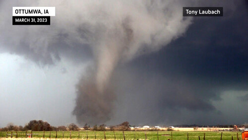
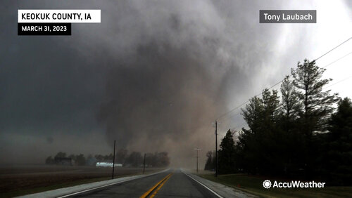
In one of the most unbelievable feats of my career, I won bigtime in Iowa. Myself and chase partner, Ed Grubb, got on the Ottumwa EF-4 at birth, actually waited for it near Ottumwa for the better part of 90 minutes as it came up from Missouri. Once it passed north of Ottumwa, we took a county road north of Agency and watched as the business end of the storm wrapped up and at 3:37pm, the birth of a monster.

fbLaubachOttumwa.jpg

fbKeokuk.jpg

We put this tornado live on the AccuWeather Network as we tracked it between Agency and Martinsburg, Iowa. We estimate we were south of the tornado by half a mile when it crossed our road to the north. We witnessed a few properties heavily damaged between Agency, Martinsburg, and eventually east on IA-149. The various areas of damage slowed us as we stopped to check on folks. By the time we cleared the area, the tornado was well off to the northeast. Ed saw the satellite tornado south of the main twister as we were eastbound.

Hands down, the most impressive, most photogenic, most intense tornado intercept I've ever had in Iowa and ever had in March. Arguably a top 10 career tornado intercept for sure.

Below is a compilation of live reports and raw video of the hits leading up to the intercept, plus great video of our approach as the tornado crossed the road to our north.

 
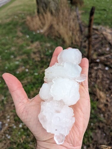
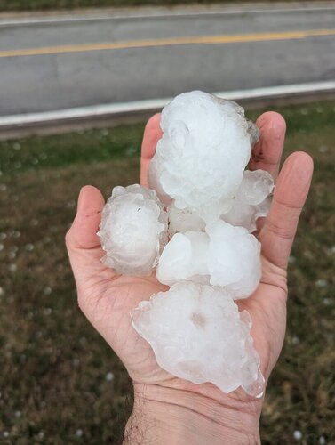
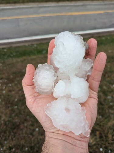
I haven't had a chance to edit structure video of the storm yet but @Ethan Schisler and I played with the cells in western Illinois and intercepted a tornado-warned cell that passed through southern Adams County. We saw several funnels and a possible tornado that got rain wrapped, but there was no visible damage. We came back through the Liberty and Fishhook areas on US 104 and were able to document a plethora of large hail 2"+ in diameter that littered the area just 10-15 minutes prior. There was some incredible hail fog and plenty of roof, siding and tree damage where the heaviest hail had fallen.
 

Attachments

  • 338989868_5928717853907594_6943531933967391095_n.jpg
    338989868_5928717853907594_6943531933967391095_n.jpg
    110.9 KB · Views: 0
  • 339058196_764147621684591_9126786213626804324_n.jpg
    339058196_764147621684591_9126786213626804324_n.jpg
    98 KB · Views: 0
  • 338591268_2442437682571382_5886792165698304547_n.jpg
    338591268_2442437682571382_5886792165698304547_n.jpg
    100.9 KB · Views: 0
Back
Top