Greg McLaughlin
EF5
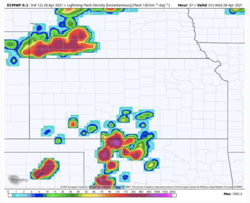
A significant severe weather episode appears to be in store for Tuesday, April 27, 2021 across much of the southern and central Plains. Model data has been persistent ejecting a strong large scale trough from the southern Rockies into the Plains Tuesday 4/27. Strong WAA will transport a moist boundary layer north across the plains in advance of an eastward surging dryline. The nose of a strong mid-level jet is forecast to overspread the warm sector by Tuesday afternoon creating an environment that would appear to favor intense supercells with all hazards likely.
There are some significant differences in the synoptic setup between various models. The GFS has shown quite a bit of inconsistency between runs while the ECMWF has shown remarkable run-to-run consistency. The ECMWF solutions show a more volatile environment featuring a sharp dryline across western OK with strong instability across the warm sector to the east with a strong southerly low-level jet in place. Forecast deep layer shear is quite impressive and mid-level flow is perpendicular to the dryline. This would favor supercells with an attendant threat for all hazards. In fact, the ECMWF solutions have a pretty high ceiling for tornadoes should it verify.
The GFS shows a less volatile environment with hints of meridional mid-level flow which would be more parallel to the dryline. The GFS has also been aggressive mixing the dryline much farther east into eastern OK compared to the ECMWF. I suspect the ECMWF will end up being more accurate assuming current trends in data continue, and this is reflected in SPC's Day 6 placement of severe probabilities.
Obviously the finer details of this upcoming event will not be resolved until the day of, but model trends do suggest this event could be rather significant, and depending on how things play out we could be looking at a tornado outbreak if full potential is realized.
Nebraska and perhaps Iowa may need to be added to the title at some point if severe probabilities end up being farther north than currently depicted.