2021-03-13 EVENT: TX/OK/KS

James Gustina

Supporter
Joined
Mar 9, 2010
Messages
671
Location
Dallas, TX
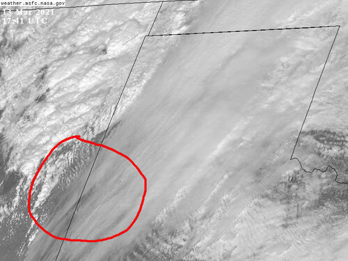
While this setup has a myriad of issues, I do think it deserves its own thread now that we're within 84 hours of the event. Current model consensus (with the GFS being an outlier) has a bowling ball cutoff low over the four corners region Saturday morning with a 95-100 knot jet max ejecting over the southern High Plains by 21Z. The 00Z Euro from yesterday evening progged a wavy/diffuse dryline moving east across the Llano Estacado in the early afternoon and gradually sharpening at the Caprock by 00Z, with high 50s dews ahead of it and some small pockets of 60F onto the Rolling Plains near the Oklahoma/Texas state line. The GFS has been much faster in pushing the dryline all the way past I35 by 00Z which doesn't fall in line with any other model output from this week.

Instability has been forecast to be meager but small areas of >750 j/kg MUCAPE show up in the 18-21Z timeframe before widespread precip and cloud cover overspreads the region ahead of the dryline. Saturated profiles seem to point to cloud cover issues early on in the day as well which may limit the overall severe threat.

0-6KM shear has been consistent in the 45-50 knot range with reasonably good winds out of the southeast at the surface at 10 knots. However, the 00Z Euro and the 12Z NAM have been pointing to a weakness/backing at 850 mb as the jet enters the Panhandle that may cause messy storm modes for any cell that is able to initiate and stay semi-discrete.

Overall, this looks like a heavy precip event first and foremost with the outside shot at a mid-afternoon cell staying semi-discrete long enough to produce some hail/damaging winds before it lines out. The tornado threat seems low given potential storm mode/CAPE issues but I wouldn't be surprised at a brief window for one in the early afternoon on the western edge of this setup.
 
Last edited:
After initially brushing off this closed low from a chasing standpoint, I am coming around to Saturday offering enough opportunity to watch with some interest. It's been quite a few years since we've had even a moderately interesting opportunity this early out on the open Plains, so color me impressed in that regard.

This is far from a textbook early season setup, though, with a deep closed low undercutting broad western NA ridging concurrent with eastern troughing; so, not exactly 3/13/90 or 3/28/07. I think the difference between some nice early-season supercells and a bust will hinge on sufficient afternoon clearing/heating for the >750 J/kg MLCAPE axis to extend at least a few counties E of the dryline. The GFS/NAM are quickest to eject the upper low and sweep the dryline into stable air over C OK, whereas most international guidance is slower and more favorable, with the potential for ingredients to overlap briefly somewhere in the general vicinity of a Seymour-Perryton axis. However, the 12z ECMWF just rolling in has trended somewhat faster than its previous runs.

I will say, if you're going to get a surprisingly decent chase day this early in the season, this ticks a few boxes I'd value highly: seasonably impressive moisture and supportive LCLs, as well as a bent back dryline with relatively "backed" wind profiles (relative to a more mundane WSW flow setup and N-S dryline, which so often means a cap bust or sky high LCLs this early in the spring). Given the dryline orientation and model QPF signals, a period of discrete storms during at least the mid-late afternoon timeframe appears plausible before upscale growth by evening. I expect if anything good happens it may be relatively early, prior to 00z; thankfully, some fcst hodos already look good enough for nice supercells with low-end tor potential by 18-20z.

I won't be too shocked if this devolves into a 25-mi. wide instability axis, or a less favorable scenario for the upper low evolution (e.g., the 12z NAM) wins out and hoses things. But if the past few ECMWF runs are more on track, I can envision some pretty respectable storms for early March, and SDS-fueled weekend crowds to match!
 
Looking at the newer models, things are looking pretty good from south central Kansas to the SW Oklahoma and into the SPS-CDS areas on Saturday as far E as I-35 later in the day. That area will be under a jet with 135 kt winds rotating around the Four Corners closed low.

I didn't chase at all last year. Might have to get out Saturday.
 
I'm not optimistic about Saturday's setup but I am trying to learn how this stuff works, so if anyone understands something I am missing/misinterpreting it would be greatly appreciated!

Based off latest NAM Runs

Elk City OK area 21Z Saturday looks fantastic from a wind shear perspective. Favorable hodographs, veering winds with height.
Mid Level Lapse Rates for this area around 7.7 - is this on the lower side for initiation? Lid strength area of 4 for this area also indicates the capping inversion is too strong. MLCape sub 1000 seems to be the case off various model runs. Seems like this thing just won't have the juice to get it done?

0-3KM Cape for this area on the latest RAP run is 27 J/kg also...

Again learning! So if I sound like a total newbie somewhere let me know?

Thanks!
 
Hi Mark,

Welcome to the chasing community.

As someone who has been doing this for 50 years (really), never let a model discourage you in and of itself. Conditions can change amazingly fast.

I've posted the Day 2 for the day before the F-5 Greensburg Tornado. Not only was Greensburg in an unhatched "slight" risk, the tornadoes in NW Oklahoma late the afternoon of the 4th were in a "no severe" area.

Here is the tornado watch from less than two hours before F-5 2013 Moore Tornado. Note the chance of ≥F-2 is "low."

This is not to criticize anyone -- it is simply to illustrate that things can change in a hurry.

As to SW and W Cent Oklahoma, I agree 100% the shear is great. But, can it pop?

The 18Z HRRR shows forecast high temperatures over the threat area to be in the low 70's. That is somewhat higher than earlier runs. The area will be below a screaming jet stream.

To me, this is a "decent" (not "great") setup. We don't have much ability to anticipate weak short waves rotating around upper atmospheric lows. One of those, plus the generally falling heights, may mean more than is generally expected.

Good luck!!

Mike

Screen Shot 2021-03-11 at 1.25.57 PM.png
Screen Shot 2021-03-11 at 1.20.04 PM.png
 
The 12z guidance seems to have raised the threat compared to yesterday with a slowing of the primary upper level low. Aside from the 12z NAM, which veers the LLJ/1-3 km flow thanks to a stronger lead wave/further east ULL and results in funky wind profiles early on (not to mention pushing the front/dryline eastward quickly), the consensus seems to be increasing the region of destabilization with some pretty typical High Plains/early season wind profiles by 21z for supercells. Lapse rates prior to initiation look great across guidance and moisture should be more than sufficient. If we can get some degree of heating Saturday afternoon, it could be a pretty good show.

I do have some concerns about rapid upscale growth on Saturday should the winds aloft become too meridional and yield more parallel shear vectors to the initiating boundary, along with convection from Friday near the stalled front resulting in cold pools/outflow boundaries, although I'd tend to think initiation will be more isolated tomorrow given the lack of stronger forcing.

Seems like a decent setup given the time of year though, assuming the NAM 12 km is not on the right track, and a good opportunity to dust off the cobwebs following a very quiet offseason (well, all of last season generally).
 
The 12Z NSSL/ARW WRF flavors and 12Z HRRR both seem to be painting an increasingly favorable supercell environment in the 20-22Z timeframe along the edge of the Caprock around Crosbyton and up to Silverton. The biggest unknown seems to be warm front placement and will likely depend on the reinforcement by overnight convection from today's setup traveling through the Texas Panhandle and western Oklahoma. Shear vectors have been progged to stay more orthogonal with the dryline for a longer period from 18Z to 00Z which would be ideal. Models are painting in 1250-1500 j/kg areas of MLCAPE just off the Llano Estacado by 21Z with 250-300 m^2/s^2 0-3KM SRH which is about as perfect as I think we can get that far west this time of year.

Upper 50s/Lower 60s dewpoints are currently pooling on the southern side of the front that's currently dipping from just north of Lubbock and curling back up towards Vernon which bodes well for seasonally above average moisture for tomorrow's setup assuming the front isn't forced further south overnight by the aforementioned convection. A rapidly deteriorating cap is one of my biggest concerns at this moment but that's something to worry about more morning of. All in all, this looks like it has the chance to be a pretty good setup and I'm betting the hordes will be out in full force for this one.
 
Everything appears to be coming together for this setup and the SPC has upgraded to moderate. Actual dew points this morning on TX and OK Mesonets match the models, with upper 50s / lower 60s pushing close to the area as forecast, which I believe is ~2500-3000 feet elevation. Warm front location likely won't be an issue, the warm sector won't be uncapped, initial storms will move roughly orthogonal to initiating dryline. I guess concerns would be potential for clouds/precip limiting instability and the fact that NAM is sneaking in a few soundings with significant veer-back below 2km, while HRRR is much less pronounced in this regard. It looks like NAM only blows up one long-track supercell, while HRRR is blowing up several.

Seems like a very chase-able setup, good luck to all out there. Stay safe.
 
There are a number of issues with today's set-up, from both chase safety and forecasting perspectives. The region with the best tornado potential is obvious. It's also a very small area. Looking over soundings from surrounding locations, there is not really a second "tornado" option today -- although this could change. Storms should be moving around 45kt, which is not ripsnorting mode, but still a challenge that will require fast-paced intercepts. If premature convection :) does not spoil the show, I'd expect Mad Max level chase convergence around one or two storms. No doubt the potential is there for a major event, but hundreds of aggressive chasers trying to intercept fast moving, potentially violent storms in a confined region will not be fun.
 
Looking everything over, I'd likely bust west towards Clovis, NM / TX border and take advantage of the early bird special -- hopefully catching something before everything becomes a mess. The RAP, GFS and other soundings do support rotating storms in that area and you might avoid the circus early on. Cold outflows and anvil seeding further N/NE might be a concern later.

Update... tornado watch issued for portions of E/NM and W/TX.
 

Attachments

  • GOES17412021072liBWKz.jpg
    GOES17412021072liBWKz.jpg
    86.6 KB · Views: 0
Last edited:
I'd try south of the warm front WF and dry line DL intersection today. That area will be mess; visibility might not break; and, chaser convergence could be tough to manage.

Only a short window away from the prime target. Possible to get a secondary differential heating boundary intersection with DL farther south. Can't discern a true outflow boundary from yesterday; but, something could be there and intersect the DL. No promise.

I feel like Friday producing is encouraging for Saturday chasing. Be safe and good luck!
 
IF were were out there right now, I would set up somewhere around Tulia, Ashtola, or McClean TX. To me that's where the early discrete cells stay in the cleaner air based on their storm vectors. So you either chase from Tulia NE and hope you can keep up, or you wait for it to come to you up in McClean, all the while hopefully just out ahead of the expected QLCS development. The Helicity Swath Tracks on the HRRR have been pretty consistent over this area for the past several runs. Personally, chasing pre-QLCS discrete storms moving at 50mph with HP modes, ugh. This is all assuming early convection doesn't throw a wrench into things early on. Radar analysis should be fun tonight. Be safe out there who ever is headed out.
 
If one of the two supercells south of Amarillo gets it's act together in the next 20-30 minutes, it could be a serious problem.

Edit: Not liking how the the leading cell looks on radar, really trying to ramp up. Anyone in AMA or nearby areas needs to be thinking about underground shelter.

IMG_16F4FC23A329-1.jpeg
 
Back
Top