2017-05-18 REPORTS: KS/OK/TX

Joined
Dec 8, 2003
Messages
1,412
Location
Southeast CO
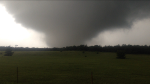
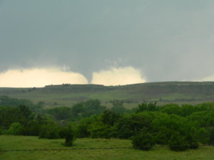
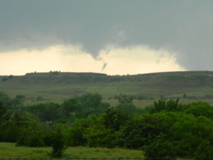
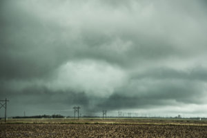
I was hanging out at the motel in Elk City where I'd been holed up since Tuesday night. I figured that with my target of somewhere from Sayre to Arnett there was no reason to burn gasoline early. When I saw the radar light up near the Red River I thought "Oh what the heck" and flew south. I arrived in Martha (a bit NW of Altus) just in time to see a tornado in progress. I have heard it's being called the "Duke" tornado. I shot video of it for 3½ minutes, but the quality of it is poor enough that I'm not sure I'll ever post it online. That's mostly because I only got within about 5 miles of it before it roped out and dissipated. I then drove north and chased the storm from Reydon to north of Enid. Here's a screenshot of the Duke tornado:

170518.PNG
 
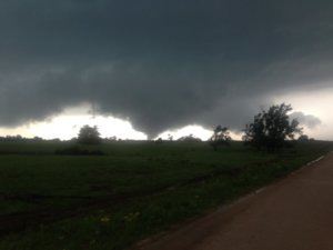
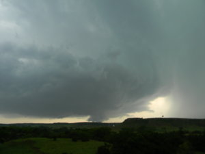
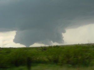
IMG_0611.PNG IMG_0585.JPG I started this day up in Medicine Lodge, Kansas. As the afternoon progressed it became clear that initial storms would fire quite a ways further south and west of me. I decided to head for Woodward, OK and take a look at the storms coming off the TX border. I ended up intercepting a very intense cell just south of Fort Supply, Oklahoma, but immediately realized it was very HP and getting interfered with by all the storms going up at the same time. I was pretty sad and felt a bust was certain. Decided to head east and keep an eye on any storms to the south that might stay discrete. Long story short, I saw a supercell on radar nearing Seiling, Oklahoma. I blasted east at about 5 over the speed limit and got north of the cell into position to core punch. Once I exited the FF precip I gained a view of a tornado in progress. Dream scenario. Ended up taking some mud roads to the west to intercept. Got pretty close. It was amazing. Loud and ripping up trees. A day I'll never forget. @Ben Holcomb ended up coming down my road to witness the tornado as well. That was the only other chaser I saw on that road. I think it's safe to say that chaser convergence only applies to paved roads.

 
Mike we were on the same storm. We jumped on it a touch earlier, it was a gorgeous storm and the rotation was impressive. I can't watch the vid at the moment but did you catch some of it while it was multi-vortex and with the side vortices? That was a really cool storm and we were a little on the fence about dropping down because of the subpar radar presentation, but we knew it was in the "vance wedge". Like you, we assumed that cell had the best chance to cycle up after its cell merger and likely remain discreet.

I think we were on that cell for probably 1 - 1.25hrs, it was a great day. High risk bust overall? Maybe....but not for us, I'll get some pics up tonight we can compare shots/locations etc.
 
We left Dodge City in the morning and got to Woodward shortly before lunch. Saw the storms going up early and to make a long story short, spent most of the day out of position at critical times which resulted in seeing wall clouds and a couple funnels. A pretty disappointing day.....
 
We left Dodge City in the morning and got to Woodward shortly before lunch. Saw the storms going up early and to make a long story short, spent most of the day out of position at critical times which resulted in seeing wall clouds and a couple funnels. A pretty disappointing day.....

Same story as Todd. After leaving Dodge in the morning we headeded SE. A wrong turn and major detour due to road construction cost us an extra hour so we reached N OK a little later than hoped. Got tangled in the junk near and N of Woodward. A piece of it broke off to the east and went tornado warned. We watched a rotating wall cloud and couple of funnels from it near Alva. By that time the Seiling/Waynoka supercell was approaching, but it turned a bit left and died. We never were able to get out of the crapvection and get on the eastern side of things where inflow was unimpeded. Congrats to all who did.

High Risk also means high risk for chasers. Next time will try to play the more subtle late-season set ups and hope for isolated supercells.
 
I arrived Wichita Wednesday afternoon and after checking data, decided to overnight in Pratt. That morning, I decided on a Kansas target closer to the triple point. I was concerned that too many storms would go up at the same time in western OK. I initially waited in Medicine Lodge too keep an eye on storms firing farther south. When storms initialized on the boundary near St John, I headed north toward the northward moving storms. I encountered this tornado with unusual southwesterly motion south of Great Bend, Kansas. View is north on 281 from the Barton-Stafford County Line. The dust whirl is visible in the adjacent field later in the video. Touchdown is 4:30 PM and it lifts around 4:33 PM CDT.
 
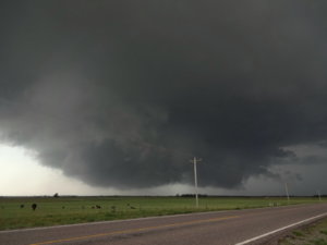
But wait, there's more... I think this is one of the cooler WC's I've seen. This was the "Wheeler TX to Seiler OK to Fairview to Carrier" storm when it was about to cross Hwy 30 S of 33 (north of Reydon).

DSC00165.JPG
 
Left work around noon in OKC to head toward Woodward. By the time we arrived, cells had been firing for bit and I decided to focus on the one just west of town. We went north on highway 34 for a few miles were we could see a decent wall cloud starting to form. I wanted to head east toward Freedom, so I found a paved road. Unfortunately about four miles on that road, it turned from paved to dirt. I do a lot of work in this area, so I know how horriblethe dirt roads can become when they get wet, so I was not going to take that risk. Now I'm in a bad position since another cell had started to merge with the one I was on from the south and I only had one direction to go. So I booked it west back toward 34 and was absolutely blasted by 70+ mph winds and blinding rain. I was honestly getting worried since I knew there was some circulation in the are, but I could tell that the winds were blowing to the east and I was moving away from the possible circulation. I eventually get back on the highway, but now I'm behind everything.

At that time the cell near Seilling was really ramping up, so I was going to head toward Seilling so that by the time I got there, the storm would be north of town. As we made our approach, the storm dropped a decent sized tornado by Chester. I eventually arrived in Chester as the storm had lifted north, then I turned north to try and catch it from the South. Coming up to Waynoka,we could see the wall cloud. Finally, about 15 miles south of town, we got to a high point and we saw the storm drop a good sized tornado near the Little Sahara State Park. It lasted a few minutes and I was able to live stream it on Facebook, but the video was poor quality and you cant see anything. So the tornado lifted and we went into Waynoka and made our way to Alva.

The storm made a couple of attempts to reform, but once it approached the Kansas border, it became outflow dominate and died. All the storms were looking really lame at this point, so we went back to Alva, and decided to call it a day.
 
Initial target for this day was Alva but after traipsing north we re-adjusted to Seiling and then Vici. The initial storms that went up right over the Antelope Hills drew us even further west and as the southern storm began to ingest and reorganize its updraft we cut north to Fargo. By this point, things were already extremely low contrast and the concern for another messy high risk day seemed justified.

f0cb7129a897808fa832261f7882d540.jpg

We kept pace and kept attempting to drift north. A dicey road option and the NE storm motion essentially screwed us between Fargo and Woodward and put us way behind as the storm started to slowly get its act together while going into the road deadzone over the Cimarron River Valley. We cut through Woodward and began pushing north on Oklahoma 34 but were forced to stop as strong winds and driving rain prevented us from catching up as the storm drifted away. It began to shows signs of a pretty strong low-level meso but was almost completely rain-wrapped and we decided to drop it for a storm to the east, southwest of Waynoka. We moved east on US 412 and on the way decided to swap focus to the now-tornado warned storm southwest of Seiling.

Poor approach options limited us a bit as the core was right right over US 281 so we continued past the junction and then onto N2360 Road. This initially appeared to be a mistake as it took us into the Glass Mountain formations (buttes) that line the edge of the Cimarron River. But as we continued south, we finally got a nice view of the Chester tornado with great structure overhead.

a728ee6dd9423b06a8ae0415e56ba80c.jpg

c90cb4db6323bcb8a7a05c67e368ec74.jpg

95992fc03d714102b915c79f5f03468e.jpg

After doubling back north, we noted another brief multivortex tornado and then continued on the same road north of US 412. The road ended up being a great choice, as it curved around the river and into an open area with a great view. We had a great view of the big cone (although just about all my photos were crap) and then witnessed one more brief attempt at a tornado as the mesocyclone occluded.

35ad1820351ac1fb6b76ae592d3282a2.jpg

5949c49526059504602f01045e7ff92d.jpg

After initially attempting to keep up with the storm going north on US 281 towards Waynoka and encountering the horde for the first time of the day, we ended up dropping south to Seiling to gas up as yet another supercell-ish storm shot off near the Antelope Hills. We stayed north of the Canadian and enjoyed a pretty cool laminar shelf before packing it in and heading back.

8fe78da2b197e3116748fbda8b82530b.jpg
 
Seeing all the pics and videos of the Chester/Seiling tornado is like a kick in the gut! We spent the previous night in Woodward and thought waking up we wouldn't have to go to far, so we meandered a bit east of Woodward and drifted a bit north as well stopping in the town of Carmen to fuel back up. We ended up looping back west and got to 281 east of Waynoka. We stopped there for maybe 10 minutes while watching the first storm going up in southwest Oklahoma.
I noticed some more blips showing up northwest of Elk City along the TX/OK border and thought those will be our storms, the storm down south now near Duke is too far away. But then I got impatient. The storms along the TX/OK border initially were taking a while to organize and there was a cluster of junk over Elk City just a bit north of the huge supercell that now dropped a tornado near Duke.
So we blasted down 281, through Waynoka and Chester and Seiling. We even had thoughts about stopping in Seiling due to the road options in multiple directions, but instead we marched on south. I try to follow the rule of not going after stuff so far away because of course almost always you're never going to get there in time. But today long tracked tornadoes were supposed to be a good possibility.
We finally pulled up on the storm which by now didn't have a tornado on the ground but was still mean looking and was cycling with a new area of strong rotation near Cordell. The storm was HP with a beautiful green core and tons of positive CG strikes that we didn't want to get out of the car.
We ended up staying with the storm most of the way back towards I-40. There was supposedly another confirmed tornado at some point, but all we saw were a few wall clouds. Ended up on some of the most remote, unkempt, red dirt roads I've ever seen and thankfully the rain stayed away from us.
So I started the day only about 30 miles from probably the most photogenic tornado of the day and instead drove way to far to try and catch something that didn't really produce again after the first brief tornado it dropped.
Storms died down fast enough that I started the long drive home towards Omaha at 630p.
 
Started my day sitting at a crappy rest area by Taloga, should have stayed put. I was discouraged by the persistent stratus deck and cool damp air and saw on visible sat. plenty of clearing and cumulus streets to the south so I began moving south. The southern storm really got going as I was crossing I40 and I clipped through the outer edge of the hail core and came up behind the wall cloud south of Lone Wolf. The wall cloud and motion was very impressive and a tornado looked imminent but never happened, not sure why as the storm was completely isolated, inflow was strong, and little precip was falling under the updraft. I was astounded at the lack of chaser traffic though, I can only assume most were following the storm from the south. Storm started going HP and chaser traffic began accumulating so I dropped back a new storm developing to the southwest. Struggling with modified air from the prior storm the new storm still made a valiant attempt south of Cordell, developing a nice wall cloud. Storm had several misfires as it moved northeast. Hang my head at a crappy way to end my chasecation as next week looks wretched so time to head home.

 
Pretty hardcore bustola for me.

Headed west from OKC and watched the Duke-Hobart storm go up on radar. It really got its act together and produced that nice tornado just after we got off I-40 at Clinton to get after it. We got around the core before the storm got to Hobart and had a really enjoyable and relaxing 15 minutes with the storm south of Hobart. We saw maybe two other vehicles once we left US-183 to the west. At this point the storm had a massive wall cloud, but not a ton of upward motion or rotation. It would have been an absolutely fantastic backdrop (with the small mountains pimpling up around the area) if the storm had produced a visible tornado then. But after a few minutes any hints of the wall cloud seemed to vanish and suddenly all the rotation was buried in the rain north of Hobart. Not wanting to mess with that crap, we pretty much immediately gunned it south for the storm coming towards Vernon, TX. Sure enough, we were too late to get the tornado on that one, too. We couldn't get south fast enough and had to jump east on US-70 at Davidson. That stretch is bad for storms moving E or ENE, because you have to wait for a long time for the rear flank to cross the river and become visible. We sat along 70 for what seemed like an eternity, but finally we started to see a ragged wall cloud crossing the river southwest of Grandfield. It exhibited pretty traditional HP structure for awhile, with a fat inflow tail developing, and radar velocity indicating a tight circulation, but embedded in the rain. Since all we had were narrow dirt roads, we had to stay out of the rain. By the time we got to Grandfield the storm had mostly lost its structure.

We called the chase about the time we got to Randlett. We punched through the core of it on I-44 on the way back to OKC and had to stop at one point due to zero visibility rain and high winds. We were just north of the Walters toll booth, no more than a few miles from the mesonet site that recorded the 104-mph wind gust, so we probably just narrowly missed that (after having called the chase, no less).

Congrats to those who scored the Seiling storm. I have to admit that one had me scratching my head. Not sure why that particular storm survived that mass of convection up there while everything else around it died.
 
Tornado bust for me, though I saw some nice stuff near OKC at/after sunset. I started in Woodward, moved east to near Waynoka and waited for quite a long time to commit to a storm. Finally saw the circulations beginning to ramp up near Freedom, and went north to Alva to intercept the easternmost one. The RFD filled with precip almost immediately, and I could not see what was on the other side of it despite getting to within a mile of the couplet north of Alva. By now, the reports of the Waynoka storm producing were coming in, so I headed that way. I arrived on it within about 20 minutes, but it was visibly winding down as it moved due north into the outflow-cooled air from the Alva storm. At that point, I was out of play for anything else, and started heading back to OKC to stage for the next day., I passed the second Seiling storm, but it was never really at risk of doing anything due to the extensive convective overturning in the area.

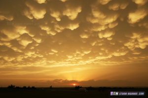
When I reached I-40 at Hinton, the sky lit up with a nearly Dodge City-caliber sunset mammatus display, which I stopped to watch and photograph for about 20 minutes:

may1817b.jpg

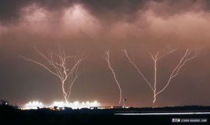
After this, while driving east at El Reno, I saw multiple upward lightning discharges occurring at the OKC tower farm under the stratiform shield from the exiting MCS. I stopped for a few minutes to grab a couple of these at El Reno:

may1817c.jpg
 
I saw the same tornado as Bill Hark, but from farther away and through the trees. Can't really call this chase a bust since I did see a tornado, but from my distance it was intermittent views through the trees and low contrast. And I was moving and got no video until I found a place to stop, and by then the tornado was coming to an end. Tried to video while driving but messed that up. Honestly, from where I was I could not tell whether it was a tornado or just a funnel. I was on that storm from the time it started, having noticed agitated cumulus east of my target of Greensburg (modified northward from Coldwater due to road closures) and decided to go for that area. Then followed it north to Great Bend. Later, as I navigated the flooded roads in Great Bend, I noticed a nice-looking storm developing NE of there and decided to go for it. Soon it was TOR-warned but did not produce as far as I know, and I could not catch up to it anyway. Full report to come later. But overall a bit of a disappointing day. Yes, at least I saw a tornado, but brief, low-contrast, through trees, too far away, and not much to show for it in pics or vid.
 
I chased this day leaving Iowa the night before and arriving in Pratt, Kansas around 2:00PM. I was chasing mostly solo this day, had a friend with me, but I did most all of the driving. So therefore, as rule of thumb would have it, my photos are less than spectacular because I messed up the focus settings on my camera (noob move I know), but its tough when you're driving and you are putting safety first. Anyway we got on the storm near Seward, Kansas and saw several tornadoes, mostly weak though. The first tornado of the day occurred as I was driving up to it, I didn't get any quality shots of it because I was driving, but my friend, Kholby Martin who was caravanning with me got this shot looking north at the time. I got a few shots, but they are mostly blurry, and like other posters here, trees and pull-offs were my enemy as far as viewing what looked like a decent tornado to me. Anyway here is my buddy's shot who was ahead of me:
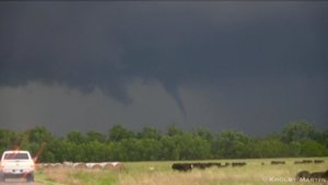
36931b1c5f3cf5afa0563076eb1e6037.jpg

I managed to pull over and observed tornado #2 to the left of the tree-line and got a blurry shot out the window as it did an elephant trunk to the ground kicking up some debris. A new mesocyclone was already developing to the WEST....yeah the storm motion on this thing was to the northwest initially so like Dodge City I expected the hand off to occur there and indeed it did.
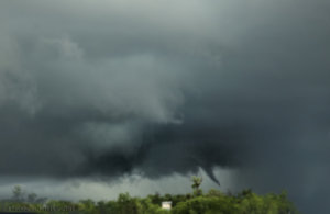
9f054afacc1cee4fdbcfc19490185291.jpg
Sorry about the quality, normally I'm never this bad, but like I said, try driving and doing everything at ONCE and you'll get frustrated too. Still a beautiful sight. Tornado #3 already forming in the foreground to the left...I found a pull-over spot and thought we were going to get a significant tornado as the low level rotation ramped up significantly, vortices would occassionally lift from the mid-point above the ground kicking up some dust.
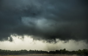
90a5868d2e33da3d0330cad27716270f.jpg
Weak multi-vortex tornado southwest of Seward, Kansas. Every now and then a vortex would rip up from underneath the meso, pretty weak stuff though.

It was at this point that another supercell from the east had merged with the original storm and things were getting messy. I found an east road option and manage to see TWO additional tornadoes southeast of Seward....again very brief and weak. The cone condensed all the way down before I could pull over (theme of the day) and the rope condensed all the way down after I left (lol). Both were kicking up some debris, I had to do some contrast enhancing because I was so far away...but still a neat shot regardless I guess.
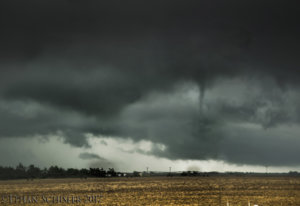
277aef59b2e7b0335e1ba15a53cbbccb.jpg
Two tornadoes at once SE of Seward, Kansas

I bailed west at this point for a supercell near Pawnee Rock, Kansas which appeared to be harboring a significant tornado. However the problem here was that the storm motion wasn't favorable for long lived tornadoes as the storms were moving either northwest or north and jumping the warm front. So I got west near Pawnee Rock, Kansas and got in the RFD of what I thought at the time was a very large tornado. I couldn't shoot any photos or video because the roads were so bad and I almost got stuck. I did witness what I believe to be another tornado off to the southeast of the main mesocyclone as I exited the bears cage just east of town. Road options really hampered getting closer and my tires on my vehicle don't do good on Kansas or Nebraska roads..
2b64ae7848b347aaad0f4f14df03b501.jpg
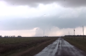
Brief cone tornado near Pawnee Rock, Kansas

After that, the storms pretty much died out in my vicinity, I went after one last storm southwest of Greensburg....but it didn't do much, so i got a hotel in Greensburg and was asleep by 9pm after driving over 13 hours all day. Was an exhausting day and exhausting chase, but I suppose it was worth it considering I still saw 4 or 5 for sure tornadoes. I was kinda upset over missing the big tornado near Seiling, Oklahoma....but Southern Kansas was my target all along and it verified for me with some tornado shots, I just wish they could have been better and more longer lived....but that is how it goes. I chose to head home the next morning and not chase the next day because things looked pretty hosed....that ended up being a poor decision...but at least I made it back to Illinois (a 12 hour drive almost) by 8pm lol.
 
Back
Top