This was a fantastic day on the Oklahoma target!
Summary:
May 18 was a highly successful chase day in west-central Oklahoma, playing the southwest side of a moderate-risk zone as per the SPC. The tornado probabilities were 15%, with hail 45%, and wind 15% - With significant (hatched) tornado and hail probabilities. There were three possible targets for this day: One up in NW Kansas / SW Nebraska, one in NW to west-central Oklahoma, and another down in NW Texas. The Oklahoma target was preferred. I left Enid around lunch time and after attending church there, via Highway 412 west, choosing a refined target area near and to the southwest of Woodward, Oklahoma. It became apparent that convective initiation was imminent while in Woodward during mid afternoon, with a warm front to the NE and dryline approaching from the west out of Texas. The SPC issued MCD 860, and subsequent tornado watch box 287, valid until 10 PM CDT for my target area.
A convective shower was noted to the southwest near Canadian, Texas, and began moving towards Higgins just after 4 PM. I headed west and southwest out of Woodward, via SR 15, reaching the now developing supercell storm southwest of Shattuck, Oklahoma and west of Highway 283. The storm split with the right side consolidating and moving slightly east of the mean motion vector. This storm rapidly strengthened over Ellis County, then became tornadic, and passed near Arnett and eventually near Sharon. Up to 5 tornadoes were observed with this storm, especially near Arnett, with giant - And destructive hail - Causing damage to the vehicle windshield on Highway 60. I continued east on Highway 60 to near Vici, then north towards Sharon along SR 34. The chase was wrapped up before disk near Mooreland along Highway 412. I headed east from there to I-35, then south to Highway 64 east, then Highway 177 to Stillwater, where I spent the night.
Storm chasing details:
May 18, 6:00 PM - Interception and direct penetration of an extremely severe and tornadic thunderstorm from just southeast of Higgins, Texas, and northeastward past Arnett, Oklahoma, mainly along and near Highway 60 from Libscomb (TX) to Ellis County (OK). The storm was a powerful cyclic (LP / classic) supercell storm. The storm produced at least 5 tornadoes, all of which were observed, including a significant one at close-range barely missing Arnett. Tree damage was noted with this storm, as well as some ground scouring. Giant hail was encountered with this storm, with stones up to 3 inches, damaging the vehicle windshield with the tornado in progress west of Arnett. 60+ MPH RFD winds were also encountered, along with moderate rain and frequent lightning. The storm eventually evolved to LP mode from near Arnett to west of Sharon, and subsequently weakened via down-scaling near dusk. Conditions causing the storms were surface heating, a dryline, a warm front, low pressure trough, and strong upper trough. Documentation was digital stills, audio, and HD / 4k video. A 2022 Jeep Renegade was used to chase the storm. A tornado watch was also valid for the area until 10 PM CDT.
Video link:
Gallery:
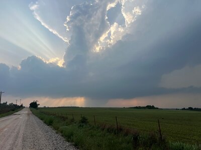
 Above:
 Leaving Woodward, Oklahoma and heading south and southwest, a small storm fires between Canadian and Higgins, Texas. Anvil blow-off streams overhead. The view is to the southwest.
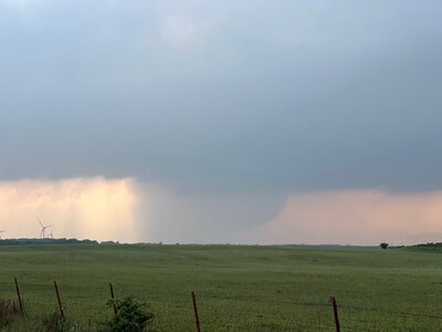
 Above:
 One of the first tornadoes from this storm. A thin rope with dust swirl below it. This was near the TX / OK border by late afternoon. The view is to the west.
 Above:
 Incredible view of a tornado at maximum intensity southwest of (and barely missing Arnett). Praying the town would be spared, the tornado rapidly lifted and no damage was caused in Arnett. The view is to the southeast.
 Above:
 Hail up to 3" smashes the windshield. Giant hail was being pulled around the mesocyclone from the northeast to southwest on the NW side of the storm.
 Above:
 Fifth and final cone tornado plants just northeast of Arnett. The view is to the north during the early evening.
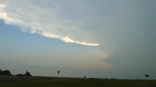
 Above:
 View of weakening LP supercell storm west of Sharon with incredible storm structure and "barber pole" updraft.