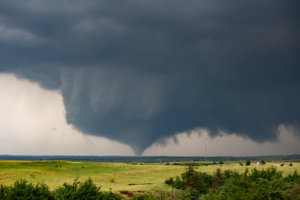
2017-05-18 REPORTS: KS/OK/TX

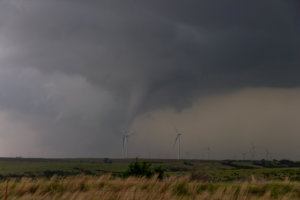
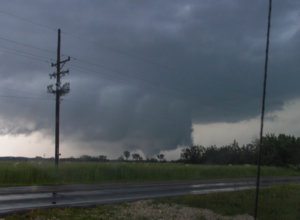
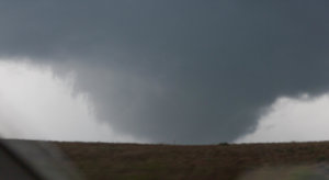
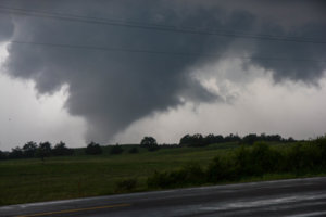
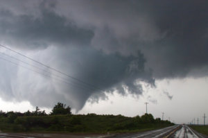
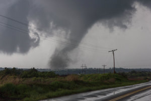
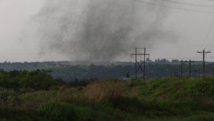
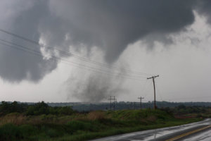
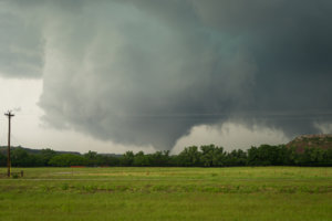
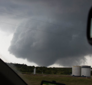
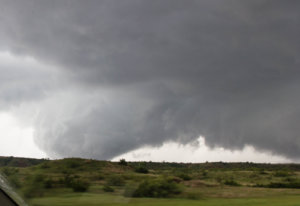
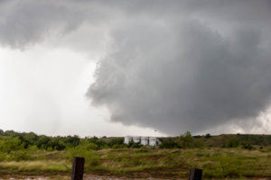
My target was Seiling, where I planned to sit and wait to see which/if any sups later in the day would form and become dominant. However, that plan was altered after we stopped in Clinton for gas/lunch. While there, we watched the early sup in SW OK crank up and become tornado-warned, and then produce a confirmed tornado. I wasn't expecting that so early, and I began to question my entire forecast; would this early show end up being THE show, and if we sat there patiently, might we take ourselves out of the day by simply choosing to watch it from afar while waiting on storms that would never come? We waited...and waited...and waited. Finally, I decided to try and get in front of the storm as it rolled NE towards Cordell. We drove down to Cordell, but I couldn't shake the feeling that we needed to go back to Clinton and just continue to wait for later, better storms. So, we turned around upon entering the north side of Cordell, and drove right back to the same spot on the south side of Clinton off US183. And we waited...and waited...and waited. Reports of more confirmed tornadoes with the cell (now south of us and out of play position-wise) continued over the scanner. Visually there was no help, with storms everywhere and anvil shadows casting gray gloominess over the entire sky. It never occurred to me to continue with my original plan and just drive to Seiling, until a tornado warning for a storm we couldn't even see from 30 miles away came over the scanner. This was it, this was our shot. We blasted north for 30 miles, still having no clue visually about the storm. Upon approaching the OK51/US60 intersection west of Seiling, a huge updraft base/lowering came into view...with what looked like a large tornado below it. We quickly figured it out, and urgently worked our way through Seiling as quickly as possible, heading north on US281 towards Chester. The tornado came into view gradually, but trees were an issue and we were only getting a look in glimpses. By the time we found a stopping point, the tornado was roping out over the road. We continued north a few more miles, then found an excellent spot. We watched a second tornado develop from another huge, sculpted updraft base, which was morphing steadily between multiple vortex fingers/truncated bowl/fat stovepipe. Once the contrast became too bad, we continued north, only getting glimpses between hills, trees, and chaser traffic. Decided to leave the storm after this tornado roped, and headed back south and west to pick up a severe storm near Leedey. Nothing came of this, and we called the chase. Video of tornado #2 (near Cedardale) is below...

 
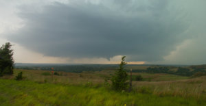
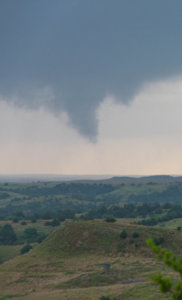
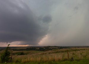
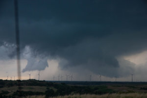
We left Owasso Oklahoma at about noon on and headed west. Primary target somewhere west or south of Enid. Cells started going up about the time we hit Lahoma and we noticed a cell merger taking place south and west of us. We opted to head south toward Seiling despite the poor radar presentation. We knew we were in the "vance wedge" and felt the cell was isolated enough that it might make something happen. As we were coming into Seiling the cell went warned. Once we got to Seiling we went another few miles to the south and thats when it got really fun.
 

Attachments

  • IMG_2325.jpg
    IMG_2325.jpg
    160.5 KB · Views: 2
  • IMG_2326.jpg
    IMG_2326.jpg
    93.6 KB · Views: 3
  • IMG_2332.jpg
    IMG_2332.jpg
    188.5 KB · Views: 3
  • IMG_2343.jpg
    IMG_2343.jpg
    129.4 KB · Views: 3
  • IMG_2345.jpg
    IMG_2345.jpg
    143.6 KB · Views: 3
  • IMG_2366.jpg
    IMG_2366.jpg
    210.9 KB · Views: 3
  • IMG_2374.jpg
    IMG_2374.jpg
    86.5 KB · Views: 3
Here's a few more images. This was as the storm was north of Seiling and heading in the general direction of Waynoka. We couldn't get much closer due to the significant chaser convergence, folks driving 25-30mph on state highways, blocking intersections stopped and out looking, really dumb behavior by some folks.

The good news was despite that mess we were still able to grab some shots as the cell cycled a couple of times. As we got up north on a clay road we thought we might get another tor out of it but it couldn't quite muster it .
 

Attachments

  • IMG_2386.jpg
    IMG_2386.jpg
    145 KB · Views: 3
  • IMG_2388-2.jpg
    IMG_2388-2.jpg
    191.8 KB · Views: 3
  • IMG_2396.jpg
    IMG_2396.jpg
    175.1 KB · Views: 3
  • IMG_2397-2.jpg
    IMG_2397-2.jpg
    187.9 KB · Views: 3
  • IMG_2397.jpg
    IMG_2397.jpg
    173.9 KB · Views: 3
Last edited:
Great shot Greg
I finished pulled the rest of my shots down and running them through light room real quick this morning, here's a few more.

I believe these were all north of 412 as we drove up 281 toward Waynoka.
 

Attachments

  • IMG_2441.jpg
    IMG_2441.jpg
    97.3 KB · Views: 0
  • IMG_2449.jpg
    IMG_2449.jpg
    140.1 KB · Views: 0
  • IMG_2444.jpg
    IMG_2444.jpg
    144.6 KB · Views: 0
Last edited:
Well, after reviewing my pictures and video and comparing notes with other chasers, I am feeling better about this chase than I initially did. Although I knew I had at least one tornado, my video of it was poor, distant, and low contrast, and a bad navigation choice had deprived me of an at least somewhat better/closer view. However, I now know that I saw at least two tornadoes, and very possibly three - and my video of the second one is better, even though at the time I was not at all sure it was a tornado. And I got some nice pictures of other storms, too, including at least one more funnel cloud on another storm. So all told, 2 or 3 tornadoes, at least 2 funnel clouds, and a couple storms that were in some ways more photogenic than the ones that produced the tornadoes.

I have now completed my chase report, which includes my video of the two definite tornadoes and one possible one, as well as several pictures of that storm and several others, including one northeast of Great Bend that gave me another funnel cloud. You can access my report at:

http://www.johnefarley.com/chase51817.htm

That storm by Pawnee Rock that nobody was on initially to the west was an absolute beast. We saw at least 2 tornadoes (albeit weak) with that one. I thought actually for a minute it was going to wedge with the pregnant looking base, but the storm motion was more northerly so not favorable for significant tornadoes along the boundary. Still a fun day (to me) in Western Kansas. I didn't have any issues with chaser convergence either, which is crazy for a kansas high risk day lol. Figured I'd add that in there since the discussion is still going.
 
Started the day in Woodward, and initially went after the cell that was developing west of town. I soon let this storm go though, as it was becoming HP, had other cells interfering with it, and was moving into a less favorable environment. I noticed a nice discrete cell in a better environment off to the southeast near Taloga, and set off in pursuit of it. I finally got a view of the base near Chester, and was soon treated to a stovepipe tornado complete with a beautiful Chapman-esque RFD occlusion above it. a9d4d388cd1d6beb84fb97c0e468793f.jpg
I followed the storm until it began to weaken north of Waynoka, and then played around with a couple other cells before heading to Enid for the evening. It felt good to finally get some May 18th redemption, as exactly 4 years earlier I chose OK over KS and missed out on the Rozel beauty, but thats storm chasing, you win some and you lose some!
 
I was reviewing some video of a cell near Alva, OK, about 4:45PM/2345Z. I remember being frustrated the funnel on that storm didn't take root. But months later, taking time with the video tonight, it looks like there may actually have been a brief spinup associated with it. The dust seems more associated with movement of the funnel than the RFD. There is a report close to that time in the right spot at NOAA - 2017 Oklahoma Tornadoes. (Report #38)

 
Good day all,

Below is my late-posting of this chase log for May 18. I was also chasing with Derek Sibley on this chase.

Summary: On May 18, we woke up to a high-risk chase day, expecting a major tornado outbreak in Oklahoma. By the end of the day, it turned out to be more or less mediocre day for chasing with more messy storm development instead of discrete supercells. We forecasted and left Oklahoma City during the morning and headed west to near El Reno on I-40, then Highway 270 to the preliminary target area of Woodward, Oklahoma, stopping there to look at data and for lunch. By 1630z, the SPC had much of NW Oklahoma and SW Kansas in a high-risk outlook. Tornado probabilities were 30%, wind at 30%, and hail at 45%, ALL hatched for significant. By early afternoon, SPC issued MCDs 756 and 758, and subsequent PDS (particularly dangerous scenario) tornado watch boxes 235 and 239 for the area, valid until 8 and 11 PM CDT, respectively. From early afternoon, it became apparent that convection was developing from south to north in a weakly capped environment, which is bad for a good chase. The result was a messy cluster of storms everywhere by late afternoon, with tornadic supercells embedded in areas with better air to work with, not the fearful long track violent tornadoes expected by many.

The chase took us out of Woodward to west of town near Fargo and Fort Supply, then north on 183 to 64 east out of Buffalo and to near Alva. Two tornadic supercells were encountered there, one rain wrapped near Alva, and another classic one with a tornado near Avard and NE of Waynoka off Highway 281. We backed up 281 to Alva and back west on 64 to SR 14, then south to reach 281 and all the way to Seiling, then continued south via 183 to near Custer City, and west on SR 33 to check convection near there. We wrapped up the chase via 33 back to 183 south to Clinton, meeting several other chasers (including Ben with Weather Nation and Tim Marshall) for dinner. I did an interview there as well for Weather Nation. After dinner, we spent the night in Clinton, Oklahoma.

1). May 18, 3:00 PM - Interception and observation of a very severe thunderstorm from near Fargo, Oklahoma to Fort Supply in Harper County, and along SR 46 to Highways 64 and 183. The storm was a classic to HP supercell thunderstorm. A rotating wall cloud was observed with this storm, but it quickly evolved to a line segment and weakened due to storms developing south and southeast of it. Conditions encountered were heavy rains, frequent lightning, 60 MPH winds, and small hail. The main core was not penetrated. Conditions causing the storm were surface heating, a dryline, a low pressure area, and upper trough. A 2016 Jeep Wrangler was used to chase the storms. Documentation was digital stills and HD video. A PDS (particularly dangerous scenario) tornado watch was also in effect for the area until 8 PM CDT.
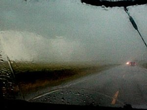
2). May 18, 4:30 PM - Interception and penetration of a very severe and tornadic thunderstorm in Woods County, Oklahoma near Camp Houston along Highway 64. The storm was an HP supercell storm with a possible rain-wrapped tornado in progress as it was penetrated from the west. A funnel cloud developing and disappearing into rain was observed, with an area of strong rotation / dust being lofted as the weak tornado developed and lifted north (in poor visibility). Hail to 1", strong winds to 60 MPH, very heavy rains, and frequent lightning was also observed when penetrating this storm. Conditions causing the storm were surface heating, a dryline, a low pressure area, and upper trough. A 2016 Jeep Wrangler was used to chase the storms. Documentation was digital stills and HD video. A PDS (particularly dangerous scenario) tornado watch was also in effect for the area until 8 PM CDT.

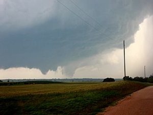
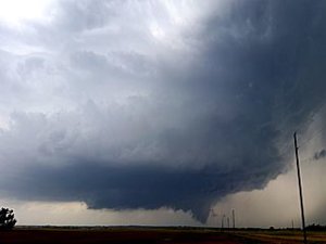
3). May 18, 5:15 PM - Interception and observation of an extremely severe and tornadic thunderstorm in Woods County, Oklahoma along Highway 281 and between Avard and Waynoka. The storm was a classic and cyclic supercell storm. A large cone (or even wedge tornado) was observed with this supercell looking southwest from near Avard. The tornado evolved to multi-vortex and then a large wall cloud. Another wall cloud and large funnels developed as the storm cycled. The funnel formed from the new mesocyclone while the tornado near Waynoka was still in progress. The storm also had a very striking visual appearance (with "stacked plates" presentation). This supercell evolved to LP through downscale growth and weakened northwest of Alva. The storm core was not penetrated (contained at least 2" hail), but light rains, 40 MPH winds (inflow), and frequent lightning was observed. Conditions causing the storm were surface heating, a dryline, boundary interactions, a low pressure area, and upper trough. A 2016 Jeep Wrangler was used to chase the storms. Documentation was digital stills and HD video. A PDS (particularly dangerous scenario) tornado watch was also in effect for the area until 8 PM CDT.

4). May 18, 6:30 PM - Interception and observation of a severe thunderstorms from west of Custer City and near highway 183 and SR 33 west of Putnam and Arapaho in Dewey and Custer Counties. The storm was a multicell cluster of strong and severe storms, formed by two supercells evolving to HP and merging ahead of the dryline. A large funnel was observed on the forward flank of the storms west of Putnam, as well as a large shelf cloud towards the southern portion of the storm complex. The cores were not penetrated. Frequent lightning, heavy rains, and 45 MPH winds were encountered. Conditions causing the storm were surface heating, a dryline, a low pressure area, and upper trough. A 2016 Jeep Wrangler was used to chase the storms. Documentation was digital stills. A PDS (particularly dangerous scenario) tornado watch was also in effect for the area until 8 PM CDT.


m18tor27.jpg

Above: Possible rain-wrapped tornado to the west and northwest of Alva, Oklahoma on May 18. The tornado would be to the left in this picture. The view is to the east.
m18tor28.jpg

Above: First view of the Waynoka tornado from near Avard, Oklahoma looking to the west and southwest during the afternoon of May 18. The tornado, although weakening, is in the center of this picture. The next storm "cycle" is to the left of that (funnel / rotating wall cloud).
m18tor29.jpg

Above: New rotating wall cloud / funnel near Avard on the Waynoka cyclic supercell. The storm was classic structure, with a striking visual appearance.
m18fun5.jpg

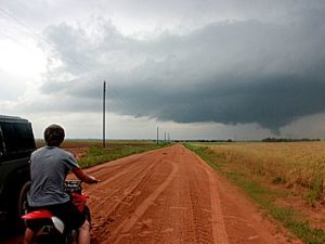
Above: Funnel and supercell structure with a teenager (from a local farmstead riding his dirtbike) watching it. The view is to the west near Avard, Oklahoma.
 
Back
Top