Ethan Schisler
EF5
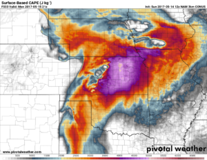
I figured I would start a short thread for this one. I'm limited on time, but things look fairly decent tomorrow along the dry line in West Central Kansas. It kind of reminds me of May 21st last year (the Leoti day). The NAM and GFS both show the first in a series of shortwaves ejecting into the plains for tomorrow. Instability ahead of this feature looks very high with values exceeding 3000 J/KG over a large portion of real estate from Iowa back to the Texas Panhandle.
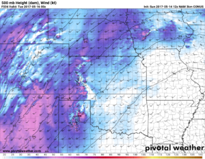
And by 21-00z a 40-50 knot shortwave ejects into the high plains and allows for storm intiation between this time period.
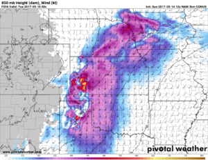
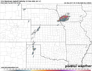
850mb winds look to back nicely toward sunset as well. A cap bust might be my only concern, however with the progged shortwave, I think storm initation could and will occur. The 3km NAM is showing CIN mostly eroded over a large portion of Kansas by 21-00z anyway. As far as targeting tomorrow. I could see a target in Kansas, perhaps the Texas Panhandle and if the 12km NAM is right maybe another one up in Iowa. I wish I had more time to go into detail on each of these areas, but I don't. So I figured I'd leave this up as a place-maker to get talk going!

And by 21-00z a 40-50 knot shortwave ejects into the high plains and allows for storm intiation between this time period.


850mb winds look to back nicely toward sunset as well. A cap bust might be my only concern, however with the progged shortwave, I think storm initation could and will occur. The 3km NAM is showing CIN mostly eroded over a large portion of Kansas by 21-00z anyway. As far as targeting tomorrow. I could see a target in Kansas, perhaps the Texas Panhandle and if the 12km NAM is right maybe another one up in Iowa. I wish I had more time to go into detail on each of these areas, but I don't. So I figured I'd leave this up as a place-maker to get talk going!

