Ben Holcomb
EF5
Seems like the possibility of a deep south Texas tornado event on Sunday. I have been watching the evolution of this system for almost the past week, and models (GFS and NAM) have been consistent with a strong, negatively tilted shortwave blowing through Mexico and TX on Sunday with a warm/moist warm sector ahead of it.
Trends have been further south than original models (which had us chasing almost to the Red River) but some things have remained consistent - a pretty moist (dewpoints >60F) albeit small warm sector ahead of the dryline with a northeast moving low. The dryline was showing rapid eastward propagation in earlier GFS runs, but the 12Z NAM today seems to back off on that, holding it consistently near the US/Mexico border.
I am seriously considering a run south on Sunday.
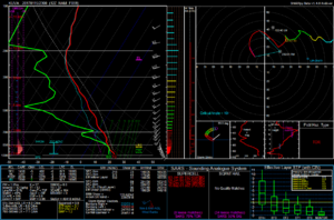
Here is a sounding from Uvalde, TX at 23Z Sunday.

