2016-10-04 EVENT: TX, OK, KS.

adlyons

EF2
Joined
Feb 16, 2014
Messages
167
Location
Norman, Oklahoma
SPC SWOD48 has highlight a 15% risk area for day 6 across portions of the southern plains for a potential severe weather day. This has been something myself and a few friends have been watching on the long range guidance for a few days now. It has remained remarkably consistent over the last few runs with some minimal changes in timing and structure of the ejecting wave.

General Synopsis:

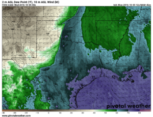
Current upper level flow is dominated by enhanced ridge across the central us associated with a west coast rex block as well as a remnant cutoff low over the ohio valley and eastern us. Medium range guidance indicates little change over the next 3 days with high latitude zonal flow developing around the periphery of the central US ridge. Cut off low is expected to meander around the east coast eventually weakening. Beginning day 3 western US ridging begins to break down in advance of developing west coast trough moving on shore by Day 4 Sunday. Trough continues to dig and move into the great basin 4 corners region by Day 5 Monday with the development of a strong lee cyclone along the front range. There is some uncertainty regarding the placement and strength of this low. 500 mb trough should continue to deepen before ejecting out across the central US and southern plains by day 6 Tuesday. Strong flow aloft and the development of a strong lee low suggest potential for strong low level jet development. In terms of moisture the gulf has generally been unaffected by several weak cold fronts along the gulf coast and has retained seasonably strong moisture with PWATS over 2 inches pooled along the mexican coast. However TS Matthew is inducing offshore flow along the eastern half of the gulf shore which could potentially impact moisture return. Regardless, Models show the development of a nice sharp dryline through much of the southern plains with adequate moisture (dewpoints in the upper 50's and low 60's)

Things to like:


Things not to like:
  • Timing differences between GFS and ECMWF have been noticeable at times. GFS has been showing the main wave ejection earlier and more neutrally which drags the whole system to the east and north wile messing with the shear profiles. AKA Veer Back Veer.
  • Moisture return has been iffy on several runs. Offshore flow from TS Matthew could impact the quality of moisture return. The GFS has been mostly consistent in keeping low 60's (62-63) into southern kansas.
  • Mid and low level lapse rates have also been less than ideal. Cloud cover ahead of the dryline in some of the models appears to be limiting the surface temperature impacting instability. Would like to see the development of a wider instability corridor and some higher surface temps.

Summary:
Looks like the fall season could get rolling here soon with an active pattern. This setup may be worth watching. Looks like some of the major ingredients are in play. Fall events can be quite large like last years November 16th Outbreak. Always good to pay attention and see what happens.
 
I agree entirely on what you have said. The main problem so far (and I know that the available energy is the hardest to predict) is that we don't know how much energy will be in the atmosphere. Also, where do you receive forecast accurate hodographs? I cannot ever seem to find any, especially on Pivotal Weather.
 
I agree entirely on what you have said. The main problem so far (and I know that the available energy is the hardest to predict) is that we don't know how much energy will be in the atmosphere. Also, where do you receive forecast accurate hodographs? I cannot ever seem to find any, especially on Pivotal Weather.


Not sure what you mean by forecast accurate hodograph.
 
I was meaning that some of the hodographs were completely different than the SPC, which I have fixed the problem on my own, forgetting that there were numerous forecast models! Thanks anyway though.
 
Good stuff! 12Z GFS today got my attention. Agree with your "Reasons For" and have the same concerns. Moisture always worries me with fall set ups, but like you stated the GFS has been consistent at progging low 60 dews. Be nice of that sun was out in advance of the DL to really drive up CAPE and lapse rates. It's a long drive out so here's to things improving over the next few days.


Sent from my iPhone using Stormtrack mobile app
 
The event has came into the range of the 12km NAM as of this morning. One thing I've noticed is that both the GFS and NAM have shown a secondary surface low forming in SW KS/NW OK during the day on Tuesday, however there isn't agreement on how well organized/long lasting it will be. As of right now based on the NAM/GFS I've been favoring the area in South Central Kansas/Oklahoma border region. Instability on the latest NAM is quite higher than the GFS (however that is usually the case with that model), likely overdone somewhat. Storm mode will be the biggest question if the NAM solution comes into fruition in my eyes. I'm not a fan of the NE/SW oriented dry line, nor the strung out surface lows.
 
To continue with what Greg said, there seems to have been a notable increase in moisture on all of the aforementioned soundings from 00Z to 12Z. Surface dewpoints have made it to the 60s in Southern Oklahoma per the mesonet at this hour. The real question in my mind is lapse rates - They seem to be mediocre at best both in forecast and in real soundings to the west right now. I would like to see mid levels be >7C right now, but they aren't.

Water Vapor shows a vigerous trough in the western US, just now starting to eject over the rockies. I'm still concerned about timing, as the NAM hasn't had completely optimal timing, but with a system this strong it may not be a problem.

Bottom line, I feel like I'll be pulling the trigger and chasing in Oklahoma somewhere along the dryline tomorrow afternoon.
 
The biggest unknown right now for me is when the first jet maxima will eject over the High Plains. We already have pretty meh lapse rates to the west (thanks to the source region being nice and wet along with a Pacific airmass sitting over northern NM/western CO) which would definitely not benefit from a lead impulse shooting off convection over the target region. That said, 6.5C/Km definitely isn't a death knell and it looks like we might get modest height-falls/mid-level cooling in the early afternoon in SW Oklahoma along the dryline to maybe compensate a bit. The shear profiles are also a bit hit or miss just going off what the 12Z NAM has tossed out, but there are definitely some profiles that look favorable enough around the 40 corridor down to the Wichitas.

I don't have any real expectations for this one, but I'd be surprised if we don't see a storm squeak out at least one tornado somewhere on the dryline tomorrow, barring the profiles going full VBV.
 
4d2474cef3d5848acc7dfbc66085adba._.png

I know most local folks in the Southern Plains will be chasing tomorrow. Not every October you get a decent southern Plains setup. Overnight and morning model data has continued to trend the Kansas target downward in terms of chaseable tornadic potential. It appears probable a cool pool will develop with early afternoon convection. That cool pool/OFB will move east and shrink the warm sector through early evening. It'll also tend to undercut convection and diminish tornado potential. There will likely be a few brief tornadoes along with plenty of large hail and damaging wind gusts. I wouldn't be too surprised to see a small MDT in KS for hail/wind potential if everything were to come together.

1fa8dbee6c7511f90e43fd742f09c17a._.gif

970be56ce4f29f21abf34ea7811e03d1._.png

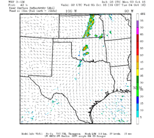
My focus on a chaseable target will be in West-Central to Northwest Oklahoma. My preferred model of choice is the 0Z/06Z TTU WRF. This typically conservative model shows the Kansas play well along with a few discrete cells south into Central Oklahoma. 12Z 4KM & 12KM NAM indicate any dominant supercells would have the potential to become tornadic. Storm motions will be a tad more favorable and with more discrete storm mode compared to Kansas. Potential caveats that could diminish potential tomorrow would be convection tonight that results in more cloud cover tomorrow. Another factor would be if moisture return is less impressive or more shallow than models show. If some of this morning's model runs do come to pass I wouldn't be surprised if one or two supercells produced a couple tornadoes tomorrow in Oklahoma - possibly infringing on the OKC metro by 7 PM. We'll see how trends evolve tonight.
 
Been delighted to see the moisture forecasts improve as this event has neared. It seems increasingly likely we will see mid to even isolated upper 60s dews throughout OK and into S/C KS (not upper 60s in KS, but mid 60s still seems plausible). Cloud cover is also trending downward, leading to warmer surface temps forecast in the 80s rather than the 70s as the GFS had been suggesting for days coming in. Despite the adequate low-level thermodynamics for early October, the comparably poor lapse rates result in unexpectedly lower instability compared to what you'd typically expect from something like 82/68 in April or May. Widespread 2000 MLCAPE during the afternoon appears unlikely, but there will likely be isolated spots where such instability exists, albeit briefly. Such CAPE is still plenty to get tornadoes when considering the impressive deep layer shear and adequate low level shear.

My remaining concerns are the following:
-Will cloud cover verify as more widespread than forecast, thus seriously limiting instability and storm coverage?
-Will storms go too early and overturn the atmosphere, thus wiping out large swaths of the warm sector before prime time?

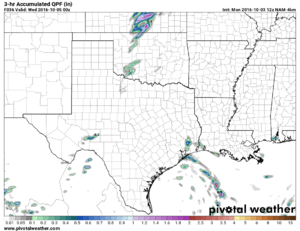
Most of the models, especially the NAM, GFS, SREF, and NCAR ensemble, have been rather aggressive with precipitation coverage throughout the day north of the KS-OK border. While more sparse south of the border, forcing is also weaker, and with the potential for limited convergence near the dryline in OK, a "cap" bust cannot be totally ruled out (note "cap" in quotes because there really isn't going to be much of a cap, but storms could still fail to form due to lack of forcing).

It's also interesting to note that two members of last night's NCAR ensemble progged rotating storms along the Red River, near LAW/SPS. Couldn't really discern the environmental differences between those members and the others that didn't fire much down there. So uncertainty is still an issue with this system. At this point, i could see this being anywhere between a regional severe weather outbreak and a mostly benign, isolated thunderstorm day.
 
I haven't had a chance to dive really deep into tomorrow, as I won't be able to chase, but based on SPC SREF it looks like we've got a Goldilocks zone from Beatrice, NE down to Wichita, KS. 1500+ Cape, good SRH, OK ESHR, good forcing, good moisture...It's all coming up just about right for a decent fall event.

Regarding the Northern Target: SREF's bulls-eye is somewhere between Beatrice, NE and Friend, NE. If anyone chases Nebraska a lot they know about the tornado-genesis zone in Jefferson county, which has more tornado's per SQ mi than any other county in the state. If I were a betting man, I'd bet that's a good starting target. I am concerned about early morning crapvection, as the CAMs all predict, but it wouldn't surprise me at all if we get super-cells forming out of their remnants shortly after lunch with continued convection down the line to the SW.

As for the southern target, I really like the Wichita area and chasing tail-end Charley. Anything north of that might get cutoff from the southerly flow too quickly or get cold pooled and anything south looks like will have weak forcing. Good luck tomorrow, gentlemen!
 
Looking over 00Z data, the NAM seems to be way overdoing moisture. In fact, after looking at the 00Z LCH sounding, I am quite concerned. Most of our sfc winds are out of the SE and gusting up to 46 mph (Beaver, OK) this hour with dewpoints in the upper 50s to low 60's. With that said, the LCH sounding shows significant drying in the moisture profile, especially below 850mb. Flow in the gulf appears to be mostly East to West, with the best moisture showing up in the CRP/BRO soundings.. and even Del Rio.. but that doesn't seem to be our source region at this hour, so I don't know if we'll realize the upper 60s dewpoints the NAM is showing with 2000+ CAPE. Seems like that might be quite a bit overdone.

That said, if anything fires off the dryline in OK, I will be there.
Need to look to the west. DRT has a 65 degree dewpoint.
 
I haven't had a chance to dive really deep into tomorrow, as I won't be able to chase, but based on SPC SREF it looks like we've got a Goldilocks zone from Beatrice, NE down to Wichita, KS. 1500+ Cape, good SRH, OK ESHR, good forcing, good moisture...It's all coming up just about right for a decent fall event.

I have to disagree about this area. Upper level flow is parallel to the sfc boundary with strong linear forcing and little cap. It screams nasty squall line almost immediately. You may have some embedded rotating cells but in terms of discrete or even semi discrete I really think you are going to have a hard time in that area.
 
Back
Top