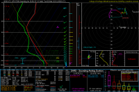
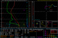
2016-03-07 EVENT: NE, KS, OK, TX

James Gustina

Supporter
Joined
Mar 9, 2010
Messages
671
Location
Dallas, TX
We're still currently sitting just outside of NAM and other medium-range models, but getting the ball rolling on the recent consistency of the GFS and ECM is a good start.

Per the latest 12Z run of the GFS, a lead impulse is progged to enter the southern Great Plains around the late morning on Monday ahead of a much larger longwave that will still be off the western coast of California by late Monday. Moisture return has been the main sticking point so far, with generally varying solutions on the degree of moisture return between the NAM and GFS by Sunday. A weak baroclinic zone situated southwest of SPS appears to stunt return flow over the weekend but has gradually been removed by the NAM while still being present in the 12Z GFS. Mid-50 dewpoints appear to be likely but beyond that is still in free fall and we've still got about two more days before we'll get an actual idea of the kind of fetch we have.

Even with moisture depth and northward limit is still in free fall, a sharp dryline has been consistently appearing to begin the day just east of the state line and sharpen as it traipses east. Slightly backing sfc winds ahead of the dryline coupled with MLCAPE values from 1250-1500 j/kg have been consistent along the dryline from Chickasha through Wichita Falls along the moist axis. While the overall shear profile seems ok, some VBV has been showing up in previous runs and may make things a bit harder. Rapid WAA at 850 mb with the slight SW turn to the 850 winds might introduce some capping issues but nothing has shown up as thermonuclear yet.

All in all, nice to see something with the possibility of putting out some isolated storms on the horizon but what exactly we're looking at all appears to still be in free-fall relative to moisture return and how our vertical shear profile shakes out.
 
I think Wichita Falls and another just inside OK, maybe near Wakita. This from concentrating very long on the recent runs of the GFS.

So with this in mind, I'll back it up to Vernon, TX and Buffalo, OK. (Actually Freedom, but look at the avatar!)
 
We're still currently sitting just outside of NAM and other medium-range models, but getting the ball rolling on the recent consistency of the GFS and ECM is a good start.

Per the latest 12Z run of the GFS, a lead impulse is progged to enter the southern Great Plains around the late morning on Monday ahead of a much larger longwave that will still be off the western coast of California by late Monday. Moisture return has been the main sticking point so far, with generally varying solutions on the degree of moisture return between the NAM and GFS by Sunday. A weak baroclinic zone situated southwest of SPS appears to stunt return flow over the weekend but has gradually been removed by the NAM while still being present in the 12Z GFS. Mid-50 dewpoints appear to be likely but beyond that is still in free fall and we've still got about two more days before we'll get an actual idea of the kind of fetch we have.

Even with moisture depth and northward limit is still in free fall, a sharp dryline has been consistently appearing to begin the day just east of the state line and sharpen as it traipses east. Slightly backing sfc winds ahead of the dryline coupled with MLCAPE values from 1250-1500 j/kg have been consistent along the dryline from Chickasha through Wichita Falls along the moist axis. While the overall shear profile seems ok, some VBV has been showing up in previous runs and may make things a bit harder. Rapid WAA at 850 mb with the slight SW turn to the 850 winds might introduce some capping issues but nothing has shown up as thermonuclear yet.

All in all, nice to see something with the possibility of putting out some isolated storms on the horizon but what exactly we're looking at all appears to still be in free-fall relative to moisture return and how our vertical shear profile shakes out.

Nice analysis!! My biggest concern at the moment is will there be clouds ahead of the dryline preventing max instability build up? Not too convinced that Omaha area is a play due to poor moisture return, but like you said, wait for NAMs. One could argue that better shear environment near the Low, but finding a "middle" ground to everything right now seems appropriate. Way too early to even talk about target areas lol! SPC agrees I guess due to pretty large area. One thing that seems consistent so far is the position of the Low somewhere in south-central Nebraska and the dryline position from KS to OK. I think GFS might be overdoing moisture return that far north, but we'll have to see. I do agree around OK area for better moisture return ahead of the dryline for a possibly moderately unstable air mass (depending on clouds). Cmon on clouds!! Don;t screw this up for us :'(
 
I completely agree with the Wichita Falls area statement. I noticed that the other day as well as a primed area. My only concern is what also was mentioned but at the moment In my opinion I believe this is looking to be a widespread HP event with maybe a low end risk as there will be to much contamination from the multiple weak short waves that are expected to eject eastward through out the week starting on Sunday. This will probably limit any good surface based convection to explode. I certainly won't complain about the rain as it should set up things going into April and May if this pattern continues and this is a hint going forward. One thing I have noticed over the years which models have a hard time picking up on is when these closed lows dip as far SW as the models are expecting. Usually that helps fuel the moisture return in the low level jet that is being shown to be present. They just typically under estimate it especially the Euro. I guess things will be a little more clearer tomorrow and Saturday.
 
Some dry air entrainment in the vicinity of the dryline along with the moisture issues isn't screaming complete HP on the southern end to me right now. But, the slight S-shape to the hodographs down there also makes me think it might be one of the typical early season hybrid days should a supercell manage to get going along the Red River. At this point, it really is hard to say.
 
Not a huge fan of the boundary layer moisture depth on this sounding from the 00z GFS E of Lawton, but otherwise it's pretty darn solid. Slight VBV, but not exactly of the storm crippling variety.

934f11ddfd00f7504928421a8bb2cbf0.png
 
NAM may come out with better southeasterly surface winds as it often does, which if correct would enhance low level shear which is already impressive on GFS. The NAM is also more optimistic with moisture return on Sunday as well as early Monday. Clouds are an issue ahead of the dryline, but looks like enough clearing could occur somewhere ahead of it to produce some isolated supercells. Deep layer shear is lacking near the surface low, with the main upper wave residing south in TX and OK, although the enhanced low level shear could yield some tors if the mid 50s dews can make it that far north. Best target appears to be farther south of the surface low along the dryline where a wider instability axis could develop and the better shear for sustained supercells exists. At the moment this appears to be central KS down to the Red River. It's probably too early to begin picking targets, but overall a pretty impressive setup to start the season after a long drought of March events.
 
I've also been looking at the northern OK/ southern KS area.. the largest difference is the mid-level wind profile weakness (VBV) is not as apparent on forecast soundings up there as it is in southern OK.

Yes dewpoints are slightly lower up there and slightly lower CAPE as well, but it is closer to the colder mid lvl temps (nearing -18C@500mb BY 0z). Also for whatever its worth the GFS has been extremely consistent with developing a descent convective precip. signal on around the KS/OK boarder.

Winds are slightly weaker near anvil level in KS but still do-able from a storm-relative perspective.

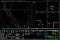
Heres a 0Z forcast sounding from Braman Ok, note less VBV, shorter deep shear vector, solid SRH in lowest 2Km or eff. layer, less CAPE, not much CIN

00_GFS_096_36.85,-97.19_severe_ml.png
 
Just to build off of what @samuel stone noted, the northern extent of decent moisture return definitely increased with the more bullish NAM and the shear profiles in and north of I-40 between El Reno and Watonga have a much less pronounced VBV profile. That said, even with the VBV towards the southern end, the NAM has still been progging pretty damn good low-level shear along the dryline from Watonga to Burkburnett. The NAM pulling the 60F dewpoint line further north also served to add to the previously average CAPE values and is putting 1750-2000 j/kg ML along the dryline with petty excellent curvature in the lowest 1 km by 00Z (about 35 minutes before sunset in the region we're looking at). I pulled a random sounding from between Apache and Carnegie, OK at 00Z shown below.

4e30bde120f553316bf61a958c68a597.png
 
I'll release a forecast for the Northern target area tomorrow, but until then I remind everyone not to forget about the climatology of early spring major outbreaks in the central plains, KS/NE specifically. A very early spring outbreak aka the great Easter Outbreak of 1913 occurred despite highs in Omaha only around 50 and very low CAPE. A strong low was located just to the SW of the area, and intense moisture advection from strong S/SE winds had driven LCL's way below 1km. The positioning of the low, the jet, and the DPVA are similar between that outbreak and Monday, however models indicate that DPVA will be weaker than what we'd expect in a major outbreak, and I consider DPVA to be a highly underrated contributor to outbreak potential.

In situations like this, CAPE only needs to be around 1000, and as long as the surface remains moist and bulk shear and SRH stay stupid high, like they are forecast, tornadoes can pop up just about anywhere the sun shines for a few hours. In the case of extreme moisture advection, its possible to get tornadoes in areas where there was virtually no sunshine or cape at all, due to the magic of theta-E adv.

In summary, keep an eye on the northern target (I'm going to say Hebron, NE to Norfolk, NE for now), the enhanced local vorticity near the low could spell trouble, in particular as SRH ramps up around 6pm, when the Great Omaha Tornado (and a total of 6 EF4+) struck.
 
That lower DPVA value is likely due to the timing of that shortwave ejecting onto the Plains. I wouldn't be surprised if something up by the surface low/WF got going but the storm type with how weak the SR ventilating winds are that far north coupled with pretty low LCLs might make things tricky. That said, with the weaker steering SR winds, storms won't be flying away from the sfc low meaning and on top of the theta-E advection in the lower levels you mentioned, you won't need much sunshine to get storms going up near the low.
 
Agreed with the notion that northern target (north-central KS into NE) could overachieve, but might be too HP for good chasing. I would probably stick to West OK at this point, but things can/will change.
 
The 12Z NAM and GFS are pretty different in the thermodynamic and kinematic nature of this system. The NAM is overall much more "friendly" for severe weather, with steeper lapse rates, more moisture, and thus more instability, but also has weaker winds, and therefore slower storm speeds. If the 12Z GFS verifies across Oklahoma, then expect storm speeds of 40-50 kts, and also possibly punier storms.

One aspect the models agree on that may be of slight concern is the phasing for the southern end of the event. The trough axis is forecast to pass over Oklahoma in the early afternoon rather than in the evening. So the best lift may occur before full destabilization can occur, and if no storms develop by around 00Z when instability is forecast to be greatest, there may not be enough lift to support storm development. As of now, the NAM seems to be going with the latter, as it progs basically no precip along ANY of the boundaries (but yeah, convective parameterization issues yada yada yada). On the other hand, the GFS progs some light convective precip.

I suspect the differences between the NAM and GFS are mostly due to PBL/LSM physics, but if they use different DA systems, then that could be a cause, too. Since we're getting into the transition season with green up in progress at varying rates across the region, and since the green up appears to be early relative to climatology, it is possible the models are not picking up on this. If that's true, then moisture quality is probably being underdone. Also, the Gulf has recovered fairly well from recent "clean sweeps", and we're only looking at a weak offshore component to the flow which looks to be removed by this evening, with no intervening events to block return flow. Also consider lower friction due to less than full seasonal LAI values across Texas. I would tend to think a more moist forecast will verify. But then again, as a chaser, I'll keep my favorite phrase in mind:

"If there's one thing the atmosphere loves to do, it's to prove meteorologists wrong."
 
The lead impulse moving through early might not necessarily be a death knell but it definitely increases the probability of persistent cloud cover and that thermodynamic environment never being realized on top of the lifting issues if the dryline manages to somehow remain clear. Thankfully we've still got some time before we even sample that shortwave which will hopefully provide a clearer picture.
 
I've been watching this most of the week, and basically been waiting for the NAM to come into range.

Over the last several runs, the GFS has been surprisingly consistent. A little more variation between the 12Z and 18Z NAM, though. The GFS seems to push the dryline a little further east, which for me would indicate a target somewhere between I-35 and US-81 in north central OK. As of right now, I'm thinking somewhere between Kingfisher or Enid, where I have the option to quickly recover to the west via OK-33, OK-51, or US-412 if need be. If the NAM stays consistent, I may shift a little west.

After the Carolina chase last week, it'll be nice not having to feel like I'm redlining my motor just to keep up LOL
 
Back
Top