• A friendly and periodic reminder of the rules we use for fostering high SNR and quality conversation and interaction at Stormtrack: Forum rules

    P.S. - Nothing specific happened to prompt this message! No one is in trouble, there are no flame wars in effect, nor any inappropriate conversation ongoing. This is being posted sitewide as a casual refresher.

2015-11-11 REPORTS: IA/MO/IL

Joined
Jan 14, 2011
Messages
3,087
Location
St. Louis
I arrived home in the St. Louis metro late Tuesday night after a multi-day journey to North Carolina, with the primary purpose of the trip to visit my uncle in Charlotte who was in ill health. I learned that he passed away this afternoon.

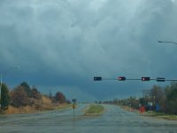
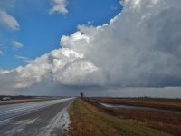
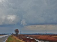
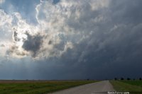
After that trip, I was too tired to wake up at 5AM this morning to get to the surface low target in Omaha/SW IA in time. So, I decided to just go with the easy target of the tail-end Charlie storms in north-central MO. I did not expect much, as they were going to be on the southern end of the arc of convection (usually you want to be on the northern half of that arc in these setups). Nonetheless, I saw some nice storms in the first chase I'd been on in almost 2 months - some small hail and some cool fast-moving rain curtains as the cores swept over the road.

Here is some video from my dashcams.

 
Started out the day in fog and 1/2 mile visibilities in Bennet, Nebraska. Moved east to Syracuse, NE and stationed there for a bit watching as the cells to the west built up. Took a look at the cells coming in from Beatrice and Tecumseh areas - wasn't really liking them at that point. It seemed the dry punch was really starting to affect them already and as they moved north I was concerned they would cross the cold front anyway. Look to my east and sustained area of cumulus, low topped cumulonimbus. Make my way east through Nebraska City, NE when I happen upon the low topped - watch the cell cross east of Nebraska City with a lowering on it as I watch from the city (and stuck at a long red light).

DSCN1409.JPG


As I get closer - lowering goes away but there is still some very weak rotation, then it starts to get what I consider to be the cold core look.


DSCN1422.JPG

- keep an eye on for a bit in that notch - and then a very quick horizontal funnel appears.

DSCN1426.JPG

It rapidly dissipates and then the cell blasts north - it starts to look ragged, so I let it go... I then continue east on Iowa HWY 2 and get overtaken by the arc of storms coming from the southwest. Try to stay ahead of them but fail - can't seem to keep up or see much so decide to call it a chase at 2:15 pm. The cells I were chasing to my east did eventually get tornado warned near Mt Ayr, but wasn't worth it to me to keep following them . After looking back at radar - I realize that the cell I had seen the quick funnel with had gone north and then when it came under the influence of the southwest dry punch and warm front (most likely) threw a tornado down near Avoca, IA. Not unlike what happened near Eads, CO 5/9. Got that one, didn't get this one.
 
Sorry about your uncle @Dan Robinson

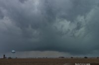
I targeted Unionville, Missouri and got there about 2:00. A line of storms had formed to the southwest and was approaching fast. Just as I started heading north of town towards Iowa a tornado warning was issued.

fe143ec4fb9b3ba8fa1ccb928e610a38.jpg
Iowa Missouri Line by Kevin Palmer, on Flickr

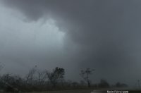
I tried my best to keep up with the storm as it moved northeast at 50 mph. I tried to just drive north knowing the circulation would be getting closer to me at the same time. I couldn't approach it since it was just moving too fast and would have been dangerous. The road network wasn't great either with a lot of hills, trees, and gravel roads. Finally I got as close as I was willing to get and the roads allowed me to. But the visibility was horrible. I tried to bring out some of the cloud detail in this picture. I'm not sure if that is a wall cloud on the right or not. This was near the town of Mystic at 3:20.

e5848f8f7567bcbd0108842a3ff7142f.jpg
Mystic Supercell by Kevin Palmer, on Flickr

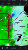
The rotation kept getting stronger on radar and based on the appearance I was almost certain there was a tornado hiding in the rain. And indeed there is a storm report of a destroyed house at 3:27 (about the time of this screenshot).

RS.PNG

I started to wait out the wind and the rain in my car and checked the radar again. A new area of rotation had suddenly appeared on radar and it was already over my head. I saw some low, fast moving clouds but not much else. But a new tornado warning was issued for this rotation about a minute later. I'm glad it was nothing because things change so fast on a 50 mph storm and I had no time to react.

3284b4f19b26fe565044e0e7b10686b6.jpg
Rain Wrapped by Kevin Palmer, on Flickr

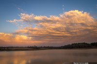
The day ended with a nice sunset on the backside of the storm at Rathbun Lake.

aef08e6f2bd328c8321d8201c73a32e0.jpgRathbun Lake Sunset by Kevin Palmer, on Flickr

Overall I'm still disappointed and wish I had stayed home. At 9 hours of driving this is my longest chase yet. This is the 6th confirmed tornadic supercell I've chased this year, but like all the others I have no tornado pictures to show for it.
 
Yesterday was a challenging chase, and for us (Rob Forry and me) it was complicated by the loss of data right when we needed it most. These were not storms to intercept without radar, rainy as they were and moving as fast as they were. We finally parked our butts (the vehicle, too) at I-35 and US 34 by Osceola and waited for a tornado-warned cell to move in. In that location we at least had radar, but it disappeared jockeying E/W. So after the dissipated circulation moved past us--just to our west, I think--and after enjoying a brief straight-line clobbering, we decided to scuttle east toward Melrose and intercept another cell that showed vigorous rotation to the south. Once we made the move, we quickly lost radar, but it was either that or give up. Fortunately Rob managed to get a bit of nowcasting via ham radio from a couple other chasers, but the bottom line was, we busted. Ironically, one of the day's tornado reports came from Melrose, but with our approach from the west and no knowledge of how the storm had evolved, we opted not to core our way toward who-knew-what. Safety first.
 
I left Kansas City around 9am heading to Rock Port and planned to adjust from there. Once I got to Rock Port I made a great decision to go after the cell that dropped the first tornado that Connor saw. I followed that up with a bad decision to stop and watch a developing cell over Auburn which slowed me up enough that I missed the tornado. It happens as we know luck plays a factor good or bad.

I headed back towards I-29 and got a blue screen of death on my laptop along the way. That ended happening a few times and made it hard to stay focused chasing solo and using RadarScope and PYKL3. I used the apps to stay on the cells in MW MO and made the best of the situation.

I ended up not seeing a tornado but I chased in November on Veterans Day and had a good chase. I was hit by hail, very heavy wind and heavy rain and saw some lowering but nothing was rotating. All in all it was much better than staying in the office and the latest I have chased before.

Congrats to all that scored and sorry to hear about your uncle Dan.
 
I started out in Nebraska City around 11am and went east along route 2 trying to stay ahead of the storms. At some point around 1pm I was in the path of a rotating storm and had to move east. I saw a funnel cloud in my rear view mirror and got out and tried to get a video of it with my phone. As I was filming I noticed a debris cloud near the barn below the funnel (you probably won't be able to see it in my craptastic video). Later, I got caught up in a bigger scarier storm that was heading NE towards Corning, IA and had to navigate out of it. I tried to catch up with it later but I couldn't keep up with it and I decided to head back around 3pm. It was great to finally see a tornado on my second chase.

 
Yesterday was a challenging chase, and for us (Rob Forry and me) it was complicated by the loss of data right when we needed it most. These were not storms to intercept without radar, rainy as they were and moving as fast as they were. We finally parked our butts (the vehicle, too) at I-35 and US 34 by Osceola and waited for a tornado-warned cell to move in. In that location we at least had radar, but it disappeared jockeying E/W. So after the dissipated circulation moved past us--just to our west, I think--and after enjoying a brief straight-line clobbering, we decided to scuttle east toward Melrose and intercept another cell that showed vigorous rotation to the south. Once we made the move, we quickly lost radar, but it was either that or give up. Fortunately Rob managed to get a bit of nowcasting via ham radio from a couple other chasers, but the bottom line was, we busted. Ironically, one of the day's tornado reports came from Melrose, but with our approach from the west and no knowledge of how the storm had evolved, we opted not to core our way toward who-knew-what. Safety first.

I thought yesterday was a pretty successful chase despite some of the set backs (lessons learned). Always great to chase with Bob and get a helpful hand from the HAMs out there when you need it, even though they about blinded us all with (as @Ben Holcomb put it) their disco circus lightbar show... I need to pull my pics and video off my camcorder yet to see what I have. That first TOR warned cell we were on near Osceola was something. I haven't seen cloud decks and ground scraping mesos like that in a while.
 
What a tough chase yesterday, tougher than I expected honestly. I figured given the very strong shear up-stairs, we would have low topped ventilated storms that were easy for viewing (not so easy for chasing due to fast motions). I guess most of that ended up being right, except for the fact we were left chasing embedded type supercell structures. Got on the storm that produced the Corning, Iowa tornado, saw a couple funnels with that that were about 75% condensed, couldn't get any good pics no thanks to the rolling hills and rainwrapping. Evidently this touched down and did some damage per the reports I saw, I can't confirm anything for sure!

Anyway, I headed east on 80 and got ahead of the developing squall line before dropping south of Iowa City and intercepting an embedded supercell near Millersburg, Iowa which produced a tornado as the mesocyclone was in the process of occluding (~4:45PM). The audible roar was pretty good with this even though it was about a mile or so away. It developed to my south and then I was able to parallel it as it moved northward and eventually completely occluded. A new handoff occurred to the east briefly, but I couldn't confirm this second area as a tornado for sure, even though there were likely damaging winds at the surface. Overall not a bad chase, albeit very frustrating due to poor visibility, bad terrain at times, and fast storm motions. I can't complain though, getting a tornado on Veterens Day in Iowa isn't something you can do every year. I've attached a couple video caps below...
c5de0b805e09c7bfc37ef90d5cf0c0ef.jpg

abf828f9d020ce020d373b3b6866353a.jpg
 
Tough chase, but that was expected.

Targeted the SW quadrant of Iowa. Knew I just had to get into a storm and hope for the best as the name of the game was playing tag with QLCS circulations. Got into several of these circulations with dramatic windshifts and swirling tree debris but nothing I can confirm for sure.

We did catch one brief tornado that occurred near or on DSM airport. The tornado apparently did some minor damage to a few of the hangars. Afterwards it was white knuckle driving on I-80 trying to punch through the line of storms which was hauling away at probably 70mph. That was not an easy feat by any means. As difficult of a chase as it was, to be able to snag at least one last tornado before winter is always a bonus.

Screen grab of funnel associated with brief, weak tornado:

0d6153f90e07dde194e5676a6ea78d74.jpg

Video:

 
Back
Top