STexan
EF4
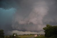
Surprised this thread isn't started already. I moved on the Graham, TX storm but it fizzled about the time I arrived. Saw a little scud clouds but that was it. Then ran down and got SE of the storm that tracked from Cisco area over to Granbury, just east of Granbury right at dark and it too was playing out. I actually woke up in Ardmore planning to drive to Guymon but decided it wasn't worth that trip, what with north TX still having some play left.
These are some test clips shot @4k and resized to 1080 for youtube
The Red River is flooding like crazy. (Red River above Muenster, TX)
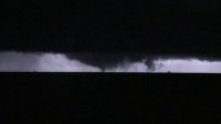
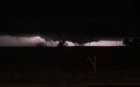
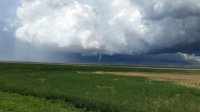
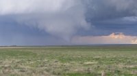
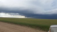
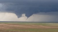
Meso Over Granbury, TX
These are some test clips shot @4k and resized to 1080 for youtube
The Red River is flooding like crazy. (Red River above Muenster, TX)
Meso Over Granbury, TX


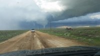
 DSC05413
 DSC05651
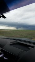
 DSC05801


")