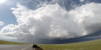
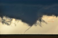
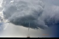
I had been eagerly watching the models for this event for almost a week in hopes of being able to get a decent tornado chase relatively close to Denver. Not often do I wake up a 3am to check the latest SPC Guidance, but I did about every night last week leading up to Saturday. By Wednesday, I had accepted the fact I might have to travel a little further than normal and chase possibly in the southern high plains. On Thursday night, I began to get more excited at the prospect of choosing a “secondary” target that I was comfortable with; NE Colorado/NW Kansas as NAM was showing CAPE up around 2000, plenty of shear, fair EHI, and 50’s dew points between 18Z and 0Z Sunday.
Friday afternoon I made the call to my fiancé; we were heading to SW Kansas (or somewhere around there) for her second storm chase.
On Saturday morning I began studying the MCS/visible satellite hoping that my initial target was clearing. Slowly, it was. After looking at the RAP around 7am Saturday, I noted a nice plum of CAPE, EHI 0-3km and EHI 0-1KM forecasted and (hopefully) adequate dew points for tornados in SW Colorado given the lower temps. SPC furthered my hope with a 10% tornado prob. I refined my target to Kit Carson, CO. I informed my fiancé that we were going to leave Denver at 1630Z and no later as HRRR initiated storms around 19Z.
We gathered up our dog, plenty of goldfish for snacking, and set our way. We battled our way east on I-70 towards Limon with heavy rain and small hail, and saw several people hydroplane into the ditch. Once to Limon, we headed SE on 287 towards Kit Carson. When we arrived to Kit Carson, I noticed some small cells popping up about 100 miles south on the CO/NM border. SPC mentioned this on the mesoscale discussion with 95% probability of Tornado Watch Issuance (yay!). Soon thereafter, the watch was issued. In fear of missing something on the southern cells forming, I decided to retarget down to Lamar. On the way, the small blips on radar of the storms never became anything impressive. When we arrived to Lamar, we filled up with gas. I contemplated driving another 50 miles down to Springfield, CO to get closer to the storm making its way north, but decided not to as I was worried something would fire further up North or West. At this time, there had already been several tornado warnings (and tornados) about 90 miles west of us. I was a little nervous I was missing the ‘show.’
We headed a few miles south of Lamar and watch the sub-severe cell work its way north – both visually and on radar. Every few scans the hail marker would go from <0.50” to 0.50” or 0.75" but never showed impressive scans..but the fact it was still even showing up on radar for over an hour impressed me. I kept telling myself (and fiancé) that we were doing the right thing by waiting to see if this storm did something as it continued north into the better environment rather than heading west to the other storms already matured.
As the storm neared Lamar, we headed north to stay in front of the storm. About 5 miles north of Lamar, we headed east on some dirt roads into a State Wildlife Area gambling that the roads wouldn’t be too muddy. After a few miles, we were able to get on a north road option that would keep us relatively parallel with the storm as it moved generally north.
Suddenly the radar started to intensify for a few scans and I started noting some scud being sucked up into the storm. I got excited and watched the storm begin to develop a lower base. I then noted an RFD notch forming, and told my fiancé “we are watching tornadogenesis in front of our eyes” as I described the dynamics of the storm that was a few miles west of our position. We grew excited and before we knew it, a nice funnel formed and quickly put down a rope just to quickly dissipate again (right as we got alerted of a tornado warning), but the main funnel remained. Within another minute or two, we had this:
[Broken External Image]:[URL]http://i9.photobucket.com/albums/a85/jacbbp/DSC_4197.jpg[/URL]

(VIDEO BELOW AS WELL AS MORE PICTURES IN VIDEO)
We watched for 8-10 minutes (maybe longer, time warps when you are watching a tornado and taking pictures) as the beautiful tornado matured, morphed, and died capturing video and still pictures of the tornado. We noted how deep the RFD notch became and hoped for another show soon. We headed north and saw a new circulation developing with swirling clouds. The TIV headed north, but we opted to head east a few miles to have a safe north route for (what ended up being) the rest of the chase. We got in place about 10-15 minutes later to watch a beautiful tornado touch down a few miles to our northwest (VIDEO BELOW AS WELL AS MORE PICTURES IN VIDEO):


This tornado seemed much stronger and we noticed a possible satellite tornado forming. Sure enough, a few moments later we saw this:

We watched in awe at this beautiful site for about 10 minutes:

We then headed east a few miles, then north to catch up back to the storm. We were far enough away that we couldn’t see what was happening with the storm, but as we began to get better contrast we saw another tornado emerging from the depths (I can’t confirm if this was the rope-out of the previous tornado or a new tornado):

As this tornado dissipated, we continued north. A nice wall cloud began forming again and very briefly what appeared to be a multi-vortex tornado touched down (no pictures or video). About 2 minutes later, this nice tornado formed:

Once this tornado dissipated, the area of circulation continued and briefly produced another tornado (VIDEO BELOW)
The storm kept trying to form another tornado, and produced a nice funnel that I do not believe touched down.
Soon thereafter, the storm began to die as it went into the cold front and the whole area began to form storms. I knew this was probably game over, so we slowly worked our way north back to I-70/Burlington with smiles on our faces, and impressive pictures to match. We wanted to sleep in our own bed that night, so I decided to not go east to the Kansas storm and we headed back to Denver. Around Deer Trail, we encountered 4” of slush-snow on I-70 and struggled to get back to Denver, encountering some of the most intense blizzard/snow conditions I’ve ever driven in.
All in all, my best (and fiancés) storm chase to date. 495 miles, 12 hours, 5-6 tornadoes, and an amazing experience that I will never forget.
Here is a Youtube video with HD video of a few of the tornadoes as well as more pictures not in this post.
[yt]
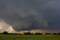
 Here is the sequence of events. Please forgive a couple of them being out of focus. In the heat of the chase, I failed to remember I had it set to manual and bumped the lens enough to jar it about out of focus. Ugh.
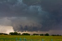
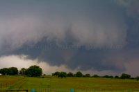
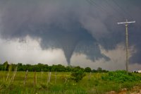
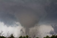
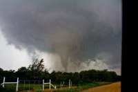
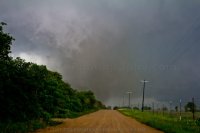
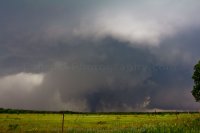


 DSC05478