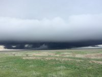
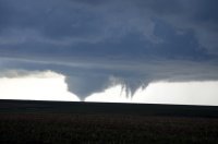
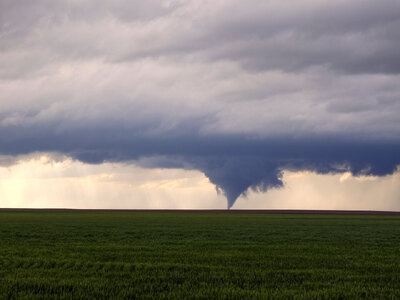
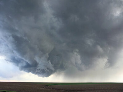
2015-05-09 Reports: TX/OK/KS/NE/CO

What an amazing day! Chased CO with Skip Talbot, blog post here:

http://faceofastorm.blogspot.com/2015/05/eads-lamar-colorado-rainbow-tornado-and.html

A few photos:

_JBE7469-e%2Bcopy.jpg


[Broken External Image]:http://1.bp.blogspot.com/-6qAFlXb29C4/VVKr2x-ELQI/AAAAAAAAF1I/E7kUkxHcmcU/s1600/_JBE7519-e+copy.jpg
_JBE7521-e%2Bcopy.JPG

[Broken External Image]:http://4.bp.blogspot.com/-R74w2P2npP4/VVKr6IRkVkI/AAAAAAAAF14/nYMYYRLUKYk/s1600/_JBE7653-e+copy.jpg
_JBE7664-e%2Bcopy.jpg

11261444_10152913358947843_1998097262_n%2B(1).jpg

_JBE7858-e%2Bcopy.JPG

_JBE7865-e%2Bcopy.jpg

_JBE7895-e%2Bcopy.JPG
 
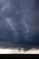
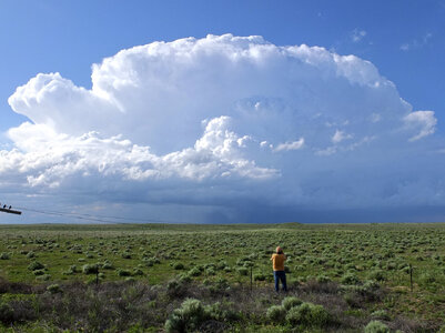
Started the day in La Junta and after a marathon the previous day from KC the target of Lamar was a very welcome backyard chase, albeit from someone else’s backyard. I initially went after a tornado warned cell just north of La Junta but bailed after it fizzled quickly. I headed to Lamar where I waited for well over an hour as the cell of the day that went up near Springfield approached. The slow, mostly northward moving cell finally passed just west of town and wanting to try to avoid the crowds I opted to go east about 20 miles to the next reliable paved road option. As I headed up 385 I seriously considered bailing toward Scott City to escape the crowds altogether as just about everyone on SN was either on this cell or massed together in far SW Kansas. The HRRR broke out a cell there along the WF and if it verified I’d have a chance to chase a western Kansas supercell in relative solitude, a very tempting prospect and an option I actually decided to do until flip-flopping and deciding to give the storm at hand a shot. So instead of heading east at Sheridan Lake I continued up 385 and stopped about a mile north of town to take in the view.

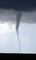
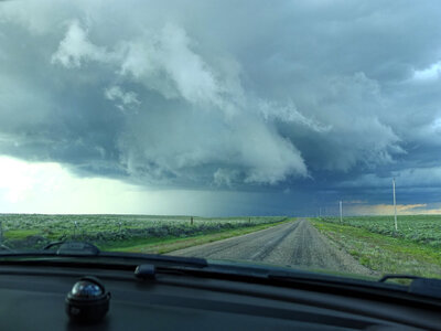
The low topped storm was oriented N-S, lacked an anvil (at least on the southern half) and had an expansive RFB on its southern half. A lowering extended below the southern most tower adjacent to the flanking line, from my distance that was all I could discern but it was soon reported as a rotating wall cloud on SN. Minutes later the first tornado formed and it really was an amazing sight from my perspective from about 20 miles away and almost directly due east. I couldn’t tell though how it was focusing on my video as the sun was blinding my view and it occurred to me that for the first time in my life I was filming a tornado with the sun beating down directly on my face. The distance between myself and the low topped storm at a time of day with the sun still high in the sky provided me a unique experience where the sun was actually above the tornado producing storm and shining down upon me. I guessed with the video and fortunately it turned out okay, in all I witnessed 6 tornadoes and captured 5 on video as the storm cycled and progressed northward. The strategy to distance myself was rewarded not only by the spectacular view of the entire structure but by the lack of crowds, in fact the entire 7 minutes of the first tornado was filmed without a solitary chaser in sight and the remaining five tornadoes outnumbered the total number of chasers in sight throughout the entire tornado time span. The first two tornadoes were shot from 385, the remainder each from successively closer distances from the gravel road network west of the highway and east of the storm.

At Cheyenne Wells the storm was increasingly taking an outflow dominant appearance and I should have bailed for the convection in Kansas, not doing so probably cost me from scoring a few more tubes. I did get on the cell north of Grinnell and briefly viewed the lightning illuminated lowerings to my north but chaser traffic combined with my apathy to chasing after dark put an end to the chase and I headed to Hays for a comfy stay at the Holiday Inn Express.

In summary it was an awesome day that featured a slow storm speed, favorable storm motion in relation to my position, fantastic perspectives, excellent visibility and multiple high contrast tornadoes. The chasing itself was very low stress, navigation was a breeze and I was basically all alone during the peak of the chase. Add the relatively short distance from departure point to storm intercept plus the 25 mile distance for the chase itself and overall it was definitely an A+ chasing experience!

 
Lack of capping was plaguing us all week, as well as weak lapse rates over the southern plains and TX targets. The arrival of the negatively tilted trough on Saturday meant the return of steep lapse rates and cyclogensis. We opted for the cold core target over CO/KS (see Jon Davies' writeup: http://davieswx.blogspot.com/2015/05/may-9-2015-cold-core-tornado-set-up.html?m=1 ) as it would yield the most photogenic storms and was over very favorable terrain. Lack of capping was still an issue though, and we feared the whole warm sector would just go up by late morning as the warm air advected north. However, lingering morning precip and cirrus actually acted like a quasi-capping inversion, delaying warm sector initiation until the cold core target could properly recover and shear and instability combos were maximized.

Brindley and I took The Doghouse, newly equipped with a rotating camera turret, with two camera operators with IMAX quality Reds: Phil Bates, and Payton Ware up to eastern Colorado. We had a slight handicap starting our day way down in Vernon, TX as we waited to get our crew assembled before tracking up to Amarillo to drop off cars. We made it in time, arriving on a robust low topped supercell north of Lamar, CO about 20 minutes before it produced the first tornado. There was no anvil on this storm, just blazingly white and solid convection in the super steep lapse rates of the high plains cold core setup. Dews in the low 50's to upper 40's with temps in the low 60's and we were actually freezing out there, despite this thing being a total tornado machine.

It looks like we got a fully condensed anticyclonic tornado, which formed on the southern/bottom end of the horseshoe updraft. I'll have to confirm the motion on that one, but it was in the anticyclonic spot. Brindley's photos also appear to show both a cyclonic and anticyclonic circulation at the same time with a horizontal vortex arch between them.

The storm's death was amazing too. There was this green whirlpool of doom spinning overhead, when this dramatic shelf cloud came crashing in from the northwest. It undercut the tornado cyclone and brought a quick end to the tornado machine, while the storm continued to gust out hard with multiple gust fronts. Stunning day.

Here's the video chronicles of our chase with the Doghouse:

11201120_10101393229738451_5331752936335916555_n.jpg


11140072_10152911364142843_7868712384340643849_n.jpg


11168540_10101393423734681_7278640886538864212_n.jpg


Couple video grabs:
11246362_10101393803164301_2615744926837886300_n.jpg
10155176_10101395804563481_1472683637541246188_n.jpg

10923385_10152644727287843_91286210851_n%2Bcopy.JPG
 
I was chasing with Jon Stone, Amy Phelps, and Tabitha Hawk on this day. After a frustrating day of watching towers go up and die in Guymon, OK as well as watching a low topped supercell NW of Canadian, TX we declared our a day a bust and headed back to Norman at around 6:30 PM. There were 3 cells that fired up in the Eastern TX Panhandle at the time but they didn't look too impressive on radar so we continued on home a bit peeved about the tornado reports up in Colorado and in North Texas. By the time we got into Western Oklahoma we caught up with the southern storm east of Sweetwater. After punching through the core of the storm we stopped at a gas station a few miles south of Berlin, to our surprise we punched the core of a supercell. We sat for about 15-20 minutes shooting away at this constellation prize.

11260713_1420430388277648_2521219323140912633_o.jpg

11142430_1420430241610996_2026036059461601907_o.jpg

11187278_1420430304944323_8041709739506580375_o.jpg

11181235_1420430424944311_3087998082453314611_o.jpg


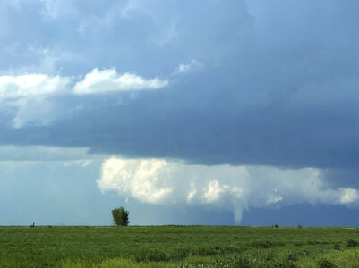
It even produced a funnel cloud that lasted maybe 30 seconds.

11150556_1420430221610998_1389583527876815452_n.jpg


We headed east on highway 6 towards Elk City to stay with this storm before turning north and pulling over on a country road west of town. I noticed a larger funnel dipping down a couple miles to our north so we continued northward on a gravel road to get a closer view. We pulled off in a wooded area in time to see another funnel drop down this time reaching the ground.

These are the only good shots I got of the reported tornado north of Elk City. I made the noob mistake of not hitting the record button on my camcorder when the funnel was closer to the ground. Tabitha got a good shot of the funnel as it was near the ground.

11234983_1420430428277644_8480737802513100912_n.jpg

11218625_1420430454944308_6113031096502431411_n.jpg


I would have loved to have been in Colorado for all of the photogenic tornadoes that day, but one of my bucket list items in chasing is to see a tornado not a lot of other chasers have seen. I accomplished that on this chase.
 
Like a few others, Erik Perozo and I woke up in Altus. Initial target was Johnson City, Ks but we both commented that Colorado had guaranteed tornadoes. Got to Johnson City and waited instead of just heading straight into Colorado. We did eventually see a couple of the Colorado tornadoes but were not in a great position before the south moving OFB killed the storm. After that we decided to head across North Kansas to play the cells that would be interacting with the warm front. When we got into Kansas the Oakley cell went tornado warned about 20 miles east of us. As we approached decided to hook slice since it was moving slowly and the hail was small. Came through the hail on I70 to have a tornado on the ground just to our South. Watched it for a few minutes before moving East to turn around at the next exit when it dropped a second brief tornado. This is where the fun really began. We chased this storm almost 20 miles up mud roads in a Prius. Almost got stuck repeatedly but the cell just kept producing. It had 3 tornadoes on the ground at the same time at least twice. Once it had two fairly large stovepipes with a smaller satellite. It produced ropes, multi vortex, stovepipes, cones, twins, triplets and was producing them non stop. The only thing we didn't see was a long track tornado or a wedge. We ended up chasing the storm all the way up to McCook, Ne where it crossed the warm front. I'd say a conservative estimate would be over 20 tornadoes. I still haven't pulled the video but will do that in the coming days and post some screen shots. What started off as a day full of mistakes turned into an incredible day. We never even considered the south target because we'd just had enough of HP storms.
 
I was north east of Eads, CO when the Lamar cell started dropping tornados. I believe my final count was in the 6-7 range, but need to go back and check. Will post pics and video in the next couple day.

After bailing on that storm, went after Colby, KS supercell to try to get some lightning, but got caught up on backside, so eventually headed back west to Goodland where I boondocked in the car overnight after wife told me about blizzard conditions back home. Generally chilly and uncomfortable evening, but made it home this morning.

Hell of a day. I went out after structure, but all the low clouds killed that plan and accidentally ended up with tornados, so can't complain.

I'd like to credit the folks in chaser chat for sharing so much info. Their discussions helped me decide to head back west and catch one hell of a storm.

Pictures:

I believe I was about 20-22 miles NNE of Eads at this point.
09MAY15-001.jpg 09MAY15-002.jpg

After bailing out from first position not wanting to get caught up in the rain on the terrible dirt road I shot this one from US40 Just West of Cheyenne Wells.
09MAY15-003.jpg

On way back to Goodland after bailing on Colby cell.09MAY15-004.jpg
Next day on way home from Goodland. Bummer.
10MAY15-001.jpg

Overall...awesome time. My personal best chase to date.
 
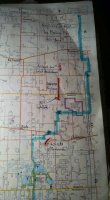
This is our estimated tornado track map from Colorado including our route taken that day (Saturday/9) with help from other chasers in the area to triangulate positions / track lengths especially for that period after the big cone touched down and when we had to reposition east / north. Good pics of the satellite above, I have one where I blew it out contrast-wise to fully capture it virtually all the way down. (Blue is our track, orange are the tornadoes, of which we counted five.)
 

Attachments

  • 150509 CO Tornado Tracks.jpg
    150509 CO Tornado Tracks.jpg
    55.1 KB · Views: 191
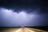
Started the day targeting SW KS and left Omaha somewhere around 7:30. By the time we made it near the CO border, western KS had cleared so we figured we'd stay put despite the small storm that was starting in SE CO (which would go on to produce multiple tornadoes of course). We didn't think we'd make it to that storm in time and towers were starting to move off the dryline in the TX/OK panhandles so we headed south to intercept those. Pretty big mistake in hindsight, but I'm not sure we could have made the CO storm in time. We ended up playing around with the marginal storms in the OK panhandle and far SW KS for a while and then close to sunset got treated to a fantastic light show. If we're gonna bust, we may as well do it with incredible light and some nice landscapes. (sorry about the size, don't feel like re-uploading it to a different host at this point)

[Broken External Image]:https://scontent-dfw.xx.fbcdn.net/h...78_1031369163554080_5274612353756442215_o.jpg
 
My chasing partner and I left home around 5:30 pm Friday evening and made it to York, NE before getting a hotel. On Saturday, we drove to the southwest corner of Kansas, ending up in Johnson City by early afternoon. We watched 20 or so other chasers, some of whom looked pretty experienced, converge at the spot we were sitting. This gave me a false sense of security, because I figured I must be doing something right if they all end up at the same spot as me. We watched a couple showers try to get their act together as they moved over us, all while noticing the cell over by Springfield, CO. I thought we were in a good spot, so I decided not to go for the cell in Colorado, instead waiting for something closer to develop. We moved up to Syracuse and waited some more, with it becoming increasingly apparent that the showers we were watching weren't going to strengthen much. As we were sitting there, we saw the TIV go by, heading to the now tornado producing storm in CO, which by this time I thought was too far away to reach (another mistake).

We eventually decided to follow a shower up the CO/KS border, hopelessly wishing it would develop into something more. Ended up in Cheyenne Wells having seen nothing whatsoever. By this point, we had pretty much given up, so we headed east on US 40 to set up for the next day. But then I noticed there was a tornadic cell south of Oakley, KS. We decided we might as well go for it, even though we were 80+ miles away and it was only 20 miles or so south of the interstate. We flew down the highway and approached the storm as we moved into Oakley. We jumped on the interstate as they were stopping traffic just west of the interchange. As we came up the ramp, the tornado appeared a few miles in front of us. I couldn't believe that we caught up to it, and that it was still south of the interstate. We watched it through the rain for a few minutes, then inexplicably decided to drive into the backside of the cell instead of waiting to the west of it so we could watch the tornado. We had to hide under an overpass because I wasn't sure how big the hail was going to get.

By the time the storm passed and we could go ahead again, the wall cloud was a ways in front of us and to the north of the highway. We saw a few funnels and I'm pretty sure one touchdown as we drove into Grinnell. We went as far north as we could through town before the pavement stopped. Sat there and watched the storm move away from us to the north with emergency personnel who were waiting to get called somewhere. We went back to the interstate, got off at the next exit and took highway 23 north. We caught back up to the storm around Selden, jumped on US 83 and joined all the other chasers paralleling the storm as it moved north. Stopped a few times and occasionally saw the multi-vortex tornado during the lightning strikes. We also saw the same TIV that we saw earlier in the day in Syracuse. This was my first time chasing at night and I thoroughly enjoyed it, although the strong inflow was much colder than I expected. We followed the storm all the way to McCook, NE before ending the chase. Tried to find some food, but couldn't find a single place that was open so we made our way to Kearney and grabbed a hotel.

Here's our video of the tornado. Not the greatest quality, but I was just happy to see anything after the frustrating day. It was also my chasing partner's first tornado.

 
After quite a few challenging (and somewhat frustrating) chases in north Texas recently, it was a breath of fresh air to be back in wide open southwest Kansas. Even after all the practice this year, I still find myself really struggling to account for early morning convection. On this day we awoke in Woodward, OK and were soon enough greeted with that rumbling morning thunder (otherwise such a nice sound). Figuring central Oklahoma was out for the day, we headed towards the OK panhandle and sat at the Balko gas station for about an hour with quite a number of other chasers.

The overcast skies had transitioned to scattered cumulus, and south winds were howling, so I figured airmass recovery was well underway. I noted some low 60 dews in the TX panhandle that I figured would have no trouble reaching well up into Kansas (spoiler: they didn't). We also noticed the building storms over Colorado, but I opted to remain where we were (bad cell reception along 285 in CO, and I figured any tornadoes there would be short lived and we'd probably miss the show anyway - never considered the possibility of a tor-machine).

So we wandered north and west as the afternoon progressed and the dryline moved NE towards us. We wandered a little west. Then we wandered a little north. And then for fun we wandered east and back south. Finally, some towers started organizing back near Balko, and we moved to intercept them east of Meade, KS. Our original storm got overrun by an elevated cell from the south, but interestingly a new cell developed right on it's forward flank and was able to get organized, much to my surprise. As the RFD punched in from the west and then wrapped north, it created a very striking "donut" around the center of rotation. About this time, a tornado warning went out, and we moved NE through Minneola to stay just ahead of the storm. Chaser crowds thickened along 54, but there was ample opportunity to pull off and get timelapse in the fading evening light. At several points, I thought we'd get a brief touchdown, but I never saw anything conclusive. We finished the night by letting the (by then non-warned) bear's cage approach and pass just to our west as the final daylight faded.

A challenging day, but ultimately rewarding even without any of the tornadoes.

 
Shoulda stuck to my original forecast of E CO but didn't. Sat around in SW KS watching turkey towers try to become storms and fail. Blasted into CO to make a vain attempt to catch the tornado machine near Eads, finally did just as it got undercut and air temps plummeted into the 40s. Made mad dash towards North moving storm in Kansas snagging some consolation dusk tornadoes. Frustrating day, but not a total bust.

Full write up: http://www.aerostorms.com/may-9th-kansas-dusk-tornadoes/

5915KStor2.png


Kansas-Night-Storm-Tornado.png
 
Another better-late-than-never post. Started out from Santa Fe, NM, overnighted in Amarillo, and made it into southwest KS that afternoon, but realized early on that I didn't like the cool stability there. So, I turned around and headed towards Colorado where the cold-core setup got going in the Lamar, Eads, & Cheyenne Wells area. I only saw a few people when this first of several tornadoes touched down...a grab shot below.
DSCF1402.jpg
The tornado lifted and the rotating, wall cloud crossed the road. The storm waited a bit before starting more touchdowns.
DSCF1435.jpg
The low-topped cell appeared very round and small on the radar, and in real life, too. There's a tornado in there again.DSCF1445.jpg
It went on to produce more intermittent touchdowns into the evening. Surprisingly, it never rained or hailed on me during this chase.
DSCF1464.jpg
Eventually, it got undercut and didn't produce anymore. But, the light and clouds soon appeared ethereal as a chill settled in with the darkness.
DSCF1472.jpg
Finished the day by driving back to Santa Fe, NM in the dark, thinking to myself, I like Colorado; I've got to do this again sometime.
 
Last edited:
Back
Top