• After witnessing the continued decrease of involvement in the SpotterNetwork staff in serving SN members with troubleshooting issues recently, I have unilaterally decided to terminate the relationship between SpotterNetwork's support and Stormtrack. I have witnessed multiple users unable to receive support weeks after initiating help threads on the forum. I find this lack of response from SpotterNetwork officials disappointing and a failure to hold up their end of the agreement that was made years ago, before I took over management of this site. In my opinion, having Stormtrack users sit and wait for so long to receive help on SpotterNetwork issues on the Stormtrack forums reflects poorly not only on SpotterNetwork, but on Stormtrack and (by association) me as well. Since the issue has not been satisfactorily addressed, I no longer wish for the Stormtrack forum to be associated with SpotterNetwork.

    I apologize to those who continue to have issues with the service and continue to see their issues left unaddressed. Please understand that the connection between ST and SN was put in place long before I had any say over it. But now that I am the "captain of this ship," it is within my right (nay, duty) to make adjustments as I see necessary. Ending this relationship is such an adjustment.

    For those who continue to need help, I recommend navigating a web browswer to SpotterNetwork's About page, and seeking the individuals listed on that page for all further inquiries about SpotterNetwork.

    From this moment forward, the SpotterNetwork sub-forum has been hidden/deleted and there will be no assurance that any SpotterNetwork issues brought up in any of Stormtrack's other sub-forums will be addressed. Do not rely on Stormtrack for help with SpotterNetwork issues.

    Sincerely, Jeff D.

2015-04-16 REPORTS: OK/TX

This was taken 3 miles east of Kellerville, TX on FM 2473, looking north. Timestamp on the video was about 6:55pm on the dot. Not sure what radar looked like right at that moment, but we did screenshot our location to the velocities from the last update we had.

CCwe2aAUsAIo-Ov.jpg


4/16/2015 ~5:15 CDT - Mammatus and developing convection to our east. Taken looking southeastward from 152 and 748 ~10 mi S of Miami and ~20 mi E of Pampa. We could see two supercells become more discrete (from the QLCS-ish appearance the convection had ~30 minutes before) -- one was southwest of us closer to I40 and one was west of us near Pampa. The meso tightened up on the supercell to our west, so, we opted to nead northward to get a better look while still maintaining a visual on the southern supercell.
IMG_1940-2.jpg


4/16/2015 ~5:42 CDT -- Near 748 / 1268 intersection ~5 mi S of Miami, TX. View is to the southwest. The rotation associated with the supercell to our west increased, and this funnel developed as the RFD clear slot cut in...
IMG_1942-3.jpg


4/16/2015 ~5:47 CDT - Along FM1268 ~2 miles E of FM 748, or ~5.4 mi SSE of Miami, TX. View is to the southwest. The funnel persisted as we moved eastward a couple of miles to stay ahead of it. It came ~80% of the way to the ground, but we couldn't ever see definitive evidence of a ground circulation. In this pic (contrast very obviously enhanced significantly), I can see what looks like a tube extending to the ground from the funnel, so I'm 90% confident this was a tornado.
IMG_1945-4.jpg


4/16/2015 ~5:47 CDT - Along FM1268 ~2 miles E of FM 748, or ~5.4 mi SSE of Miami, TX. View is to the southwest. Similar to the previous picture... Had to jack up the contrast to almost-ridiculous levels to separate the condensation funnel from the precipitation.
IMG_1947-5.jpg


4/16/2015 ~6:05 pm CDT -- We quickly left the previous location S of Miami after the probable tornado became completely shrouded in rain and hail >3" in diameter began to fall. The storm was weakening at this time, so we turned back westward to go back to look at some of the hail. I only got out of my car to pick up a few hailstones in a ~20x20' area; the largest was ~3.3" in diameter. Many of the large hailstones had large protuberances like this one. This hail ~15 minute before this picture was taken, so some melting had occurred.
IMG_1950-6.jpg


4/16/2015 ~6:52 CDT -- Near 152 ~1 mile W of Wheeler; view is to the WSW. After the Miami storm weakened, we went eastward to US83 and watched the supercells to the N through E. Given limited paved road options eastward, we opted to drop southward to Wheeler to watch the big HP to our southwest. We had an OK view into the notch of the supercell, but we suspected the real business end of the storm was embedded within the rain and hail. Structure was OK, though I didn't get a picture during the brief time the clouds cleared out enough to see a stacked plate appearance.
IMG_1952-10.jpg


Taken looking westward from a little east of Wheeler, TX. I have no idea what to make of this. It was in the right place for a relatively strong circulation observed on radar, but it's inconclusive to say the least. I'm looking at the "funnel-looking" thing just left of the center of the frame. Blasted HP!
00008-9.jpg
 
Last edited:
Chase was mostly okay until about 8 PM, after which I was thoroughly pissed off.

Left Norman around 11 AM with an initial target in the Wheeler-Perryton corridor. I saw the initial storms develop while eating lunch in Elk City. By the time I made it to Wheeler, the first tornado warned storm was well to my WNW, so I decided (regrettably) to head NW on 83 towards an intercept point somewhere near Canadian. By the time I got to the US 60 intersection I knew that was pointless, so I abandoned and turned SW. This was new terrain for me, and I was pretty appalled at how poor the terrain is in Roberts County...ugh. Also, the low level cloud deck held strong over my head until I got southwest of Miami. In fact, just before I finally emerged out from under it, light rain/drizzle had been falling on me for 10 minutes. A few miles later I turned and looked back and saw a weird sight: some sort of low-level wall of cloud had formed along the tail end of this deck. Weird.

I went west from Pampa and sat on a county road for awhile while storms decided what to do. Finally I was persuaded just to stick to the southern end of the entire complex, so I went south to White Deer, then southwest on TX-152. A few miles southwest of there I saw a big cloud of dust on the ground probably 20 miles to my south/southwest.
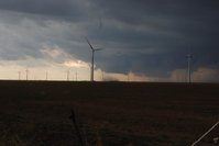
150416_021.JPG
It was under a developed wall cloud, but I could not see a funnel nor any discernible rotation in it. I'm guessing this is what prompted AMA to issue the first tornado warning on this storm. Even if this was a legitimate tornado, I'm not going to count it. Do they even have an EF-scale rating for tornadoes that weak?

I decided to focus on that area, so I moved all the way south to the southern edge of what was pretty much a short line segment by that point. On my way south I was racing to find pavement before a wall of water just to my west overtook me.

I found my way to FM293, which was the first point where I saw another chaser that whole day. After that, the crowd gradually increased. I eventually went all the way south to I-40 via FM294, stopping several times along the way to view a shallow hybrid shelf/wall cloud that had a ton of horizontal vorticity along it, with numerous attempts at tilting some of that vertically. Throughout this stretch I saw a lot of modest rotation in the cloud base, and enough vertical motion at times to get me a little excited. After several failed attempts, though, it was clear to me something was missing - probably low-level shear, but perhaps it was also just too cool.
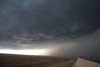
150416_047.JPG
Both of the shallow lowerings in the image above were rotating at the same time. At one point, a half-assed attempt at a funnel appeared as a strand of condensation lifting into it. The scud tag had little to no vertically oriented rotation in it, though, so I didn't really think it was going to produce a tornado.
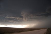
150416_054.JPG

It pretty much did this for the next hour before I finally started to race ahead of it. I witnessed a large number of gustnadoes along the way. I didn't see any evidence whatsoever that any of these could be landspouts.
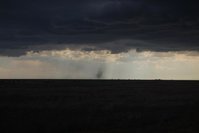
150416_075.JPG
(Pictured above: not a landspout)

Of course I was south and east of it when it decided to break away from the line, form a hook, and produce a tornado (the tornado northeast of Groom) well inside a wet hook for which you'd have to be north and east of it to have any chance of seeing it. Psh.

The road network is pretty spotty in parts of Gray County, so at this point I decided to just fly east to find a better road network, then get north and get into the notch. I briefly stopped near the remnants of Lake McClellan (it's not a lake anymore) to peak. I eventually ended up getting off I-40 at McLean and flew north, finally far enough ahead and far enough north to start to see some structure. I planned a route north and east through Kellerville back to Wheeler. I stopped on a hill that a local had named "Lookout Hill" (I know this because he joined me after I had already spent 10 minutes alone there) about 5 miles SW of Wheeler. The view to the west was spectacular.
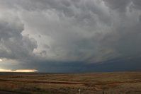
150416_090.JPG
Apparently I was a trend setter here. I sat in this spot for 40 minutes as the storm closed in. About 10 minutes after the local showed up another group of chasers finally showed up and stopped on this hill also. After that, the chaser train arrived. By the time I left that spot, there were some 10-12 vehicles parked there and 30-50 others had already gone by. It was nice to have that time to myself where I was.

Back to the storm. It did eventually produce a nice looking wall cloud, but based on the individual cloud fragments comprising it, and in spite of the increasing easterly surface winds, I could tell it was having trouble organizing at the low levels and was most likely not going to produce a tornado.
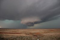
150416_118.JPG

I pretty much never saw even a hint of rotation in this wall cloud the entire time it existed (a good 20 minutes or more before I fled).

I eventually decided not to take the core of the storm, so I bolted back to Wheeler and then farther east from there. Sounds like I didn't miss much. I saw the same black smoke plume @Jeff Snyder mentioned in his post. I was pretty much ready to call the chase at that point since storms were really going up everywhere by this point, including on top of me, and I wasn't interested in getting north to the next storm up that was apparently producing tornadoes.

This is where the frustration kicked in.

I decided to find dinner and gas up in Elk City before heading home. Right as I got my food I learned of the tornado warning 20 miles to my southwest near Sayre. I didn't see anything on velocity that made it look worth chasing. Then came the tornado reports. Whatever...that storm was never a supercell...just some weird spin-up. Why didn't any other storm this day do that? So of course I bolt back out after it and it promptly shrivels up and appears to die. At this point, the old storm from before was finally crossing the OK-TX border and went tornado warned back near Sweetwater. I didn't want to chase it since it was pretty much dark at this point and I was already pissed about the Sayre tornado, but I went after it anyway. I ended up a few miles southwest of Cheyenne west of US 283 on a narrow hilly road. After the former Sayre storm re-intercepted me (I thought you were dead, you POS storm...), dumping some small hail on me, and after getting out of my car to sample some uncomfortably cool air, and after the tornado warned storm stopped being tornado warned without producing a tornado and a new tornado warning was issued back to the southwest, I got really tired of playing "Keep Away from Jeff," switched off my radio, closed my computer, and drove straight home while telling mother nature she was #1 for an extended portion of my drive home. It made me get home an hour-and-a-half later than I would've if I had just gone home from Elk City.
 
Last edited:
Didn't realize I couldn't edit my original post so adding for completion.

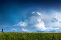
We started the day in Clarendon and decided to ignore the initial development near Pampa and hopped on to the storm that went up just east of Amarillo. After initially struggling with cold pool issues from storms to the north, around 5pm the storm finally rewarded us near groom with a nice dusty tornado with obscured barrel funnel (see picture in my first post). We then bailed south on 40 and followed it east a ways (staying south of the rotation due to bad road networks) until we were able to get well out in front of it and observe a beautiful whales mouth and even more impressive mammatus to the east.

j5Calhy.jpg


wlyT9Db.jpg


After getting behind a bit we had a very hectic race with the core to wheeler where we observed a very low wall cloud with some decent rising motion buried in the rain. Jeff, I believe we were pretty close together here but maybe at a slightly different angle, we observed a few appendages in there but they appeared to be in front of the wall cloud, but the heavy rain was really obscuring any decent view of the feature. This is the best shot I had of it.

GUbfsGR.jpg


We headed east out of wheeler and shot a little structure before eventually passing through Sayre some 10 minutes or so after the reported tornado had lifted.

3UQad1b.jpg
 
Last edited:
Saw the thing near Panhandle in the early going. I wouldn't have known it was a tornado from my perspective, but it was in more or less the right place, and others who were presumably closer called it one.

DSC_0293_wm.jpg


As the storm turned across the outflow boundary laid down by the initial blob of convection, there were several obvious areas of rotation in the updraft base and a couple dust whirls in the right places. The one east-northeast of Groom got some help from the RFD surge that turned the storm HP, and was the only thing that deserved to be called a tornado. Looking northwest from the intersection of Hwy 70 and the last dirt road before I-40:

DSC_0359_wm.jpg


DSC_0362_wm.jpg


DSC_0367_wm.jpg


The whole gust front was dotted with gustnadoes.

DSC_0372_wm.jpg


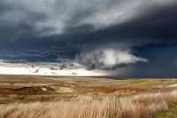
Then it was HP structure time...all pretty much the same from McLean to Wheeler.

DSC_0391_01_wm.jpg


DSC_0523_wm.jpg


From that road I saw the +CG that quite literally exploded something on a ridge SW of Wheeler.
 
Left my house around 2:30 and headed northeast towards Panhandle, TX. After not seeing the first report out there, I drove south back towards Conway. I noticed the storm out over Amarillo beginning to show strengthening. There was a lot of little areas of rotation approaching Conway and I registered that the storm was interacting with the outflow boundary it pushed out several minutes before. As we began driving east, we suddenly had a very rapidly rotating wall cloud almost above us, just slightly SE. As soon as we noticed that, dust began to swirl under it. At first I thought this was just some gustnadoes, but the rotation was rapid above the base as well. The weak tornado went on for about 3 minutes before dissipating, not hitting a single thing under it's last few seconds north of I-40.
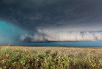
bscap0030-L.jpg


We almost, ALMOST bailed completely on this storm. In fact, I had bailed down 287 southeast of Claude thinking this storm was junk and saw the storms on radar by Silverton. I thought man...that area's been untouched all day. Its gotta do something, right? Well, we got to Goodnight, TX before I turned back north towards I-40. That storm was still the best on radar at the time, so couldn't just leave it alone. So back on I-40 we went, and the storm cycled to produce that brief tornado near Groom. We kept going east, with intentions of driving north out of McLean to intercept again. We leisurely fueled up and took a restroom break in McLean. The storm didn't look too hot. Looked like a lot of outflow on the southern end of the storm. But it still had a bit of a notch further north. So, we blasted north and east on FM 2473. This is where things got interesting. As we watched a wall cloud trying to develop east of the precip, I noticed the RFD surging to our west and cutting right through the wall cloud. With little data, we were unsure whether to stay or bail east. I decided I wanted to see what was in this rain. So as everyone began to bail east, I was watching the rain curtains. The rain switched from due west to southwest. So far, so good. Eventually, there was no more traffic. Everyone was either east, or south of us. After the main blast of RFD passed, we saw the edge of a wall cloud appear to our north. We decided to parallel it and keep a slow pace. The rain was very rapidly flying into this area. The roar of a tornado can be heard. And eventually we started catching glimpses of the tornado as the rain cleared past us. It was a pretty large cone/almost wedge tornado.

bscap0038-XL.jpg

bscap0041-XL.jpg


We only had a visual on it for about 3 minutes before the rain wrapped it up again. We drove south and east for about 5 minutes before stopping again. The roar was still audible at this time. We decided it was time to get out ahead of it again. Once we got to Wheeler, the storm lost it's good looks. We were surrounded by heavy precip and tornadoes to our northwest. We decided to just call it a chase and celebrated with steaks at Big Vern's Steakhouse in Shamrock.

More photos from this day can be viewed HERE
 
A little late to this party...but it took a while to get the pictures off-loaded and posted. For more photos and a full write-up visit:

April 16, 2015


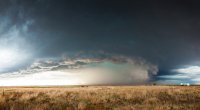
Anyway, I was hoping that SW Kansas would be interesting, since it looked like they would be on the northern edge of the better CAPE and shear. Unfortunately as I approached Meade, it looked as if that target would bust, so the only option was to get south to the cells in the TX Panhandle. As I moved down the line each successive cell died. So, ultimately the only play was the more organized convection on the far southern end of the line over Amarillo. So I set up shop between Pampa and Lefors just in time to see the first dusty tornado in the distance near Groom. No pics of that tornado, but shortly after it dissipated I snapped a few shots of the evolving HP supercell.

IMG_8800.108202144_large.jpg


As the storm continued east, I dropped into Shamrock to refuel before running back to the north to get one more good look at it as it went into Wheeler. While in Shamrock I stopped near this old abandoned radio station building and shot a couple more scenic shots of the HP hog as it went into Wheeler.

IMG_8987.108202307_large.jpg


IMG_9007.108202334_large.jpg


As I was heading home I decided to punch through a weak looking storm over Sayre. About the time I emerged from the half-dollar sized hail I noticed a WEA alert on my phone. Confused I opened RadarScope only to see that cell was newly tornado-warned. So I found an off ramp and looked to my west only to see the brief, but well-formed tornado about 5 miles west of Sayre.

IMG_9035.108202417_large.jpg
 
Last edited:
Sorry, I'm just now finally getting caught up on my last few chases. Had a great time this day, even with the HP structure. I had to work and so couldn't get out of Dallas until 11 or so. Had a few friends along. We came up 287, quickly observing that the popup storms around Childress weren't going to get it done. We continued up 287 and then took 70 up towards I40. We stopped at I40 and 70 north and were able to observe the Groom, TX wall cloud / tornado through the rain to our North.


_MG_7674-Panorama.jpg

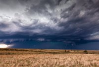
We dropped back down to I40 and headed East to Alanreed and then headed north a few miles. The HP structure was gorgeous.


_MG_7692.jpg


We again dropped to I40 and headed East, this time getting off near McClean

_MG_7719.jpg

_MG_7761-Panorama.jpg
We still had time so we headed north on 273 and up into the notch of the storm. There was an inflow tail here feeding up into the rain and hail. Very cool.

_MG_7828.jpg


We then blasted East towards Wheeler, deciding at this point to continue to head East on 152 away from the now less than stellar looking HP back to our West. We dodged a few small hailers along 152 and then decided to take 30 south to observe the storm near Sayre from the back side. This updraft on this storm was amazing, and we were even able to witness the tail end of the Sayre tornado from a few miles away.

_MG_7841-Panorama.jpg


All in all an excellent day!
 
Last edited:
Back
Top