• A friendly and periodic reminder of the rules we use for fostering high SNR and quality conversation and interaction at Stormtrack: Forum rules

    P.S. - Nothing specific happened to prompt this message! No one is in trouble, there are no flame wars in effect, nor any inappropriate conversation ongoing. This is being posted sitewide as a casual refresher.

2012-05-19 REPORTS: KS/OK

Incredible day. Drove to Pratt, Ks on Friday. Started the chase heading north toward St John, then east on Rte 50. Saw a gustnado around Stafford, then went a little further east pn 50 and then south on Rte 14. After a needle-like funnel south of Kingman, the following four pics are of the tornado around Rago, Ks

093.jpg


109.jpg


112.jpg


127.jpg
 
Not a bad day for us. We stuck to our target of western OK for some discrete stuff. We indeed got the discrete stuff, but the LCLs were too high for anything to really get ramped up. It looked like it was going to tornado near Clinton, OK...but the cold front just undercut everything. Anyways, I got the best structure I've shot all year. Definitely well worth it!

IMG_0168.jpg


IMG_0186.jpg


IMG_0238.JPG


IMG_0244.JPG


IMG_0255.JPG
 
Last edited by a moderator:
Chased along Hwy 50 got in to some big hail at times over 2"and and a Gustnado or two near Stafford Then turned South and headed to west of Kingman. Started to see weak Tornadoes further to my south kept stopping to watch and try and get pictures but contrast from where I was was poor and so are my pictures. By the time I got on Hwy 14 south of Kingman the biggest Tornado of the day was partly rain wrapped and in poor contrast as it crossed the Hwy and I was on the air with stream back to TV station did not get a picture of it at its strongest. So here is link to what I did get.http://www.flickr.com/photos/27494159@N04/
 
Last edited by a moderator:
I initially was targeting Hutchinson, KS because it had been a while since my last chase and I wanted it to last more than two hours, so I headed north but ultimately decided to stay in Medicine Lodge, KS just in case storms fired near the border. The first cell went up just north of Pratt as moved at a snails pace to the southeast so it was easy to catch. I stayed with it until it expanded southwards, when I decided to head south towards Kingman and that's when the real show started.

This was the first one of the day, no clear condensation funnel but on the ground (reminded me of Wellington, Tx a couple of weeks ago).

2ajarkz.jpg


Afterwards it just kept getting better....

2u8icz8.jpg


vczdw4.jpg


I couldn't tell if this was a funnel on the left with a tornado without a condensation funnel on the right crossing the road, or just a tornado that reached that far over....


v79lhh.jpg


Another one spawned shortly after that....


ic1r1x.jpg


And my last one of the day.


148zyio.jpg
 
Last edited by a moderator:
Wasn't expecting tornadoes today in Kansas due to the unidirectional flow aloft (linear-seeded storms) and paltry moisture (high based storms). But, decided that Pratt, KS was the place to be, so the ROTATE fleet waited there until the first storms began firing north of town. Proceeded to Rt. 50 where we encountered golf ball size hail and moved eastward out of the core. Subsequent cells developed to our south and then landspouts began developing along a shear line on the edge/back side of the precip lines. Followed new convection to the south and saw more landspouts before arriving just east of Rago, KS where we saw a 20 plus minute tornado south of Rago. We were cut off by the river and couldn't get over to the tornado to drop pods. I had thought the tornado was closer to us -east of Highway 14. DOWs got some great data. All in all, a great (surprise) day despite not getting pods deployed.
 
I chased the NE storms this day since the environment seemed to be as good as any. After waiting for storms to initiate I decided to head west on the 80 after noticing the storm over KUEX starting to break the cap. On my way to the target storm I intercepted another smaller storm. This is where the excitement began when I saw a handful of gustnadoes. One of them was a tight circulation and was pretty close so I had to do a double take as to make sure it wasn't a tornado. Here's one of the gustnadoes (doesn't really do it justice):
ne_120519_1.jpg

After driving south through some pretty dusty gust front winds I made it to the southern storm which had a tornado warning on it by this time. As I made it to the storm I was greeted with this nice wall cloud:
ne_120519_2.jpg

It seemed like there was some small tornadoes/gustnadoes under the storm soon after but it got pretty dirty under the storm with the strong downdraft and all:
ne_120519_3.jpg

The structure soon became messy, and I spent a good amount of time driving east trying not to get consumed. This was a pretty good chase day none the less, I look forward to more.
 
Last edited by a moderator:
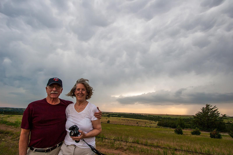
I wasn’t sure if it was worth chasing Saturday, but decided around 11:30 to give it a go. My 17-year-old daughter came along as my chase partner. She loves chasing, but we struck out on her three or four previous chases with only funnels. As for my wife, she isn’t exactly excited by it!

We had to decide on whether to chase the Kansas/Oklahoma border or the Kansas/Nebraska border. I picked the latter as I have family in N. Central Kansas and thought I’d stop by to say hello if the day was a bust. I targeted the Washington, Ks to Fairbury, Ne area. We arrived in Washington around 3:00 but storms had already begun forming along the front in south central Ks from Kinsley to Great Bend. There were also severe warned storms around Hastings, Nebraska. It was only a matter of time before the line filled in.

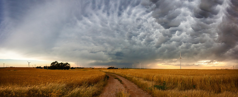
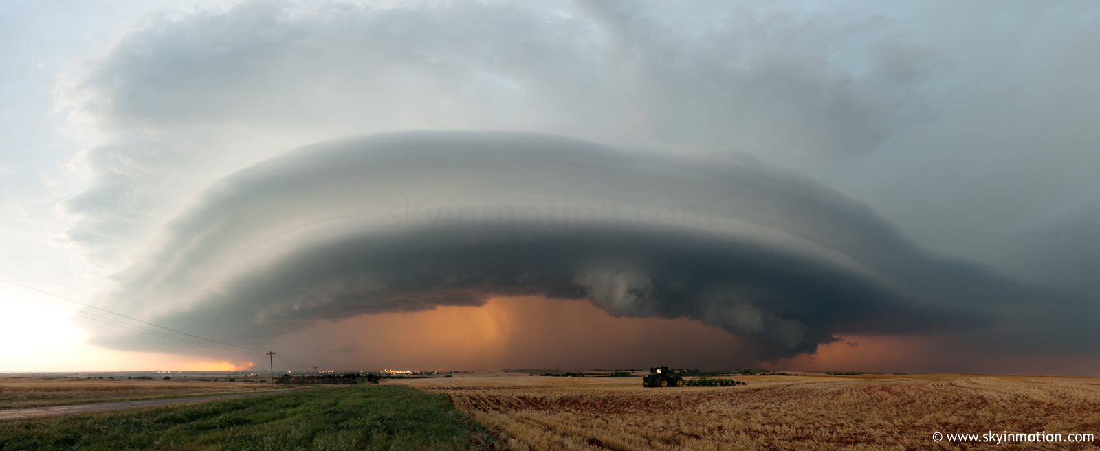
We headed west on 36 Hwy through Belleville and past US 81. Severe storms had built all the way up to Beloit so I decided to push toward Mankato then decide to go north or south on 14 Hwy. Once I reached 14 Hwy, I decided to go north to chase the south end of the Nebraska storms as they back built into Kansas. I called a fellow chaser, Jared Orr, to get his input. Although he wasn't able to chase Saturday, he was a good go-to for me and really helped me make the right decision to head north.

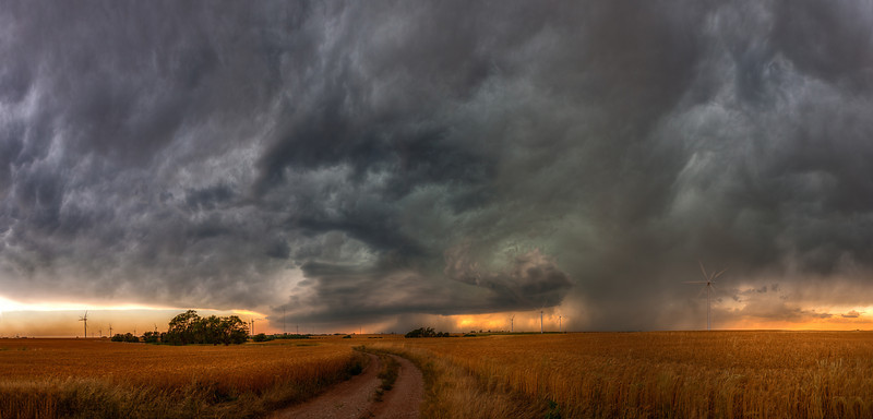
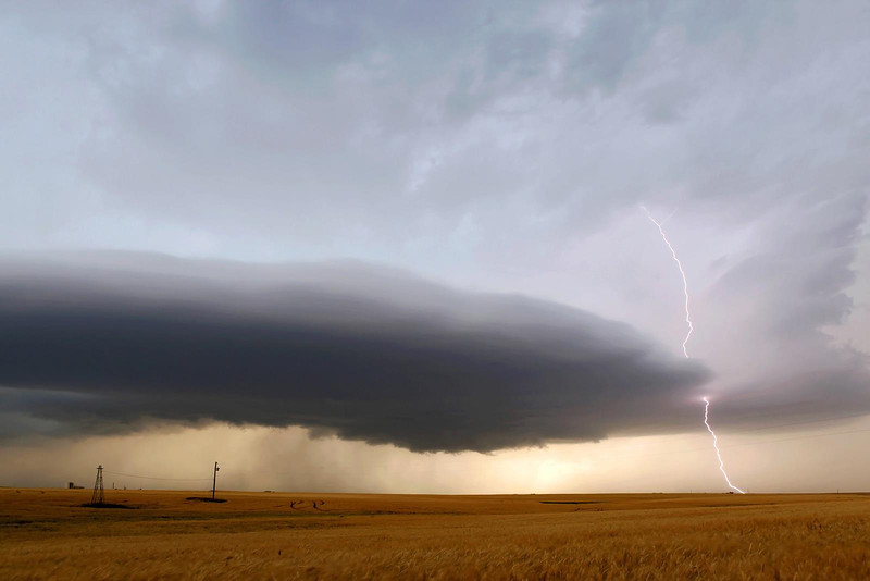
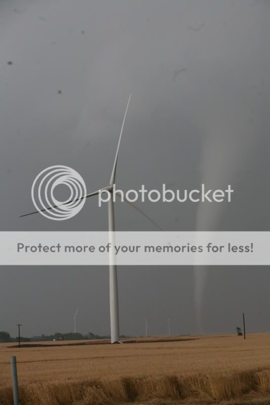
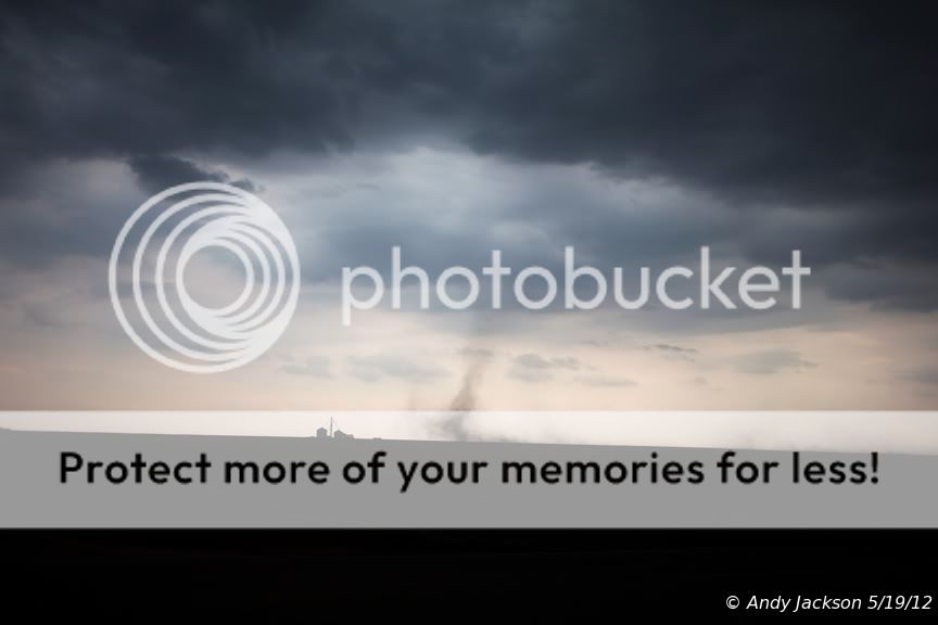
As we headed north on 14 Hwy, I began to see great rotation on the newly formed cells paralleling the highway. I didn’t see it at the time, but when I reviewed the footage, I saw a gustnado. It was 3 miles northwest of Lovewell Reservoir. I had only seen the wall clouds and funnels while driving. The video is easier to see as it is so far off, but you can see it to the right of the stop sign.
N Kansas Gustnado.jpg

N Kansas Wall Cloud.jpg

N Kansas Storm Structure.jpg

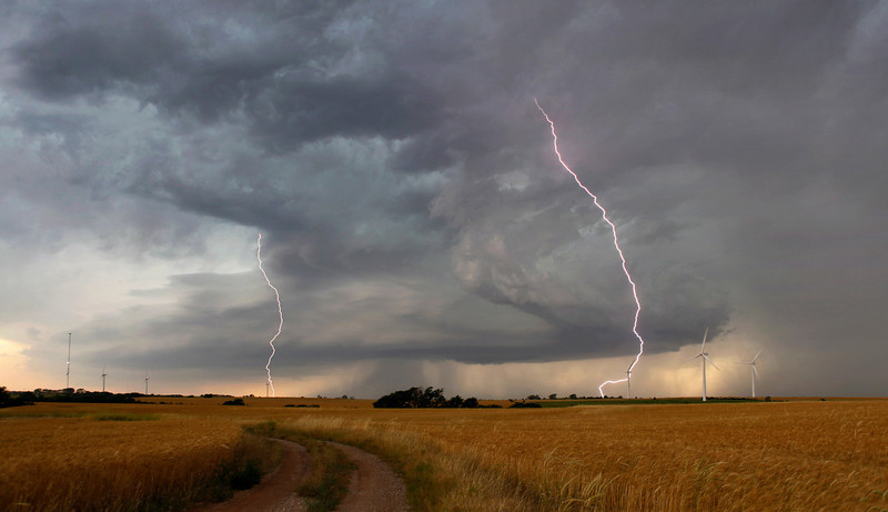
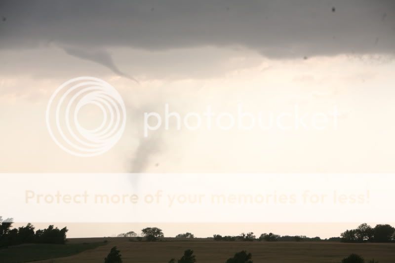
We had several funnels on the west side of the highway as we crossed into Nebraska. I lost sight of all the funnels entering Superior, Nebraska due to all the trees and onset of very heavy rain. The storm became Tornado Warned at this time so I elected to just push a few miles east on 8 Hwy and re-evaluate the data on my computer. After all, I had my daughter with me and wanted to be on the safe side. The storm had been moving VERY slow. What I didn’t know was the tornado made a hard right turn on the south edge of Superior, greatly picked up speed, and was right behind me!

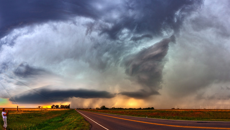
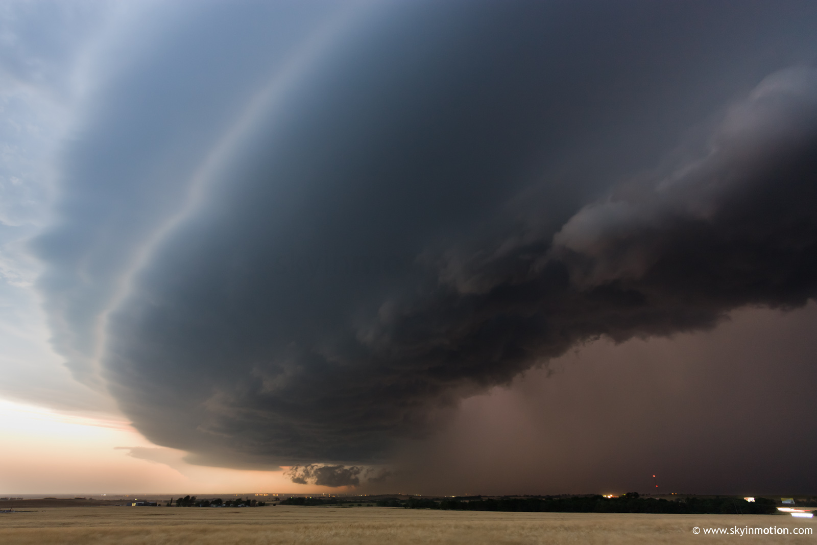
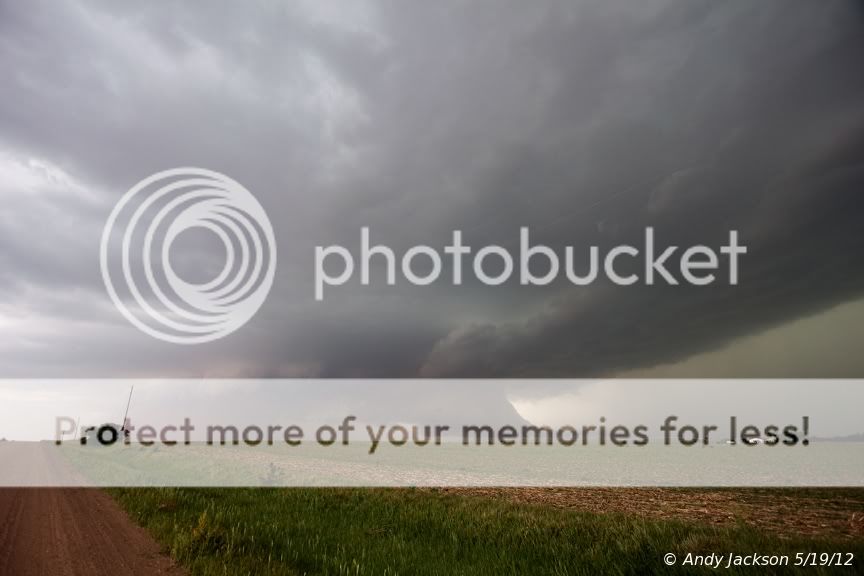
After driving a few miles, I noticed a strong rotating wall cloud only ½ mile to my south. Knowing the storms had been pushing north and the tornado was somewhere behind me, I increased my speed driving east and decided to outrun the wall cloud. Here is when I realized the situation was not good!!!

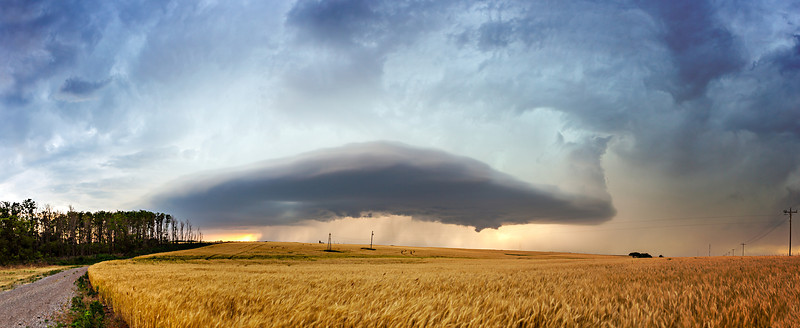
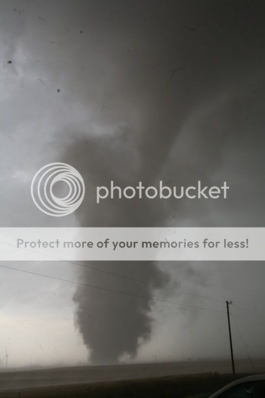
Just before Hardy, Nebraska, with a rotating wall cloud now showing a loose funnel only a ¼ mile to my 3:00 position and me driving 80 mph, debris suddenly appeared in the field 150 yards in front of me, only 50 yards right of the highway! Never seen that before… A tornado moving rapidly east/northeast and the ground contact 500 yards ahead of the wall cloud.
Hardy Nebraska Tornado 1.jpg

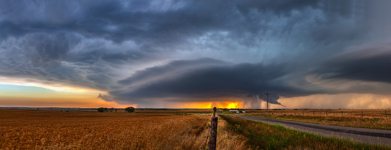
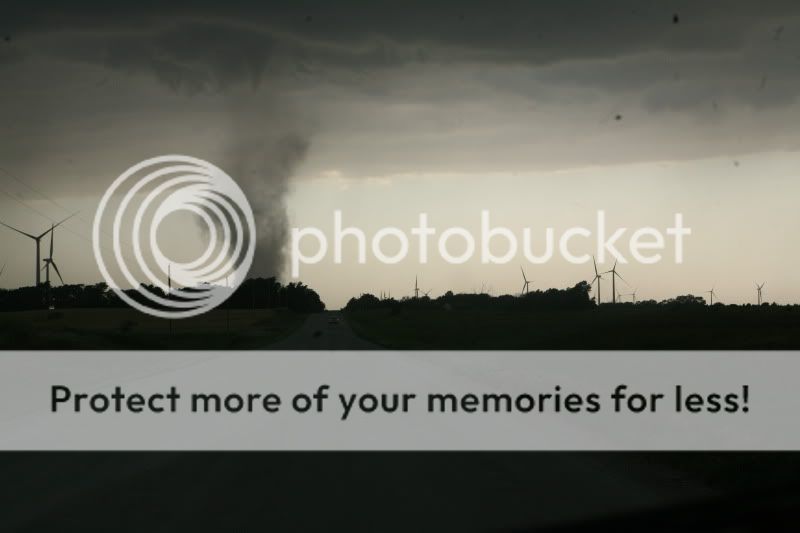
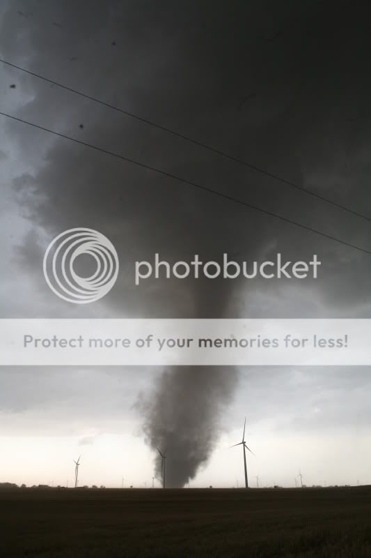
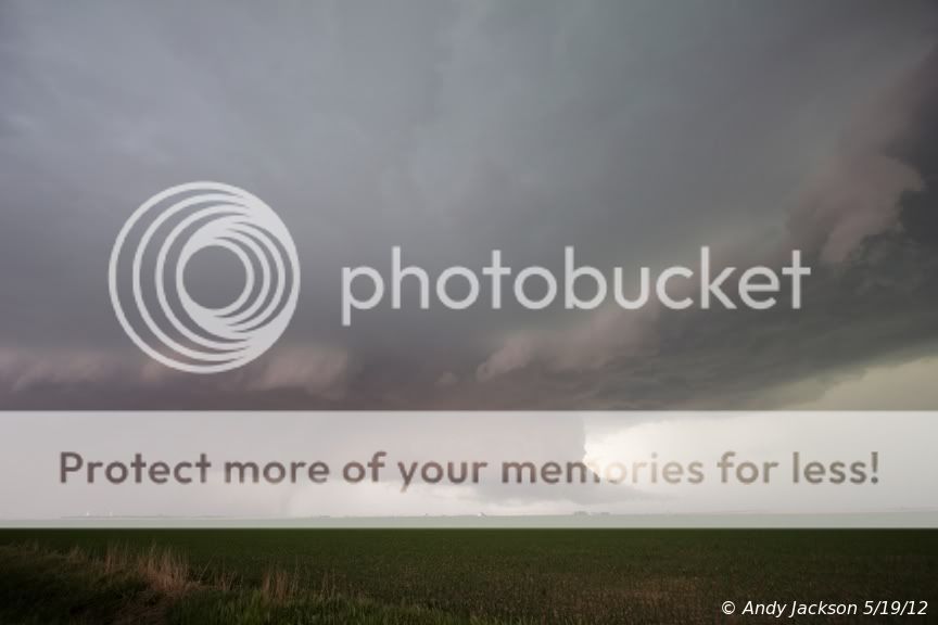
I stopped within 100 yards of the tornado which still did not have a visible condensation funnel. I put the car in reverse and began backing up the highway, but moved into the westbound lane as I sped back. Then my back window exploded as small debris was being pulled in by the inflow winds. I was completely shocked at what I saw next… A County Emergency Management Suburban came flying past me at 60mph, and then he slammed on his brakes as he entered the tornado! That was the luckiest guy in the Midwest yesterday as he came away unscathed!

Hardy Nebraska Tornado.jpg

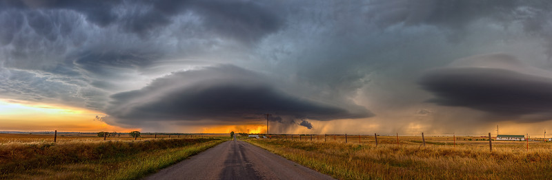
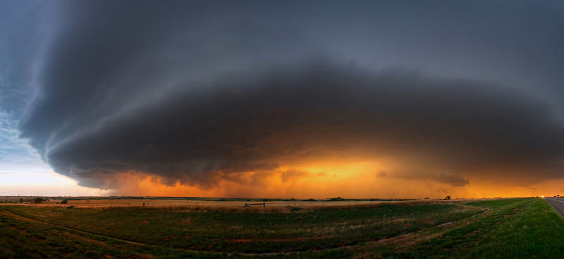
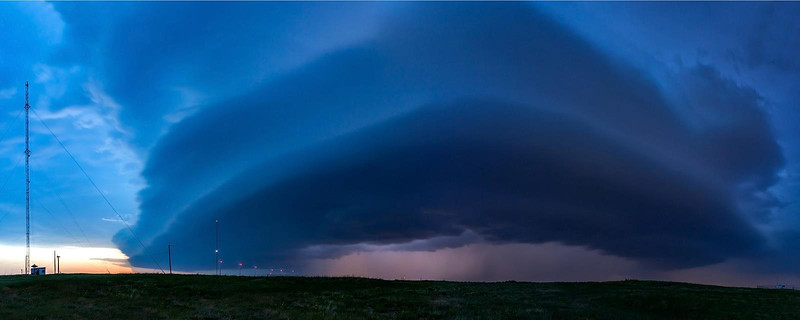
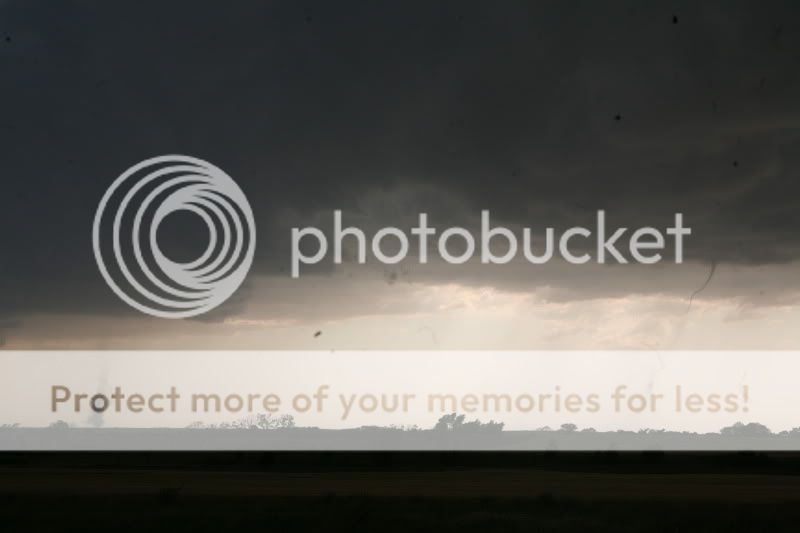
My daughter wanted to keep chasing the tornado, but with no back window and glass all over the inside of my Tahoe, we called off the chase. On the way home, I had some beautiful skies and time to thank God that my daughter was safe, she had seen her first tornado, and my wife didn't know how bad I screwed up!
 
Awesome - we managed to get on a great storm in KS which rapidly started producing tornadoes - I lost count at one point LOL... Here is a clip of our ropey tornadoes - the first ones... apologies for my squealing - I get a tad over excited LOL! http://www.youtube.com/watch?v=Uk4wRd3_HxA

By the way, if anyone wants to publish their amazing photos, we're looking for some to put in IJMet :) do send them along - you retain all copyright and as a bonus we now will advertise your websites alongside the photos published too. We need the originals though for best quality. Get in touch if you fancy sharing - great stuff to see though too.
 
I had been looking forward to the 19th for the whole week. My parents were in town from MT and I had really hoped to take them on a chase while there were here. We decided to target NW Oklahoma, specifically the area around Woodward. Models were showing the cap breaking in that area so we were optimistic about having a good day.

We setup near Waynoka on highway 281 around 4 PM and watched CU build all along the DL. After about an hour, and after consulting with my now caster Zack Biggs we decided to relocate a bit further south to intercept a strong cell coming to us from near Arnett. We dropped to highway 183 where we stayed for pretty much the rest of the chase.

We found a spot near a windfarm just south of Seiling to watch the storms. The mammatus were really amazing:


The storm was fairly linear at this point but still beautiful to see:


Lots of close lightning!


We were soon driven from this location as the lightning became very intense. We relocated a few miles south:


Another drop south and the storm had started to wrap up a bit. Lots of mid level rotation. One of the DOW trucks was also in this area scanning the storm from just behind us:


We again were run off by the intense and close lightning. We dropped further down 183 and got a little bit further ahead of the storm. We were able to film/shoot from this location for quite a while. We finally had an organized wall cloud but there was not a lot of low level rotation:


We stopped quickly just north of Clinton, OK. The southern end of the storm was really started to accelerate and we only had a few minutes here where I shot this:


We escaped the core of the storm and headed East on I40. We stopped for the last time just south of Weatherford:


It was an awesome chase, and my family really had a great time:

 
Here is my close-range video of the tornado south of Spivey, KS as it goes through a wind farm. I was chasing with Robert Balogh and we had already seen a few brief landspout tornadoes south of Kingman, KS. The last tornado appeared to be similar but I was able to obtain a much closer view due to a decent road option. Sorry about the delay as I thought that I had already posted the video here. The full report will be delayed due to the complex nature of the day.

Watch video >

Bill Hark
http://www.harkphoto.com
 
I got my new computer yesterday and decided its time to work on my older footage. So, here's a new style I might dabble with in the future. Feedback is welcomed on the production. Feel free to pimp this video around!


Watch video >
 
Last edited by a moderator:
What looked like another blowoff-worthy day in 2012 became an extremely frustrating one as the first images of ICT area tornadoes flowed in. That motivated me to jump in the car around 6pm and head for W OK, which I likely wouldn't have bothered with otherwise. I arrived in Clinton just before sunset for a high-end mammatus display, followed by a very nice shelf cloud that I shot from near Custer City. Sadly, this would easily make its way into my top 5 photography chase days of this awful year.

2012-05-20_8466.jpg


2012-05-20_8498-pano.jpg


2012-05-20_8512.jpg
 
Back
Top