• A friendly and periodic reminder of the rules we use for fostering high SNR and quality conversation and interaction at Stormtrack: Forum rules

    P.S. - Nothing specific happened to prompt this message! No one is in trouble, there are no flame wars in effect, nor any inappropriate conversation ongoing. This is being posted sitewide as a casual refresher.

2023-05-11 REPORTS: TX/OK/KS

gdlewen

EF2
Joined
May 5, 2019
Messages
191
Location
Owasso, OK
2023-05-11 REPORT: TX/OK/KS

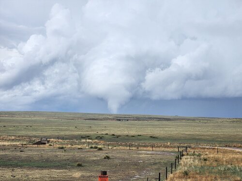
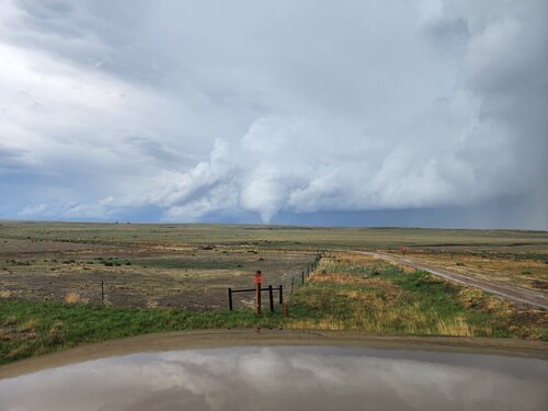
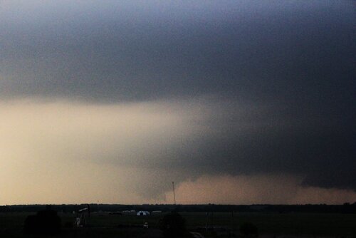
This will be part one, describing the initial storm intercept on 5/11/2023: an LP(like)-supercell near Comanche, OK. No tornadoes, and so probably a bit of a snooze for most chasers, but it featured an extremely "skinny" updraft tower and dissipated as an open helical (or cork screw) configuration which made it OK that I was out of position for the Tuttle tornado (not really.)

I had a 1PM meeting in OKC which was supposed to go an hour but wound up taking almost three, so it was getting late by the time I reached Chickasha. A cell had already formed near Randlett, which was in my target area so I monitored it as I drove south towards Lawton. While heading south, a small cluster of cells formed near Geronimo, but as they showed no signs of intensifying, I picked that Randlett storm and headed south to intercept it near Meridian/Comanche.

The cell had a distinctly LP-like character with an elongated "hook" and a center of rotation was displaced away from the precipitation core. (Here I have the 4th Tilt for velocity along with the lowest title for reflectivity just for purposes of illustration, since the rotation in the lower elevations is less pronounced.)
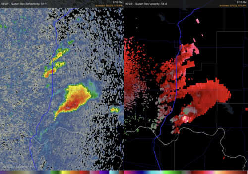
KFDR_20230511_2212Z_R1+V4.png

I like the 'blink comparator" type of presentation instead of the side-by-side offered by most apps, because it's easier to correlate features in the reflectivity with corresponding features in velocity scales. (I have stopped bugging RadarScope about offering this as an option because I am tired of being ignored. it's one line of code so if they were interested they could do it in a heartbeat. Plus--the blink comparator was good enough for Tombaugh to discover Pluto....)
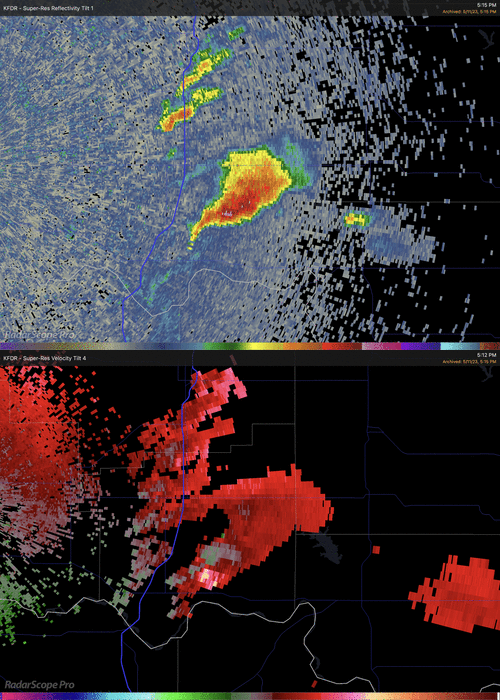
KFDR_20230511_R1V4.gif

I think I can be forgiven for targeting this cell, since it seemed like just the opening act of what promised to be a good day. (Plus, I have hard time resisting the opportunity to witness the sculpted helical form of rotating supercells....)

I intercepted it near Comanche, and was surprised at how narrow was the updraft tower. (And it's already beginning to dissipate.)

View attachment 20230511 Comanche LPc.mp4

Within 15 minutes it was over. All that's left is a cloudy helix, barely rotating.
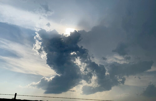
20230511_ComancheLP_DSPTD.jpeg

By now, one of the innocuous cluster of cells I bypassed near Geronimo was dropping a (confirmed) tornado near Tuttle, and I was left wondering what I missed there, and if my fixation with this LP supercell had cost me dearly. (To be continued.)
 
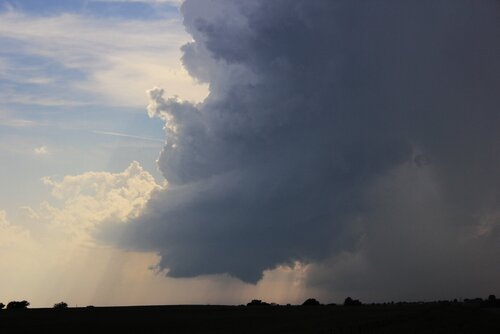
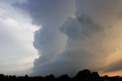
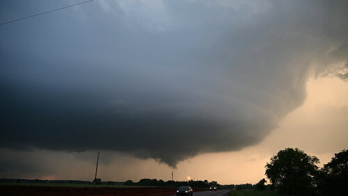
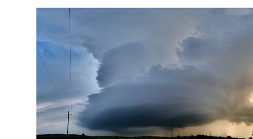
I left Altus, OK at around noon and headed to Lawton. My original plan had been to pause in Lawton and then move north toward Chickasha, but after a final round of model data, I decided to hedge my bets a bit and hang around in Lawton. I wound up sitting in a church parking lot with a few other chasers just east of Lawton along OK-7. Once there was initiation, I drove east to US-81, and then south to Comanche. I sat by myself in a pull off on some little county road for probably close to a half hour taking photos of the same supercell @gdlewen referenced above. I even had a time lapse, but my GoPro promptly corrupted the memory card somehow. I did get several shots on the DSLR though. Below is my favorite:
IMG_1138_edit.JPG

After this storm began to decay, I joined the conga line going north on US-81 towards the cluster of supercells on-going south of Chickasha. From here on, there were chasers pretty much everywhere (more on that later). I got into position on the southern most storm just north of Rush Springs. The storm wasn't really doing much at this stage. It produced a couple of scraggly wall clouds and that was about it. About halfway between Rush Springs and Ninnekah, I hopped onto another county road and followed it east, and then back north. After meandering a bit, I found myself on OK-19 just north of Alex. I broke off from the cell I was on and proceeded south towards Bradley.

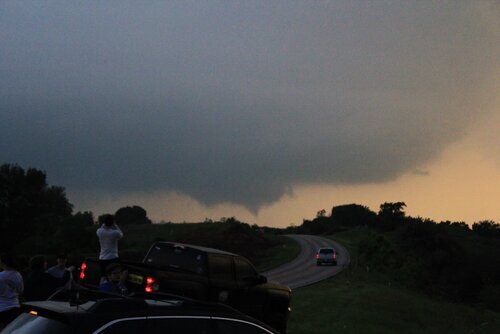
Around this time was when the tornado was reported near Rush Springs, so I made a move to intercept that storm. My whole route down OK-19 was characterized by trees, hills, and basically no visibility. I eventually came to a pull out just SE of Bradley with a great view off the side of a hill towards the north. There were several other chasers already here, and I just wanted to note how friendly they were. I rarely interact with other chasers in the field, so this was really cool to me. From this vantage point, we had clear views of the ongoing meso on the storm to the north (the storm I broke off from to head south), and also of the storm with the reported tornado moving up from our SW.

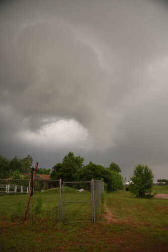
I'll start with the storm to the north. There was a report of a tornado 4 miles SW of Dibble at 8:04pm CDT. The following two photos were taken at 8:06pm. I went on Google Earth to double check my position and vantage point once I got home, and confirmed the storm to our north was the same storm referenced in the report. I had to crank up the contrast to see, but pending the survey results from the NWS, this could technically be my first supercellular tornado! EDIT: NWS Norman has confirmed an EF0 was on the ground from 8:04pm-8:07pm.
IMG_1250_edit.JPG
IMG_1252_edit.JPG

Simultaneously, the other storm was still moving up from the SW. I was able to get some decent structure shots, as well as a funnel that the storm briefly produced.
IMG_1246_edit.JPG
IMG_1261_edit.JPG

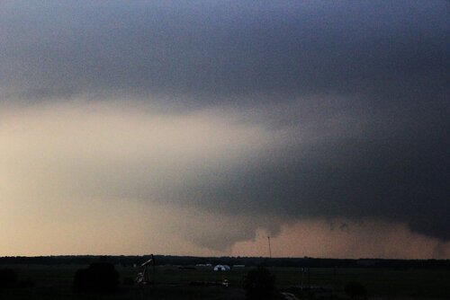
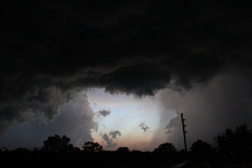
After this, I was quickly losing light and so I called the chase. On my trek north toward Chickasha (and food), I got this shot looking west out from under the meso of a storm in Alex. Nothing really significant structure wise, but I thought it was a cool photo. After grabbing food in Chickasha, I headed back to Altus and got home at around 11pm. In total, about 300 miles and 11 hours (all but about 5 hours were travel to/from and waiting on initiation).
IMG_1314.JPG

Final Thoughts:
First, about the chaser convergence. Yes there were TONS of chasers out and real estate on the side of the road was scarce at times, but as others have noted, I don't recall seeing any erratic behavior. I'm sure it was going on somewhere, but it seemed that most folks were being careful. Overall, I didn't have any regrets about being caught up in the hoards this time.

As I have already established in recent posts, I am still perfecting my chase techniques. From that perspective, I count this chase as a HUGE success. I made a decent forecast, I was out early and so I was able to let the storms come to me rather than play catch up, and I ultimately put myself into position on 3 different supercells. The only things that really went wrong on this chase were things entirely outside of my control. In the EVENT thread for this day, there are some good explanations from folks 10x smarter than me on this stuff about why the storms seemed to struggle on this day. So I won't go into it here. I was disappointed on the drive home, but after a day or two to think and process, I am really proud of myself on this one.
 
Last edited:
This post will cover the second half of my trip--picking up after the cell near Comanche died out. (BTW @Mikayla Norris: I must have arrived too late to see the funnel cloud that cell dropped. Considering it was Day of the Funnel Clouds for me, I'm sorry I missed that one.)

After leaving the Comanche Debris Helix, we headed north to catch the cells moving through Rush Springs. (Now it’s definitely a chase: although the cells are not moving fast, I can see from my mapping software that there is a lot of congestion near Rush Springs and no good way around it.) Plus, there really was no good visibility of the storm structure approaching from the south.

Traffic was heavy on Hwy-81N, surely due to chaser convergence. We even saw a chasing tour comprised of three white vans, unmarked except for a little twister-decal over the right-rear turn signal. The terrain was shallow rolling hills, with unreliable visibility of the horizon—low spots with breaks in trees proved to be the best places to stop.

A little north of Agawam (0020Z), we stopped because the wall cloud had crossed the highway, and was now E of Hwy-81. Despite no longer being backlit why the sun, and despite the rain getting heavier, we did get a good view as it receded into the murk.

View attachment Awagam Wall Clouda.mp4


The local road network made it difficult to keep pace with this cell. And, not yet realizing I should just bite the bullet and make a roundabout 40 minute drive to the Dibble-Cole-Noble axis, I opted to relocate to SH-19 between Alex and Bradley, to intercept the remaining cells in the sequence. We arrived at about 01Z.

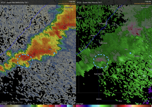
The blue dot indicates my position, and and thanks to a tip from @JamesCaruso, I now know Radarscope's markup tool writes to all panes, so no need to "blink" the views.


OKC_20230511_0100Z_RV1.png


Not very imposing in the radar view, the cell is actually quite photogenic:

View attachment Bradley Supercell.mov


We were "treated" to 2-3 weak funnel clouds as the cell moved past. At least twice, a funnel cloud appearance was accompanied by a tornado warning over the radio for our location.

Since we were in overcast, rainy conditions prior to breaking out here, I have no idea if these cells always looked so good, or if this structure was part of the intensification. Just for the sake of completeness, here is a shot of a funnel cloud just about to cross Hwy-19.

DSC_0539.JPG


This position was everything I had hoped it would be (except for the whole "these storms will not produce a tornado until they reach Dibble” part). A good view of the supercell approach and a chance to sit back and watch things drift by.

All things considered--it was a successful trip. No tornadoes but two pretty supercells. And I learned a lot.
 

Attachments

  • Awagam Wall Clouda.mp4
    3.6 MB
This post will cover the second half of my trip--picking up after the cell near Comanche died out. (BTW @Mikayla Norris: I must have arrived too late to see the funnel cloud that cell dropped. Considering it was Day of the Funnel Clouds for me, I'm sorry I missed that one.)

I'm not even sure if it was a funnel in my first image. It was so brief I was never able to get a good read on whether it was rotating or not. Might have just been "spooky scud" as i like to call it. Looks like our chase adventures mirrored each other almost exactly most of the day. I'd bet we passed each other on more than one occasion.
 
Man...it has been a long time since I have a chase report worth sharing, let alone any chase at all.

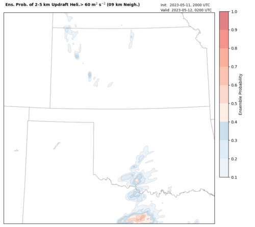
Lucky me for having been based in Norman last week for the NOAA/HWT Spring Forecasting Experiment. After performing our daily activities, I left the NWC shortly after 4 PM in the general direction of Duncan, based on output from the 20Z WoFS forecast suggesting far SC OK being the most likely location of rotating storms later in the day, and having knowledge of the morning precip in the region.

uh_2to5__swath__nmep_09km__thresh_60.wofs.f00600.png

We headed to Chickasha and then down 81, noting the development of the first storm along the way. We eventually got close enough by the time we reached Comanche to turn west on OK-53, finally settling at a spot a few grid lengths into the network just in time to catch the storm dissolve in front of us. About that time we saw the updraft towers north of this dead storm becoming more intense, and not much sign of significant convective development near to our southeast (we could see a baby updraft between us and the bigger storms well south of the Red River in TX). We discussed heading down into TX, but several factors dissuaded us. One was that deep shear was weaker the further south you went.

So we 180-ed it and got back north on 81.

Somewhere around Rush Springs we passed the southernmost storm, which had a beefy wall cloud on it as we approached, but which also appeared to significantly weaken and start to die as we were passing by. The next storms to the north remained robust looking on radar, so we intended to just view this storm briefly on our way to the storms to the north. We only stopped for a few minutes to watch this storm before moving on (this turned out to be the storm of the day shortly after).

By the time we arrived back in Chickasha, the Tuttle tornado was forming. We had local media on the radio at this point for support information, so we could hear that an obvious tornado was in progress. That tornado appeared embedded within a complex of storms, though, and we saw an obvious hook forming on the south end of that complex, very near Bridge Creek. Rotation seemed to be developing in that area, so we jumped on I-44, knowing we may end up driving directly into it. However, we hesitated and ended up pulling off at the oasis just north of Chickasha, knowing we would be committed to going all the way into OKC if we continued. We could not see anything tornadic in front of us, as it looked like there was just enough precip to block our view.

And then all of a sudden...the storm back to our south became tornado warned.

So we made our second 180 of the day and went back to 81 at Chickasha (side note...never had to pay any tolls on 44 for this!). We had to slice through the core of the storm to get out ahead of it, so we jumped on OK-19 and punched through on the way to Alex. No hail at all. At Alex we turned north and headed back up to OK-39, watching in the process for something to happen. There was rarely any upward motion, scud, or cloud base rotation during this stretch.

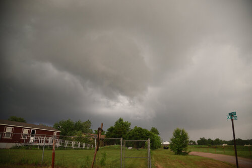
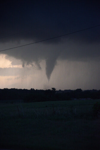
Things finally got more interesting once we got onto 39. Immediately we noted the signs saying the road was closed ahead. We were able to get to 2970 to 1370 to get around it. There were a lot of trees in this stretch, but we found an opening and witnessed a funnel cloud form to our immediate south.

05112023_001.JPG
05112023_003.JPG

We had to briefly back down the hill to comfortably get out of the potential path. The funnel was very ragged and didn't make it even halfway down before appearing to dissipate, although rotation at the top remained. Once it appeared the threat had crossed the road we crept forward. At some point we saw a sudden gust of wind - leaves went flying and the wind suddenly changed direction! A gate just down the road swung open and back in a violent manner. It was over in a few seconds. Apparently some kind of weak circulation had developed over the top of us!

The Norman WFO's information page for this event (The Severe Weather Event of May 11, 2023) shows a tornado track crossing our road between 8:11 and 8:13 PM, and the time stamps on my photos are from no more than 2 minutes before that, so it seems quite plausible that we sampled the developing stage of this EF0 tornado. I can't tell if this funnel was the beginning of it or the end of the previous EF0 that was listed as ending at 8:07 just southwest of us.

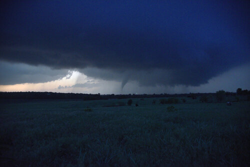
Anyway, we made it through Dibble. Curiously, we kept thinking we were going to need to bend our track east and eventually south to get to the next storm down the line, assuming that storm would eventually overtake ours. But we kept on a northeast trajectory, jumping north of Dibble and then east on Washington Road. It wasn't until we approached Washington from the west that we heard the radio freaking out about a tornado touching down. I asked my partners, "are they talking about our storm???" Between breaks in the trees we saw a good wall cloud, but no tornado under it. But there was some stuff hanging down behind it. After a little bit more, it became clear that the stuff hanging out behind the wall cloud was actually the Cole tornado touching down.

05112023_008.JPG
05112023_012.JPG

I rarely see tornadoes late in the day, and it was almost too dark to shoot this tornado with my Nikon. I had to bump the ISO up to 1600 just to make it out on my camera at 1/50-s exposures.

We turned north on OK-74/24 to keep with it, but ran into a LEO road block a few miles north. That forced us to take OK-74 east to Purcell to get around the river and back up on it, but during that traverse we fell behind and missed the Noble tornado. We went straight north out of Slaughterville to OK-9 and got back in front of the action area, but the storm appeared to run out of steam by then and we ended up calling the chase a few miles east on 9 in rain with no obvious signs of any more rotation.

It looks like the apparent formation of the Cole tornado "behind" the wall cloud was a perspective issue. Photos from other angles show a pretty obvious clear slot, and my own photos corroborate this once I examined things afterward. It was just so dark that it was tough to discern this in real time.
 
Last edited:
Man...it has been a long time since I have a chase report worth sharing, let alone any chase at all.

Thanks very much for posting thus report. It's very helpful to see how others make decisions in the field, even though an experience gap may make comparisons difficult. In the case of 5/11--your group moved on quickly from the Alex-Bradley area to head towards Dibble, while I stayed there to watch the last two cells in the line. I infer you implicitly knew these cells would not drop tornadoes soon and you had time to relocate.

My biggest mistake (and there have been some truly spectacular failures since moving to OK) was not checking to see how close I was to Dibble. The last time I checked it was 50 minutes or so, but since then I had random-walked closer so that my last stop was only 20 minutes away.

It's not quite clear from the video I posted above, but there are two updraft towers visible. The rearmost one was the last cell in the line, and sticking around for it was not worth the time. One final picture: a panorama stitched with the freeware program Hugin. (I think I will always be a sucker for this kind of shot, even if it costs me a tornado sighting. Time will tell.)

DSC_0532 - DSC_0536.jpg
 
Thanks very much for posting thus report. It's very helpful to see how others make decisions in the field, even though an experience gap may make comparisons difficult. In the case of 5/11--your group moved on quickly from the Alex-Bradley area to head towards Dibble, while I stayed there to watch the last two cells in the line. I infer you implicitly knew these cells would not drop tornadoes soon and you had time to relocate.

Not at all. We made sure to keep up situational awareness of the storms back to the south in case they went ape s*** since they had the most open inflow air. More often than not, tail-end Charlie is the storm to be on. However, there are exceptions, and this seemed to be one of those cases. There are times when the environment is not overwhelmingly supportive of producing tornadoes (such as this day), but that external sources of vorticity can provide the gap between the environment and a storm producing a tornado. Another example of this (for me) was 22 May 2011 in Iowa with a pair of discrete supercells in close proximity - the southern one briefly was tornadic and the northern one was non-tornadic until after the southern one became tornadic. I was on the northern one. My hypothesis was that the northern storm ingested a fresh OFB surge from the southern storm, which provided the vorticity for it to produce an EF2 tornado.

The other strategy is just to stay on the storm you're on instead of getting antsy and jumping from one storm to the next. So long as your storm is not dying, losing its supercell characteristics, or building upscale, there's still a chance it will produce a tornado. Most of the time you miss a tornado on a day like this it's because you were switching storms. We just happened to get lucky, really.
 
Jeff, was the purpose of the road block to keep people out of the tornado's path or was it traffic control?

Definitely trying to keep people from getting anywhere near the tornado (out ahead of it). I overheard an officer tell another one, "I'm not gonna let anybody die from this thing."

Brett Roberts also encountered a road block on I-35, and it was close to boxing him in in his escape of the Noble tornado. The amount of LEOs in the vicinity of that storm (ahead of it, not behind it in S&R mode) was unlike anything I'd ever seen before, and it was borderline problematic.
 
Back
Top