2012-04-14 REPORTS: TX/OK/KS/NE/IA

This ended up being another nice chase. As many did, we ended up hopping from cell to cell on south. Eventually our 5th cell on the day worked out and consistently produced(though most tors were very brief).

Full chase log here: http://www.turbulentstorm.com/1/post/2012/04/april-14th-2012-cs-kansas-chase.html

Not so great picture of the tornado near Moundridge, KS:
ks7s.jpg
 
04-14-12 tornado8-inet.jpg04-14-12 tornado1-crop-inet.jpg

It was an awesome and exciting day. Drove six hours from the Dallas area to NW Oklahoma, arriving about 20 miles Southeast of Woodward around supper time.
Watched one storm produce numerous funnels and continuously morphing wall clouds, then pressed North and East to intercept the cell to its Southwest moving northward from the Vici/Mutual area.
Intercepted this second storm about 4 miles South of the 412/281 intersection and watched in awe as it produced continuously morphing wall clouds and funnel clouds, including at one point an amazing wall cloud that hung just above the earth & looked like Medusa's hair with lots of mini-funnels inside of it pointing all directions.
I watched two brief touchdowns, the first of which had a secondary vortex rotating around the base.
Raced northward, with most of the view blocked by hills as the wall cloud coalesced and produced a tornado. Got stopped by a police roadblock back at the 412/281 intersection, and watched the tornado press into the Northern horizon from there.
The twin funnel photo is taken South of the intersection, looking West; the tornado is shot from the 412/281 intersection.
There must have been 50 cars parked on 412 within a block of the intersection
More photos and full chase account is on my blog site www.joyfulstormhunting.com
 
Last edited by a moderator:
Finally had a chance to upload/edit my video from this day. Like I said in my previous post, after a late start ended up on the tornado near Solomon, KS just after 7pm. It's not as close a shot as I would have liked, but it was definitely a beautiful tornado!

Solomon, KS tornado

it's shot in HD, so make sure to choose that quality on the bottom of the video:p
 
I drove all the way from Seattle to be here for this event and here are some of my pictures of the Salina Kansas tornado. 4,200 miles of driving in 4 days, totally worth it.IMG_1928.jpgIMG_1930.jpgIMG_1942.jpg
 
Up close shots of Salina Tornado 4/14/2012

Hey Ya'll,

I forgot to share my pictures here from our 4/14/2012 Chase. A few chase buddies and I made a last minute decision to chase the epic setup in KS, so we left Raleigh, NC around 5pm Friday and got in to Kansas shortly after noon or so. Later that, we picked the right supercell SW of Salina and got these shots of what was rated as an EF-4 Tornado.

Photos are on my Flickr photo stream. For video of our vantage point, see my chase partner's video (his HD camera is ALOT better than mine):

Tornado near Salina, Kansas 4-14-2012 by CackalackyChaser, on Flickr

Watch video >
 
Last edited by a moderator:
My post is pretty late, but I guessed it's better late than never. Dave Fick and myself started our day in Kansas and concluded by chasing the Cherokee, Oklahoma storm. We observed 5 tornadoes today. I will have a detailed report up on my site in a few days.. Here are a couple photos of a couple of the tornadoes we observed.

FB2.jpg
574710_659094573991_196003355_32447142_1339115255_n.jpg
148962_664869166661_196003355_32460534_1952219423_n.jpg
148962_664869186621_196003355_32460538_742257329_n.jpg
 
I don't recall any on-camera or followup reports of large hail from chasers on Hwy 4 between Crawford and Langley that day --as they followed closely, just northwest of the tornado. Did you know in advance there would be none or were you just taking a chance?

I stopped my northward pursuit on 26th Road, two miles south of the Hwy 4 curve (southeast of Crawford) and within 1 1/4 miles, as it passed to my northwest. I recently completed a detailed study of chaser locations from southeast of Geneseo to near Marquette --for my archive files. Anyway, curious about the hail absence and, if so, why it wasn't there. That was easily the best I have seen in 56 years of chasing (taped 13 minutes on HD/DVD from basically the same location) and a perfect chaser tornado, with little damage and no fatalities.

- - - Dave Hoadley
 
Here's a report to make good on the placeholder I posted earlier in this thread. The lateness is attributable to my coming down with a nasty, long-lasting virus the day of my return from the chase, and to catching up on work as I finally got to feeling better. After looking at other chasers' fabulous photos and videos from this day, I doubt I've got much to add, but it's still another piece of the puzzle for what to date has been the last significant setup of this season.

My long-time chase partner Bill Oosterbaan and I teamed up with fellow Michigan chaser Robert Forry and a friend of mine, Steve Barclift, both of whom were experiencing their first Great Plains chase, and Steve's first chase ever. We couldn't have picked a better day--one of those proverbial shooting-fish-in-a-barrel setups, though in actual practice it wasn't quite that simple.

We had overnighted at Ben Holcomb's after chasing SW Oklahoma the previous day. After grabbing breakfast, we headed out. Our plan was to simply mosey north into Kansas up I-35, then drift west toward the dryline as storms initiated--not the most sophisticated targeting, but a practical approach for that day. We took US 160 west toward Coldwater and eventually closed in on our first storm of the day. As we got close enough to get a clear view of the low-level features, we could make out a tornado in progress in the distance. It was far away but distinct, a nice cone.

We tracked with this storm, but after its initial tornadic outburst it seemed to go mushy and was having a hard time organizing as it drifted northeastward. We hung with it for quite a while but eventually opted to drop down toward the storm to our south, which appeared more robust. Naturally, the storm we dropped reorganized after we left it and started putting down tubes while our new target attenuated into a skinny cell and eventually disappeared from the radar. By then, we had dropped down yet again to the next cell below, and this one did the trick. From our first point of contact near Pretty Prairie, on up to Lost Springs and Delavan, we tracked with this storm as it dropped several tornadoes.

Here is my YouTube video. The latter part was shot after dark, and it's best viewed in low light. Then you can easily make out the tornadoes; otherwise, in brighter light you probably won't see much. For a more detailed report that also includes the previous day in Oklahoma and the following day in Minnesota, visit my blog.

Watch video >
 
Last edited by a moderator:
I don't recall any on-camera or followup reports of large hail from chasers on Hwy 4 between Crawford and Langley that day --as they followed closely, just northwest of the tornado. Did you know in advance there would be none or were you just taking a chance?

I stopped my northward pursuit on 26th Road, two miles south of the Hwy 4 curve (southeast of Crawford) and within 1 1/4 miles, as it passed to my northwest. I recently completed a detailed study of chaser locations from southeast of Geneseo to near Marquette --for my archive files. Anyway, curious about the hail absence and, if so, why it wasn't there.

- - - Dave Hoadley

David, our plan was to skirt the FF-Gust front and stay to the east of the main hail core and estimated tornado track. We were right at the top of the bend on K-4 initially, but then adjusted about 2 miles east near Plum ave. shortly before the wedge came into view. After our adjustment, and with the approaching tornado in sight, we did experience some brief and light hail. One of my chase partners, Kevin Smith, documented that brief hailing in the first 30 seconds of his video :

Watch video >

She was indeed a beauty, and probably the best I'll ever see for some time to come!
 
Last edited by a moderator:
Below is a visual chronicle of the 14-April-2012 Central Kansas storm trek as experienced by chase partners Ryan Miller, Keith Brown, and myself. Documented using four different imaging formats (analogue, digital, and motion picture film -- the later is set for it's own lone video). This 10-minute video highlights more of the experience, rather than the tornadoes from the day as a whole... but was quite fun to produce.

http://www.youtube.com/watch?v=15O00qKnAKE&list=UUuJvQxINFTbjXHSOel3zxTw&index=1&feature=plcp


Enjoy.

..Blake..
 
Finally got my chase log posted for this event which includes a full account, annotated map, stats, pictures, and video. At 40 images, 20 minutes of video, and pages of text it's my longest chase log yet. These take entirely too long to write so I'll probably be posting briefer accounts from now on:
http://skip.cc/chase/120414/

Although not my most spectacular chase, this was a crazy, hectic day filled start to finish with chasing, storms, funnels, and tornadoes. Thanks again to Jennifer Brindley Ubl for the photography and Brad Goddard for driving and saving the day through our near catastrophes.
 
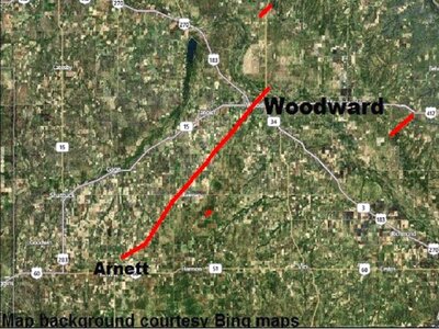
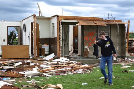
As April 14 turned into April 15th, 2012, a killer tornado returned to the Woodward, OK area. The EF-3 hit the city after midnight, but radar didn’t first detect the tornado, a spotter did! It was the strongest tornado in Oklahoma during this outbreak. Woodward was in a tornado watch for over 15 hours, and had been in a tornado or severe thunderstorm warning continuously for over 4 hours.
The storm crossed the city in five minutes, caused 6 fatalities, 29 injuries, with over 100 homes and business damaged. This major tornado was without modern precedent; one has to go back to 1947 for a stronger tornado in Woodward.
This one began 2 miles NE of Arnett at 11:50 p.m. and ended 4 miles N of Woodward at 12:27 a.m.
Screenshot 2025-01-05 at 1.17.53 PM.jpg
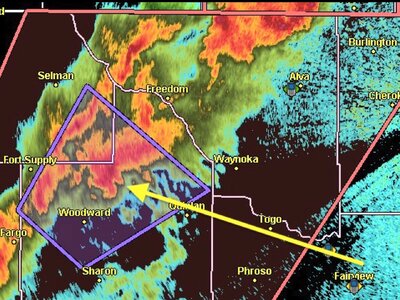
Radar image below from Vance AFB shows supercell & mesocyclone location (arrow) & warning polygon at 12:33 a.m., shortly after the tornado.
Screenshot 2025-01-05 at 12.58.54 PM copy.jpg
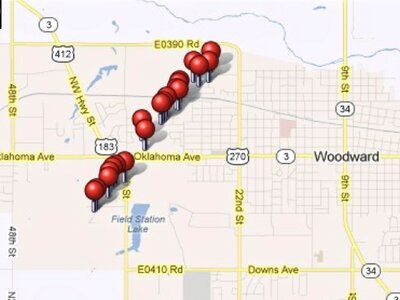
Image below shows the tornado path in Woodward using my GPS points for photographs taken during the damage survey after the chase day.
Screenshot 2025-01-05 at 1.04.31 PM.jpg
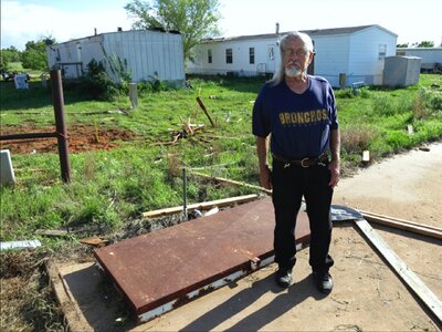
I felt for this gentleman below because his storm shelter was locked at the mobile home park when he needed it most.
Screenshot 2025-01-05 at 1.07.44 PM.jpg
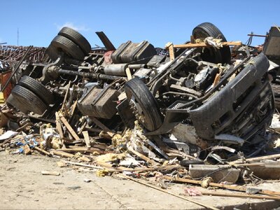
The image below shows a twisted undercarriage of a mobile home. I wouldn't want to live in a mobile home in Oklahoma.
Screenshot 2025-01-05 at 1.07.10 PM.jpg
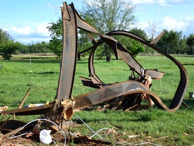
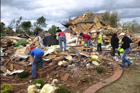
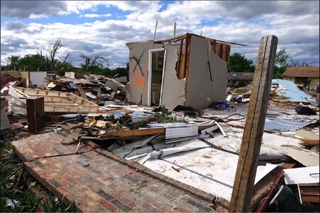
A few more images that indicate the power of nature, but also show that people get on task fairly quickly after storms strike.
Screenshot 2025-01-05 at 1.06.20 PM.jpg

Screenshot 2025-01-05 at 1.09.36 PM.jpg

Screenshot 2025-01-05 at 1.10.05 PM.jpgScreenshot 2025-01-05 at 1.11.21 PM.jpg
 
Last edited:
Back
Top