2012-04-14 REPORTS: TX/OK/KS/NE/IA

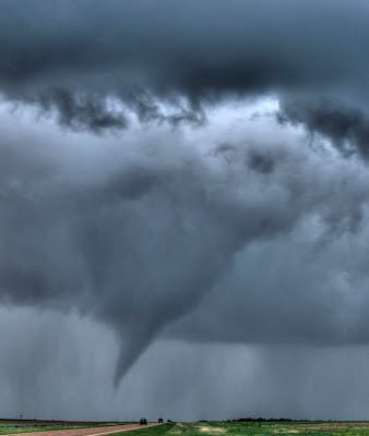
Saw a few tornadoes near Solomon and Manchester, KS along/north of I-70 between 7:00-7:30pm.

Very frustrating but rewarding day for us. Got on the early tor warned storm in northern KS around noon and almost got stuck in the mood but got out. Decided to head south and ended up in Great Bend and decided to take the southern storm of the two supercells that came off the dryline. South of town near St. John it looked HP and disorganized so we left it for another storm to the south. Got to near Pratt, Cunningham and waited/watch a supercell come up that looked decent at times with very strong inflow winds, great inflow tail into the organized cloud base with scuddy type wall cloud but could never get any good low level rotation. Left that one and decided to switch up and jinx our luck in the right direction. Busted north to the storm putting down wedge tornadoes sw of SLN. Thankfully got there in time to see a few tornadoes.

tor.jpg

tor1.jpg

caution a bit adult language

Watch video >
 

Attachments

  • Mancaster tor.jpg
    Mancaster tor.jpg
    7.8 KB · Views: 25
Last edited by a moderator:
Got on the Burdett storm, and watched it produce a few tornadoes as it tracked NE. Made up for the 1800 miles in 53 hours of driving (not all me).


A very short time-lapse. Will add another shortly.
 
We had a great chase. Caught the large tornado by Lyons/Salina KS. We have video of it beginning and chasing it. real nice footage of it out in a field. Also caught great pics to go with it. Afterwards caught some tornados Ne of Salina by Solomon/Niles KS as well.

Here's the links to our footage.

http://youtu.be/EqH1Hh6daxA

http://youtu.be/yPo-eA5CxPI

http://youtu.be/d-SlhQve1pk


Pictures of the Lyons/Salina KS tornado:
PSIMG_0727.jpg


PSIMG_0699.jpg


PSIMG_0660_1_2_fused.jpg


PSIMG_0631.jpg


PSIMG_0587_8_9_fused.jpg


a couple pics of the tornado by Solomon/Niles KS
PSIMG_0805.jpg


PSIMG_0804.jpg
 
Well some storm chaser I am. This is an addendum to my previous report. I got home and watched my video from my dash cam and found this. I couldn’t believe it. At first I thought it was a streak or glare on the camera LCD so I started wiping at it and tilting the LCD up and down. I said to myself.. “that can’t beâ€. I hooked my camera up to my TV and, there it was again. A tornado... back in the wrapped rain, but very clearly a tornado. In the background at the time you can hear me having a sneezing fit and I was also looking at a map at the time I think, etc…. looking at everything but the stinkin storm I guess. In the video you can actually see the tornado forming and then planting down, then about 5 seconds later I go on up the road. I always go solo, so I know I’m going to miss some stuff, but this was hilarious. First storm I was on. Can’t imagine how it would of changed my mood for the next six hours or so of not seeing much, before getting down to the tornado S of Anthony.

This tornado would have been the one reported in Clark county, south of Kingsdown, 2:30 or so. I’ve never spent much time with video, never uploaded to my computer or internet. This is a picture of my TV screen with video paused. Can’t believe I missed this.

IMG_0884r.jpg
 
Rice-Ellsworth-McPherson-Saline county chase

I hung around Concordia until mid-afternoon. About the time the SPC issued MCD #0529, I bugged out and headed south. I agreed with their assessment of the situation, but I decided that the action was mostly going to be to the south, where the slightly warmer temperatures were.

I stopped in Salina for a radar check and picked the storm that was working it's way northeast toward Salina. There was another storm north of it, looking to cross I-70, but I thought the one to the south looked better, and I knew the road network southwest of Salina a bit better.

At McPherson, I took US56 west to Lyons, then jogged a couple miles north of town to watch the storm. After about 10 minutes, nothing was happening, so I went back to US56 and turned east. I'm only a mile down US56 east and I could have sworn I saw a debris cloud on the ground, to the north, but trees were blocking my view. A north turn on County Road 22 got me a view and I finally saw the tornado on the ground.

After that, it was a game of trying to get some video while following it. I cut down the video to about two minutes. It's not quite as impressive as some of the other postings on here, but I was doing the best I could with the situation.

Watch video >

After I turned around at K-4 and Avenue W, I went south. One storm was all I got.
 
I added video of the first Oxford, brief tornado and the accompanying funnel to the second, upclose tornado video I posted earlier. And I hopped on the youtube bus.


Watch video >
 
I left Topeka at 12:30 and my initial target was to go to Hebron, Nebraska and while headed that way, got as far as Concordia when I decided that the storms to the north were not doing much. I decided to head back to Salina as storms to the SW were starting to produce.
When I got to Salina area, saw the storm around Lyons looking impressive. Got to Lindsborg exit and went to K4 outside of Lindsborg and found a place a couple miles west and pulled off to get radar image, hearing on the radio of the Tornado near Langley. I could not get good mapping or radar images so stayed put as not sure of the direction the storm was headed. Saw the beast cross K4 but at quite a distance. Watched the tornado with a spotter from Lindsborg Fire Dept. Once Lindsborg was spared he left and I then went north on Muir Rd. and stopped at Coronado Rd. and watched it try to reform, putting down occasional multi-vortex tornadoes.
I then followed it and once I reached I-70 and was headed east saw another large multi-vortex cross I-70 a few miles ahead of me.
Once I was just west of Solomon on I-70. I stopped on the side of the road and caught this video. When this tornado became obscured from where I was at moved along I-70 where it put down another tornado and watched it rope out. I thought the rope was never going to end as it lasted it seemed approx. 5 mins.
I then headed home back to Topeka. I had several videos, but all caught from camera on cell phone, and since I was by myself, was not very good as was paying attention to driving 1st, video 2nd, causing quite a bit of camera movement. All in all was the best chase I had been on for several years.

https://www.facebook.com/photo.php?v=10150695068527655
 
Last edited by a moderator:
Here is my 9 minute clip of the Alfalfa County tornadoes.
There is a hiccup towards the end as the inflow blew my tripod over while I was messing with the streaming camera in the vehicle.

Watch video >
 
Last edited by a moderator:
Great chase in NW Oklahoma with Jeremy Milligan, Steve LaNore (Chief Met @ KXII-TV), Jeremy Anderson, Jason Girard and Garrett Doty!!! Hoped we would avoid a lot of the massive Chaser Convergence by playing the Oklahoma end of things. Appearantly a large group of other chasers were thinking the same way, as this was one of the messiest chaser convergences I've ever run into, though, for the most part, everyone seemed very courtious and did a good job of driving through the circus, at least from our perspective...which was nice after what happened on 4/13 in SW Okla. We were generally around the Mooreland, Cedardale, Bouse Junction, Cherokee area all afternoon/evening. While it seemed to start off kind of slow on the Oklahoma side, it certainly ended with a huge Reward before sundown with the extremely photogenic Bouse Junction Stovepipe! We captured our first wallcloud with strong rotation, producing several nice funnels north of Mooreland (no pics posted cause I wanted to share more from the later Tornadoes which were far better). Our first actual Tornado that we could confirm (may have been a few before this one, but terrain made seeing ground level impossible on most of them), was near Cedardale, SW of Bouse Junction, from what began as a beautiful LP Supercell. As the storm moved closer to Bouse Junction, it quickly transitioned to more of a Classic Tornadic Supercell, producing the most amazing Tall Cylindrical/Barrel shaped Wallcloud I've ever seen! The rotation was Insane and we had no doubt we were moments away from witnessing an incredible tornado, which is just what happened! Rolled into Bouse Junction just as the Barrel Wallcloud transitioned to a massive Stovepipe, watched as it traversed over open countryside and eventually produce a couple of magnificent Twin Tornadoes! We called it a day after that, due to work obligations in southern Oklahoma/north Texas for us. Just as we arrived home in the Ardmore area, we heard the first reports of the devastating EF3 Woodward Tornado...Thoughts and Prayers to everyone affected in Woodward....

First Tornado from the LP Supercell near Cedardale, Oklahoma
S1300058.jpg


Coolest/Tallest Barrel Wallcloud I've ever seen, SW of Bouse Junction, Oklahoma
S1300094.jpg


Stovepipe Tornado just NE of Bouse Junction, Oklahoma
S1300119.jpg


S1300124.jpg


S1300131.jpg


S1300143.jpg


S1300149.jpg
 
Well, chased the Nebraska target with expectations of triple point action and avoiding the chaser convergence farther south. Right away got concerns about early convection in KS that was moving northeast. Hoped that it would still be able to destabilize again after it all moved through. Stuck close to the dryline and after many attempts of initiation, storms finally fired by mid-afternoon. Left Lexington and bit on the first storms to go up. They were way to sloppy and unorganized. There were areas of rotation and even some tornado touchdowns, but for this type of day we wanted a supercell. So we abandoned those cells near North Platte and went after the Oxford storm, where we were just a hour before. Someday I will get patience...but watching all those sups in KS, I lost what little I had. We got on the storm just minutes after it dropped the tornado. Saw a big wall cloud and got into some one inch hail, but the storm entered the stable atmosphere to the east and quickly fell apart.

Overall, a big bust. We took a chance with the triple point but it just didn't pan out. It was nice to avoid massive chaser convergence but there were still alot out there including some "chasers" that decided to follow us and piggyback without asking permission. They stopped when we did and would jump out asking us questions like crazy. It was irritating.

I updated my blog with a few pictures, but nothing spectacular. (http://chip-redmond.blogspot.com)

Chip
 
Here is one more time-lapse I made. This was just east of Kingman if I remember correctly.


Photos of the tornadoes produced by the storm that passed near Burdett are shown in my previous post.
 
Still Cant work out how to Upload Pics since the revamp, If anyone has any tips Pm Me Lolz.

Anyhow flew into DFW On Wednesday, played with some Hail in the Texas Panhandle then Busted in SW Kansas Thursday, Nice Friday 13th in SW Oklahoma Before The Big Show on Saturday and gruelling flight back on Sunday.

Pictures and More Detailed Write Up Below In Blog

http://plainschaser.blogspot.co.uk/2012/04/4-day-trip-to-southern-plains.html
 
Ingersoll-Cherokee, OK twin tornadoes

Chris Spannagle and I witnesed three supercells (but no tornadoes) over Barber/Pratt/Kingman/Cherokee counties between 21-01Z, dropping south each time, until finally hitting the jackpot with the fourth one at the US 64/OK 8 intersection a few miles north of Cherokee, OK. Saw two tornadoes simultaneously with one passing in front of the other (06:51 mark) before hitting a farm about 0.8 miles to our west (08:10 mark). Loud roar and scary strong RFD. Great structure too. Chris shot lots of high-quality stills, while I shot HD video and stills.

Watch video >

Saw a truncated cone in the twilight and after dark near the OK/KS state line, but couldn't capture any images or video.

We fell behind due to downed power lines south-southeast of Anthony and had problems turning the corner. We finally did in south Wichita/Derby, but couldn't see much and called off the chase due to bad roads.
 
First I would like to give thoughts and prayers to those directly impacted by the storms.

I started the day driving from DFW to Oklahoma City as I had to work in Amarillo on Sunday Morning. I had considered driving up 287 to be in position around Childress, because I thought that the area in SW Oklahoma would produce at least some isolated supercells.

Once in Oklahoma City at about 1:30pm, I checked the data and it was evident that kansas was already under the gun and with storms starting to fire in NW Oklahoma. I really did not want to travel to NW Oklahoma because I still felt that storms would fire in SW Oklahoma and I did not want to be out of position. Another reason was that the storms in NW Oklahoma were racing North/North East.

I traveled west on 40 to about Weatherford and at this point the storms around the Woodward area were already tornadic, I finally decided to bite and head to this area. Even though the storms were racing NNE, there were other storms firing in the Texas Panhandle and Western Oklahoma that would travel along the same path into the Woodward area.

I traveled up 281 to the area between Seiling and Waynoka and moved back and forth along 281 as each storm approached. The first storm I got on was producing funnels as it crossed 412 and was headed toward Waynoka. Another storm approached from the south, so I broke off and headed back towards Seiling. This storm produced many funnels and several touchdowns from my vantage point, but nothing sustained. The storm then organized further to produce a cone tornado as it moved northeast. I believe this was one of the storms that caused damage in the Cherokee area.

For my standards I got some decent images and video, but not nearly as good as some that have been posted already. Congratulations for all of those that captured the tornadoes on this day. For me it was definately a day I will not forget due to the number of tornadoes that I was able to witness.

One other thing that stands out in my mind regarding Woorward. They had several tornadic storms approach them throughout the afternoon. I was listening to the live coverage from one of their local radio stations. They were not meteorologists but were doing a decent job in trying to alert the public and they did have direct communication with a spotter out in the field following the storms.

At about 6:00pm after a series of supercells had passed through, they were pretty much sounding the all clear for any further storms. There were a few decaying showers still off to the Southwest but everything appeard to be dying off. They were telling the public that the dryline was about to move through and there would be no further risk of storms in the Woodward area.

I had already started my journey to Amarillo and noticed that the dryline had started to retreat. As we all know, storms rapidly fired along the cold front as it bagan to push eastward. Anyway, that last round of storms probably caught a lot of the Woodward residents off guard.
 
We (myself, Emma Faga, Brian Squitieri, and Sam Irons) chased multiple supercells across south central Kansas and north central Oklahoma. We started the day on the second tornado warned supercell near Greensburg, Kansas and then dropped south and east on a variety of supercells before ending the day near Manchester, OK after watching the tornado that tracked just north of the town.

The second supercell of the day produced a brief tornado north of Cunningham, Kansas. Debris was noted at 5:23pm CDT and the very small tornado dissipated at about 5:28pm CDT. Picture 1 shows this tornado at 5:24pm CDT and is looking north northwest. This picture was taken from about 3 miles north of Cunningham, KS. Picture 1a shows a very narrow condensation funnel and was taken at about 5:27pm CDT from about 3.5 miles north of Cunningham, KS and is looking north.

After the tornado dissipated, we dropped south to near Zenda, Kansas where we watched another supercell produce a funnel cloud (could not confirm ground circulation). Picture 2 is taken from 3 miles west of Zenda, KS and shows this supercell approaching Nashville, Kansas at 6:06pm CDT and is looking west.

2wec8r4.jpg

Funnel cloud and clear slot. Pic taken at 6:12pm CDT from 3 miles west of Zenda, KS and is looking west.

We then dropped south to the supercell that was producing tornadoes near Cherokee, OK. At 8:22pm CDT another tornado formed to the southeast of Byron, OK. It become much larger as it moved to the north of Manchester, OK and we watched it move into south central Kansas from a position southwest of Manchester until losing site of it at about 9:00pm CDT.

fm3q05.jpg

Pic taken at 8:33pm CDT from 7.1 miles N of the intersection of highway 38 and 11 or 7.3 ENE of Byron, OK and is looking NNE.

Picture 3: Condensation funnel becoming larger. Pic taken at 8:34pm CDT from same location as above and is looking NE.

Picture 4: Another picture of the Byron/Manchester, OK tornado. Pic taken at 8:32pm CDT from same location and is looking north.
 
Back
Top