EDIT: I've finally been able to capture some video, which is available on YouTube at
http://www.youtube.c...h?v=TaTZE8DU98E. After full condensation, contrast got sub-optimal as rain streamed inward towards the circulation. The data we collected are spectacular, with extreme radial velocities as the tornado moved from 3 km to 10 km to our south through east. The data are also very preliminary, and we want to make sure it's correct before giving specific numbers.
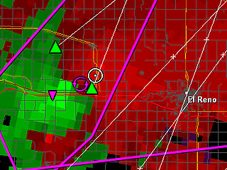
I was out with Howie Bluestein and Jana Houser Tuesday, in the operator's seat of RaXPol. Our initial target was somewhere W of El Reno. We knew that we wanted to get west of the I35 corridor, but there was little latitudinal clarity. When I went to bed Monday night, it looked like the OK/KS border was going to be the hot spot. By the time I awoke early Tuesday, the latest model data and observations seemed to indicate clearly that almost the entire central 1/3 of Oklahoma was going to be under the gun, and I could find little reason to pick one location over another. My primary hesitation with heading northward towards the OK/KS border region was the forecast of relatively backed mid-level flow, whereas the flow was progged to be more veered aloft S of I40. Since we didn't really know where we wanted to end up, we just headed westward from OKC towards Hinton.
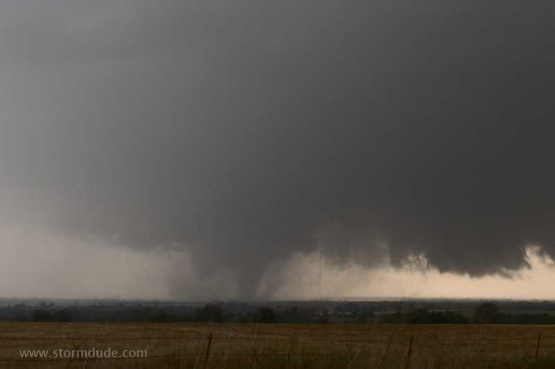
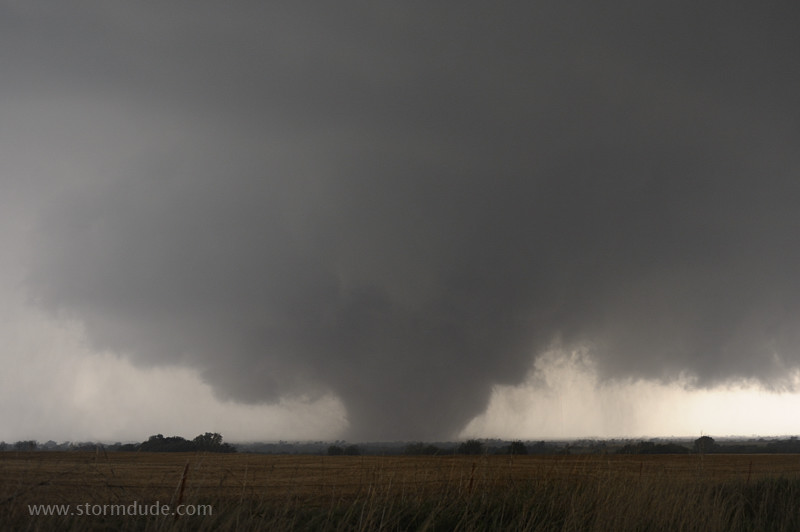
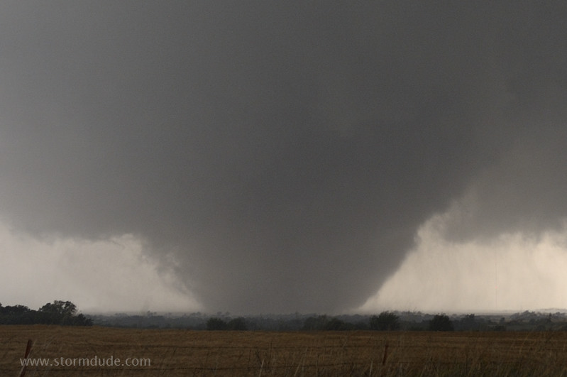
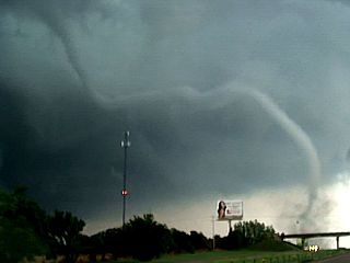
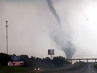
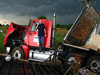
It was apparent that we weren't going to be able to catch the storms N of I40 considering the initial motion that looked to be NNE then NE. I also was very concerned about getting behind the storms, since observations and numerical forecasts indicated that the low-level shear wasn't going to be particularly favorable for the high-end tornadoes until after 4-5 pm. The RUC and 12z NAM looked to be much too far west with the dryline, and the HRRR seemed to match the more eastern position of the dryline considerably better. At any rate, we opted to try to deploy ahead of the southernmost updraft of a cluster located near Lookeba and Alfalfa. When we were up and scanning, there was an apparent tornado in progress to our southwest. Visually, we couldn't see a tornado, at least there was no condensation that was hanging lower than the already-low wall cloud that showed its face after the FFD moved through. Rotation rapidly increased to our immediate southwest. I went from thinking that we may be too far east (using the then-current NE motion) to realizing that the meso was making a beeline at our location. The low-level meso looked to turn right further, and we got a fully-condensed multivortex tornado to our SW shortly thereafter. The tornado grew in size to our immediate (~2 km) south and moved relatively slowly to the east-northeast. Although we were out of the hail (presumably under the updraft enough), we did experience some light rain at our location. Combined with the lightning, we were forced to remain in the truck, preventing any tripodded video.
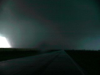
This tornado had a spectacular horizontal vortex on its north side. We'd see occasional horizontal and U-shaped vortices to the immediate northeast of the condensation funnel of the tornado, although the horizontal rotation took on a rolling pin appearance at times (very wide cylinder rotating on a horizontal axis - see video starting around 4:15). The tornado moved off to our southeast then east, and we were blasted by Howie-estimated west-northwest winds of ~70 mph. We left the storm when the tornado moved into the range beyond which we experience complete attenuation / extinction. Since we couldn't get E on I40, we had to tracked W, S, then E on on 37 towards Tuttle, crossing an apparent damage path on US 281 between Lookeba and Hinton (IIRC). We collected another close tornado dataset at the 37 / I44 interchange, approximately 2 km from the northward-moving, weakening tornado that had been a beast NE of Chickasha. Farther to our southeast, we could see (via radar) the tornado near Goldsby. We tried one last attempt to get ahead of this storm and the one closer to PVJ, but those attempts were futile as the storms moved more rapidly to the northeast.