06/12/05 REPORTS: TX

Status
Not open for further replies.
Shane, don't be so hard on yourself. I too went out today and didn't see a single tornado!

I left Pittsburg Kansas at 9 AM, headed to Lawton oklahoma and then made my way west.. instead of going into Texas I decided to go north of Atlus Oklahoma.

I missed ALL of the action in Texas, did not see a single tornado, only saw a couple wall clouds, didn't even get hail!
 
What a day! Was lucky enough to have gotten on the Kent County, Texas storm. I honestly can't say how many tornados were seen. It seems like a blur! I assumed the road options were going to kill us, but the storms and roads cooperated very well for once. CRAZY spinning wall cloud video. Looks like a time lapse! WOW!
I have a few digital stills up now.. will have pictures of other tornados from video later.
http://www2.okstorms.com:8080/images/chase...06-12/index.htm

20050612_180602_std.jpg
 
Started off the day looking at the flooded Prairie dog town fork red river SW of Memphis, TX. This was some extremely impressive flooding. Bear in mind that this river is usually almost completely dry. We then got on the storm NW of Jayton like pretty much everybody else in the country it seemed. Probably the best chase of the year I must say. I have to give special thanks to Damon Shaw and Dan Skoff for nowcasting for myself and Matt Hines. They did a wonderful job in telling us where to be and what storm to intercept. What a great way to finish off the season!

mattandfloodingriver6wy.jpg
Matt Hines looking at the flooded river SW of Memphis, TX

beaver27pq.jpg
Beaver tail NW of Jayton

largetornado3kv.jpg
Large tornado NW of Jayton

cone2filtered7sb.jpg
Cone tornado NW of Jayton

image20nl.jpg
Meso NW of Jayton

nearhamlin49wj.jpg
Southern end of meso west of Hamlin

nearhamlin64sd.jpg
Northern end of meso west of Hamlin
 
I was on the Kent county storm. If tornadoes are what you are looking for, it was hands down the best storm of the year. Like everyone else has already said, it produced every kind of tornado there is. It was like the storm was putting on a tornado clinic. Wedges, cones, stove pipes, needles, ropes, they all made an appearance today. The only problem was the roads. You couldn't get very close because of very few side roads. I just got home and I don't have the strength or time to put up anything other than video grabs. Here are some pics of the many tornadoes today.

my.php
[/url][/img]

my.php
[/url][/img]

my.php
[/url][/img]

my.php
[/url][/img]

There were three seperate vorticies at this point under the rapidly rotating meso. The third one is kind of hard to see. It is slanting out from behind the large one.

my.php
[/url][/img]

my.php
[/url][/img]

my.php
[/url][/img]

For the second time this week, I damn near got hit by lightning. The first video grab was right before the lightning hit. In the second one it is brighter because the CG hit somewhere very close to my left. I couldn't see it because my door was blocking the view. It scared the hell out of me. The video of it is pretty funny because I almost fell over backwards and I dropped a couple of F bombs in there too.

my.php
[/url][/img]

my.php
[/url][/img]

Absolutely incredible storm. I dropped South to the other tornado warned cell once the Kent county storm started to merge with it. I saw one tornado on that storm right when I got to it. For some reason I didn't have it on video. I am pretty damn sure though that it happened. Everything is just kind of one big blur of tornadoes though. I have no idea how many I saw. I will figure it out after a couple of days once I have a chance to review video and storm reports. I had at least 6 tornadoes. One of which came from the other storm. It was great to see such a wide variety of tornadoes. There were a bunch of chasers towards the end of the day on the storm. Texas Tech, DOWs, tornado attack vehicle (the tank and the red funny car one too), and a bunch of other cars that I see all the time, but don't know who they are. 2005 just got a lot better.
 
And the poor just keep getting poorer......

Missed all the tornadoes today. Sat southwest of CDS on a hill with excellent data/cell coverage - and were able to watch the whole afternoon play out - thoroughly believing that the area west/southwest of CDS would be "the spot" later on that day.

Unfortunately, the nose of the 300mb jet max came into the LBB area. And unfortunately - the UCAR surface-map page was down until around 4.45pm. With no surface that was worth a damn to look at, we were content to watch the crappy-but-cellular cells to our south and southwest do their thing - not feeling any great need to race off for hours into the boonies after a PoS.

Then - around 5.00pm our first decent surface map of the day came in and we saw the strong dryline punch coming into LBB and the ESE wind down there ahead of the dryline. But it was too late. We were in CDS. Not believing our eyes as we watched about 6 PoS storms congeal into three supercells (one tornadic but which ONE??? :roll: ) over about eight volume scans - we knew we were already late as the tornado warnings started flying and we blasted south.

Got on the northernmost cell and watched it produce blocky wall clouds and no tornadoes over hills and trees, and then carried on south through our Texas mesquite-fest and rolling-hills grand voyage. Ended up in Hamlin with everybody else near I-20 - at dark - and began to drive home.

Par for the course/year.

KR (seriously considering moving to either Midland, Amarillo, Denver, Omaha or Sioux Falls).

EDIT: I've just done the math. CDS - Girard, TX takes 2.5 hours. We were 116 miles out of position when the storms began tornadoing.
 
I chased with Jay Antle and Matt Crowther, along with Jim Leonard on June 12th. Once the tornado frenzy ensued, Jim Leonard did his own thing, as usual, and got some spectacular video of the large cone with the collar cloud from hell. Jay, Matt, and I remained on Hwy 208 the whole time, and observed the large cone from a distance (after the first truncated cone >> stovepipe event (1 or 2 tornadoes?) in lower contrast before wrapping in rain. Right after this, we figured we needed to keep going south to get out of the CG barrage and forward flank rain (shear vector had some northerly component)... and this decision cost us the following wedge... as we began to note awesome inflow tail to the growing supercell due southwest.

We immediately targetted the southern supercell west-southwest of Clairemont. In retrospect, given the awesome structure of this updraft, I don't regret missing the wedge stage (the wedge could have only been seen from quite close, from some of the other chasers' images I've seen with very low to the ground collar cloud). The southern supercell updraft structure...before it became the dominant storm...was just an awesome barrel. I got some pretty decent stills of the updraft from CR 440 just off of Hwy 70 southeast of Clairemont. This storm rapidly became very interesting with large occluded wall cloud and probable weak tornado. Several other classic tornadoes followed as we headed southeast on Hwy 70 as the "hordes" of chasers were beginning to catch back up with us... since we were out ahead of most everyone. I got stills of everything except the large cone since we were in a poor photography location... did get good zoomed in video though. Great day!

Off to the mountains for a couple days with Jay before hopefully catching some Colorado/Wyoming storms Wed-Thurs before my vacation ends.

crudely processed digital photography at http://www.underthemeso.com/gallery/view_a...mName=2005jun12

I'll have more time to process all my photos in the coming weeks.

<img src=http://www.underthemeso.com/albums/2005jun12/DSC42081.sized.jpg>

<img src=http://www.underthemeso.com/albums/2005jun12/DSC42571.sized.jpg>

<img src=http://www.underthemeso.com/albums/2005jun12/DSC42851.sized.jpg>

<img src=http://www.underthemeso.com/albums/2005jun12/DSC43051.sized.jpg>

Mike U
 
I was on the Dickens County Storm. It appeared to get choked off by the Kent County Storm, but not before producing some nice wall clouds, interesting funnels, and one weak tornado that I saw. I did the same thing as Aaron... Knew the action visible to the south was probably great, but couldn't leave what appeared to be a pretty heathy storm in its own right. Still, I had a great time. I rushed down towards Kent County when the Dickens Storm was obviously finished in time to see the massive HP beast proceed to rain itself out. The anvil crawlers were nice icing on the cake for the day.
 
Missed it all. No NOAA coverage, no spotter chatter, no definable structure further than 5 miles away (from our approach), and lost touch with our nowcaster at the most crucial point in the day. I'm sick, I'm tired, and I'm pissed.

There's nothing wrong with the 2005 season - it's just fine. The problem is me, I just suck.

Jeez Shane, why not copy my post a bit more. We got about 30 miles from the storm, but it really looked to be falling apart, so I just called it a day. I don't think there were any other reports after we turned it around, but man, if I hadn't of bit on the only NOAA weather we had and storms developing along the border, then I would've made it down there. You live and you learn I suppose...
 
Yeah Chris, we were in Paducah before the first tornado warning ever happened - but we had no clue what was happening other than it just looked dark to the west like any garden variety rainstorm, no structure at all. We'd been headed to the storm that originated in Crosby county, which our nowcaster said was severe-warned. Our last update before we lost contact withour nowcaster for good was "storm turned right, but isn't severe warned anymore." That was out last information of the day.

So sitting in Paducah, we decided to just go back to Childress to get wifi, as no one in town seemed worried, no sirens were blaring, and not even a local bothered to come over and ask 20 questions (opposite of normal). Of course the NOAA radio was silent, as was the HAM freqs (as they always are in NW TX). Visually, as mentioned, there was no definition, just a dark rain core that, from our last info, was not severe. So we saw no reason to hang around or even continue further south away from home.

But that's yesterday, and the future holds so many sweet treats. Back to "normal life" until next time.
 
Well, I met up with Jeff Snyder and that group of people in Childress. Since Jeff has already posted our log for the day, I won't repeat it. In a nutshell, it was a day of extreme timing and incredible navigation.

Operating in the blind with no data and just my eyes, I had a feeling that the south storm was the place to be. Especially after seeing the proximity of the storms with respect to each other when we did have a radar picture. Typically, the outflow from the south storm gets pulled into the north storm and sends it to crap. Indeed, this is what eventually happened. I've observed this so many times, it's hard to count...off-hand i can remember this happening on: May 29, 2004 in Kansas; June 6, 2005 (or whatever day the Marlow storm was); and yesterday. Only once have I seen the north storm go one and produce instead and that was near Cordell, OK, on May 5, 2001.

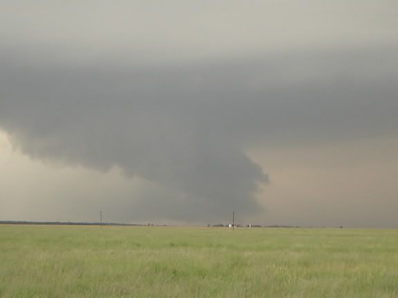
However, I was concerned about the better shear to the north and wanted to keep it as an option. Guess we made the wrong choice this time. Oh well, I've only got to chase 4 times this year, so I was at least glad I got to go. I did see that really weak tornado east of Dickens and had some good times, so it was definitely worth it. Especially the radio chatter coming home.

But like Jeff said, to know that the tornado machine was one county away is incredibly frustrating. I have to quit checking this forum after I chase. It just makes me mad.

A day late and a dollar short...so close, yet so far away...I could go on and on.

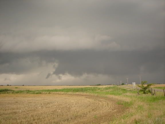
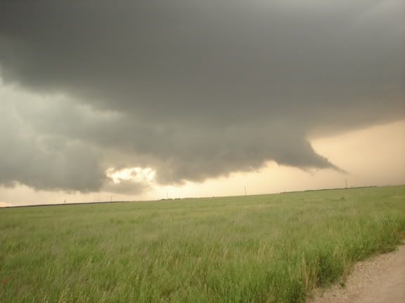
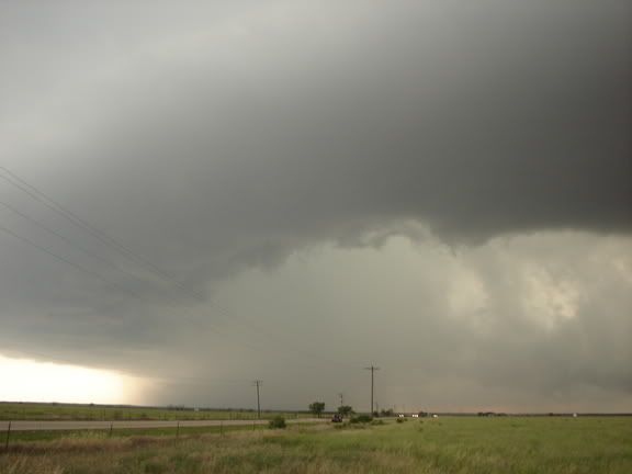
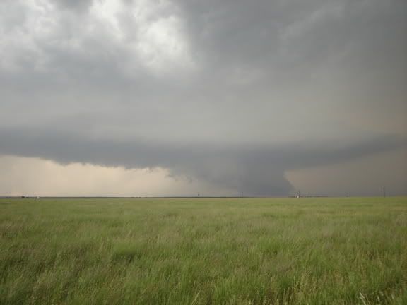
Here's a picture of what we did get.
Img_0165.jpg
 
Congrats to all that were on the tornado machine in TX! I was not able to make it that far south. I hung around in SW OK, around Hobart, enjoying the countryside. Then made my way back up and played the tail end of the grunge. The temps dropped to about 70 and it was great sitting out there watching the system move E NE. It doesn't take much to make me happy :lol:
 
Nice looking pics here ... congratulations to the Texas tornado-catching crew yesterday -

Tony L - your story sounds pretty familiar! Started my day at 4:00 a.m. yesterday with a video deadline. Once it was done, met up with Darin Brunin, Doug Mitchell and Dick McGowan in Lawrence and headed to Wichita, with the initial intent to make a dive west into extreme western KS into the panhandles as a preliminary target. Sounded like things were shifting south, so we opted to head to Lawton instead, first intercepting a nicely structured cell north of OKC that rotated for a bit and went on to indicate a TVS. We broke off, however, wanting to get to Lawton into better shear/instability. Went to Altus from there, where we checked data (Days Inn has it) ... there was the mess to our NW over the eastern panhandle that we didn't care about ... and then there was much more interesting activity firing to the southwest over central TX. Thanks much to Mike Deason and Mike Johnston for excellent nowcasting support yesterday. We intended to intercept the cell just south of Paducah ... but as it fizzled, another started up 30 miles south ... so we drove 30 miles south, where that one fizzled to be replaced by another 30 miles south. Really wanted to be closer to the monster near LBB, but Texas is a really big place and intercepting it from our position would have been like someone from Omaha wanting to intercept a storm west of Kansas City that had already iniated. So with the help of Doug Mitchell's nice navigating (considering his XM wasn't working, and my computer lost all its drivers, including GPS, forcing us to use actual MAPS - gasp) we caught up with the base on the Hamlin storm, which had a great looking meso and some really cool light as the sun was setting. It is easy to sell the Hamlin storm short after the incredible tornado-party to the west, but this really was a beautiful and well-structured supercell ... and I'm definitely happy to have at least been able to see it. Days like yesterday remind me what a big place the plains really is. Will post some pics later ... trying to recover from 24 hours straight on the road at this point.

There really is no place like the so. plains for being able to get back and see how amazing these storms can really look ...
 
June 12, 2005 - Jayton, TX Tornadoes

jun1205tor3a.jpg


jun1205tor3c.jpg


jun1205tor5a.jpg


More images found at: http://www.targetarea.net

Eric Nguyen, Amos Magliocco, Jason Politte, and I observed 6 tornadoes near Spur, TX and Jayton, TX. The first tornado was a nice tube lasting for several minutes. The meso continued eastward forming over time a large vertical condensed funnel that briefly touched down. The third tornado was long-lived and quite strong as a large cone plowed the ground. This vortex evolved into a large wedge filled with a red-tint dirt. As this became rain-wrapped, a new meso formed producing an active multi-vortex tornado with power flashes noted. Once this tornado dissipated, an occluded meso revealed a beautiful rope tornado persisting for several minutes. Shortly after the tornado, we decided to drop south to the southern supercell and observed a brief rope tornado. Awesome structure ended the classic chase day.

From Montana to Texas, what an amazing week resulting in 23 observed tornadoes! Prelim images are available from all these events at: http://www.targetarea.net

Scott Blair
 
Unbelievable 2nd day of tornadoes! David Douglas and I raked in about 2 1/2 hours of non-stop
tornadoes on Sunday in Kent county. This probably ranks as my best day ever and probably my best
year. We witnessed, photographed, and videotaped tornadoes of about every size and shape from small
ropes to large wedges, stove pipes, elephant trunks, truncated cones, etc. I really don't know how
many tornadoes. We'll have to stop and figure it out. Maybe reviewing video and photos we can
remember but it was quite a few.

Ran into and met many chasers, and witnessed crazy spectacles such as when the chasers and locals
got hit on the highway by a gustnado and there was chaos!

Perfect forecast as planned the night before with initiation near LBB along an axis to CDS. I
believe we were probably the first if not the first to be on the Kent county tornadoes out in very
rural country about 10 miles south of Spur where we were priviledged to what we think was a private
twister show. With silent staccato lightning and the dance of numerous tornadoes under the nearby
wallcloud it was simply beyond words. Excellent, excellent...bravo!

Additionally I got to call in two tornado warnings to NWS using my handy StreetAtlas NWS phone
number overlay. As soon as we did we were treated to seeing Threatnet light up the county with a
red tornado box. Thanks to Chris Novy and all the NWS folks who volunteered the numbers. I think the
phone and county overlays work great!

I'll probably try and write up a longer account later, and I have a ton of pictures and video to go
through.

Congrats to those who scored and solemn condolences for those with difficulties (I know I've been
there many times).
 
Thanks again to our nowcasters Mike Johnston, Mike Deason and Marcus Opitz. Thank you to Cingular with little or no coverage.

First pic is storm we stumbled on ~noon south of Blackwell, OK. Later we heard it was tornado warned. The rest from bottom to top are near Hamlin, TX. No tornadoes, but great structure and excellent visiblity.


Status
Not open for further replies.
Back
Top