Dan Robinson
EF5
Going through images tonight, I got the idea to start compiling a list of some tornado and funnel look-alikes that might be helpful for spotter training. I'll add to this thread if I find any other good ones.

- July 9, 2012 - Slowly rising non-rotating scud 'shark's tooth' on a gust front.

- May 20, 2010 - Knob Noster, MO - One of the most convincing funnel look-alikes I've personally seen, about 2 miles east of a tornado-warned supercell on a cold core day (at this time a supercell is in the opposite direction, behind me). This feature was located south of a new updraft from storms progressively developing eastward along an occluded frontal boundary.


- May 20, 2010 - Sedalia, MO - Fog tendrils reaching from ground to cloud base near the updraft of a rapidly weakening supercell. I saw this feature about 20 minutes after an actual tornado, produced by the same storm. No rotation or rising motion, just fog hanging in mid-air and barely moving.

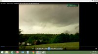
June 11, 2004 - Bancroft, IA - Non-rotating outflow feature.
- July 9, 2012 - Slowly rising non-rotating scud 'shark's tooth' on a gust front.
- May 20, 2010 - Knob Noster, MO - One of the most convincing funnel look-alikes I've personally seen, about 2 miles east of a tornado-warned supercell on a cold core day (at this time a supercell is in the opposite direction, behind me). This feature was located south of a new updraft from storms progressively developing eastward along an occluded frontal boundary.
- May 20, 2010 - Sedalia, MO - Fog tendrils reaching from ground to cloud base near the updraft of a rapidly weakening supercell. I saw this feature about 20 minutes after an actual tornado, produced by the same storm. No rotation or rising motion, just fog hanging in mid-air and barely moving.
June 11, 2004 - Bancroft, IA - Non-rotating outflow feature.
Last edited by a moderator: