Tornado and funnel look-alike examples

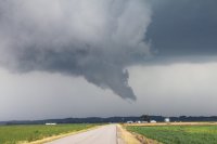
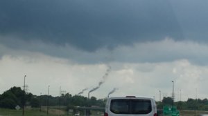
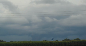
July 12, 2011 - SC IL, a 'non-rotating funnel' that I jokingly labeled at the time but would seem fitting for an area of condensation along a stalled boundary being drawn straight up yet not show signs of turning. It would dissipate soon after this shot as I'm guessing the vertically ascending parcel reached peak altitude which resulted in its demise given the stagnant wind fields. A personal head scratcher and candidate for this thread that I regret not having video of as the upward motion was impressive.
113.jpg
 
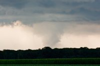
@John Farley that first photo is awesome it really looks like a mean stovepipe.

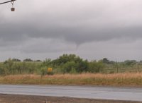
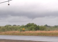
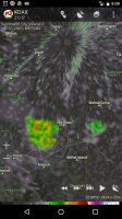
This one has an interesting story. I had no data for this entire chase, so I sent this image and many others to a friend and told him he could post them on social media. After the chase I called my buddy and according to him after he posted this photo, either the TWC or Weather Nation ( I cant remember which one) took the photo and claimed a tornado was on the ground. My friend quickly corrected them. Has this happened to anyone else?
IMG_4506.JPG
 
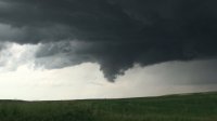
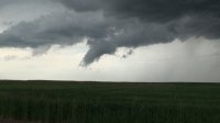
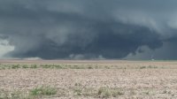
The 6-5-09 Wyoming/Nebraska storm went on to produce a couple of interesting features after the Goshen tornado. The first two actually exhibited very slight rotation but were nothing more than funnel shaped scud, the last was an instant attention grabber but was ultimately only a wicked looking scud bomb.

2009-06-05_08.jpg

2009-06-05_10.jpg

2009-06-05_33.jpg
 
Last edited:
I know it's going to be hard to tell with an image as bad as this one, but this is more likely scud than a funnel yes? I took the picture a few years back as a thunderstorm that kept us from climbing that day passed by:
ec9746103730372e1ac4a4ad78eb183e.jpg
1f2f2cfd3445ecc4b2c83290991c1716.jpg

Apologies for the awful quality, it was taken with an old cellphone at the time. Sacramento NWS office said that they couldn't see any rotation in the area on radar, but then again it's really hard to determine anything about storm where I work because densely packed wind farms look like a blob on radar:
e98b0c4ddd98c833a6733043ed6fa29e.jpg
 
20160728_132034.jpg 20160728_132039.jpg My pix from yesterday weren't showing up on my screen so that's why I deleted it.

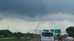
I'll try again. Like I said, this is Springfield, Illinois on a day where there was an SWS on funnel clouds in central Illinois.


This is smoke from the water treatment plant
 
I've seen a few pretty convincing ones, but the best example I've witnessed is this ground scraping shelf cloud that formed south of my house on July 20th, 2015. Was on the north side of a complex of messy storms. Sometimes I like to refer to it as my own picture of Rochelle...lol.
7.24.16.png
 
In East Tennessee, there are plenty of cases which scuds or similar features are mistaken for tornadoes (and vice versa). There's one case involving a, what I suspected, mini supercell back in October 2010. It was tor-warned while I was still in chess club meet. The point was an apparent funnel cloud was sighted at a nearby downtown. The picture was on the front page of newspapers, and I think I kept that copy. It looked rather scuddyyet descending, but I wasn't sure if it was confirmed as an actual funnel cloud. Sorry, I don't have a photo of the apparent funnel cloud online. On the other hand, somebody told me a story of unintentionally driving into a tornado in Middle Tennessee. She told me that she was driving some chess club members to a tourney at Nashville, and she was a storm spotter herself. That prompted me to wonder if the tornado was probably rain wrapped or too scuddy to be recognized until too late.
 
Back
Top