Those "Other" Tornadoes

Great thread! My favorite "other" was on April 14, 2011. I played the northern target to the northeast of the OKC metro. Hung around just north of OKC until towers exploded just to the west of I-35. Headed northeast on 44 and then north on 99 to to Hominy, OK. Got up into the inflow notch and had to bail south as the ground-scraping wall cloud quickly became partially wrapped in rain. A tornado touched down, quickly wedged out, and passed just about 1/4 mile to my north.

Video grab:
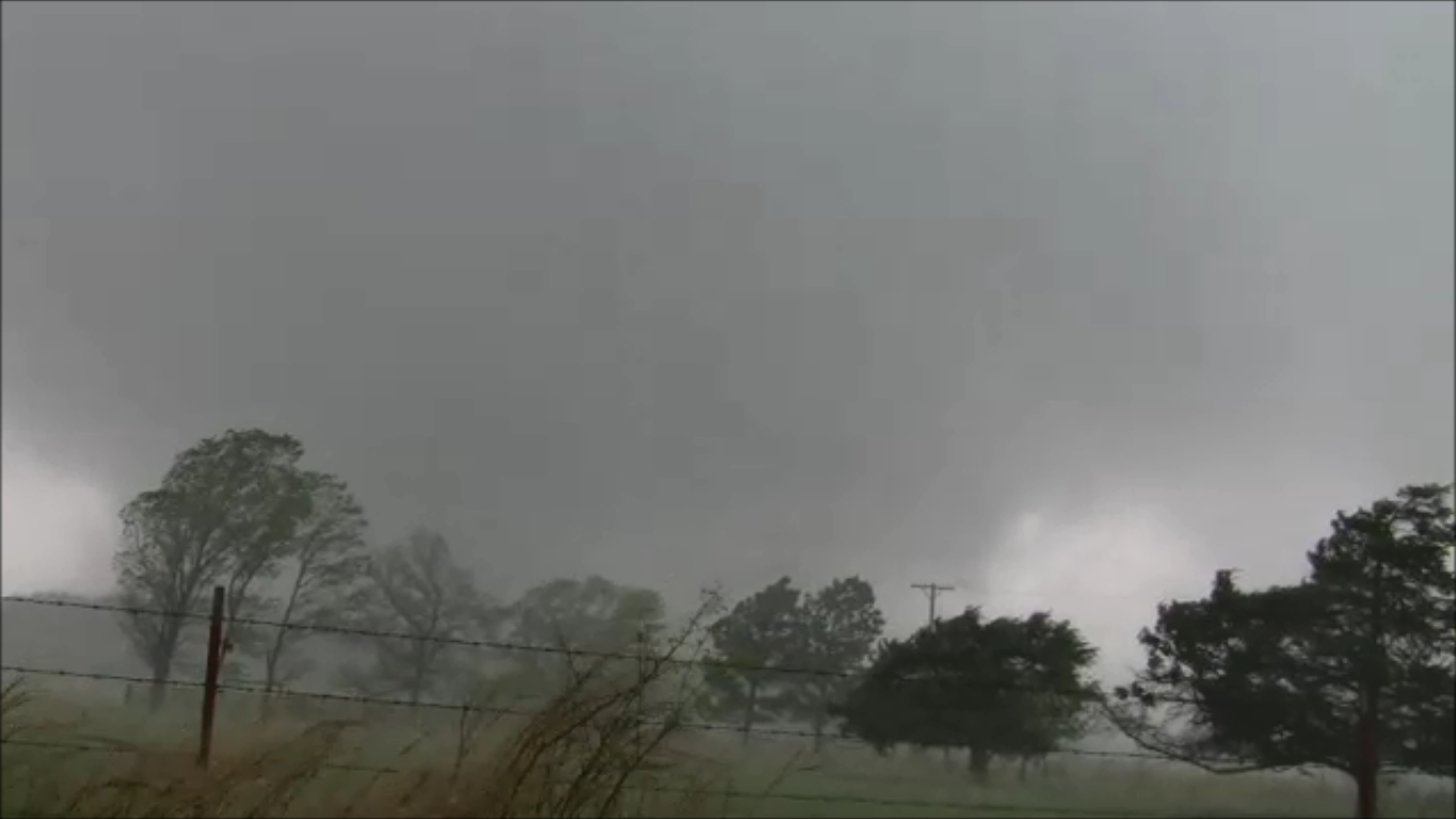
hominy%2Btornado%2Bscreen%2Bgrab.png


The storm of the day produced a strong tornado that passed through Tushka. On my way home, I actually passed through the town. The high from my catch quickly went away as I saw all of the destruction.
 

Attachments

  • hominy tornado screen grab.jpg
    hominy tornado screen grab.jpg
    10.6 KB · Views: 17
Last edited by a moderator:
Caught a tornado near Ladora, IA on 22 May 2011 (the Joplin day). It came from the northern member of a pair of brief, but both tornadic, supercells near I-80 in central Iowa. They gusted out and evolved into an MCS shortly after producing. I'm pretty sure we were one of only two groups of chasers to see that tornado. Everyone else saw the southern one.

Chase account: http://www.meteor.iastate.edu/~jdduda/chasing/2011/052211.html
 
Jeff that's really interesting, because most people forget that day was a pretty sizeable outbreak, including another killer tornado in Minneapolis. I've only seen the Joplin tornado, but never seen any other tornadoes from that day. Thanks for that Jeff!
 
Ugh those Iowa tornadoes on May 22nd 2011 are a sore spot for me. We literally missed them by a minute. Thats chasing though!

Another one for me is the Haleyville EF-3 on April 27th 2011 Super outbreak. Everyone knows about Tuscaloosa, Smithville and Birmingham, but mention this one and most people go crosseyed. It too was a very large beast, such that the entire thing wouldn't fit in this view so I have to take screen caps of the right and left edges.

20110427172312(1).JPG


20110427172312(2).JPG


Up until this tornado, that day was a huge failure on my end. The largest tornado outbreak in history and I managed to almost miss them all.
 
Winston: The Corning Ks. tornado was videotaped from beginning to rain-wrapped status, from 2 miles away, by a good friend and chase buddy, Doug Nelson. He told me to get up there if I wanted to see it, but I could not make it in time. He lives in the area, so he was well placed to see it. I don't think he is a member, and he likes to keep a low profile, but he has been on a huge number of significant tornadoes, and has been chasing since the late-70's. Here is a still from his video.


Corning tornado 5 28 13 by Doug Nelson.jpg
 
Winston: The Corning Ks. tornado was videotaped from beginning to rain-wrapped status, from 2 miles away, by a good friend and chase buddy, Doug Nelson. He told me to get up there if I wanted to see it, but I could not make it in time. He lives in the area, so he was well placed to see it. I don't think he is a member, and he likes to keep a low profile, but he has been on a huge number of significant tornadoes, and has been chasing since the late-70's. Here is a still from his video.


View attachment 8775

That's a damned impressive vidcap.....I bet the video is astounding. I'm already jealous and I've never even seen it. I wonder how many chasers there are out there like your friend. Guys who have been kicking butt for a long time, have tons of trophies, and nobody knows about them.
 
Yeah, Shane, it is a really great video. He gave a copy to the Topeka NWS to use in their spotter talks. Doug is one of the best, most knowledgeable chasers around. He has a knack of knowing right where to go, and, he seems to be in the right area a lot, so he doesn't have to travel far. I still kick myself for not leaving right away to get to Corning. I was hesitant, and missed it by 15 minutes. But, it was the day after the NW Ks. event, and I was exhausted. I will say that Doug has only recently started to document his chases, so most of what he has seen is not on film.
 
Mine was definitely the Fairview, Oklahoma rope on May 24 2011. We were on the storm while it produced the Canton wedge but weren't entirely sure how we wanted to play it... risk diving into the somewhat questionable terrain from our angle, or let it come to us and have an easier play. From our vantage most of the RFB was obscured by precipitation. But from the incredible staccato lightning the storm was spitting out and the couplet on radar we could tell something was going on. We could eventually make out the right edge of the wedge, but held our ground and let the storm come to us. Ended up missing the entire Canton tornado but caught this graceful rope tornado that followed, as the storm gave one last supercellular gasp before crossing into stable air.

This is actually a favorite intercept of mine. We didn't have the tornado to ourselves by any means, but we were all alone on this dirt road by an old farmhouse. We could hear nothing but the wind blowing through the prairie, and the distant wailing of a lone tornado siren in Fairview.

https://www.youtube.com/watch?v=wOcsiI3GXdo

Watch video >

attachment.php
 

Attachments

  • 322148_668117092834_1560634507_o.jpg
    322148_668117092834_1560634507_o.jpg
    24 KB · Views: 199
I can remember 2 that fit this thread perfectly. One was the May 21 2011 Emporia/Reading tornado. The other happened June 11 2005. Though there were 21 tornadoes reported that day, http://www.spc.noaa.gov/climo/reports/050611_rpts.html I don't believe any other chaser saw this one

We only caught it by pure, unadulterated luck after our (my) chasing strategy for the day had blown up and found ourselves clueless about how to proceed. The storm report says 2340Z and 16SW Vega, but we are on US 385 here, due S of Vega. My estimate of being 15-or-so miles from the tornado is obviously wrong. I have always been HORRIBLE at estimating distances. The tornado's path is from east to west! Vid from two different cameras is included.

Watch video >
 
Last edited by a moderator:
My favorite 'secondary target' tornado was the Medford, OK April 30, 2012 tornado. While everyone was busting hard in the Texas Panhandle I was watching a quite photogenic tornado and then went through some intense straight line wind damage afterwards.

My write up

20120501-IMG_4399.jpg
 
Maybe the closest one I could call a secondary target storm was the May 29, 2004 central Oklahoma supercell in which I saw tornadoes at Calumet and Concho, one of which was anticyclonic

I was there as well and witnessed the first two tornadoes of my life that day. I was however in Kansas earlier in the day but bailed on it for Oklahoma. Switching targets potentially cost me an incredible day but given my inexperience at the time I very easily could have busted (or worse). So while what I witnessed paled in comparison to events to the north I was still very happy to realize a long held dream of seeing my first tornadoes.

Another one that comes to mind was 5/24/08, the day of the pig farm tornado in Hennessey. I missed that one but did see a small cone later that afternoon near Orlando. I guess that one did get a lot of attention as chasers were all over the place but that tornado was far overshadowed by the one that hit the farm.

The one that best meets the criteria though would be on 6/20/11 just north of Holdredge. The main show that day happened later and to the northeast and at the time most chasers were either positioned for that event or chasing a cell just south of Holdredge. That cell had already churned out a bunch of tornadoes and I was on my way to intercept it when I noticed a newly developed cell going up just north of town. I diverted my pursuit and minutes after getting on it the cell produced a beautiful white truncated cone that traversed across the landscape in a totally unobstructed view. It maintained that appearance for most of its life before finally drilling the ground with a fully condensed needle, all the while maintaining its white appearance. It was far from being the biggest or most noteworthy tornado of the day but it was still quite a beauty in its own right and I was fortunate to be able to witness its entire life cycle.

Watch video >
 
My Significant Other(s)...(?) Would be Streator, IL. Livingston County and Dwight Tornadoes. Elmwood got the most attention, but Streator got a direct hit from the storm that tracked from Magnolia to Kanakee. (See profile PIC). https://www.youtube.com/watch?v=vaCv7u38YJQ Please enjoy the gleefully ironic chase music by my surf rock / folk musician family members. These were what I would call my real first tornadoes, First reported tornadoes, and my first night chase. This was a huge score coming off of missing both Bowdle AND Faith a little over a week earlier by making huge noob mistakes. 2010 was my inaugural year of chasing. The fact that so many stayed out of IL that day put me among a lucky few.

To a lesser extent, the Coal City, IL EF2 11/17/13. (briefly with a satellite/twin) Many other tornadoes that day---Especially Washington, IL stole the show. This was the same cell however. https://www.youtube.com/watch?v=myjqzmpcJ4E As you can see we just lined right up with where the meso was headed, it ended up curling more east of our position, but all that was between us and that tornado was the Kanakee river and the town of Wilmington, IL...we thought better of it. Tried to head north to stay with but the RFD got VERY wet, and the whole thing was absorbed by the precip core of a weaker cell to the SW....We completely lost situational awareness at that point but given the sky brightness and heavy precip there was little chance of a tornado anymore. Good thing, cause it was headed right for soldier field on a sunday afternoon. I had no idea these storms would produce so soon. Even when models predicted it, I didn't believe it. I would have left much earlier that day and targetted much further south on 55 than I did.
 
Last edited by a moderator:
Considering how many chases I've been on, it's remarkable how difficult it is to come up with even one "other tornado" I can claim. The closest thing is probably the Climbing Hill-Moville, IA, wedge on October 4, 2013. I'm not sure exactly what the distribution of chasers was that day, but I'm confident that more of them saw Wayne than the IA one. Still, Jeff P. and a few others had quality footage of the Moville tornado, so it's not the best example. Overall, I tend to be very cautious and hedge my bets (to a fault), and I think this is reflected in my lack of tornadoes from secondary targets away from the hordes.
 
Secondary targets are going to need to be more commonly considered among the more skilled chasers, in order to stay away from the obvious targets that get bombarded by everyone else. So, I think it's important to have appreciation and some pride when a secondary target works in your favor.

For me that day was May 31, 2013 (El Reno day). I wouldn't say that I purposely chose a secondary target, but I was stuck at work that day until 4 pm. Originally I was a touch bitter about being stuck, but there was a nagging feeling in the back of my head that was telling me that it was a good thing I didn't have the opportunity to go to C Oklahoma. That day had "stay-away" written all over it. Anyway, after work, I figured SE Kansas and NE Oklahoma had some potential, so I zipped down to Coffeyville and chased a few cute supercells between Nowata, Ok and Coffeyville. About the time I was going to call it a day and head back to Topeka a nice cone tornado formed deep in a wet RFD and crossed the road about 1/2 mile ahead of us. Upon it's passage and dissipation we turned on the OKC TV/radio simulcast to hear what was going on to our SW, and of course everyone can imagine the superlatives that the on-air mets were using to describe the situation 2 hours away from us. At that point and especially after I heard that Tim and company had been hit and killed I became very relieved that I wasn't able to reach that target.

Anyway...here are a few captures from that day up by Lake Oologa, Oklahoma.

May 31, 2013 tornado near Oologa Lake, OK

Tornado near Oologa Lake, OK

Sorry for the terrible quality. It wasn't dark at all, but for some reason my camera wouldn't expose right, and the video camera was very dark.
 

Attachments

  • 2013_May_31_-_1.157214812_large.jpg
    2013_May_31_-_1.157214812_large.jpg
    13.1 KB · Views: 14
  • 2013_May_31_-_2.157214858_large.jpg
    2013_May_31_-_2.157214858_large.jpg
    4.7 KB · Views: 16
Last edited by a moderator:
Back
Top