Danny Neal
EF5
Message was too long so I only posted a brief synopsis: Full event can be found here - http://illinoisstormchasers.com/recap-of-november-17th-2013-a-tragic-day/
November 17th, 2013: A day that resonates with so many of us across the great state of Illinois. Typically dates that are remembered in the weather world are not ones that bring on a positive connotation. With this paper I plan on giving an overview of the event, an in depth look at the meteorology behind it, a timeline of events, and also the efforts to restore the hardest hit areas back to normalcy. This type of severe weather episode could be considered a "once in a career" type event for a local forecaster. What made it so unusual was not only the time of year it occurred, but the time of day that many of the tornadoes happened. One listen to the live weather overview [above] will really help you understand how volatile the situation really was.
Some fast facts about the outbreak below:
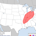 A bit of a brief overview of the weather leading up to November 17th. Illinois had been a little colder than average in the days leading up to the outbreak. I remember temperatures were well below freezing with even some snow flurries observed preceding this monster trough. To the average person, it was the signs of an early winter. Meanwhile, forecasters were closely watching the spread of weather models for an incoming system progged to impact the Great Lakes over the weekend. Local forecasts showed a warming trend and many people would grow excited at the prospects of a late Indian Summer. While the general public was preparing to enjoy a warm weekend, weather forecasters were fearing the potential for a late season severe weather outbreak. The Storm Prediction Center was one of those concerned parties and placed most of Illinois under a risk for severe thunderstorms four days out.
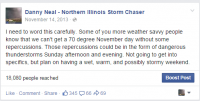
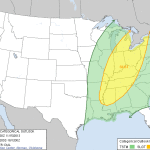 As time wore on and we transitioned into Friday, a slight risk had been placed over the Eastern half of Illinois. Still, the weather conditions present across Illinois were not what one would expect preceding an outbreak. From a personal standpoint, I was extremely concerned about the risk for severe weather dating back to Monday or Tuesday [November 12th]. Many times these systems display themselves on weather models, but often fizzle out and end up being a non-event. Many amateur forecasters will hype these events well in advance and end up looking foolish when they do not verify. I tried to be careful with my wording, but I mentioned the potential for some bad weather impacting our area. The next picture below has to be the most ominous "mid to long range" forecast I have given.
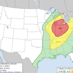 By Saturday it was growing increasingly likely that a major severe weather episode was likely across at least half of the state. Not only would damaging winds be likely, but the increasing potential for strong, long track, and damaging tornadoes. The Storm Prediction Center issued a moderate risk for severe thunderstorms with the mention of a possible upgrade to high risk. Strong warm air advection was already occurring and there seemed to be a change in the air. No longer was there this cold and wintry feel, but a strong southerly gale ushered in a several degree temperature spike by late night Saturday. As the strong warm front passed through, it sparked a few thunderstorms during the overnight hours. These storms brought heavy rain, hail, and frequent lightning but not much in the way of severe weather. Normally a forecaster would be concerned with these early morning storms. They have a tendency to throw a giant wrench in the going forecast for later in the day. Below are some posts I made leading up to the event.
From a meteorological stand point it's hard to find a more classic tornado outbreak for Northern and Central Illinois. Impressive kinematics are common with fall systems, but what makes this so odd was the off the chart thermodynamics. Generally transitional season storms have an abundance of shear but not much instability. When you get a power system with shear and instability, that's when all the red flags are raised. By early morning the writing was on the wall proverbially speaking. The Storm Prediction Center had upgraded much of the area to a high risk, previous night convection had cleared the area, and skies were mainly clear. A disastrous set of ingredients were about to align themselves across our beautiful prairies.
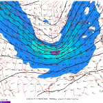
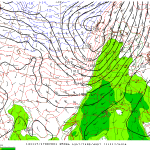
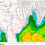
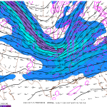 Mesoscale and upper air analysis of the kinematic fields revealed an incredibly sheared environment not only favorable for damaging winds, but also tornadoes. A negatively-tilted trough was digging into the Midwest by morning under an amplified pattern. When speaking in meteorological terms.... a pattern can either be zonal or amplified. In a zonal flow, the 500 MB flow is generally characterized by ripples while amplified flow by waves. November 17th's system originated in an amplified flow with a negative tilt to the trough axis. Negative tilt systems generally have the axis in a northwest to southeast orientation and suggest a stronger storm system. Looking at the 300 MB flow, we can see some great divergence occurring across Northern Illinois by mid morning. Divergence allows the air to rise. Toward the surface, impressive low level wind shear was present with deep layer shear closing in on 60 knots. Low level wind shear was upwards of 35-40 knots. I was a bit surprised at the lack of directional shear. If I could find one caveat with the set up, it would be the areas with the strongest tornadoes lacked the real backed winds you would expect to see in a normal tornado outbreak. Nevertheless anytime you get high amounts of bulk shear, SRH, plus the presence of a boundary in advance of a power storm system; troubles a brewin'.
Thermodynamically speaking, this system would be more reminiscent of a late spring/early summer type event over a late fall. By mid-morning, surface based convective available potential energy values [SBCAPE] were nearing 2,000 J/KG which signifies a moderately unstable atmosphere. Low level lapse rates were also steep. EHI or energy helicity index values were at 5 and 6. By definition, EHI values are the combination of CAPE and storm relative helicity values. When you have values 4 or above the potential for violent tornadoes exist. Significant tornado values were also focused across Central Illinois.
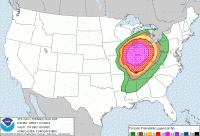
7:00 A.M.: A high risk of severe thunderstorms was issued at the 13z update
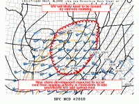
7:47 A.M.: Just before 8:00 A.M. the Storm Prediction Center released MD 2010 acknowledging the increasing threat for tornadoes across Illinois.
8:39 A.M.: A particularly dangerous situation tornado watch is issued for most of Illinois until 4:00 P.M.
November 17th, 2013: A day that resonates with so many of us across the great state of Illinois. Typically dates that are remembered in the weather world are not ones that bring on a positive connotation. With this paper I plan on giving an overview of the event, an in depth look at the meteorology behind it, a timeline of events, and also the efforts to restore the hardest hit areas back to normalcy. This type of severe weather episode could be considered a "once in a career" type event for a local forecaster. What made it so unusual was not only the time of year it occurred, but the time of day that many of the tornadoes happened. One listen to the live weather overview [above] will really help you understand how volatile the situation really was.
Some fast facts about the outbreak below:
- 4th largest outbreak in Illinois history
- Most tornadoes in the month of November in Illinois history
- Previous record was 8 in 1965
- First violent November tornadoes in Illinois since 1885
- Longest track tornado was 46.2 (Tornado #2)
- 8 deaths and 181 injuries
- 10 tornadoes had tracks of 10 miles or more
- Most severe weather was out of the region by 3 P.M.
 A bit of a brief overview of the weather leading up to November 17th. Illinois had been a little colder than average in the days leading up to the outbreak. I remember temperatures were well below freezing with even some snow flurries observed preceding this monster trough. To the average person, it was the signs of an early winter. Meanwhile, forecasters were closely watching the spread of weather models for an incoming system progged to impact the Great Lakes over the weekend. Local forecasts showed a warming trend and many people would grow excited at the prospects of a late Indian Summer. While the general public was preparing to enjoy a warm weekend, weather forecasters were fearing the potential for a late season severe weather outbreak. The Storm Prediction Center was one of those concerned parties and placed most of Illinois under a risk for severe thunderstorms four days out.
 As time wore on and we transitioned into Friday, a slight risk had been placed over the Eastern half of Illinois. Still, the weather conditions present across Illinois were not what one would expect preceding an outbreak. From a personal standpoint, I was extremely concerned about the risk for severe weather dating back to Monday or Tuesday [November 12th]. Many times these systems display themselves on weather models, but often fizzle out and end up being a non-event. Many amateur forecasters will hype these events well in advance and end up looking foolish when they do not verify. I tried to be careful with my wording, but I mentioned the potential for some bad weather impacting our area. The next picture below has to be the most ominous "mid to long range" forecast I have given.
 By Saturday it was growing increasingly likely that a major severe weather episode was likely across at least half of the state. Not only would damaging winds be likely, but the increasing potential for strong, long track, and damaging tornadoes. The Storm Prediction Center issued a moderate risk for severe thunderstorms with the mention of a possible upgrade to high risk. Strong warm air advection was already occurring and there seemed to be a change in the air. No longer was there this cold and wintry feel, but a strong southerly gale ushered in a several degree temperature spike by late night Saturday. As the strong warm front passed through, it sparked a few thunderstorms during the overnight hours. These storms brought heavy rain, hail, and frequent lightning but not much in the way of severe weather. Normally a forecaster would be concerned with these early morning storms. They have a tendency to throw a giant wrench in the going forecast for later in the day. Below are some posts I made leading up to the event.
From a meteorological stand point it's hard to find a more classic tornado outbreak for Northern and Central Illinois. Impressive kinematics are common with fall systems, but what makes this so odd was the off the chart thermodynamics. Generally transitional season storms have an abundance of shear but not much instability. When you get a power system with shear and instability, that's when all the red flags are raised. By early morning the writing was on the wall proverbially speaking. The Storm Prediction Center had upgraded much of the area to a high risk, previous night convection had cleared the area, and skies were mainly clear. A disastrous set of ingredients were about to align themselves across our beautiful prairies.


 Mesoscale and upper air analysis of the kinematic fields revealed an incredibly sheared environment not only favorable for damaging winds, but also tornadoes. A negatively-tilted trough was digging into the Midwest by morning under an amplified pattern. When speaking in meteorological terms.... a pattern can either be zonal or amplified. In a zonal flow, the 500 MB flow is generally characterized by ripples while amplified flow by waves. November 17th's system originated in an amplified flow with a negative tilt to the trough axis. Negative tilt systems generally have the axis in a northwest to southeast orientation and suggest a stronger storm system. Looking at the 300 MB flow, we can see some great divergence occurring across Northern Illinois by mid morning. Divergence allows the air to rise. Toward the surface, impressive low level wind shear was present with deep layer shear closing in on 60 knots. Low level wind shear was upwards of 35-40 knots. I was a bit surprised at the lack of directional shear. If I could find one caveat with the set up, it would be the areas with the strongest tornadoes lacked the real backed winds you would expect to see in a normal tornado outbreak. Nevertheless anytime you get high amounts of bulk shear, SRH, plus the presence of a boundary in advance of a power storm system; troubles a brewin'.
Thermodynamically speaking, this system would be more reminiscent of a late spring/early summer type event over a late fall. By mid-morning, surface based convective available potential energy values [SBCAPE] were nearing 2,000 J/KG which signifies a moderately unstable atmosphere. Low level lapse rates were also steep. EHI or energy helicity index values were at 5 and 6. By definition, EHI values are the combination of CAPE and storm relative helicity values. When you have values 4 or above the potential for violent tornadoes exist. Significant tornado values were also focused across Central Illinois.
- Negatively tilted trough
- Strong divergence
- 35-40 kt of low level shear
- SRH of 400-600
- 60 kt bulk shear
- 2,000 J/KG SBCAPE
- EHI values of 5-6
- LCL heights under 750M
- High Shear/Moderately Unstable
7:00 A.M.: A high risk of severe thunderstorms was issued at the 13z update

7:47 A.M.: Just before 8:00 A.M. the Storm Prediction Center released MD 2010 acknowledging the increasing threat for tornadoes across Illinois.

8:39 A.M.: A particularly dangerous situation tornado watch is issued for most of Illinois until 4:00 P.M.
