John Farley
Supporter
This week, while skiing at Wolf Creek, Colorado, I experienced the heaviest single-event snowfall I have ever witnessed - 36 inches. The storm began Monday afternoon, as I was driving up to Pagosa Springs from Santa Fe, where my wife and I had spent Thanksgiving. I encountered some snow from just south of the NM/CO border on, and also saw some falling over the highest mountains in northern NM and southern CO. But the heaviest snow occurred around Wolf Creek Pass, including the Wolf Creek Ski Area, where I had made plans to ski Tuesday, Wednesday, and today, Thursday. As it turned out, skiing was very difficult Tuesday due to the intensity of the snowfall, which averaged a little under an inch an hour all day, but in heavier bursts reached 3 inchs per hour for short times, with visibilty 100 feet or less. It was interesting that some of these bursts were accompanied by strong outflow winds, while other times when it was snowing more lightly there was no wind at all. On one occasion, you could actually hear the snowburst coming before you could see it, as the wind roared through the trees near the crest of the Continental Divide. Soon, the snow swept down the mountainside and visibiltiy dramatically decreased - but you could hear it before the ridge began to disappear in the heavy snow. Most of the snow fell between Monday afternoon and Wednesday morning, but a couple more inches fell during the day Wednesday, bringing the storm total to 36 inches. Being a skier and a Midwesterner, I have seen a lot of big snowstorms, but around 18 inches is the most I had previously seen in one single storm (though once on a ski trip in Steamboat Springs I did encounter two 15-inch storms separated by a break of about 12 hours). But in this storm at Wolf Creek, there was never more than a short break in snowfall from the time the storm started until it ended.
Here are a few pics:
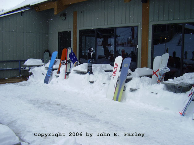
This picture of the ski area's sun deck gives some sense of how much snow came down.
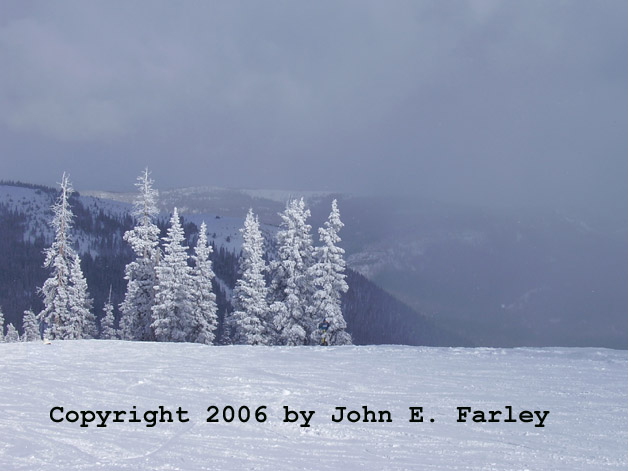
This picture, looking southeast from the Continental Divide, was taken Wednesday afternoon, toward the end of the storm.
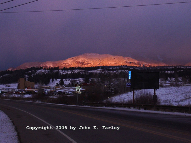
Just at sunset, as I was returning to Pagosa Springs after skiiing, the sun briefly appeared under the clouds to create this alpenglow in the snow-covered mountains.
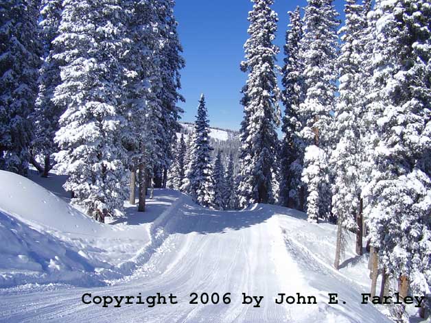
This image, taken today after the storm had passed, shows the beauty of a freshly-fallen snow. It also shows the depth of the new snow - when this run was groomed, the snow was so deep that it looked like a road plowed out after a heavy snow.
Wolf Creek is far from the only place influenced by this massive storm. It produced up to 8 feet of snow in the mountains of Washington State, then sank south all the way into southern New Mexico and west Texas and the Texas panhandle, and is now influencing areas from Oklahoma through Illinois.
Here are a few pics:
This picture of the ski area's sun deck gives some sense of how much snow came down.
This picture, looking southeast from the Continental Divide, was taken Wednesday afternoon, toward the end of the storm.
Just at sunset, as I was returning to Pagosa Springs after skiiing, the sun briefly appeared under the clouds to create this alpenglow in the snow-covered mountains.
This image, taken today after the storm had passed, shows the beauty of a freshly-fallen snow. It also shows the depth of the new snow - when this run was groomed, the snow was so deep that it looked like a road plowed out after a heavy snow.
Wolf Creek is far from the only place influenced by this massive storm. It produced up to 8 feet of snow in the mountains of Washington State, then sank south all the way into southern New Mexico and west Texas and the Texas panhandle, and is now influencing areas from Oklahoma through Illinois.