David Yates
EF0
I think the superstorm of March '93 was the first 5 day storm to verify. That changed everything. Mid-range is 3-5 days. Long-range is 5-10 for purpose of discussion.
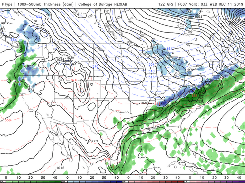
3-5 day shows a quasizonal flow. This will produce mountain snow in the west and northern tier. The transition period will show WAA as high pressure moves off NE coast and bonified artic airmass devlopes in Central and eastern Canada, day 5 (Image 1) These are the ingredients for next potential storm.
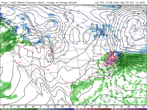
The quandry is first or second impulse wave amplification..... Is it day 5 or day 10? (Image 2)
3-5 day shows a quasizonal flow. This will produce mountain snow in the west and northern tier. The transition period will show WAA as high pressure moves off NE coast and bonified artic airmass devlopes in Central and eastern Canada, day 5 (Image 1) These are the ingredients for next potential storm.
The quandry is first or second impulse wave amplification..... Is it day 5 or day 10? (Image 2)
Attachments
Last edited: