Hi Everyone,
Here is
good news! I am happy to report there is a solid bill to create a NDRB being marked up in the U.S. House Science Committee. It has been introduced by Rep. Jared Moscowitz (D) who, before being elected to the House, was appointed by Gov. Ron DeSantis (R) as the Emergency Manager for the State of Florida. As many of you know, Florida has frequently received high praise for the way it handles disasters.
The bill has both D and R cosponsors.
It does need some tweaks. I realize wading through the info below may seem like a lousy way to spend 30-60 minutes but
this is how the process works. I urge you to do it.
Please contact your congresspeople to move this forward and I'd like to make the process as straightforward as possible. You can take this info and use it as you like (don't need to credit me) to ask your congressman/woman to support the bill with, hopefully, these tweaks:
General Comment:
I have attached the bill as it was the 12th. I have al concern that, based on some press release info that came out last week, there is going to be an attempt for emergency managers to dominate the Board. I don't want any single profession to do that.
Specific Suggestions for Improvement You Can Send to Your Congresspeople (Especially if you live in Florida or Moskowitz's District
“Acts of Violence” and “Technological Disasters” (some of the latter could overlap with the responsibilities of the Chemical Review Board) are outside of the expertise required to study and make recommendations pertaining to Hurricanes, Tsunamis, Tornadoes, Earthquakes, et cetera. I recommend those responsibilities be deleted from the bill.
The NDRB should be an independent agency. Thank you for recognizing that important fact.
Findings that are “non-accusatory” and “not intended to find fault” – mentioned twice in the draft -- are contradictory to the goal of saving lives and mitigating economic loss. The National Transportation Safety Board publishes the names of the persons involved in its reports (e.g., naming the captain of an aircraft that crashes). The purpose of naming names is not accusatory, it is for the purposes of clarity. The draft makes it clear that, as with the NTSB’s findings, the NDRB’s findings will not be able to be used in litigation.
The determination of the economic loss due to disasters should be made by the Bureau of Economic Analysis rather than NOAA.
While it would be highly beneficial to have a disaster database and reference guide (similar to the NTSB’s disaster database), the discontinued NOAA Billion Dollar Disaster Database (BDDD) was discontinued because a
single personprepared it via methods known only to him and he has left federal service. The BDDD was flawed as this peer-reviewed paper in
Nature (one of the world’s most prestigious journals) explains:
https://www.nature.com/articles/s44304-024-00011-0 My recommendation is that a new database be created based on solid scientific data and techniques. The language of the draft makes it clear the new database must be built on solid science.
The purpose of the "domestic preparedness consortium mentioned" in the draft is not clear. I comment that a federal National Disaster Review Board is needed to ensure that local, state, tribal and other entities are not involved in hiding embarrassing data and similar activities.
There is no reason for the NDRB to have field offices. The numbers of individuals with the knowledge and experience in natural hazards and social sciences is small. It would be more effective to have a national headquarters with experts in that location. The Board (like the NTSB) should have a contract with a private jet company so expert investigators can be quickly flown into the area of the disaster.
The NDRB should be located well outside of the Beltway in the central U.S. This is to attempt to insulate the Board from politics. The central U.S. is favored for logistical reasons and for climate reasons, e.g., a hurricane could take out the NDRB headquarters if it was near the East Coast and an earthquake or tsunami could take out NDRB headquarters if it was located near the West Coast.
The NDRB should
not be collocated with a federal agency or laboratory nor should it be located on the campus of a university with a major department in meteorology, seismology or related sciences. This
counterintuitive recommendation is to prevent a form of “regulatory capture.” Consider: if a federal laboratory recommended a defective technique or technology, there may be reluctance to criticize the lab due to personal relationships that will inevitably develop due to being in close proximity.
The language that the “Board shall not interfere with ongoing lifesaving efforts” or other activities is quite different from the way the highly successful NTSB operates. Recalling the January mid-air collision between the helicopter and the American Airlines flight, the NTSB was on-site at Reagan National Airport within two hours and it
directed the operation. The “corporate knowledge” of the NTSB is usually greater than local first responders and they can be helpful in the immediate search and recovery operations. This language should be stricken from the draft.
While the parties to the review
should be able to make recommendations to the Board prior to the publishing of a final report, the sharing of the draft report with third parties should be a discretionary function of the Board rather than a requirement. By making the sharing with perhaps as many as 6-9 parties the likelihood of leaks and preemptory public relations campaigns becomes far more likely. This may limit the effectiveness of the Board. This language should be modified.
The language of the draft explicitly says that one of the goals of the Board is to “avoid duplication” with other federal entities. Because the United States spends ~$5 billion annually on an expert United States Climate Assessment (USCA; see:
https://www.aoml.noaa.gov/fifth-national-climate-assessment/ ), the National Disaster Review Board should
not have climate among the Board’s responsibilities. Otherwise, there will inevitably be conflicts – both scientific and political – between the two groups to the detriment of the nation.
The requirement for two members of the Board to be emergency managers is excessive. I recommend that one member be required to have EM experience. Note: there is nothing to prevent the nomination of an additional member(s) with EM experience.
The requirement that two members of the Board have experience working with “at risk” populations is excessive in a seven-person board. I recommend that one member be required to have this experience.
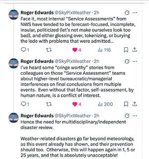
Finally, the Board should take over the task of validating NWS storm warnings. The NWS should no longer evaluate and investigate itself.
The purpose of the “notice of inquiry” language is not clear. I recommend it be clarified in future drafts.
Letter to Congresspeople You May Adapt For Your Use
Below is the general text of a letter you may wish to send to your congressional delegation. I recommend you put it in your own words
and add any of the above "specific suggestions."
Dear _________________:
The U.S. storm warning system, once the envy of the world, has developed major cracks in the past twelve months. After five decades of decreasing death rates thanks to more accurate storm warnings and response techniques, we have entered an alarming period of mega-disasters. Our nation cannot afford for this trend to continue and worsen.
- People across the nation were shocked and saddened Independence Day when they learned of the flash flood in Texas that took the lives of 138. A disproportionate number of children were killed as their summer camps flooded in a matter of minutes.
- In January more than 400 people were killed as fires swept across Southern California. Accompanying the fires were accusations of malfeasance by local officials. Estimates show these fires will be the costliest disaster in U.S. history, exceeding 2005’s Hurricane Katrina.
- In both January and August, incorrect tsunami warnings were issued for U.S. territories in the Atlantic and the State of Hawaii, respectively. These false alarms resulted in people frantically spending hours in traffic as they attempted to get away from the coast. False alarms of this nature make it less likely people correctly respond in the future.
- National Weather Service tornado warnings have been 20% less accurate and 40% less timely since 2010. They have met their accuracy goal just one year since 2011.
- Finally, 100 were killed in the Appalachians as a result of flash floods related to Hurricane Helene. The forecasts of those floods left a great deal to be desired.
Representative Jared Moskowitz, formerly Florida’s Director of Emergency Management, has introduced a bill in the House to create a National Disaster Review Board (NDRB). The NDRB will be modeled after the hugely successful National Transportation Safety Board (NTSB).
Just as the NTSB has made flying incredibly safe, the NDRB will investigate and learn the causes of failures related to natural disasters (earthquakes, volcanoes, hurricanes, tornadoes, etc.) and will devise solutions. The Board’s recommendations will emphasize “best practices” which will be widely adopted – saving lives and mitigating economic loss.
The bill is currently being drafted on by the House Science Committee. I support the creation of a National Disaster Review Board and recommend you consider being a co-sponsor.
Very best wishes,
[Your Name and Any Family Members' Names]
This is the way we get bills passed.
Please, please, write your congresspeople, especially your representatives in the House.
The Board is the only I know that will allow us to save lives and reverse some of the issues that have manifested themselves in recent years.
Mike