9/28/06 REPORTS: VA, WV, TN, NC

Joined
Apr 19, 2005
Messages
122
Location
Roanoke Valley, Virginia
roastormthumb0928.jpg
ominous0928small.jpg

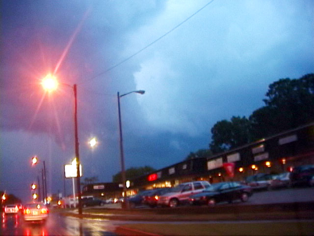
My chase today consisted of a walk up a flight of stairs to the roof garden of The Roanoke Times building in downtown Roanoke, Virginia. These photos were of a rain-free cloud base that exhibited some rotation (left) and of an advancing shelf cloud over the Roanoke Valley.This severe-warned storm with a long-lived mesocyclone resulted in numerous reports of 3/4 to 1-inch hail north of my location, with hail covering the ground in some locations.

Click here for bigger versions of the left photo and the right photo.

More on today's storms on my Weather Journal blog.
 
Chase Report Thursday September 28

With an approaching cold front, marginal but adequate instability, great upper level support and shear, severe storms were likely across the Mid-Atlantic. The biggest negative (for me) was the position of the low. As of Wednesday night, I was hoping for a slightly southern position that would place the best combination of backed winds and or factors in the northern Virginia area. Luckily, my scheduled on Thursday would allow me to take off by about 3:30PM. When I updated my forecast Thursday morning, the low was actually shifting farther north and the best area for tornadic development was in central Maryland toward Pennsylvania. There was no way I could reach that target by the time of initiation especially due to the heavy traffic around Washington D.C. (I would have gone if it was a weekend and I could have left earlier.) The next best area was just west and south of Richmond. Visibility was unusually good and a tornado was still possible in a storm developing ahead of the main line. I was expecting isolated storms to be potential supercells. The SPC later upgraded their tornado risk to 5% in central Maryland and 2% for Virginia.

I waited and monitored development from my office. As expected, a line of storms formed in western Virginia and slowly moved eastward with individual cells going northeast. Finally at about 5PM, I left and headed west on I-64. There was an isolated storm near Prince Edward county moving northeast. I dropped south on 288, a nice new bypass that crosses the James River. I noticed that the storm was gaining strength and showing intermittent weak shear on XM. Its movement was shifting more to the east and it would track along 360. I planned on taking 288 to 76 directly to the intersection with 360; however, the turnoff was backed up with traffic for approximately ½ mile onto 288. I remembered why I usually avoid this part of the Richmond area especially in rush hour. Arrgghh!! The storm was now showing significant rotation and continued to have a severe warning. I backtracked and turned off on 76 west, another bypass which was supposed to curve west, then south and intersect 360 farther west. I wasn’t sure if it had been completed as my maps showed “under construction” and my GPS didn’t even list it. 76 went about ¼ of a mile and stopped. There has been so much construction in this previously rural area that none of my maps were accurate. At 6:05PM, I finally found Otterdale Road that heads south and intersects 360 on the other side of Swift Creek Reservoir. I blasted south but had to slow due to curves. At times, I could see glimpses of an amazing updraft. Of course, the view toward the storm was completely blocked by the longest continuous line of trees that I have seen in a long time in the Richmond area. The storm was going nuts on radar. Dave Lewison called and gave me updates on the storms position. He was seeing a TVS that was not shown my WX WORX. I reached 360 just as the rains hit and visibility decreased. The storm was following 360 eastward. I turned east, trying to get ahead of it. The storm was pulsing, at times showing amazing rotation. I was starting at the westward extend of out of control development along 360 and as I went east, traffic increased on the 4 lane highway. Pull offs were impossible due to traffic channeling, turn lanes, and construction. I was briefly able to get out of the rain as the storm pulled east and slightly north. I could see some mid level rotation, hints of a clear slot but no wall cloud of funnels. The storm was still intermittently impressive on XM and by Dave’s account. At one point, I could see some rising scud but couldn’t pull over to properly assess and viewing while driving was hard. I followed the storm into downtown Richmond, eventually with a couple mile of my house. Due to traffic and lights, the storm pulled ahead of me. I stopped the chase on 64, just east of Richmond due to darkness. I then had to call my wife who was shopping at Nordstroms in Richmond’s west end to get to a lower level as a tornado-warned storm passed overhead. This storm was part of the line and a funnel was sighted but no damage reports.

My storm was never tornado-warned despite significant rotation and a TVS. A report later showed tornado damage in extreme northwestern Nottoway County. (About 15 miles away at my closest approach) Total miles: 110.

Updated Prelim Storm Reports

http://www.spc.noaa.gov/climo/reports/060928_rpts.html

View of updraft from southern part of downtown Richmond (702PM)
092806702PMrichmond.jpg


XM radar image and map with my position approximately 556PM. Tornado reported 5:40PM

http://www.harkphoto.com/092806XM555PM.jpg


Oh well, if I had only left earlier…

Bill Hark
Eastern Fury: Tornadoes of the Eastern United States
http://www.harkphoto.com/EasternFury.html
 
Last edited by a moderator:
Back
Top