Bill Hark
EF5
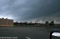
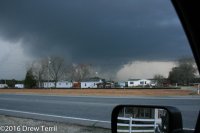
I left Richmond, Virginia at approximately 10:30 AM with an initial target area of Durham to Henderson, North Carolina. The parameters were coming together for a significant and rare February tornado outbreak across central North Carolina and Virginia. Determining a target was difficult as I expected a line of supercells to develop and rapidly move northward. Any storm could become tornadic. Although there was a conglomeration of storms to the east, the forecast models were showing a broken line of storms from western North Carolina moving eastward into the better air. This was already evident as I headed south on I-95. I turned southwest on I-85 and drove past Durham. My plan was to target the southern part of the most isolated cells in the line of storms that had already passed Greensboro. The cells were racing northeastward around 50 mph while the line slowly drifted east. One isolated area moving in the direction of Danville was too far north for interception. There was another area to the south and it would eventually pass over Durham. I backtracked and waited for its arrival on the northeast side of Durham. The storm was tornado-warned and there were reports of funnel clouds. Luckily, I-85 was almost parallel with the storm. I followed it northward but had difficulty finding a viewing area due to trees. At Falls Lake, I looked for a place to see the storm but the lake was surrounded by trees and there were no places where a road came to the lake edge. I continued north and tried again on the north side of Butner. The storm had a nice hook echo, and I could see a lowering between the trees by 4:10 PM. As the storm was pulling away, I blasted north and intercepted it again near Oxford. The suspected tornado was rain-wrapped. There were reports of damage it that area but I couldn’t see anything distinctive. I watched it by exit 202 at 4:30 PM and couldn’t anything other than rain curtains and a hint of a clear slot. I blasted northeast on I-85. Thanks to construction delays, the storm slowly pulled ahead of me. I gave up near South Hill. There were other tornadic storms in the line coming up from the south. I intercepted another one east of South Hill on 58. There was a definite wall cloud that soon dissipated. It passed to my west and north. At this point, it was too dark to chase and I headed to Emporia for dinner and to wait for the line to pass. I was briefly concerned when the tornado siren sounded in Emporia but a check of the radar showed I was in the periphery of a large warning area and in no danger.
Comment: The areas north and northeast of Durham toward South Hill is miserable chase territory due to the trees. It's even worse than the usual challenges in Virginia and North Carolina.
Comment: The areas north and northeast of Durham toward South Hill is miserable chase territory due to the trees. It's even worse than the usual challenges in Virginia and North Carolina.


