9/24/2006 Reports: Va / Nc

Joined
Apr 19, 2005
Messages
122
Location
Roanoke Valley, Virginia
ncshelf2small.jpg
lakekerrwallsmall.jpg


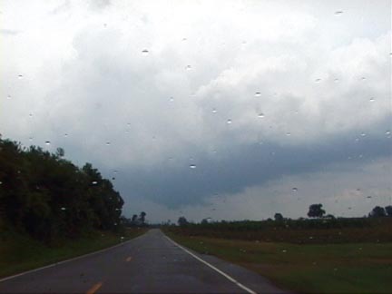
Got in a pretty decent chase to start the fall along the Virginia-North Carolina border on Sunday, as a strong cold front cut into warm, humid air to the east. This wasn't a great setup by any means, as shear and helicity ended up being weaker than they appeared they would be a day or two earlier, but with a Sunday afternoon free, I decided to target the area between South Boston and South Hill, Virginia, on U.S. 58, hoping to find more instability there with insolation. The temperature gradient was strong, with readings near 90 (dew points low 70s) over the coastal plain while temperatures back home in the Roanoke area were barely 70. I watched cumes climb east of South Hill but realized they were struggling and moving too fast east ... I wasn't planning on going all the way to the coast for this marginal setup. So I turned back, thinking the chase might be over, when my nowcaster Dave Carroll pointed out intensifying "gusty showers," as NOAA weather radio described them, to my west and southwest. These "gusty showers" billowed quickly into decent thunderstorms, and one even developed a meso and a severe thunderstorm warning. From this storm, near Lake Kerr on the Virginia-North Carolina state line, I got these pictures of a lowered cloud base (I wouldn't quite call it a wall cloud) and an ominous shelf cloud over a hayfield. Not bad for a September chase that I almost gave up on.

More about my chase here.
 
Kevin my day started like your with asking myself if it would be worth going out to chase or not and as you said it was Sunday so no loss and gas is $1.94 so not much of a hurten. This is a shot of the two cells that were riding along the Va/Nc border and the shot was taken in Weverly, Virginia as the storms started to collapse...

1838590-369c21792ac1730d.jpg
 
Last edited by a moderator:
I didn't have high hopes for the day despite the SPC 5% tornado risk across Eastern Virginia/North Carolina. There was decent upper level support and an approaching cold front. I targeted an area just northeast of Rocky Mount, NC hoping to catch some cells that might form ahead of the predicted line of storms. Unfortunately, surface winds were from the southwest across the entire area except for a persistent southerly wind reported from the Ahoskie station in NC. I would have blown the day off but I had no other plans and it was Sunday. I drove south on 95 to Roanoke Rapids as storms formed along a prefrontal trough. My target area was in NE North Carolina (Windsor to Ahoskie) The northerly part of the line became more isolated and moved ahead of the other storms. I drove south through the developing storms, then east on 481 following the dominant storm now to my north. I followed it northeast . In the town of Enfield, I noticed a lowering under the main updraft. This lowering was more visible as I headed northeast on 481 toward the town of Tillery. (IMAGE BELOW: 3:22PM, looking northeast) There was some brief shear on XM but I couldn’t see any rotation. I was having a hard time keeping up with the storm. Of course, the storm strengthened as it approached the Chowan River that feeds into Albemarle sound. This was a barrier to any further progression east. Luckily, the storm started to fall apart on the otherside of the river. During this period, I had been watching some isolated storms just north of the Virginia border. I then headed north through Murfreesburo, then east on 58 to follow one of the isolated storms. I caught up with the storm on 460, just west of Suffolk. There was a nice shelf cloud but lighting was decreasing and it was already passing to my north thus I didn’t get the nice views that William posted earlier. I ended the chase since the storm was moving into a metropolitan area and headed to the Virginia Diner for a nice dinner of fried chicken, greens, sweet potato and green beans.

A fun Sunday afternoon chasing mush. As I expected with strong but unidirectional winds from the surface to higher levels, rotating storms were unlikely but I couldn’t not chase. I still don’t know why the SPC gave a 5% risk. I would have given it 2% or less. I passed many cotton and other fields with great visibility. XM was being annoying. At one point I noticed that the state roads were missing on the WX WORX GPS and map while interstates, cities, small roads were present. Restarting XM had no effect. When I completely turned off the system and restarted, all the roads loaded. The location of the storms seemed several miles off their indicated position on XM even accounting for fast storm movement and not immediate updates. In general they seemed shifted south. I don’t know if there was any relation to the road problem.

092406lowering.jpg


Bill Hark
"Eastern Fury"
Tornadoes of the Eastern United States compilation for sale
http://www.harkphoto.com/EasternFury.html
 
Back
Top