6/24/06 REPORTS: SD / MN

Joined
Jun 16, 2004
Messages
430
Location
Minneapolis, MN
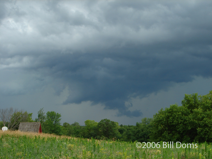
Fun little chase that was less than 100 miles in length. Hail and nice structure seen, along with a few instances of damage to a wind turbine and trees. Full account on my website.

Even some pretty flower pictures - yay flowers. :D
 
060624002.jpg


The McLeod cell never tripped my trigger today as it kept
blobbing out so decided to work on the yard instead while watching
cells fire to my north and west. When the Stearns cell went SVR
figured I go take a look. Went to Silver Creek and watched the shelf
Andrew Revering was under to my west SLOWLY approach. Drifted
west some then up Wright CR7. Eric Whitehill called to tell me to listen
in on the Skywarn hub as was pretty busy. Watching this lowering
under the shelf when Nick Elms relays a public report of a wall cloud
and funnel over Clearwater. Called MPX to notify them the report was
not valid as no spotters were in the immediate area at the time. Followed
the cell east where it formed another massive “wall cloud-ishâ€￾ looking
lowering under an area of enhanced updraft associated with the shelf.
Died after about 5 minutes but was a cool feature to watch. Headed
home from Monticello on CR15. Heard another report of a wall
cloud over Rogers by the public on the hub. Had a great view looking
east from Pelican Lake. Was another area of enhanced updraft on the
shelf so called MPX once again and headed home.

Great job by the Stearns, Wright, and Sherburne spotters and net
control people today. Good judgement calls...A+++ after taking some
heat the past couple of years.

Here are the pics: http://www.mnwxchaser.com/06june24.html
 
Saw the storms developing near Aberdeen around noon. After looking at mesoanaylsis it appeared that at least moderate SBCAPE (1500-2000 j/kg) had developed and that dewpoints had held on despite northerly flow in the low levels (in the upper 50's). Intercepted the first cell NE of Watertown that became svr warned upon getting to it. Experienced copious penny to nickel sized hail with this intial cell as I moved east in front of it. As I crossed into Minnesota the beautiful 5 layer caked shelf with aqua color glowing through each shelf striation. Continued E/SE for the next hour photographing this cell and then turned south and went through some of the more mariginal cells. Lots of boiling clouds along the shelf, espically during the intial 20 minutes after the severe warning. I wasn't expecting much today given the releatively weak shear and northerly flow (though an anti-cyclonic supercell seemed quite possible). But, im glad that we can still get some good storms even with the continuing hostile pattern.

Also saw the distant Hand County cell from Brookings. I didn't check the radar at the time but apparently it was producing a tornado (it's 120 miles to the west). It at least had good 0-3km CAPE going for it and LCL's were also much better than intially expected as yesterdays moisture seemed to stick around. Also worth noting that the RUC seemed to underforecast 0-6km shear for most of the area.


Back
Top