Ryan Pfannkuch
EF1
4/20/07 REPORTS: NE
Just rolled into Goodland for the night...and needless to say feeling a bit frustrated right now for missing the night tornadoes in NE.
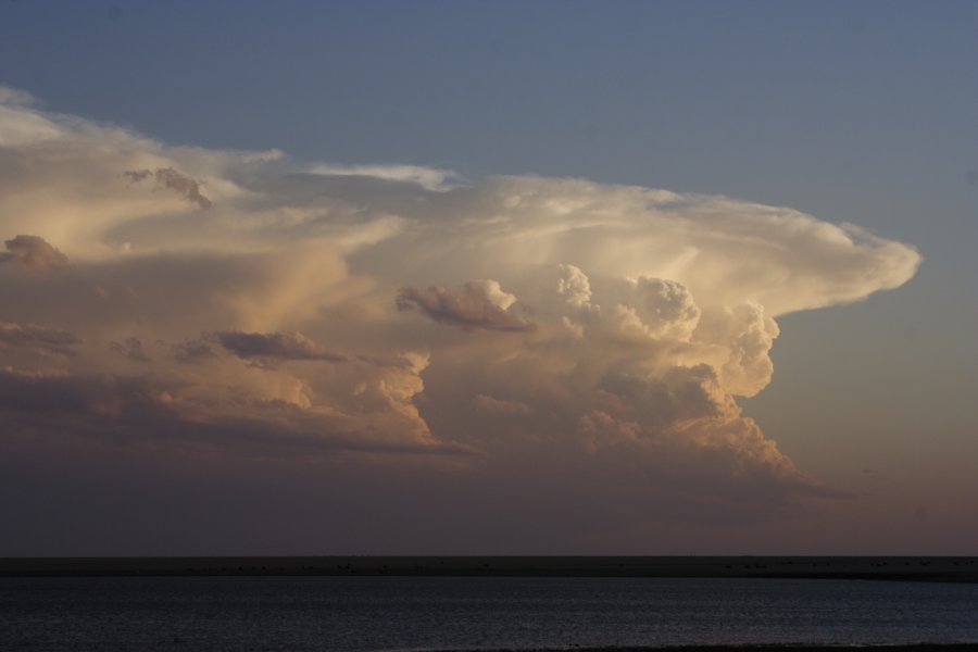
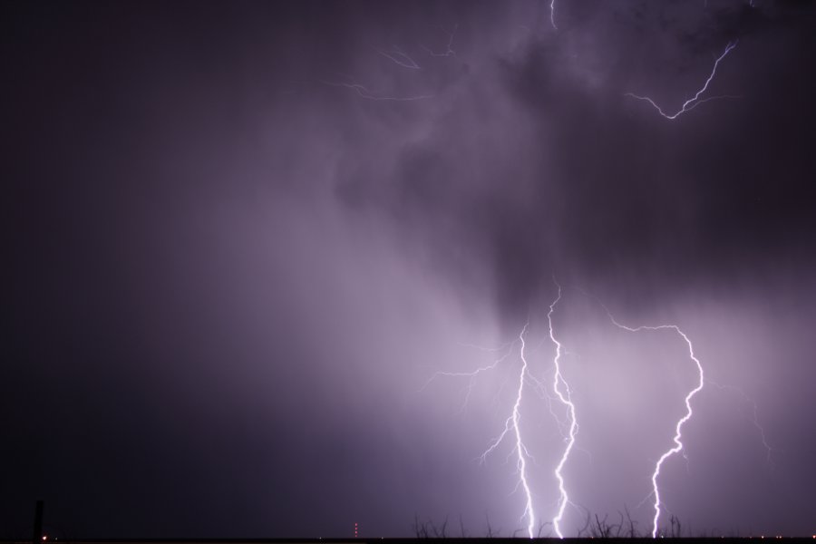
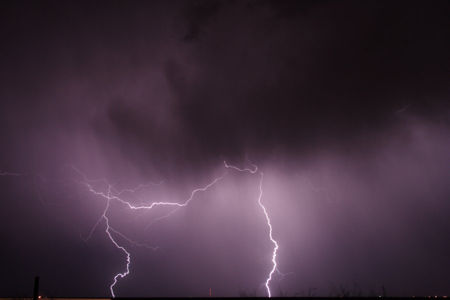
I left Hastings at 245pm with the plan of simply driving to Goodland and seeing if anything interesting happened along the way. I honestly had very little confidence in supercell initiation today given the limited forcing aloft and limited convergence along the DL. Well, much to my amazement...just west of McCook I noticed an areas of towering CU about 20 miles to my SW so I pulled off onto a gravel road near Trenton and literally watched several small storms initiate all around me for the next few hours. Bases were very high, but the storms had great structure and made for some nice eye candy. I wandered north into Hayes County keeping just behind the dominant updraft...but at sunset I decided to call off the chase and head for Goodland to start getting in better position for Saturday. As though I even have to mention it...as soon as I got about 50 miles away from the storms I had earlier watched initiate around me...the cluster evolved into a large supercell in northern Frontier Co. and started dropping reportedly large TORs after dark. Amazing.
Now I understand these TORs apparently happened after dark, but the truth is I NORMALLY do chase after dark if storms are discrete. In this case, I just got too focused on getting into position for Saturday and talked myself into letting them go...after all...there had been no large dominant supercell up to that point. To further add to the insult, at least one of the TORs was reported in western Dawson Co., which is my own NWS CWA (I hate missing stuff in the "home CWA", always have). Anyway, sorry about the frustration, but hopefully this day serves as a reminder for all of us to stay focused on the present situation and not worry about the next day until "all is clear."
Hopefully some of you on here scored the NE TORs and can fill me in on exactly what happened after dark...as I was caught napping on the tornadic potential today.
Just rolled into Goodland for the night...and needless to say feeling a bit frustrated right now for missing the night tornadoes in NE.
I left Hastings at 245pm with the plan of simply driving to Goodland and seeing if anything interesting happened along the way. I honestly had very little confidence in supercell initiation today given the limited forcing aloft and limited convergence along the DL. Well, much to my amazement...just west of McCook I noticed an areas of towering CU about 20 miles to my SW so I pulled off onto a gravel road near Trenton and literally watched several small storms initiate all around me for the next few hours. Bases were very high, but the storms had great structure and made for some nice eye candy. I wandered north into Hayes County keeping just behind the dominant updraft...but at sunset I decided to call off the chase and head for Goodland to start getting in better position for Saturday. As though I even have to mention it...as soon as I got about 50 miles away from the storms I had earlier watched initiate around me...the cluster evolved into a large supercell in northern Frontier Co. and started dropping reportedly large TORs after dark. Amazing.
Now I understand these TORs apparently happened after dark, but the truth is I NORMALLY do chase after dark if storms are discrete. In this case, I just got too focused on getting into position for Saturday and talked myself into letting them go...after all...there had been no large dominant supercell up to that point. To further add to the insult, at least one of the TORs was reported in western Dawson Co., which is my own NWS CWA (I hate missing stuff in the "home CWA", always have). Anyway, sorry about the frustration, but hopefully this day serves as a reminder for all of us to stay focused on the present situation and not worry about the next day until "all is clear."
Hopefully some of you on here scored the NE TORs and can fill me in on exactly what happened after dark...as I was caught napping on the tornadic potential today.
Attachments


Last edited by a moderator: