gdlewen
EF4
Looking ahead to Tuesday which looks very promising at this time. 3 Day Convective Outlook puts the target up north, but I am eyeing the dryline mostly because I prefer dryline storms. The SPC discussion specifically mentioned the cap being the major factor inhibiting convection south of Kansas, so obviously that could ruin my day.
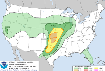
[4PM CDT] Edited to reflect 1930Z Day 3 Forecast, which expanded SLGT risk to include OK/TX (from Marginal):
It seems to me that, a few days out, the NAM always presents sharp, clean drylines; however 3 days out it is hard to ignore results like these.
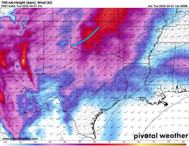
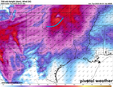
With the Slight Risk currently assigned to KS-NE-IA-MO mainly due to elevated convection ahead-of and along a warm front advancing across KS/MO, I'm interested in what folks have to say about their plans for that area. There is a significant cold air mass at the surface forcast over IA/MO. We'll see how that holds. (The code to calculate that cold air depth is still experimental, and really only used to make sure my LSI calculations handle elevated convection correctly, so apologies for the odd outlier. Work in Progress.)

[4PM CDT] Edited to reflect 1930Z Day 3 Forecast, which expanded SLGT risk to include OK/TX (from Marginal):
 |  |
1300Z SPC 3 Day Convective Outlook | 1930Z SPC 3 Day Convective Outlook |
It seems to me that, a few days out, the NAM always presents sharp, clean drylines; however 3 days out it is hard to ignore results like these.
 |  |
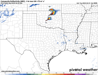
NAM Forecast Supercell Composite for 00Z Wednesday April 2, 2025 | NAM Forecast 3km-EHI for 00Z Wednesday April 2, 2025 |
With the Slight Risk currently assigned to KS-NE-IA-MO mainly due to elevated convection ahead-of and along a warm front advancing across KS/MO, I'm interested in what folks have to say about their plans for that area. There is a significant cold air mass at the surface forcast over IA/MO. We'll see how that holds. (The code to calculate that cold air depth is still experimental, and really only used to make sure my LSI calculations handle elevated convection correctly, so apologies for the odd outlier. Work in Progress.)
Last edited: