• A friendly and periodic reminder of the rules we use for fostering high SNR and quality conversation and interaction at Stormtrack: Forum rules

    P.S. - Nothing specific happened to prompt this message! No one is in trouble, there are no flame wars in effect, nor any inappropriate conversation ongoing. This is being posted sitewide as a casual refresher.

2024-03-13 REPORTS: KS

I left Kansas City at 1pm heading to 56 highway and I-335 to sit and wait for storms. As I waited I was eventually joined by a few other chasers and we talked about the day ahead. About 5:30 we headed for initiation just to our west around Council Grove. We watched cells fire and die off until the southern cell started to really get it's act together. Rapid rotation started just south of highway 4 and the east of Alta Vista with first touch down happened there. I watched a nice white tornado then two at once which from my angle I thought was a multi-vortex wedge about to start. I followed the storm on dirt roads with others until a tree was blocking our path. I ran the Tundra over it to break it up which allowed others to get through too. I followed the storms all the way to north of Topeka before calling it. What a nice March Kansas day! I have to go through video but my photos are not great but I look forward to see others.
 

Attachments

  • AV1.jpg
    AV1.jpg
    71.8 KB · Views: 10
  • AV2.jpg
    AV2.jpg
    24.8 KB · Views: 7
  • Blurry Large.jpg
    Blurry Large.jpg
    61 KB · Views: 7
  • Blurry too.jpg
    Blurry too.jpg
    136.1 KB · Views: 12
  • Radar and my location.jpg
    Radar and my location.jpg
    179.1 KB · Views: 16
  • Two on the ground.jpg
    Two on the ground.jpg
    92.1 KB · Views: 15
  • Sony.jpg
    Sony.jpg
    123.2 KB · Views: 7
For many years, I have had a strong home target bias if there is an appreciable supercell/tornado risk locally, even if there is a much better prospect farther away. The time and gas money savings is part of that, but it’s more the fear of a rogue high-end event happening in my backyard while I potentially bust 7 hours away.

While the Kansas triple point/dryline bulge looked very good (and it did produce), the local target here was not bad at all itself. Models agreed on multiple supercells firing during the afternoon right in or near the St. Louis metro area, and our environment looked sufficient for something interesting to happen: good upper support and great turning-with-height in the low levels. Our main limiting factor was dewpoints only in the 50s.

Models originally pointed to Wednesday's storms firing at close to 7pm and farther northwest near Wentzville, but an agitated cumulus field south of St. Louis at 3pm indicated that a new and arguably better target much closer to my home just east of the city. I got on the road just as the first storms fired to my southwest. I could even see them from home - not bad when the target storms are that close!

I had an easy intercept course to the first storm west of Fayetteville, IL, but it vanished by the time I arrived on it. The next storm was approaching Ruma to the south, so I headed that way, arriving in plenty of time to my observation point just south of town. I passed through nickel size hail on the outskirts of the core in town. The storm was moving slowly enough that I was able to stay at this spot for quite a long time as it approached. The storm took on some nice structure, with a rounded base and some striations appearing alongside the vault region.

march1324a.jpg


An RFD surge began shortly after this image, and strong differential motion was commencing at cloud base. As this passed directly overhead of me, a strong and persistent circulation developed. This was the view looking straight up:

march1324b.jpg


About 30 seconds later, the southerly winds at my location rapidly increased, then suddenly shifted to very strong westerly RFD. The power poles along the road began to lean slightly as the wires were pulled hard to the east. Dust and small leaf debris started kicking up a few hundred feet to my north. I jumped in the car and moved south to get out of the way of the power lines in case they fell. My rear dashcam shows a potential small circulation in the field kicking up dust, but it's inconclusive if this was a tornado or just RFD winds.

I got back on Highway 3, heading east to Evansville and then to Sparta to re-intercept the storm. It was clearly losing strength by this time, with the updraft shrinking. I had a nice view of the LP-like structure from Sparta:

march1324c.jpg


As my storm continued to shrink, I turned my focus to new storms back to the west near Waterloo. I moved north to get in front of this at St. Libory, at which time a nice wall cloud formed for about 10 minutes at sunset while the storm was still about 20 miles to my west:

march1324d.jpg


This storm also started a long weakening phase as it approached me. I moved up to New Memphis to shoot some of the nice lightning it was producing, but frustratingly I left my lens on autofocus, resulting in the shots being slightly out of focus. I did capture one of these channels on 6,000fps high speed, though.

The storms continued their weakening, with the nearest active storms being all the way west of the metro, past Wentzville that Id need to go all of the way to near Springfield, IL to see. Models hinted that these would also weaken, and radar trends seemed to support that - so I didn't go after them. I ended my chase day not long after dark.
 
This was such a bad bust of a chase, it would not be worth a post either in the EVENT or REPORT threads unless something could be learned from it.

The optimal target area in KS, as described by @Mike Smith, was not practical for me on 3/13, so I opted to keep an eye on the dryline in OK, just in case. (Not much hope, really, with poor moisture convergence, strong capping, etc. In the SPC 1630Z Convective outlook, the severe potential was “expected to remain very isolated and uncertain regionally.”)

Despite the high-bust potential, I did not want another of those “Caught Looking” chases where I was sitting at home when a single cell broke the cap.

At 21Z the Oklahoma Mesonet was showing an odd dryline bulge approaching OUN, and the 21Z Norman sounding also suggested the cap was either weakening, or the dryline was just moving through the area. By 22Z, a few cumulus were forming along the dryline, so I headed out with my daughter, who hasn’t yet been out on a chase in OK. Here’s the 21Z OK Mesonet data with OUN marked by a white circle. I find this display format easier to read than the maps put out on the OK Mesonet App. (I’m working the bugs out of my mesonet plotting code but I’ll get there. Nothing outside the OK border should be regarded as real…yet.)

/var/folders/_z/g8kv07_j0316xlmq4jm5l3340000gn/T/com.microsoft.Word/WebArchiveCopyPasteTempFiles/Aetvjf0ulzc8AAAAAElFTkSuQmCC

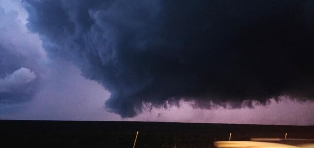
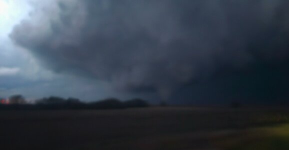
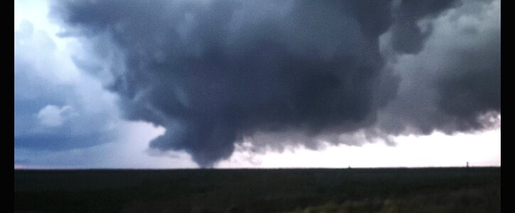
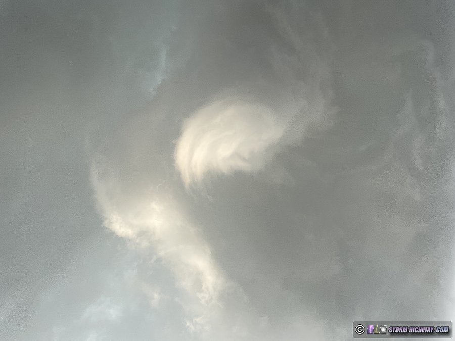
We drove along US-60 towards Tonkawa, which I think is Osage for “The Place Chases Go to Die.” (This was a mistake, by the way: all day dewpoints had been increasing from the south, so the richer moisture fields were always going to be south.) By 2331Z, Mesoscale Discussion 221 was issued for E OK into SE KS. We had been watching the towering cumulus mentioned in the MCD for a while. But from the ground, they were unremarkable, and there was visible evidence they were struggling to maintain themselves.

By 715PM CDT (3/24 0015Z), things are dissipating, and I really think cumulus medocris would be a better classification for these clouds by that time. Only far off to the south was there anything that could lay claim to the title “towering cumulus”.

[Here should be a JPG of what the TCU looked like from the ground but all image sizes are rejected as "too big". I think it's important to document how things looked from the ground: they don't look like TCU at all.]

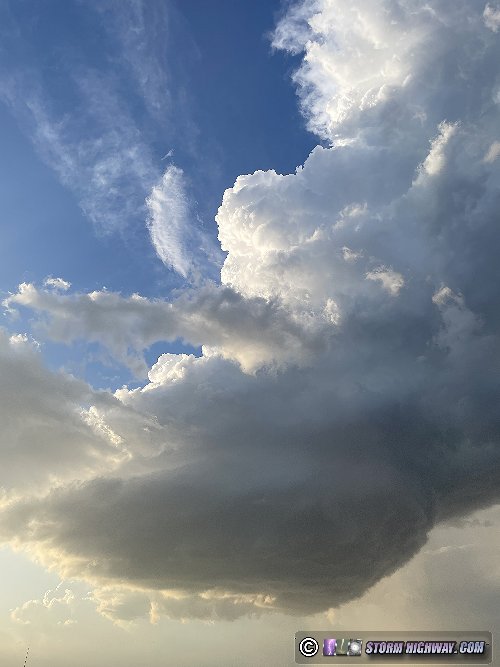
Most important part of the day: my daughter just moved here a year and a half ago, but had never been to this part of Oklahoma. She thought it was absolutely beautiful, and the view worth the trip.

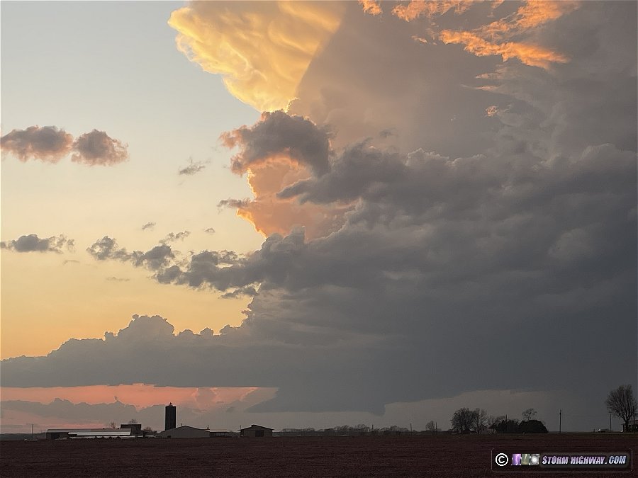
By 1930 CDT, this southern cloud mass had developed a weak radar echo. The cell was near Stroud, OK, 65 miles due south as the crow flies. It rapidly became supercellular, splitting, and dropping 1” hail along its path towards Tulsa. There was no way to really catch it, given the road network, but since it was on the way home, it was in front of us the whole way.

What Went Wrong?

Other than the decision to go out at all, I'm not sure that’s the right question. Better to ask, “What could have been done better?” Obviously heading down I-44 towards OKC would have put us in position for the storm, period. But other than a vague “further south would be better”, was there any overlooked information? Anything to learn?

I think so—I overlooked the potential for “underrunning”. In most of the papers I’ve read, underrunning is usually described as a situation “where warm moist air flows out from under the western or northern edge of the lid”. Generally, it seems to occur when a perturbation causes the local wind field to turn more normal to the lid, and causes the mT airmass under the lid to undercut the uncapped cT air mass W of the dryline. This is my understanding: the underrunning air represents a density current that is either buoyant enough for ascent in the cT air or gets caught up in the solenoidal circulation around the dryline, or both.

For this report, I checked the potential for underrunning late in the afternoon on March 13. The “lid” is formally defined by Carlson, et. al. as the isopleth of their Lid Strength Index equal to 2K. Anything below 2K favors severe weather if convection can be initiated, while severe weather becomes more and more unlikely as LSI increases above 2. For the 00Z NAM model output on March 14, the LSI analysis looks like this:

NAM_LSI_20240314_0000_F00_20240320_2304.png

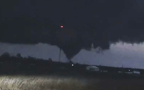
In OK, there is a significant component of the surface wind field normal to the Lid (the heavy contour represents the value of 2K). You can see the Stroud storm track from the hail reports that start just at the lid edge, indicating convection initiated W of the lid, as would be expected in the case of underrunning.

The positions of the dryline and surface fronts are obvious from this “stability analysis”. Note: I take the “lid” part of the definition of underrunning very literally; although the lid generally seems to follow the position of the dryline, I think it’s important not to assume they are the same.

So, it certainly looks like underrunning could have been involved in the development of the Stroud storm, and I should have run the analysis while kicking back with my daughter waiting for something to happen. Given the uncertainty on timing and location in the severe weather forecast, anything to help anchor the search area would have been helpful.

Edit: In re-reading this, I realize it's important to demonstrate why the Stroud storm developed so explosively once it crossed the lid boundary. LSI is the sum of a Lid Strength term (like a CAP) and a Buoyancy Term, where Carlson's Buoyancy is ≈ 1/2 the value of the Lifted Index (LI)*. So, double the values of Buoyancy in the plot below to estimate LI. There is plenty of buoyancy for development E of the Lid:

NAM_BUOY_20240314_0000_F00_20240320_2305.png
* Now I need a reference:

 
Last edited:
I arrived in Topeka about 4p waiting for initiation. I decided to wait along the warm front a bit further east in the better parameter space.
At first I didn’t pull the trigger and head west when the first cells formed just east of the low back to the west of me and I noticed some TC to the south of Topeka so I drifted south of town.
I waited as long as I could for something to really take off near Topeka, but was running out of daylight. Meanwhile the cells to my west had finally really organized and so I gave up on my stubbornness and finally headed west. Eventually a huge storm did form southeast of Topeka but was heading right into the KC metro area.
I made it to the Eskridge area and actually had a nice cell with a wall cloud just to my north in front of the main cells near Alta Vista. At the Hwy 99/4 intersection, I SHOULD have kept going west towards Alta Vista, but instead chose north on 99 towards Alma. I believe I overestimated distance and storm speed to the cell and thought heading north would be best to stay in front. I tried multiple times to head west and get closer to the storm, but road options were non existent or sketchy at best.
I finally ended up in Alma and was able to find a road west out of town. I made it to a hill under a radio tower and was able to see all the way back to the storm about 7-8 miles to my southwest right at sunset. I could see the LARGE wall cloud/tornado under the storm from my vantage point. It was heading directly at me slowly about 20-25 mph. I stayed there about 5-10 minutes before the hail started falling and the tornado was getting closer.
I went back through Alma and dropped south on 99 driving through quarter to ping pong ball sized hail. I was able to get out of the rain and hail briefly before the RFD swung around bringing strong winds and big hail again. I managed to get hit by a couple of what sounded like really big stones and sure enough have a very large dent just above my passenger side door from what had to be easily a 2+” hailstone.
Here’s my chase video I put together:

IMG_0289.jpegIMG_0292.pngIMG_0294.png
 
My initial target using my handy dandy yahoo chaser targeting method was the Konza Prairie Preserve near Manhattan, KS, which ended up 27 miles from where the first (only?) tornado touched down. Got in a good three mile hike that afternoon and it wasn't long afterward that the show began. Storms fired off to the south and I ended up in Council Grove before I started moving back north. It tried off an on for a while before dark but couldn't quite get it done. With very little light remaining it got its act together and put a good sized tornado down near Alta Vista. After it moved northward I followed along and it developed an epic wall cloud and structure but it was too dark to see and I couldn't find a spot to pull over anywhere because every single turnoff/pasture entrance for miles was full of other chasers. Lost data and visual of the storm and called it a night.

It was a good chase.
 

Attachments

  • tornado1.JPG
    tornado1.JPG
    234.2 KB · Views: 2
  • tornado2.JPG
    tornado2.JPG
    207.7 KB · Views: 2
Back
Top