JamesCaruso
Staff member
On 7/23/19 there were four tornado reports from at least two separate confirmed tornados in Yarmouth / Cape Cod Storm Prediction Center 20190723's Storm Reports
Just a sliver of the coast was included even in the *general* thunderstorm outlook
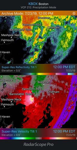
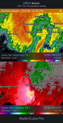
Reflectivity had a distinctive supercell shape and the base velocity image looks pretty decent if not all that “tight” - especially for that region (obtained from RadarScope archive from around the time of the first report)
I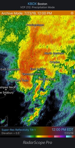
Pretty amazing video of the roof of an inn being torn off

 boston.cbslocal.com
I was not following the weather at all that day. Anyone have any insights into how/why this supercell and tornado was able to form?
Just a sliver of the coast was included even in the *general* thunderstorm outlook
Storm Prediction Center Jul 23, 2019 1630 UTC Day 1 Convective Outlook
Severe weather, tornado, thunderstorm, fire weather, storm report, tornado watch, severe thunderstorm watch, mesoscale discussion, convective outlook products from the Storm Prediction Center.
www.spc.noaa.gov
Reflectivity had a distinctive supercell shape and the base velocity image looks pretty decent if not all that “tight” - especially for that region (obtained from RadarScope archive from around the time of the first report)


I

Pretty amazing video of the roof of an inn being torn off

CBS Boston - Breaking News, Sports, Weather, I-Team Investigations
Latest breaking news from WBZ-TV CBS Boston.
I was not following the weather at all that day. Anyone have any insights into how/why this supercell and tornado was able to form?
Last edited:
