Steve Frederick
EF1
Before I go any further, I have a question. This was the 2nd time that I was caught off guard in 2019.
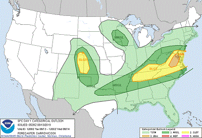
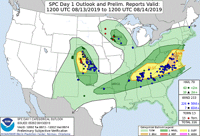
By off guard, I mean that the site I check for storm prediction SPC Day 1 Outlook
only depicted the area I live in as (TSTM-light green) a 10% or higher probability of thunderstorms.
As far as I know, even as the storms were active, NOAA never moved the rating above TSTM probability for my area ?
I understand that none of the tornadoes in Minnesota last Tuesday, were high EF rated, or long duration/destructive ones, but they were tornadoes nonetheless.
Can someone recommend a better storm prediction site ?
Like I said earlier, I was caught off guard, so the first I was aware of any severe weather in the area was when I heard the sirens going off in town.
(Mankato) Around 3:00. Looked out the window to the north east & saw why they were going off.
I won't bore anyone with unnecessary details, but I do need to explain one thing before you watch the video.
The video of the tornado at the end is bad for 3 reasons.
1a- It was a substantial distance away, which means I had to use the zoom.
1b- When heavy zoom is used, the built-in stabilization feature is basically rendered useless.
2- On top of that, the sun was out. It was at my back, which caused extreme glare on the camcorder screen, making it almost impossible for me to see what I was filming.
The tornado was SE of Janesville Minnesota.
All that being said, I'm thrilled to have seen a tornado that day!


