Quincy Vagell
EF4
I set out for the High Plains yesterday and debated between two targets. After getting to Amarillo around midday, I opted to drift north, as there were signs that convection would soon be initiating in southeastern Colorado.
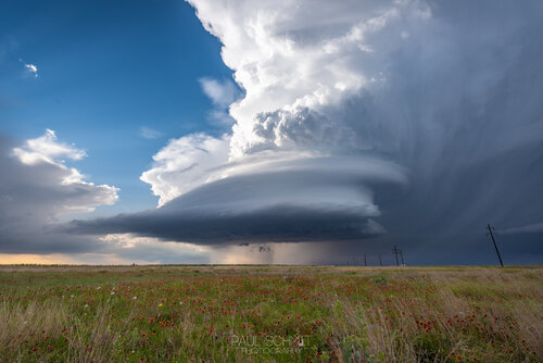
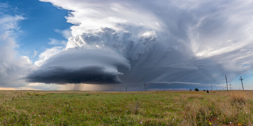
A cluster of semi-discrete storms formed in Baca County and as I got closer in, I was not too impressed with what I was seeing. With dew-points in the mid to upper 40s, these storms were struggling to intensify and cloud bases were quite high.
One storm near the Oklahoma border did organize better and started producing large hail. I dropped south through the storm to get a better look from the south side. There still wasn't much of a visual and storms were starting to fire farther south, on either side of the New Mexico/Texas border. For the time, I stayed with the storm that was crossing into the Oklahoma Panhandle.

The storm continued to better organize, moving into somewhat more favorable low-level moisture. Despite near-surface winds of 10-20 knots (kicking up a lot of dust in the inflow region), dew-points were only around 50 degrees. There were times in which the storm looked like it was trying to form a wall cloud, but these attempts were not enough.
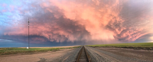
I drifted south a bit as more storms were firing in the northern Texas panhandle, but the most intense supercells were forming south of I-40. There was also a debris signature on radar just northeast of Adrian. I was much too far away to catch this storm, but I did catch some mammatus at sunset on the back side of the storms.
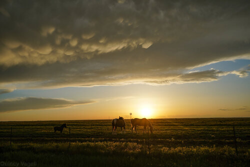
I still consider today a successful chase for having supercells to follow and a few photo opportunities, but it was clear that any bonafide tornado threat and potential for intense supercells was going to be where there was better low-level moisture. Dew-points were in the lower 50s near I-40 and even higher farther south. Kudos to storm chasers who caught the more southern supercells! I hung back north for logistical reasons and jumped on some of the early storms in hopes for a longer window of chasing.
Patience is key!

A cluster of semi-discrete storms formed in Baca County and as I got closer in, I was not too impressed with what I was seeing. With dew-points in the mid to upper 40s, these storms were struggling to intensify and cloud bases were quite high.
One storm near the Oklahoma border did organize better and started producing large hail. I dropped south through the storm to get a better look from the south side. There still wasn't much of a visual and storms were starting to fire farther south, on either side of the New Mexico/Texas border. For the time, I stayed with the storm that was crossing into the Oklahoma Panhandle.

The storm continued to better organize, moving into somewhat more favorable low-level moisture. Despite near-surface winds of 10-20 knots (kicking up a lot of dust in the inflow region), dew-points were only around 50 degrees. There were times in which the storm looked like it was trying to form a wall cloud, but these attempts were not enough.
I drifted south a bit as more storms were firing in the northern Texas panhandle, but the most intense supercells were forming south of I-40. There was also a debris signature on radar just northeast of Adrian. I was much too far away to catch this storm, but I did catch some mammatus at sunset on the back side of the storms.

I still consider today a successful chase for having supercells to follow and a few photo opportunities, but it was clear that any bonafide tornado threat and potential for intense supercells was going to be where there was better low-level moisture. Dew-points were in the lower 50s near I-40 and even higher farther south. Kudos to storm chasers who caught the more southern supercells! I hung back north for logistical reasons and jumped on some of the early storms in hopes for a longer window of chasing.
Patience is key!
