2017-5-26 REPORTS: IL/IN/CO/KS

The warm front in central Illinois had been on my radar for the the past day, but I didn't call off of work to chase due to the fact that short-term models had the cap squashing any storms by early afternoon. However, by mid-morning, the models flipped and started showing storms persisting along the boundary for the duration of the evening. This was not a situation to ignore, so I left work at noon and made the trek north to Bloomington-Normal.

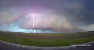
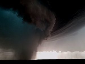
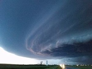
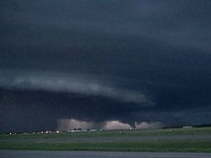
The obvious storm of the day initiated west of Peoria and strengthened as it approached Bloomington with frequent lightning. However, it was cold and outflow-dominant. Thinking that it may get its act together as it encountered the boundary, I stayed with it. This was not a leisurely task, as the storm was moving at a good clip - I could not stop for more than a minute at any given location. Finally, as the storm crossed Interstate 55, it began gaining supercell characteristics both visually and on radar.

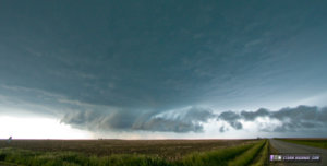
There was no surface-based inflow, however, as forward-flank outflow and the RFD continually undercut the inflow notch. This continued for the rest of the chase, and I did not note any low-level inflow making into the storm - everything was constantly being undercut by northerly winds blasting out of the core. Nonetheless, the storm had some mean-looking structure as it tracked southeast, along with a broad circulation and beefy hook echo on radar:
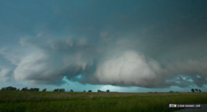
may2617a.jpg may2617b.jpg may2617c.jpg
With fading daylight, work at 5:30AM the next morning and another big chase day to follow on Saturday, I broke off of the storm at Danville, IL and started the 3-hour drive home.
 
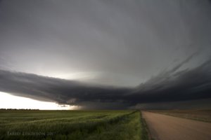
Like seemingly everyone else, I played the upslope in eastern Colorado this day. After lunch in Limon, Co we set up in the Last Chance area and waited for the developing storms to come out of the Denver Metro. As the storm pushed east toward Last Chance/Anton/Cope it morphed into a wonderful supercell. I'm suspicious of a few potential tornadoes, the first was what looked like a distant rope while the storm was still near Denver, and the second was what looked like a white cone buried in the rain as it approached HWY 385. As the storm continued its HP transition we jumped way south and east in order to look at the structure and were not disappointed. We led the storm eastward through Goodland and ultimately let it go once darkness settled in.

For more photos and a write up of the event: http://slightrisk.net/chase_2017/may_26

774a5aafdbc7f0b7dc3bb0e74a40fdb8.jpg
Great structure just north of Burlington, Colorado

cdd243d8fa1a4eded376dd1c103100ab.jpg
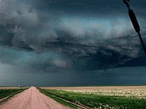
More structure from east of Goodland
 
Good day all,

May 26 was a pretty good chase day, with a long-track supercell storm chased from eastern Colorado well into W Kansas. Sorry for the late post. Details are below...

Summary: May 26 was another chase day, also in Colorado and into Kansas, in pretty much the same areas as the day before, maybe starting out farther west. The SPC had an area over much of northeastern Colorado and in to part of western Kansas in a slight risk outlook, with hail and wind probabilities both at 15%, and a 2% probability of tornadoes. Upon forecasting, it appeared the best place to start out would be near the eastern side of the Palmer Divide area, anywhere from I-70 east of Denver towards Limon and Byers. I headed west on I-70, reaching Limon around lunch time, and waited for storms to organize on the higher terrain southwest of Byers off I-70. Storms eventually organized in the upslope airflow by mid afternoon, and a long-track supercell was followed from near Byers, and eastward along Highway 36 to near Idalia (again). The SPC also issued MCD 844 and subsequent severe thunderstorm watch box 268, valid until 8 PM MDT (9 PM CDT). The storm was followed east and southeastward, via 36 and 385 to Burlington, then back into Kansas on I-70 to east of Goodland. After chasing was wrapped up, I continued east on I-70, making the long drive to Salina, Kansas (to be in range for a busy chase day on the next day), arriving there for the night after midnight.

May 26, 5:30 PM - Observation and penetration of a very severe and possibly tornadic thunderstorm from Arapahoe county near Byers, Colorado via I-70 and Highway 36, then eastward through Washington and Yuma Counties to near Idalia, then eventually (via Highways 36, 385, and I-70) into Kansas near Goodland in Sherman County. The storm was a classic to HP supercell storm. Several penetrations were made on the storm, including a hook slice into the "bear’s cage" north of Anton, Colorado. Very large hail, with numerous 2" (and possibly to tennis ball sized) was encountered with this storm. Heavy rains, 60 MPH winds, and frequent lightning were also encountered. A possible tornado was reported near Idalia, but it was low contrast and not visible from my vantage point. The storm had a very striking visual appearance, with striations, RFD cut with funnels, and dramatic "stacked plates" appearance. Conditions causing the storm were surface heating, upslope wind flow, boundary interactions, a low pressure lee trough, and upper trough. A 2016 Jeep Wrangler was used to chase the storms. Documentation was digital stills and HD video. A severe thunderstorm watch was in effect for the area until 8 PM MDT (9 PM CDT).

m18sc27.jpg

Above: Supercell storm intensifying north of Highway 36 and entering Yuma County in Colorado.

m18sc29.jpg

Above: Area of intense rotation deep inside the "bear's cage" of the storm north of Anton, Colorado. Isolated baseball sized hail was falling at the time. The rain / hail "core" just left of the center of the photo is rotating hard and can possibly be a weak tornado.

m18sc28.jpg

Above: Impressive view of the storm near Goodland, Kansas off I-70.

m18fun8.jpg

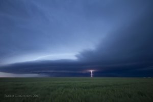
Above: Lightning illuminated HP storm evolving to bow segment near Goodland, Kansas late on May 26. There are a few funnels on the forward flank of the storm.
 
Back
Top