Brian McKibben
EF3
Overview
Westerly flow at 500 mb and lots and lots and lots of surface moisture = Severe Weather!
Surface
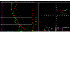
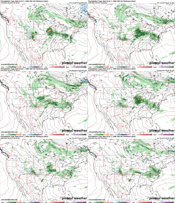
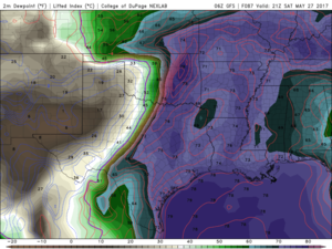
It is going to be down right soupy this weekend. Moisture returns starts on Thursday. The northern gulf is not looking good right now. However, since the gulf doesn't get cleaned out we see very nice moisture return by Sat with dewpoints possibly into the low to mid 70s (I don't think we will see upper 70 Tds like GFS is forecasting). Nevertheless we could see extreme CAPE values. Sounding below paints the picture. I doubt we get 6,500 MLCAPE, but >5,000 MLCAPE is not out of the questions.
After no real defined dryline on Fri it looks to sharpen by Sat and sets up east of I-35 by 21z. Theta-E values will be off the charts with 370+ K throughout the warm sector.
Upper
50+ kts of WSW flow at 500 mb should be good enough to yield decent 0-6km shear aoa 40 kts. So we should at least see some supercells initially. Plus there is decent veering in the wind profiles. 850 mb flow is modest (aoa 30kt) at best and a little too westerly for me. But it should be enough to do the trick.
Conclusion
I don't expect a tornado outbreak, but I do think we could see a monster tornado with any discrete cell. The amount of instability alone will cause extreme stretching of the updraft and there is enough 500 mb flow to get that bad boy titled. Plus I don't see the CAP being as strong on Sat as it is on Fri, so we should see storms fire.
There are a number of high cape marginal shear events out there to compare this event to. I can think of 2 such events that resulted in F4 tornadoes. I would just plan to be in place at initiation because you could get no storm to tornado in less than 45 min.
Special Treat
It would be neat to see a storm work with this much potential energy. It would look like a bomb going off. 8,000+ SBCAPE and 6,500+ MLCAPE. That would be insane to say the least. Of course this sounding is cherry picked.

Westerly flow at 500 mb and lots and lots and lots of surface moisture = Severe Weather!
Surface
It is going to be down right soupy this weekend. Moisture returns starts on Thursday. The northern gulf is not looking good right now. However, since the gulf doesn't get cleaned out we see very nice moisture return by Sat with dewpoints possibly into the low to mid 70s (I don't think we will see upper 70 Tds like GFS is forecasting). Nevertheless we could see extreme CAPE values. Sounding below paints the picture. I doubt we get 6,500 MLCAPE, but >5,000 MLCAPE is not out of the questions.
After no real defined dryline on Fri it looks to sharpen by Sat and sets up east of I-35 by 21z. Theta-E values will be off the charts with 370+ K throughout the warm sector.

Upper
50+ kts of WSW flow at 500 mb should be good enough to yield decent 0-6km shear aoa 40 kts. So we should at least see some supercells initially. Plus there is decent veering in the wind profiles. 850 mb flow is modest (aoa 30kt) at best and a little too westerly for me. But it should be enough to do the trick.
Conclusion
I don't expect a tornado outbreak, but I do think we could see a monster tornado with any discrete cell. The amount of instability alone will cause extreme stretching of the updraft and there is enough 500 mb flow to get that bad boy titled. Plus I don't see the CAP being as strong on Sat as it is on Fri, so we should see storms fire.
There are a number of high cape marginal shear events out there to compare this event to. I can think of 2 such events that resulted in F4 tornadoes. I would just plan to be in place at initiation because you could get no storm to tornado in less than 45 min.
Special Treat
It would be neat to see a storm work with this much potential energy. It would look like a bomb going off. 8,000+ SBCAPE and 6,500+ MLCAPE. That would be insane to say the least. Of course this sounding is cherry picked.
