Brian McKibben
EF3
SPC day 2 enhanced risk for the Ozarks.
Surface:
12z NAM and 4km NAM on 20170305 vs 20170304 puts the DL further west by about 80-100 miles. It shows the DL stalling somewhere near the I-35 corridor with a triple point setting up in NC Okla.
New 18z 3km NAM Td map:
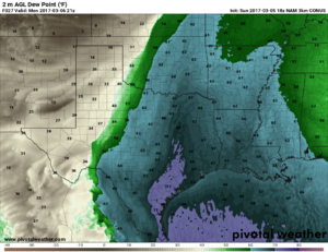
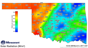
Low 60 Tds seem reasonable given current conditions via mesonet.

I don't think we will see any Tds > 65 due to the lack of abundant rich (>70) low level moisture per 12z 20170305 soundings along the gulf. South TX is currently showing low to mid 60 Tds.
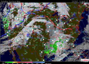
Even though Tds are in the low 60s, I do not think moisture will be much of a problem this early in the season. Also, there has been decent moisture advection the 2 days prior to event. The depth of the moisture from CRP is > 1km.
UPPER:
As noted in SPC discussion, most upper forcing will be well to the north of the target area. This is seen on 18z NAM with a negatively tilted trough at 500 hPa.
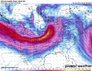
If i remember my streak streak quadrants correctly this put the Left Exit region in IA and MN. But we could also seem some PVA in the right entrance region (correct?) which would be in the KS and OK/TX panhandle area. 75 LRs of -7° C per km seem decent but not amazing.
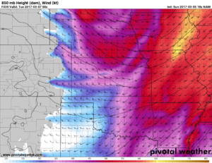
At 850 hPa we have 45+ kts of SW flow east of the DL by 00z. This cmobined with slight backing of surface winds after 00z increases 0-1km helicity to AOA 200 m2/s2.
CONCLUSION:
With all that said, tomorrow could be a day that gives us at least a few chasable storms. NAM puts some storms in the enhanced risk region ahead of the DL in the warm sector. But I am a guy that loves that "Dryline Magic".
I'd target the TP if it was me, because the terrain in the enhanced risk area is not fun. Good luck to all.
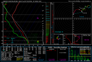
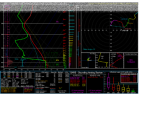
Here is a bonus sounding. Somehow I found the PDS Tornado Just east of OKC metro near Shawnee.
Surface:
12z NAM and 4km NAM on 20170305 vs 20170304 puts the DL further west by about 80-100 miles. It shows the DL stalling somewhere near the I-35 corridor with a triple point setting up in NC Okla.
New 18z 3km NAM Td map:

Low 60 Tds seem reasonable given current conditions via mesonet.

I don't think we will see any Tds > 65 due to the lack of abundant rich (>70) low level moisture per 12z 20170305 soundings along the gulf. South TX is currently showing low to mid 60 Tds.

Even though Tds are in the low 60s, I do not think moisture will be much of a problem this early in the season. Also, there has been decent moisture advection the 2 days prior to event. The depth of the moisture from CRP is > 1km.
UPPER:
As noted in SPC discussion, most upper forcing will be well to the north of the target area. This is seen on 18z NAM with a negatively tilted trough at 500 hPa.

If i remember my streak streak quadrants correctly this put the Left Exit region in IA and MN. But we could also seem some PVA in the right entrance region (correct?) which would be in the KS and OK/TX panhandle area. 75 LRs of -7° C per km seem decent but not amazing.
At 850 hPa we have 45+ kts of SW flow east of the DL by 00z. This cmobined with slight backing of surface winds after 00z increases 0-1km helicity to AOA 200 m2/s2.

CONCLUSION:
With all that said, tomorrow could be a day that gives us at least a few chasable storms. NAM puts some storms in the enhanced risk region ahead of the DL in the warm sector. But I am a guy that loves that "Dryline Magic".
I'd target the TP if it was me, because the terrain in the enhanced risk area is not fun. Good luck to all.
Here is a bonus sounding. Somehow I found the PDS Tornado

Last edited:

