• While Stormtrack has discontinued its hosting of SpotterNetwork support on the forums, keep in mind that support for SpotterNetwork issues is available by emailing [email protected].

2016 Southwest Monsoon

Jeremy Perez

Supporter
Joined
Aug 31, 2008
Messages
344
Location
Flagstaff, Arizona, USA
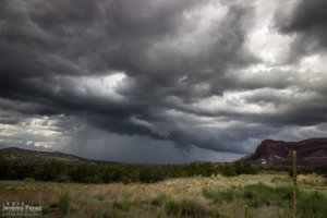
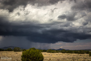
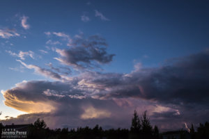
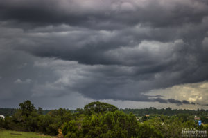
It's that time of year again. If anyone wants to post their monsoon chasing / photography adventures here, please do...unless it's a big event that warrants a Target Area thread.
 
2016-07-01 REPORT: NORTHERN AZ

I had a nice local storm chase today. I headed west, past Wiliams, to catch storms as they started firing and hopefully ride them east with some road network testing along the way.

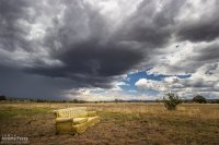
A little after noon, I took an I-40 exit at Welch Road a few miles east of Ash Fork to get some shots as convection was developing to the west. Somebody had kindly donated* a sofa. It was facing the wrong way, but I was not tempted by its mysterious comforts.

*dumped

img20160701-IMG_8778_640px.jpg
Furniture spotting on Welch Road east of Ash Fork - 1950Z

As cells blew eastward, I cruised back to Williams and took Rt. 64 north to see what would pop up next on the outflow. I stopped a bit south of Valle to watch a transient lowering, as one does when trying to randomly spot landspouts. While I was there, another chaser, Joseph, from Grand Canyon Village stopped to say hi before making his way toward Flagstaff. Convection at this point was pretty laid back, wimpy and grungy as I circled back southeast on Hwy 180.

img20160701-IMG_9375_640px.jpg
A momentarily interesting updraft east of Valle - 2031Z

img20160701-IMG_9382_640px.jpg
Tendrils of rain that kept reflexively catching the corner of my eye - 2052Z

Although I’d been hoping for a chance of a developing cell drawing up some vorticity as the gust front passed the San Francisco Peaks, it seemed pretty unlikely at this point. So I decided to run an audit of one of the forest service roads, north of the Peaks in the no-man’s-land between Hwy 180 and 89.

I got about three miles in, before the likelihood of getting stuck and busting my car in the rocky, cratered road became too great. I stopped and found a spot to hike up a hill to get some shots of a pretty decent cell popping up north of the Peaks by that time. Lots of terrain mostly blocked the view as it continued eastward and joined a strong line of storms that moved off onto the Navajo and Hopi Reservations.

img20160701-IMG_8784_640px.jpg
Looking east at a cell developing north of the San Francisco Peaks - 2159Z

img20160701-IMG_8793_640px.jpg
Some wildflowers in the area starting to like the recent rain - 2203Z

img20160701-IMG_9388_640px.jpg
Rain core getting established - 2207Z

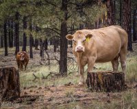
After shooting a few angles, I made my way back down toward Hwy 180 and did a bit of Coconino Cow Spotting before calling it a day.

img20160701-IMG_9393_640px.jpg
Bossy momma

Full report / larger images:
Storm Chase - East and North of Flagstaff || 1 July 2016
 
Thanks, Tim.

2016-07-02 REPORT: NORTHERN AZ

Monsoon storms got an early start on July 2nd. The night before, HRRR was trending toward an MCS rolling out of southern Nevada and into Flagstaff by around 6 AM. I set my alarm for 5 and sure enough she was right on schedule just west of town. I quickly threw myself and everything else in the car and headed out on east Route 66 to watch it plow through town.
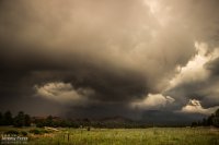
img20160702-IMG_9398_640px.jpg
A nice eddy sculpts the gust front as it rushes by the south side of Mt. Elden - 1231Z

Since it looked like it might stay interesting, I headed east to Twin Arrows—and was reminded how much I disliked the view from that exit. So I headed a bit further east to the Buffalo Range Road exit—no real foreground elements to speak of, but at least it wan’t fences, power lines and dumpsters. As the gust front moved in, a northern stretch of it lunged out and sculpted a terraced shelf.
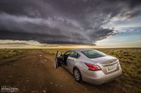
img20160702-IMG_8955_640px.jpg
Beautifully sculpted shelf cloud between Twin Arrows and Two Guns - 1302Z

I jumped further east to Two Guns and composed some shots of the ghost town structures with the heavy morning sky. I’ve snagged a few photo ops with the stone structures in the area, but this was my first time working with the buildings on the east side.
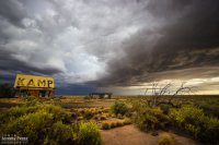
img20160702-IMG_8962_640px.jpg
Moody sunrise over Two Guns - 1313Z

After that, I raced ahead to Holbrook and then southeast on Hwy 180. The line of storms was messier at this point but still had some moments of shelfy goodness to offer.
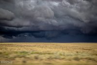
img20160702-IMG_9001_640px.jpg
Tantalizing scud photographed on the move, southeast of Holbrook - 1458Z

As that line weakened and moved off to the east, I had a look at models again. Indications were that the morning cirrus shield would move on, the atmosphere would recover, and more storms would fire, despite subsidence in the wake of the morning MCS. So I headed back west and decided to explore Homolovi State Park for a little bit while convection slowly got going again.
img20160702-IMG_9429_640px.jpg
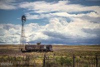
Receding convection and windmill on Hwy 180, southeast of Holbrook - 1612Z
img20160702-IMG_9727_640px.jpg
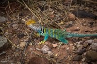
Collared Lizard showing off its colors at Homolovi State Park

Once storms got going again, they continued firing west of Leupp while tracking along and north of I-40. So I headed over to Rt 99 northwest of Winslow, then the Meteor Crater Road exit, and then back to Rt 99 south of Winslow. Storms were not as sculpted as they were that morning, but still offered enjoyable viewing on desolate roads.
img20160702-IMG_9633-2_640px.jpg
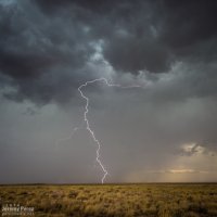
Lightning strike from north of Meteor Crater Road - 2246Z

I wrapped it up with a time lapse near Clear Creek as distant storms pulsed along a southward moving outflow boundary.

Short sequence of time lapses

More/larger photos here: Storm Chase - Northern Arizona || 2 July 2016
 

Attachments

Last edited:
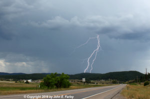
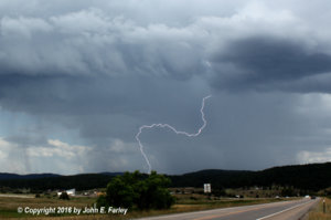
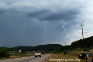
As moist monsoonal flow returned to southwest Colorado August 1, several thunderstorms developed near Pagosa Springs. This one formed south of town, as I watched from along U.S. 84 about 2 miles southeast of Pagosa Springs. It became quite intense for a while before backbuilding and drifting off to the southwest into northern New Mexico. It produced localized very heavy rain, enough to cause small rock and mud slides across Blanco River Road, a few miles down the highway from where I viewed the storm. And it also offered me some nice lightning photo ops.

5d7bc2bf88d3284a4ffae82bfcc0c24a.jpg

6e44a9a7b65377d423f90ce42a63e809.jpg

4e65ce3b99cfc8c6711a00a90e2b36a7.jpg
 
An intense storm northwest of Abiquiu Lake in northern New Mexico yesterday afternoon. The storm produced torrential rain and some hail, and appeared to have had some supercell characteristics. Note the rainfoot feature likely caused by a wet microburst or wet RFD - and in the third and especially the fourth picture, clouds being formed near the ground and forced up the side of a canyon due to the wind and cold precipitation.

d10c74d30204f2e89792d9ffce5e757d.jpg

df00384f3607f7ee64157df8a9ade001.jpg

d1795baebaa2f127f958080738ad0686.jpg

6bdde9741e68453434fc76d54228b73d.jpg

Here is a short video clip I made from four stills I took over the course of a minute or so of the storm, showing the cloud that formed near the ground due to cooling from the rain, wind, and hail, as the cloud surged up the side of a canyon.


Full report with a little more detail at http://www.johnefarley.com/storm80816.htm
 
This season has definitely been a PITA for me this year...not too many days worth chasing...I did make it up to Sedona a few weeks ago and managed to snag a few lightning shots and a brief funnel. Other than that, just a handful of other lightning shots, some decent stormscapes, and the sunset haboob July 29th
 
Like usual, I've gotten way behind on posting shots and reports except on the all-too-easy Facebook.

5 August

Around noon, I followed a strong cell east out of Flagstaff as it drifted along north of I-40. I managed some time lapses south of the Twin Arrows/I-40 exit as it was draping a shaggy shelf cloud around its core. I paced it further east to Buffalo Range Road where it ran into a boundary being laid down by another line of north-south convection to the east. The interaction worked some beautiful structure into the updraft of the original cell before it merged, mushed and gusted out. I tried for some more convection further north on the AZ-87 toward Dilkon. Nothing strong materialized, but the landscape was stunning against the tattered sky.

img20160805-IMG_1043_640px.jpg
Flaring shelf cloud north of Twin Arrows - 1924Z

img20160805-IMG_1065_640px.jpg
Eastbound convection looking north from Buffalo Range Road & I-40 - 1954Z

img20160805-IMG_1949_640px.jpg
Enhanced structure as interaction strengthens eastbound cell - 2011Z

img20160805-IMG_2109_640px.jpg
Disorganized convection southeast of Dilkon - 2132Z

More/larger images here:
Storm Chase - Northern Arizona || 5, 6, 10 August 2016
 
6 August

Another noon chase, and another cell drifting east out of Flagstaff. This one was over Doney Park with a severe warning when I first got on it. The warning soon dropped off and I ran some more time lapse ops on the structure at Twin Arrows again. Later that evening while visiting friends, a pair of cells popped up north of the San Francisco Peaks. The sun was setting and casting a mellow light on the anvil and updrafts as lightning moved around their innards. A few bolts snuck a peek outside the clouds, but I only caught a couple while shooting the time lapse sequence.

img20160806-IMG_1103_640px.jpg
Severe-warned storm over Doney Park as seen from Winona & I-40 - 1903Z

img20160806-IMG_2501_640px.jpg
Looking north from Twin Arrows & I-40 - 1936Z

img20160806-IMG_1344_640px.jpg
Twilight storms north of the San Francisco Peaks from Doney Park - 0253Z
 
10 August

Some tropical storm moisture and a Pacific low overlapped a bit over northern Arizona, and I headed east once again for a look. My first view was from east Flagstaff of a cell to the southwest over Kachina Village. Although the base was strung out, it was still decent by Arizona standards as it played at displaying some tail cloud characteristics. After that dissipated, I got east on I-40 and hung out at Homolovi State Park for a while, grabbing time lapse as a new cell got going southwest of Winslow. This one sported some more beautiful structure as the orange landscape reflected up onto the base of the storm. Bryan Snider and his wife Monika showed up and we shot some time lapses together as the storm grew a lowering and grumbled at us. We got ahead of it as the rain moved in and watched from Hibbard Road as it withered and sheared away. Later that night, another round of convection slowly moved up from Verde Valley and gave an opportunity for some nighttime lightning photography at Sunset Crater National Monument. Not a lot of nearby CG activity as the storms weakened by this point, but still some good under-cloud illumination against the cinder hills and ponderosas.

img20160810-IMG_3208_640px.jpg
Cell over Kachina Village as seen looking southwest from east Flagstaff - 2010Z

img20160810-IMG_1439_640px.jpg
2014Z

img20160810-IMG_3856_640px.jpg
Lowering on a new cell over Winslow as seen from Homolovi State Park - 2302Z

For our monsoon storms on days with decent bouyancy and a fair amount of shear or along a convergence zone, it seems like these concentrated lowerings can form for a few minutes when the updraft strengthens and a stout precipitation core helps lower LCLs near the updraft. Although reasonable rising motion can sometimes be seen, rotation is often either non-existent or so slow as to be nearly imperceptible. Typically, the gust front forms soon after and smears the feature and the nearby base into a shelf. Which is what happened here and fun to watch in the time lapse.

img20160810-IMG_3861_640px.jpg
2303Z


img20160810-IMG_1891_640px.jpg
Sheared convection looking west from Hibbard Road & I-40 - 2331Z
 
Back
Top