• While Stormtrack has discontinued its hosting of SpotterNetwork support on the forums, keep in mind that support for SpotterNetwork issues is available by emailing [email protected].

2016-09-09 REPORTS: IL/IN

Joined
Jan 14, 2011
Messages
3,535
Location
St. Louis
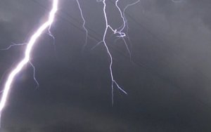
I witnessed a likely tornado on Friday near Irvington, IL with power flashes under a rotating wall cloud. I also experienced my closest lightning strikes in many years - enough to give me a headache from two open-window thunder blasts from GSs at a couple hundred feet. My chase report and video is at the following link:

http://stormhighway.com/blog2016/sept1016a.php
sept916ayt.jpg sept916b.jpg
 
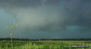
I hadn't been paying attention to the weather for this day, much to my dismay it looked fairly decent by late morning. However the fly in the ointment was I had an appointment in Peoria at 2:30PM. I wasn't sure if I could get out in time or not to chase. Luckily for me, I arrived early and was able to leave by 2:15. I headed south down I-55 and then eventually south of Decatur toward the Vandalia area along I-70. Because I originally had no intention of chasing this day, I had very little with me as far as cameras go (only my Iphone 6). I got on the first storm near Vandalia and followed it east. Observed a couple of wall clouds and several occlusions, the motion originally wasn't anything I would consider tornadic as it struggled at the low levels with rotation. Eventually though we did observe quite a bit of rotation as it was south of St Elmo.

View attachment f57dcdead8fc63d767e50f28cb6f4395.jpg
Supercell with wall cloud 2E of Vandalia along Highway 40

I got to I-57 when I let this cell go for an ongoing cell northeast of Effingham. Thanks to I-70 and slow storm motions, I was able to quickly get to this cell arriving from the back-side in time to see a well defined funnel cloud halfway to the ground 3 miles W of Greenup, IL. We did observe VERY brief ground circulation under this funnel (lasting several seconds tops). Originally I wasn't certain in it touching down, so I only reported it as a funnel cloud (to avoid any false reports). I thought maybe as it was occluding it would fully condense, but the rotatational velocity of it, just appeared too weak for it do anything more than what it did. I followed this particular cell east as shortly after my funnel encounter, it picked up a tornado warning. We noted several other occlusions and new mesocyclones, although low level rotation appeared to be significantly lacking.

View attachment 34897ab066e62a0521b98b99ff097925.jpg
3W Greenup, IL Funnel with brief ground circulation

In addition, despite the NWS confirming an EF-0 tornado S of Casey, IL, I didn't really see anything for myself there as I was right under it. At least anything more than a wall cloud with lazy motion and rising scud. I called the chase near the town of Martinsville, IL and headed for home. Overall a decent chase, I would rate it a 6/10. Missing the significant tornado near Champaign hurts a little bit, but its hard to complain when you get on 2 nice looking supercells, see a funnel cloud (likely brief tornado), and don't have to deal with any precipitation or rainwrapping, nor many other chasers clogging the road.

View attachment beea2e7fff789b971b809da3e167a236.jpg
Occlusion (likely non-tornadic) 1 SE of Casey, IL. New wall cloud forming to the right. I didn't note anything tornadic here despite ILX confirming a brief EF-0 tornado.


View attachment 341ab700ae4d0055bdbb656d98dda310.jpg
~Crappy~ cell phone pano of the back-side of the storm near Martinsville, IL.

My photos are pretty low quality, like I said all I had was my phone. And I didn't wanna risk my car getting broken into, in downtown Peoria sitting there lol. I do regret not having the DSLR especially for the late evening structure/lightning on the back-side of the storm which was pretty good. And this was a rather last minute chase too, which I ended up traveling 629 miles round-trip (not so local eh?) lol
 
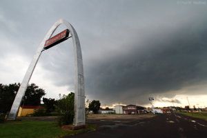
Heading south for the initial development moving out of the STL area, impressive structure at Vandalia where I had a Dan Robinson moment.
IMG_2568a.jpg

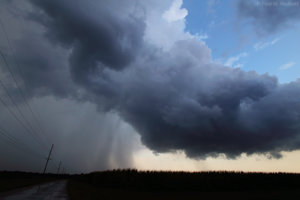
Continuing south to pause at Salem for an unsuccessful lightning attempt. Still a cool scene or so I thought...
IMG_2581a.jpg

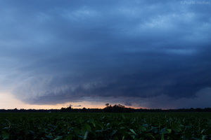
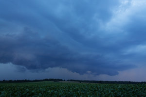
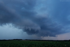
Continuing even further south, caught what remained of the Irvington storm near Kell as it cashed out into a beautiful blue hour 'supershelf'. It was here the property owner rolled up on his ATV and offered me a beer while we chatted about his concern over potential bean damage. I politely declined for having to make the long drive home. In retrospect, it might've helped smooth the regret of leaving the Vandalia storm as well as missing the Champaign county activity.
IMG_2798a.jpg

IMG_2801a.jpg

IMG_2804a.jpg
 
Last edited:
Back
Top