2019-05-27 REPORTS: CO/IA/IL/IN/KS/MN/NE/OH/WY

Joined
Jun 16, 2015
Messages
476
Location
Oklahoma City, OK
The story of this chase goes back to the 26th. I bailed the moderate risk in eastern Colorado early to start going east. I was really impressed with what I was seeing with respect to supercell/tornado potential across the Midwest today.

I made it to the Kansas City area late on the 26th and blasted east first thing this morning. The initial plan was to target either far southeastern Iowa or adjacent Illinois, on the east side of the Mississippi, near Keokuk. As I got to the Hannibal area, I was a bit concerned that a small convective complex moving into southeastern Iowa might not be ideal for a target. The more conservative play was to go east and then north toward the Peoria area, to be able to either continue north, or intercept storms coming from the west.

Another concern was that low-level wind fields were veering, particularly across the southern part of the target area. Even though the storms mentioned above had a relatively unimpeded inflow region, they were displaced south of the warm front (away from more substantial shear) and I wasn't sure they would gain much low-level rotation until the LLJ ramped up closer to sunset.
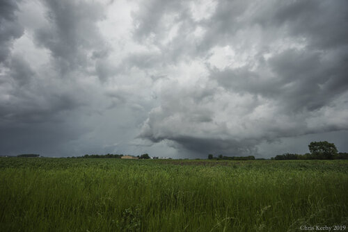
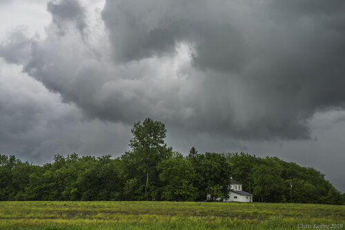
I chose to let the storms come toward me and even though radar was a bit jumbled looking with multiple storm interactions, I noticed that one particular storm appeared to be transitioning toward the dominant storm within a cluster. I approached near Williamsfield, IL and was somewhat surprised to see a well-defined, rotating wall cloud. The velocity signature on radar rapidly became more impressive and a tornado warning was issued.
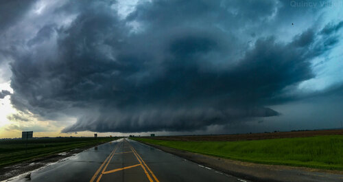
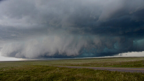
190527_pano.jpg
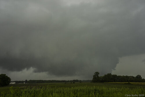
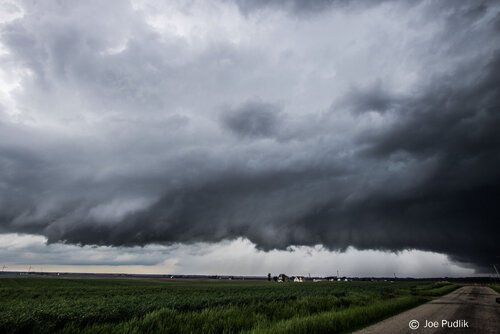
I stayed with the storm until it reached the north side of Peoria. It was the first time I had chased in the area and probably should have just bailed south to get on the east side of Peoria Lake. I wanted to stay close to the storm for as long as possible, in case it did produce. At one point, when it crossed directly in front of me on IL-40, it appeared as if it was very close to producing a tornado. A ragged, rotating cloud base was lowering, but after it passed by, I had to blast south and turn around to get back east again. This cost me about 20 minutes.
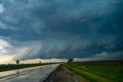
190527_sony.jpg
I eventually caught back up with the storm, but it was gradually weakening. I tried to gain ground on the southern end of a band of storms that was approaching the Indiana border, but this proved futile and I bailed a short time later. If the target area for the 28th wasn't several hundred miles farther west, I might have kept up with storms into Indiana. I'm not even sure how possible that would have been, given storm motions around 50 mph and speed limits that averaged below 55 mph, if you factor in stop lights, stop signs and population centers.

Overall, even though I did not see a tornado, it was a worthwhile chase. I have not had much luck seeing any sort of structure this year, nor have I seen much defined structure in the Midwest, period, while chasing. The tornado-warned supercell passing directly overhead made up for what was initially a very risky play. It turns out that the system sped up maybe 1-2 hours quicker than most models were showing. Instead of intense storms moving across northern Illinois around 4-6 p.m. at peak heating, the storms were already exiting Iowa by 2. Instead of northern Illinois being the epicenter, Indiana was full of tornado-warned storms through the late afternoon/early evening. I added Ohio to the title, given the extent of tornado damage there tonight, although most of those tornadoes probably happened after dark.

The lesson here, if there is one, is that the warm front is going to be the main focus for tornadoes, unless you have better backing of low-level wind fields. The wind profiles were not bad and that explains why I still encountered a supercell with a low-level mesocyclone, but it did not produce a tornado due to relatively weak low-level shear and winds that were somewhat veered.
 
Last edited:
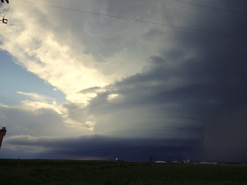
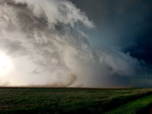
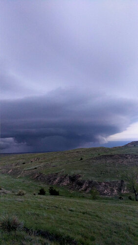
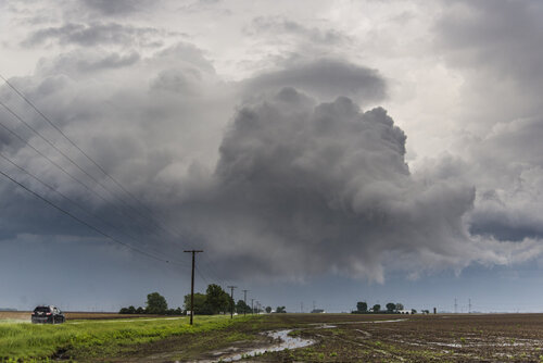
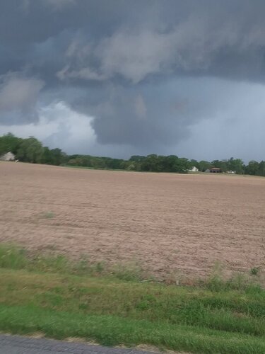
I didn't get on the storm that originated near Denver, but I did chase the one that tracked from approximately Otis CO to Holyoke to Hayes Center NE. I saw there were several tornado reports associated with this storm, and all of the reports said "brief", and I didn't see any of them. Regardless, what a fantastical mothership storm!! I have seen motherships, but wow, this one was one for the ages. Chaser convergence wasn't too terrible, either. I don't think I had my camera set right, but here's one of the pics I shot. Almost looks like a gigantic light bulb, huh?

DSC00222.JPG
 
We got on the first cell by the Denver airport and watched it drop the brief vortices around the wall cloud which was the theme for the day with little brief tornadoes. We followed it up to Fort Morgan then bailed for the cell forming south of Akron. I was on it south of Akron and chased it until dark. There were many brief tornadoes and gustnadoes but the structure was the best part of the cell. I usually have a photographer with me but she could not come which is a shame due to the truly amazing structure.
 

Attachments

  • 20190527_172300.jpg
    20190527_172300.jpg
    123.9 KB · Views: 0
  • 20190527_174207.jpg
    20190527_174207.jpg
    141.7 KB · Views: 0
  • 20190527_180850.jpg
    20190527_180850.jpg
    65.4 KB · Views: 0
  • 20190527_180942.jpg
    20190527_180942.jpg
    210.3 KB · Views: 0
  • 20190527_185846.jpg
    20190527_185846.jpg
    167.3 KB · Views: 0
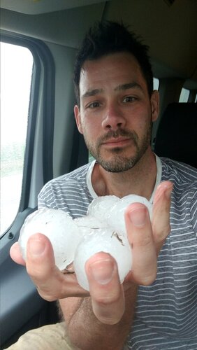
This really was a fun chase. We started with an initial target of Ft. Morgan, CO after leaving Burlington, CO late morning. As we were traveling, a storm fired east of the ridge near the FTG radar site and moved slowly northeast. We pushed south to intercept, as a new cell on the north became the dominant cell. We followed this all the way to Julesburg, CO, before dropping south to another cell near Holyoke, CO. This initial cell produced lots of great structure, including an impressive rotating mesocyclone with wrapping rain curtains and a brief tornado that was reported northeast of Sterling, CO. When we got on the new cell, there was another tornado reported south of Holyoke, though I'm not so sure that wasn't exactly a gustnado beneath an area of low-level convergence and rotation, since it seemed to be largely outflow winds near the area where the circulation was reported. As we followed this storm east towards Lamar, NE, we came on the back side of some 1.5" - 2" hailstones. We worked east and caught back up to the rear flank of the storm, when a new tornado warning was issued for areas near Imperial, NE. We saw some tree debris go airborne from a farm off of US 6 right before getting slammed by warm 90 mph RFD winds, and what MAY have been a brief tornado in a field several miles NW of Imperial, before the storm exhibited some prolific structure as night closed in. This was a great chase with storms that produced some incredible structure on the western Plains. There may have been a few brief tornadoes, but another situation where, if so, they were brief, weak and with no clear condensation funnels that were able to prove anything discernible from my vantage point.
 

Attachments

  • Snapchat-779809100.jpg
    Snapchat-779809100.jpg
    98.7 KB · Views: 0
  • Twitter_20190527_145005.jpg
    Twitter_20190527_145005.jpg
    51.3 KB · Views: 0
  • Twitter_20190527_162938.jpg
    Twitter_20190527_162938.jpg
    237 KB · Views: 0
  • P1010223.jpg
    P1010223.jpg
    135.1 KB · Views: 0
  • Snapchat-186496083 (2).jpg
    Snapchat-186496083 (2).jpg
    111.6 KB · Views: 0
When we got on the new cell, there was another tornado reported south of Holyoke, though I'm not so sure that wasn't exactly a gustnado beneath an area of low-level convergence and rotation, since it seemed to be largely outflow winds near the area where the circulation was reported.
I don't have much to share about the storm yet, but I can confirm what Jesse posted above. I was about 200 yards away from it and am almost 100% sure it was a gustnado. That whole area was outflow/RFD and the "wall cloud" some reported was an outflow scud lowering with zero rotation. What might not have been visible to folks a little further away was the other dirt getting blown up around the drill bit circulation that was all blowing to the east with the outflow/RFD.
 
I targeted Western Illinois yesterday afternoon for the potential of a strong tornado or two as I thought things looked pretty good going into early afternoon. We approached the cluster of supercells near Burlington, noting a couple wall clouds at times but no rotation really. I tracked the storm all the way east to Galesburg contemplating just driving 8 miles south to my house and ending the day. Alas saner minds prevailed, I continued east on County 10 and then 150, I observed a brief tornado 1 mile south of Dahinda, IL around 3:15pm as the storm was ramping up again. I never got a view of the good structure near Williamsfield as I was under the wall cloud the entire time and didn't notice any other circulations aside from some mid level rotation. We ditched that storm at Lacon for another storm east of Peoria, noting a high based funnel outside of Benson, IL. Originally I thought this was just a funnel, but Hunter Anderson (chaser from Wisconsin) was under it and confirmed ground circulation. I turned around and drove the hour back home, pulling in shortly before 630pm. Not the best day, also not the worst.

18416
1S Dahinda, IL 3:15pm, I got about 3 minutes of video of this forming and dissipating.

18417
3NW of Benson, IL around 4:37pm. High based funnel with reported dust under it...lol.


18418
Dying storm near Roanoke, IL....
 
I've uploaded two videos of this feature that was reported as a tornado yesterday to my Google Drive. This was approximately 6 miles south of Holyoke, CO looking west from HWY 385.

There is a descending funnel looking finger aloft, but if you watch you'll notice a lack of discernible, concentrated rotation in a tight fashion aloft. The dust cloud is getting kicked up in a region associated with otherwise outflow winds. There was formidable inflow, and immediately cold outflow winds followed as the feature got closer to Hwy 385. I understand people can view the storm from different perspectives and see things that others cannot, so this is just what I saw.
Video 1
Video 2
 
That is how most of them were Jesse 100% correct but one did have vortices and was confirmed by B. Sullivan per Taylor Wright. That is the one I saw and that someone reported. Overall very gusty and dirty lol
 
Started off my day in Chicago around 10 am. At first i was about to target Davenport but get lured by storms coming from Burlington.
Intercepted TW supercell with nice wall cloud near Williamsfield. It didnt look that promising so i kept going E.
Intercepted second TW cell near Benson. This storm hit me with some high winds near Washburn, i saw one state trooper car pushed from the road into a ditch. At one point i was thinking that will happen to me too.
Observed funnel cloud W of Benson which is reported as brief touchdown. Didnt see ground circulation from my viewpoint.
My photos are similiar to Quincy's and Ethan's so i will not post them.
 
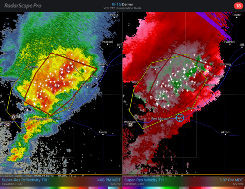
I am the George Costanza of chasing. Another day of misfortune. Started the day in Goodland with a rough target area from Fort Morgan to Sterling. Picked up first cell near Fort Morgan but new development occurred rapidly to the northeast and we were somewhat dejected that yet again we would be faced with embedded rather than discrete supercells. Thought we should stay on the tail end but soon realized the only tornadic circulation was way up near Sterling!

28D2A5B0-0078-48E5-9C12-D1221C1DD041.png


As you can see on the radar capture we were already hopelessly behind at this point and made the further error of choosing Route 138 instead of I-76 out of Sterling, which slowed us down even further. We finally got back on the interstate and battled hail, periodically stopping if it seemed to get too big. Meanwhile, there was a new couplet not too far down the road and I think another brief TOR report but we never saw anything.

We finally dropped south off I-76 to get out of this and tried to plan a renewed approach to the storm. Bottom line is we waited too long to bail on this storm and head for the Yuma/Holyoke storm. In a rare moment of disagreement with my chase partner, he wanted to wait even longer. At this point road options were limited; we would have to go back to Holyoke and drop south on 385. The storm was going to cross 385 and move south of Holyoke, so we probably would have had to let it go and follow it from behind, but at least we might have had a brief look at the updraft from its east from 385. We were already late in even having this discussion, so it may have already been too late, but my chase partner wanted to stay with the northern storm because of the bad road options on the Holyoke storm. By the time he came around to my way of thinking, it had cost us 10 or 15 minutes. I don’t know if that would have made a difference, we still might not have been able to get south of Holyoke in time. The only way to intercept was to go southwest to Holyoke on 23 and take the east road (6) out of Holyoke toward Lamar NEB.

We got to Holyoke when the core was already due south and over 385, so we had to wait there until the core cleared and we could head east from Holyoke and follow behind. The hail core was just south of the road most of the time, so we threaded the needle, stopping whenever the hail started getting larger. Once the road jogged southeast, we were able to get south of the hail core and thought we were home free to blast each, but the circulation tightened and pulled the hail back over the road as a new hook formed. So now we’re pretty much hook slicing, RFD wind blasting us from the left/north, although the couplet had already shifted north of the road. We came out of this into a lighter wind from the right/south but couldn’t see anything good and did not see the brief tornado that was reported in the area. All that work for nothing. We really couldn’t go north on 61 toward the couplet because there were no east options anytime soon off 61, and we might have been cut off by RFD hail even backtracking south again. So we pretty much bailed east hoping to get outside the storm for structure at that point, but even that wasn’t great, maybe because our angle/perspective wasn’t ideal heading SE as the storm moved NE.

It was exciting tangling with the storm, seeing the hail accumulations on both this storm and the earlier one, but overall a very frustrating and embarrassing performance. I don’t think we missed any good tornados but certainly missed out on some great structure. We were in rain and hail a good part of the day, which is not a good indicator of chasing success. The only saving grace was stopping near dark, just west of McCook, to watch the supercell flashing like a shorted-out lightbulb, near constant lightning illuminating its innards like an x-ray.
 
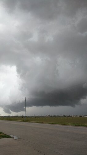
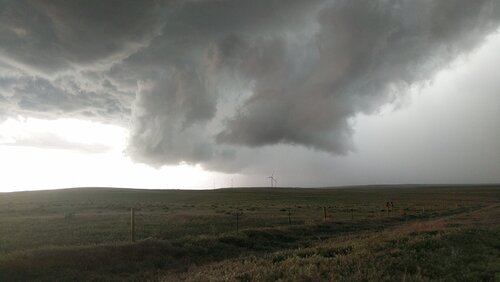
I couldn't decide whether to target east of the quad cities or stay put in southeast Iowa. I decided to run some errands & think about it and multiple cells in SE IA appeared to have just been tornado warned after I was done so I started heading towards them. The 1st pic is a wall cloud that reportedly produced a brief tornado near West Point IA. The 2nd pic is a wall cloud that I couldn't visibly see any rotation at the time near Denmark IA. The 3rd pic is the same wall cloud but it had pretty good visible rotation at this time before I lost visual in the hills & trees and it reportedly produced a tornado southwest of Burlington IA. I then crossed the Mississippi in Burlington but couldn't catch back up to the storms due to traffic & called it a day.18480_DSC1254.jpg_DSC1258.jpg
 
Ended up chasing locally on Monday, across N/C. IL... I ended up heading out just after noon, with a target of near or just south of I-80...Between I-74 and I-39. Ended up passing the first initial supercell that pushed across the south Chicago metro, just as it was starting to get going in the far SW suburbs. However, I decided to not chase it, given it was heading into the metro and could put me out of position for the main activity west. On the drive down I was also watching the cluster of tornadic supercells pushing from SE. Iowa into W. IL, but was not fond of how messy and clustered they were. Stuck with the original plan and I made it to Princeton, prior to 2PM. By this time a few supercells had developed near MLI, and were starting to slowly mature and push east. Ended up grabbing some food really quick in Princeton, before heading after the better looking storm just as it went tor warned. I reached the storm as it was approaching Deere Grove. At this time, the storm was outflow dominant and fighting other storm development nearby. Continuing to stair-step east with this storm, to north and northeast of Walnut, the storm continued to be fairly outflow dominant, as it ingested another storm or two...However, there was one point that it did seem to make an effort to organize for a sort time, with even a more concentrated area of rotation/lowering. I continued east with this storm through the Sublette area, eventually reaching Route 251. Through this point the storm continued to be outflow dominant, and there was also widespread additional t'storm develop, which would hamper further potential with this storm. At this point I called it a chase and headed home.

May 27th, 2019 - N. Illinois Chase

storm2.jpg
 
Last edited:
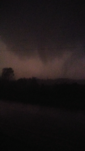
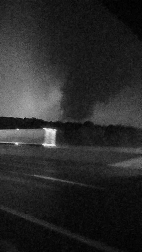
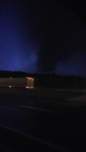
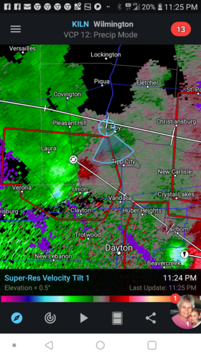
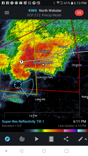
Started in northwest Indy. Followed the supercell across about four counties before dropping south and getting into the PDS Rochester Tornado. The last picture attached is the only shot I got of it however when we caught up to the tornado at the very end while it was dying. Looked multivortex but it was weak. Have a video of that as several vorticies touched down and went back up. Got on 75 south back in Ohio right after and made it just south of 70 when we stopped at an underpass and watched the EF2 tornado in northeast Montgomery County cross the highway. Got my phone out just in time to take a short video of tbe tornado as the powerflashes and lightning lit it up. Overall three tornadoes. Very happy with how the chase went. Its all cell videos and pics so the quality is lacking but the experience was something else.

Once I find a way to upload the video of the EF2 tornado I will post that soon. I took some screenshots from the video in the meantime.


Attachments

  • Screenshot_2019-05-28-08-44-56~2.png
    Screenshot_2019-05-28-08-44-56~2.png
    393.2 KB · Views: 0
  • Screenshot_2019-05-29-00-21-19~2.png
    Screenshot_2019-05-29-00-21-19~2.png
    112.1 KB · Views: 0
  • Screenshot_2019-05-28-08-44-56.png
    Screenshot_2019-05-28-08-44-56.png
    547.5 KB · Views: 0
  • 20190527_164202.jpg
    20190527_164202.jpg
    112.2 KB · Views: 0
  • Screenshot_2019-05-27-23-25-53.png
    Screenshot_2019-05-27-23-25-53.png
    853.8 KB · Views: 0
  • Screenshot_2019-05-27-18-13-51.png
    Screenshot_2019-05-27-18-13-51.png
    739.7 KB · Views: 0
  • Screenshot_2019-05-28-14-20-22.png
    Screenshot_2019-05-28-14-20-22.png
    574.6 KB · Views: 1
  • IMG952019052795173134460.jpg
    IMG952019052795173134460.jpg
    51.8 KB · Views: 1
Last edited:
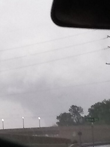
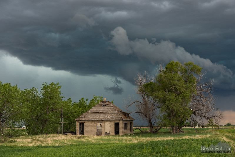
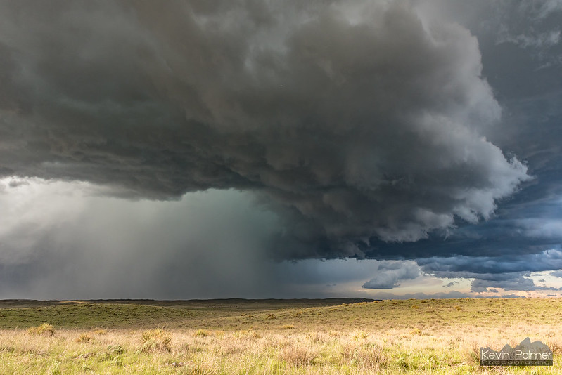
I started the day in Fort Morgan and just after 1PM headed for the cell south of Wiggins, which became tornado-warned early on.


Nobody's Home
by Kevin Palmer, on Flickr

But the storm split just as I got close to it. I'm still not sure what exactly happened here and haven't heard anybody mention it. The MCD specifically talked about right splits having a higher tornado potential and I thought that was a general rule. But the opposite happened here, with the right cell dying out and the left cell becoming dominant. But it didn't matter, the movement was slow enough I was able to get back ahead of the left cell.

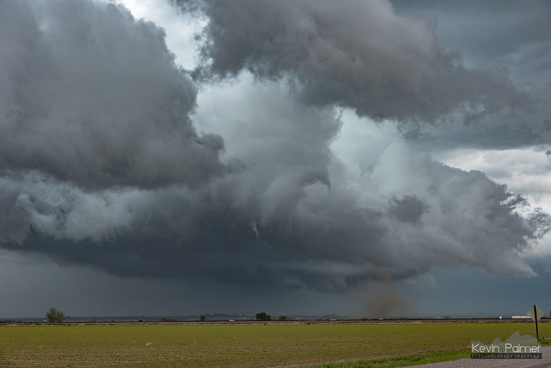
I saw the clearest rope funnel of the day while driving back east, but wasn't able to get a shot. In Fort Morgan there was lots of low level rotation, and a brief spin-up. I'm unsure if this was a tornado or a gustnado.


Brief Spin Up
by Kevin Palmer, on Flickr

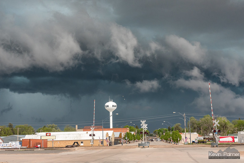
I continued to follow the storm towards Sterling and then east. Here it produced an ominous, ground-scraping meso and seemed to pick up speed. Then in Haxton it became outflow dominant with a nice shelf cloud.


Ground Scraping Meso
by Kevin Palmer, on Flickr


Downtown Haxtun
by Kevin Palmer, on Flickr

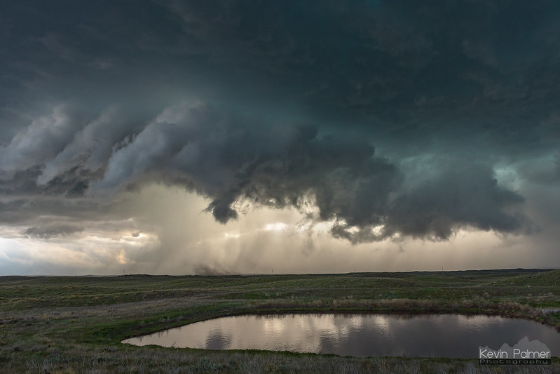
I lost interest in the storm at this point, but noticed another new supercell coming up south of Holyoke. I let it come to me and as it crossed Hwy 385 there was lots of low level rotation and swirls of dust. But again it's hard to say if this was a tornado or not.


Holyoke Tornado?
by Kevin Palmer, on Flickr

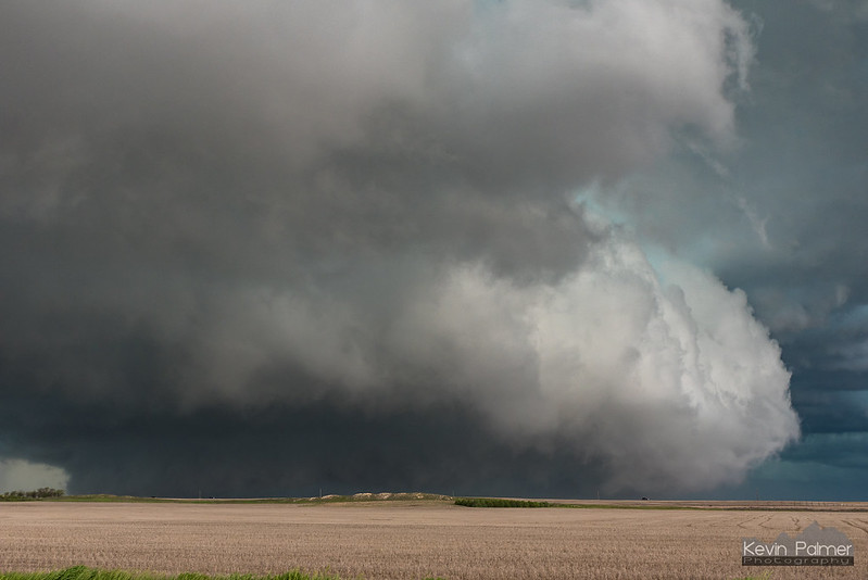
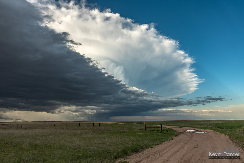
I followed it a little farther on dirt roads before letting it go at the Nebraska border. It was getting late and I wanted to get home at a decent time the next day. Of course this is when the structure of the year was happening on the other side. Oh well.


A Little Bit of Sunlight
by Kevin Palmer, on Flickr


Letting It Go
by Kevin Palmer, on Flickr

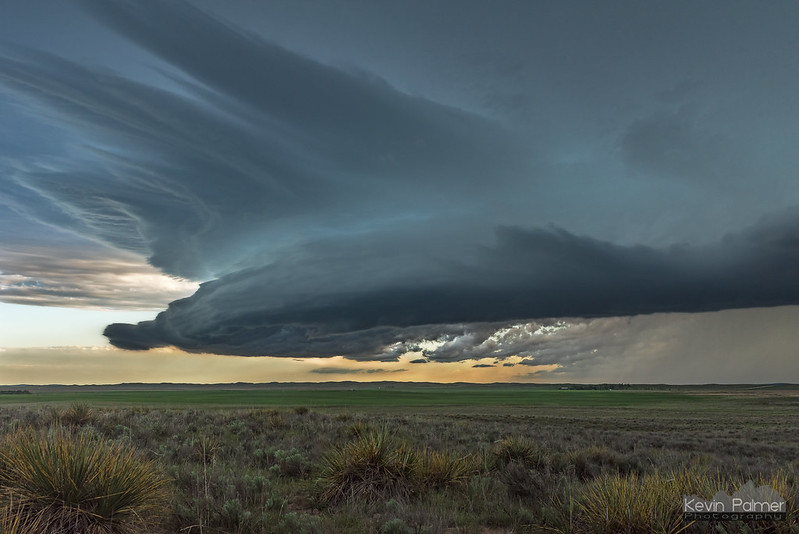
But then a 3rd supercell near Wray stopped me from leaving. It showed some nice structure. I was surprised it went tornado-warned, since there was only broad rotation.


Wray Supercell
by Kevin Palmer, on Flickr

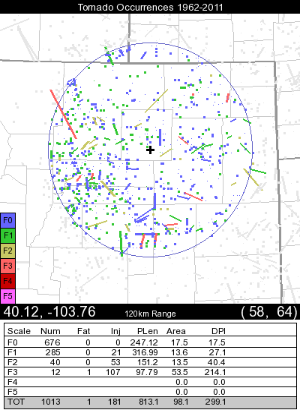
The last 2 days was my first time chasing in Colorado, which was a goal this season. I learned why Colorado's tornado occurrence map mostly shows dots instead of lines (see attachment). There were a lot of chasers out but I didn't run into any major problems. Mostly I found it amusing all the SN reports of tornadoes right next to me when I could see nothing definitive. Some reports came in 15 miles away from the storm.
 

Attachments

  • Colorado-Tornado-Climatology.png
    Colorado-Tornado-Climatology.png
    56.9 KB · Views: 1
This setup prompted me to end my Plains trip 2 days early. Since my target was on the warm front between Davenport, Iowa and Peru, Illinois, US 36 across northern Missouri was the travel route instead of going back home via I-70 through St. Louis. I left Cameron, MO about an hour late due to a miscalculation about the transit time, which put me behind the initial storms on the Iowa/Illinois border. I finally reached the target storm northeast of Mendota, but found the storm outflow dominant with no visible surface inflow making it over the huge shelf cloud that spanned the RFD gust front to the forward flank. Despite this, the storm managed to produce a small tornado at Paw Paw immediately after I left it. Storms were moving fast this day also, meaning when the Indiana border-area storms got going, I was too far west to be in position to reach them.

I didn't take any photos or videos this day. My chase was essentially over at 7PM.
 
Back
Top