2016-06-13 REPORTS: CO/KS/MT/NM/OK/TX/WY

Joined
Jun 16, 2015
Messages
476
Location
Oklahoma City, OK
What a wild day for myself. I started the morning in the Black Hills (visited Rushmore) and was insistent on the Colorado play, so it was a 7-8 hour drive to get into position.

After rushing down for a tornado warned storm that quickly merged into a line, I decided to blast southeast into the Texas panhandle, where there was better low level moisture and backed near-surface winds.

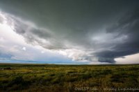
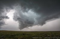
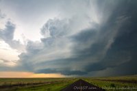
A slow-moving supercell formed just north of Amarillo and took seemingly forever to better organize. I had a visual on a very low-hanging, rotating wall cloud. It spat out a few funnels (from my vantage point) before showing some signs of weakening.
https://www.periscope.tv/w/ai46yzFs...KQiLA_S58zwlhLXw3AWvVf4FuZRRgJ-LcbBSmQq0hsZnL

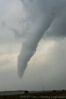
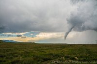
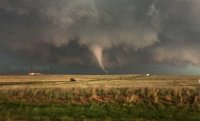
I moved east to get closer and just as I was nearly directly under the circulation, it dropped a tornado in front of me. I could see it for about three minutes before contrast went way down and the storm became rain-wrapped.

I took a brief cell phone video that's slightly better quality:
https://twitter.com/stormchaserQ/status/742529879413952512
160613.jpg
 
I took a half-day off work and left at noon to chase the Colorado storms. I couldn't go too far because I have to be back to work tomorrow. I started by driving about 50 miles east of Colorado Springs where a small section of 2,000 CAPE was forecast, but once I got there I decided to head south toward La Junta at the developing storms in southern Colorado. By the time I got to La Junta, I realized the storms were not going to become organized enough to produce a tornado until moving into Oklahoma or Texas. Low on time, I decided to head west towards Pueblo and back up to Colorado Springs. That's when I saw a wall cloud forming ahead of me.


A few reports of funnel clouds came in from that storm, but none confirmed. I stayed on that storm until it died out, and then drove to the scenic viewpoint on I-25 in northern Colorado Springs to get some photos of the sun rays coming from Pikes Peak.

View media item 1162
 
Great chase yesterday in southern Colorado. Had to work a mid shift so didn't have time to catch the second half down in TX, but the storm coming off the Raton just east of Trinidad was pretty awesome. And best part of the chase--only a handful of chasers including Mike Umscheid and Brandon Sullivan. Chased the line east to Springfield with some pretty strong bow echo winds, then called it a day and had a filet on my home in La Junta.

TADtor-aST.jpg

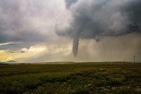
Heres the tornado as it first touched down. Got a bit larger, may have been a multi-vortex for a short while but was partially rain wrapped with poor contrast (partly due to early in the day) so I wont past those shots. Those white things are golf balls that started to get bigger as I bailed east.
TADtor-eST.jpg

Heres the tornado as it got ready to start roping out. This is a wide angle shot so it was a bit closer than it looks.

TADtor-jST.jpg

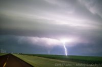
Finally, some nice lightning from a storm headed towards Colorado Springs as I arrived home in Pueblo... A real cool chase that almost made up for the complete drought that would have been my week long chase vacation last week...

TADtor-o2ST.jpg
 
Pulled off something that I am not sure has been done before. Caught tornadoes in 2 different states on the same day, that are not adjacent to each other (Trinidad, CO & Amarillo, TX). I know Mike Umscheid and Jeremy Holmes were able to make both tornadoes as well.

I figured this week was probably the last chance at something with decent midlevel flow south of I-70 for the year. I planned on taking Tuesday off, but changed it to Monday on Sunday afternoon as the setup was closer and was too good to pass up. Targeted SE Colorado, but was a bit nervous leaving the Panhandle as some models fired storms there too. The surface flow just north of the Black Mesa out of the due east was too good to ignore. Got lucky that the HRRR was off on it timing and the Panhandle stuff went later than forecasted

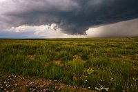
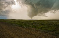
I originally went to Campo with plans to adjust from there. Felt confident that just north of the mesa was the place to be so I drifted west to Kim, CO. Storms had already fired west of Trinidad in the mountains and south into NM, but I was a little hesitant to go that far west. I let the storm get a little more mature before I blasted west about 50 miles, while only see ~3 other cars on my way west. I got in range of the storm as it moved east of Trinidad with the wall cloud scraping along the north edge of the mesa. Really was a sight to see. It was pretty clear this storm had a tornado coming. The wall cloud tracked along just south of Highway 160, between the highway and the mesa. Soon after it pulled off the mesa the wall cloud tightened up and drop the tornado. I only saw a handful of other chasers on the storm, which given the lack of stopping places off that highway would have been bad with anymore. Pretty sure we all got the same shot because we kept stopping in the same places. June in CO and not a 100 chasers, it just felt weird.

5551d4a81f452137d954bed25da3675c.jpg

5946c6f78d2fd2fa00806d2b7c8e01b6.jpg

8accbf1ebe5c628ca2fdb43b02ec3709.jpg

3600e35ede87ff396f12363e2d28a7f5.jpg

One thing I will say about that storm was it had some really big hail for what I was expecting. Even stranger was it was tossing these big stones out east of the tornado out of the southwest, since it had wrapped up so much.Definitely picked up a couple new dents from that storm.

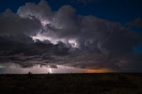
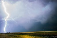
After that storm crapped out from storms coming up from the south I decided to go back to Boise City for gas. I stayed in Boise City for about 5 minutes before deciding to try a make a break for home (Amarillo) and while hoping the storm north of town might wait for me to get there. It looked like junk when I cored it on 287 as it was ingesting some other cells from the south. I made my way around east of the storm right as it really ramped up the structure. One of the craziest cg producing storms I have ever dealt with. Didnt get too many shots of lightning as I really couldnt get out of the car. Ended up a little too far east getting structure shots and missed the best tornado shots, but being east had it's perks too. Once again only a handful of chasers were on the storm, more than the Trinidad storm but still so few that it made you wonder if it was really June. Didnt know it was possible to see tornadoes in the Southern Plains and Colorado without a horde around it. Sitting alone on a highway and staring a storm like that one down, it really doesnt get any better.

ac7ba2948b836d8023c45e5ea861b413.jpg

46feca03180088a3cb7079355be7f382.jpg

2986872a83fde9d9d50c0e073fe9eb69.jpg

Photo album: https://www.facebook.com/media/set/?set=a.10104045800390477.1073741946.9609344&type=1&l=b60b8b0366

Video (18 minutes), mostly time lapsed of Trinidad and Amarillo storms:
 
Last edited:
Back
Top